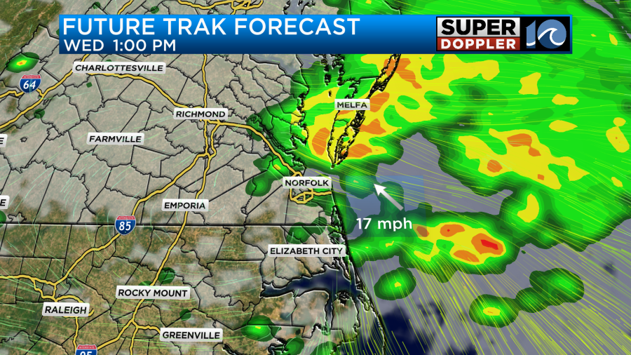
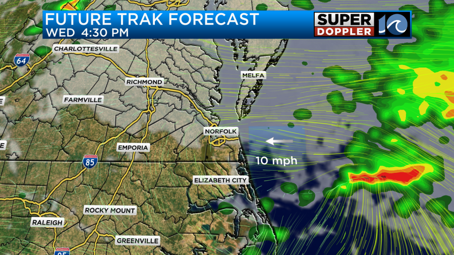
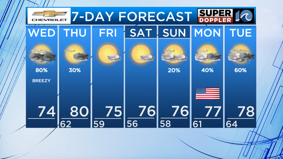
We have been getting soaked all morning long as a large area of low pressure has been bringing rounds of rain and thunderstorms. As we head throughout the rest of your Wednesday more heavy rain is possible mainly for the midday hours and late evening.
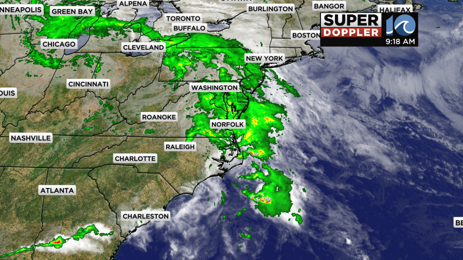
During the midday hours, inland areas will begin to clear out but along the coast heavy rain will continue and we could even see a few storms become severe. It will depend on how much heating we are able to generate during that time but the best chance is looking to be for parts of North Carolina. The primary threat will be for wind gusts as high as 60mph.
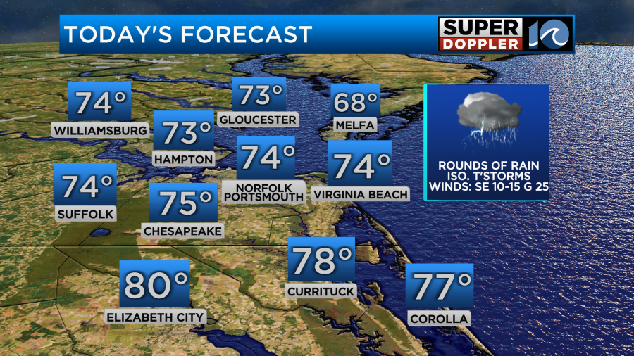
With the clouds and the rain, it will take a little while for temperatures to warm up this afternoon. There will be a little bit of dry time and possibly even some sun late this afternoon and that will help to warm us up. Highs will be a little below average in the lower and middle 70s for most. Parts of North Carolina will be a little warmer with highs closer to 80 degrees. It will remain windy for the rest of the day with gusts nearing 30mph out of the southeast.
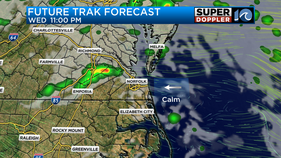
As we head into the evening we will begin to dry out throughout most of the region. The sky will turn partly cloudy to the south while northern areas along the Peninsulas and Eastern Shore stay mostly cloudy. There will also be a chance for an isolated shower or downpour but the coverage will be minimal.
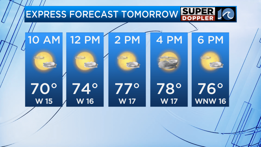
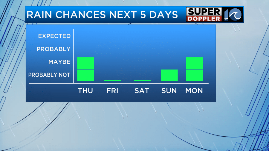
As we head into the day tomorrow some drier air will return allowing for sunshine in North Carolina for most of the day. The southside will also see a fair amount of sunshine mixed in with a few more clouds. This sunshine will help warm us up back into the upper 70s to lower 80s. A stray shower is possible across Hampton Roads as moisture wraps around the departing low pressure system. The best chance for rain will be for the Peninsulas and Eastern Shore. It will not be a washout!
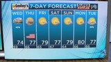
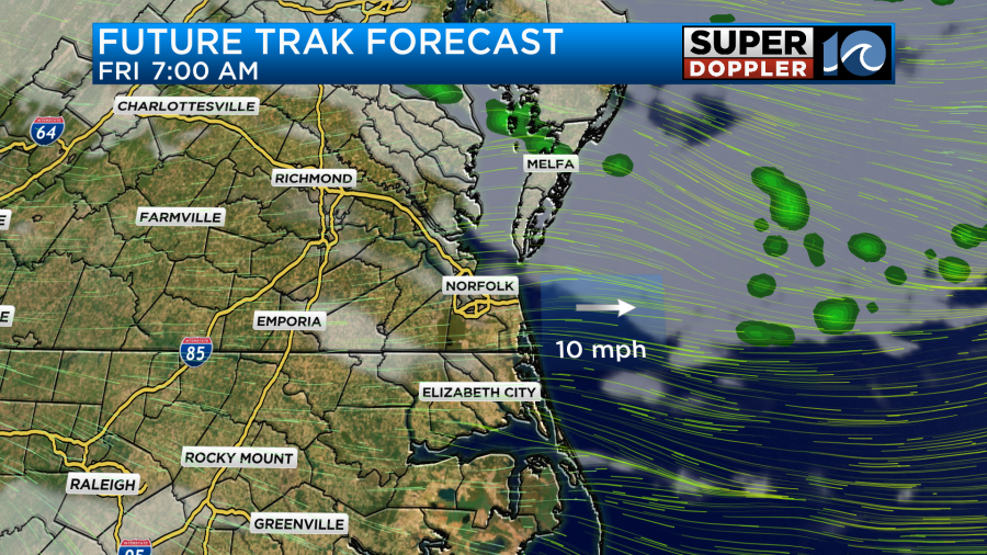
As we head into the day on Friday our weather will be much nicer with mostly sunny skies across the region. A stray shower is possible around sunrise to the north but dry air will limit the coverage. Highs will be a bit cooler in the mid 70s but humidity will be down so it will feel fantastic!
The dry weather continues for most of Memorial Day weekend as Saturday and Sunday feature low rain chances and plenty of sunshine. Highs will remain in the middle and upper 70s with low humidity.
Rain looks to return to the region on the Monday of Memorial Day but the coverage as of now is likely to be scattered. Models are indicating that Tuesday will feature more rain but this could change between now and then so stay tuned for updates.
Stay dry and enjoy the nice weather early this weekend!
-Meteorologist Brian Michigan