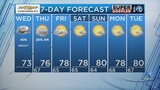
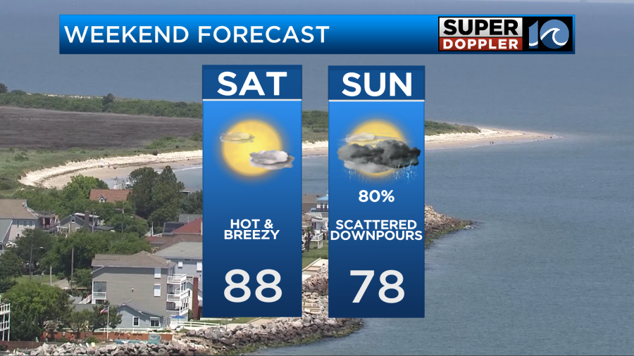
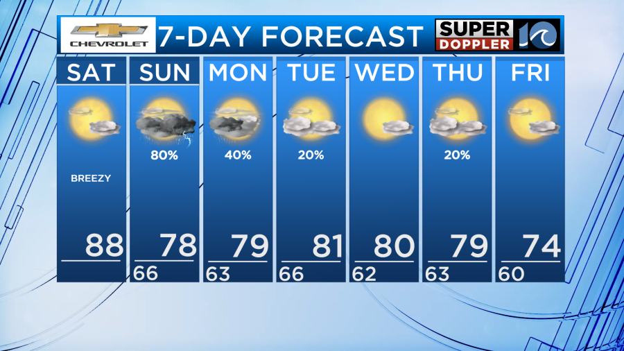
We are in for another classic weekend split across Hampton Roads. Earlier in the week it looked as if Saturday would be a wet day before an omega block pattern set up across the lower 48 pushing the storm timing back to Sunday. This will allow for another hot and humid day with temperatures near running 10-15 degrees above normal!
While our area remains dry today, interior sections of Virginia and North Carolina will experience rain today so if you plan on traveling west into the Piedmont region be prepared as some rain could be heavy at times.
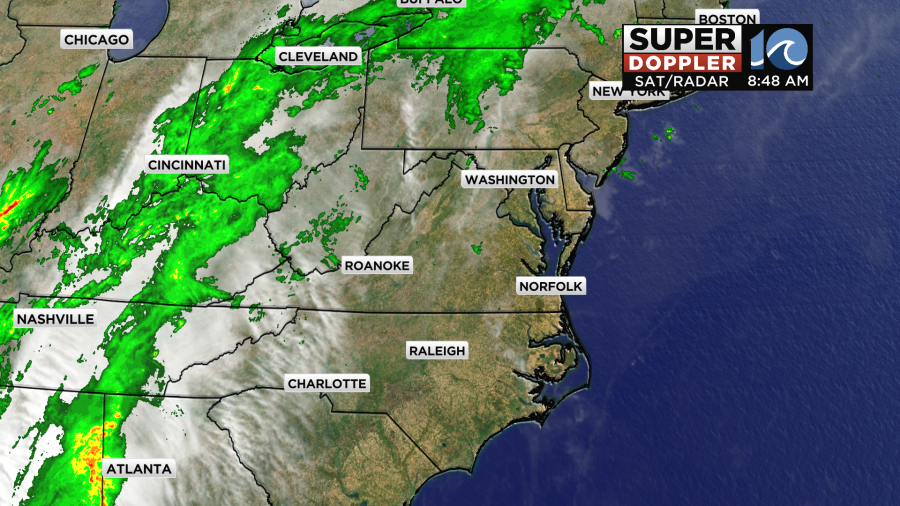
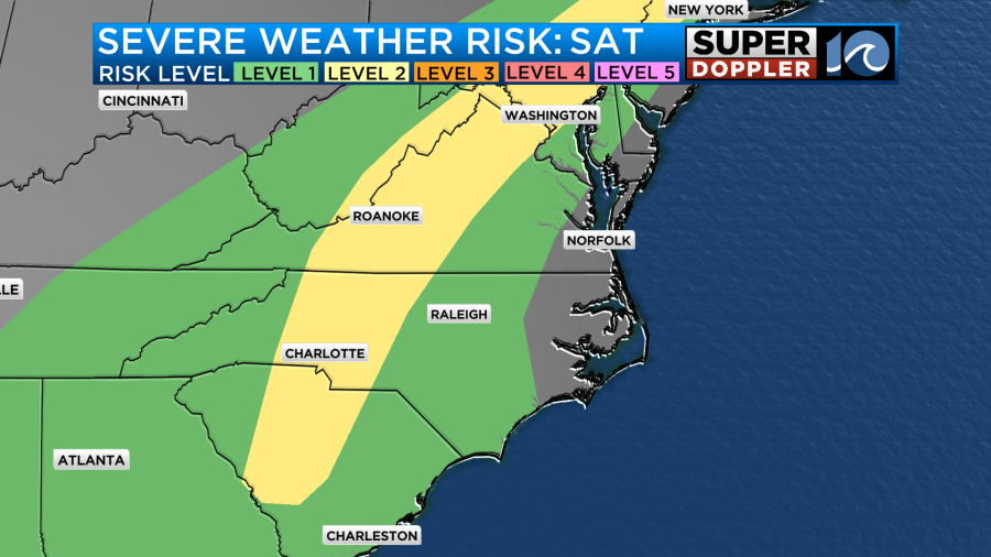
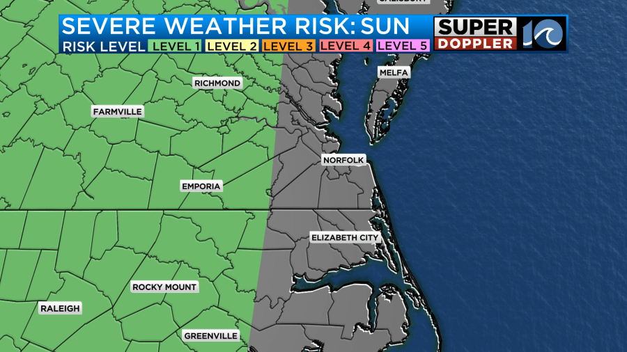
Not only could the rain be heavy for inland areas, but severe storms are possible as well with straight line wind gusts of 50-60mph being the primary risk.
As a result, the storm prediction center has a level 2 out of 5 risk across parts of the Piedmont region and into the mountains of Virginia.
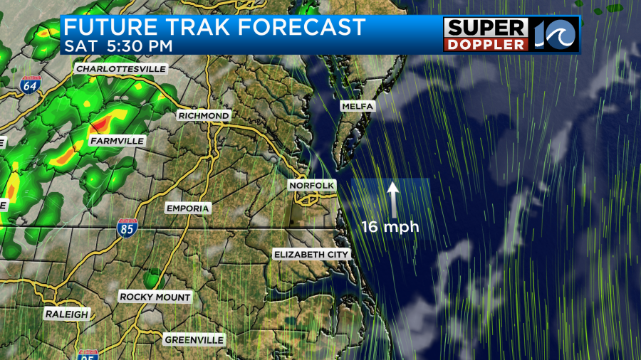
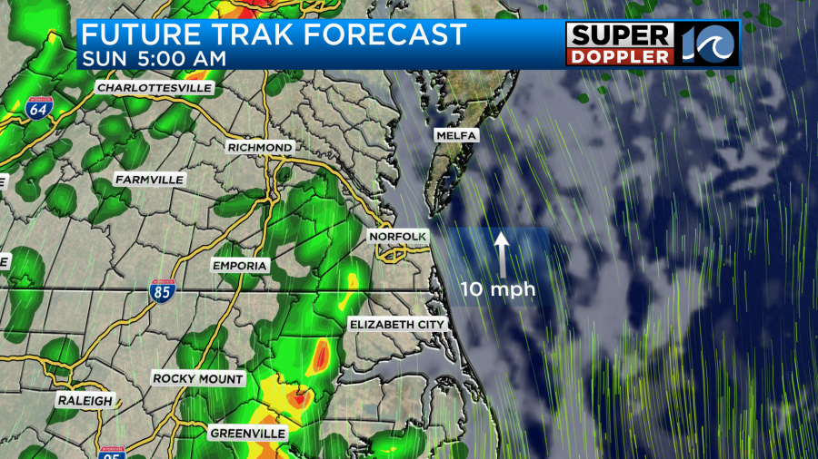
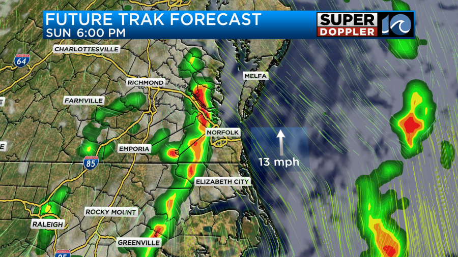
As the front moves east through the evening and overnight hours, rain chances will go up early Sunday morning. Starting around 5 am for the southside and northeast North Carolina, scattered downpours will be possible as well as some isolated thunderstorms. If you plan on getting out on the roads early tomorrow, give yourself some extra time as heavy rain could slow down your drive.
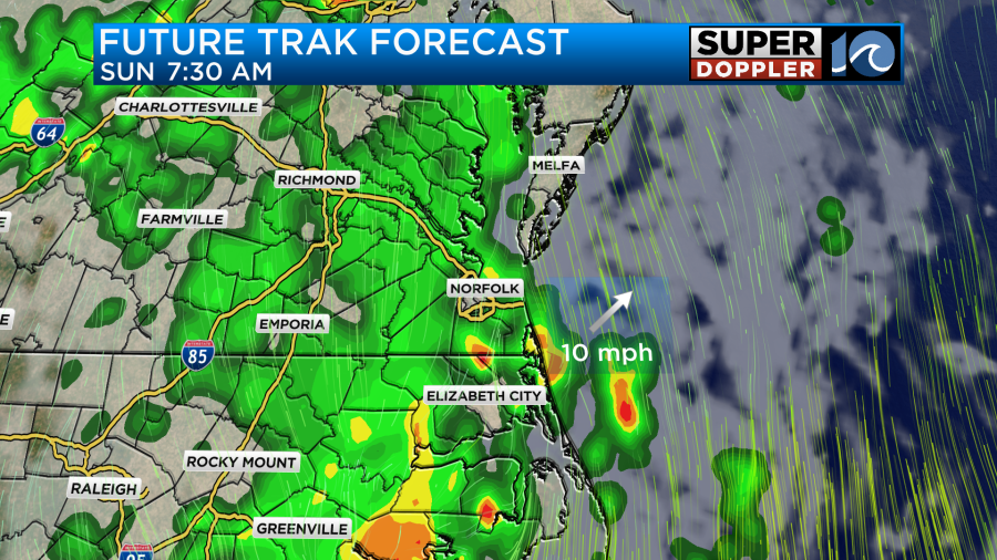
Rainfall will continue to be steady to even heavy at times throughout the early morning hours. By around 8 am, rainfall will be more widespread across the region including the Peninsulas and portions of the Outer Banks. The Eastern Shore should expect widespread rainfall to develop soon after 8 am.
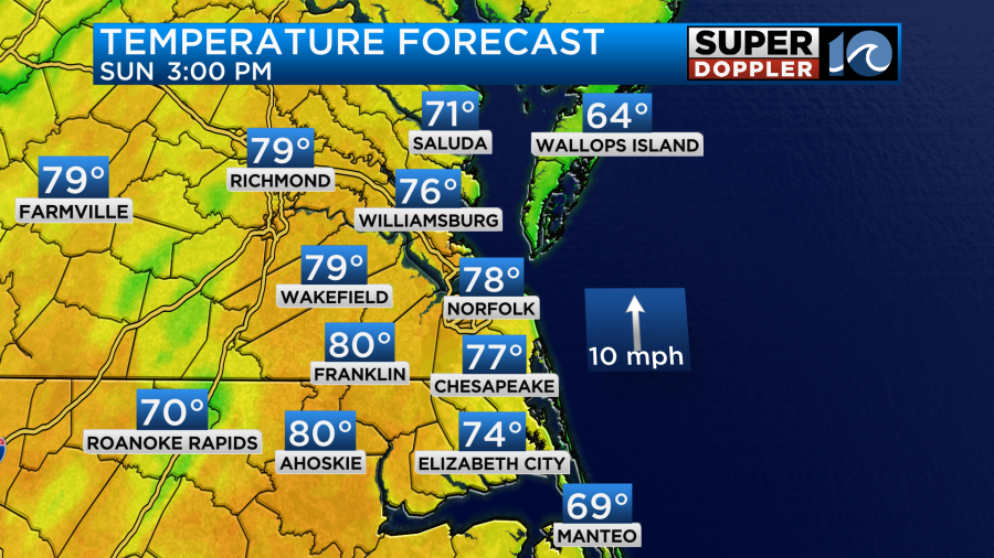
As we head into the early afternoon we will get a brief break from the rain and it is possible for a good amount of sunshine to pop back out. With the sunshine and southerly winds, temperatures will get back up near 80 degrees for the afternoon.
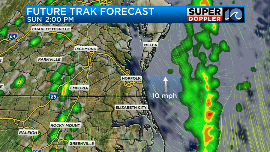
This brief break in the rain will only fuel the atmosphere for another round of showers and storms later in the day tomorrow. Some storms could be strong with winds upwards of 60mph possible.
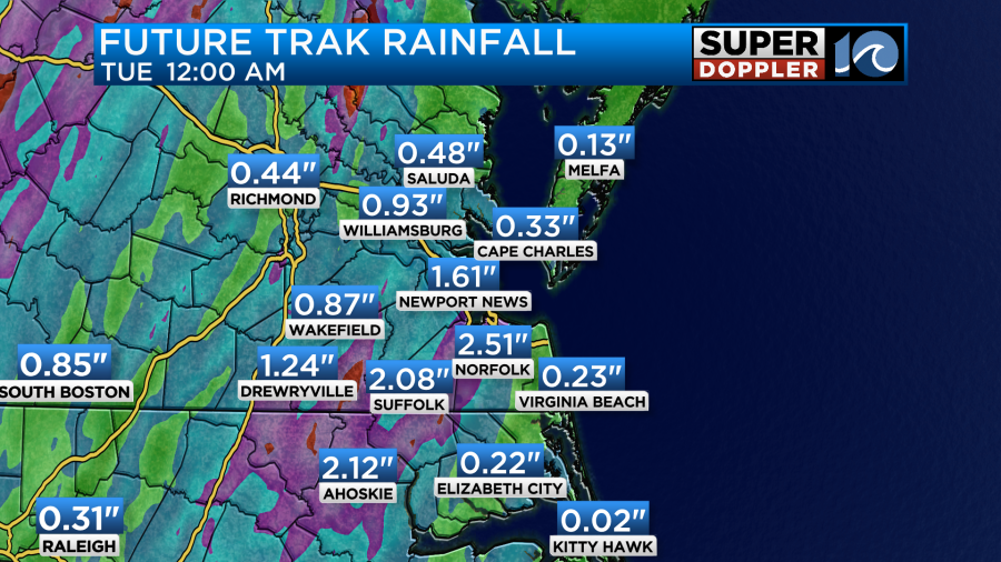
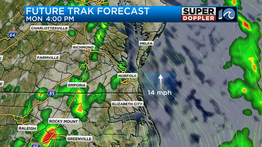
As we head into the start of the next work week this pesky upper level system remains across the area. With the front lingering nearby, another round of rain will return during the afternoon hours of Monday with isolated thunderstorms mixed in. Some areas which experience multiple rounds of heavy rain could see over an inch of rain over the next few days.
This system will likely pull away from the area with dry weather returning as we head into the middle of the week.
Have a good weekend!
-Meteorologist Brian Michigan 🤙