
Today we are going to have some pretty rough heat and humidity over the region. We have a warm front to our north with high pressure building in stronger just offshore.
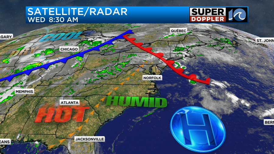
There is a cool front over the Midwest that will provide us some relief, but that won’t get here until Thursday night.
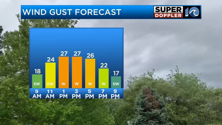
Today we will have lots of sunshine through the day. I can’t remember the last time we had a full day of sunshine. Along with that we’ll have a southwest wind running at 10-15mph with gusts to 25mph.
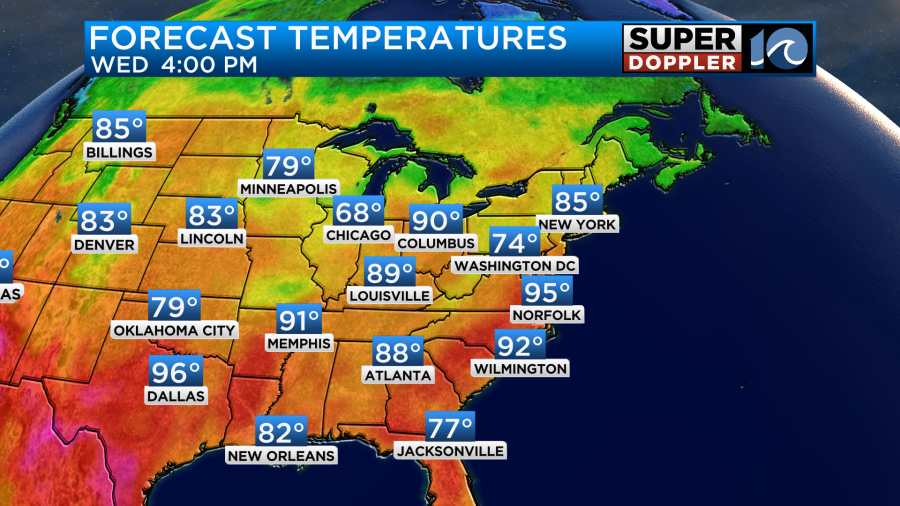
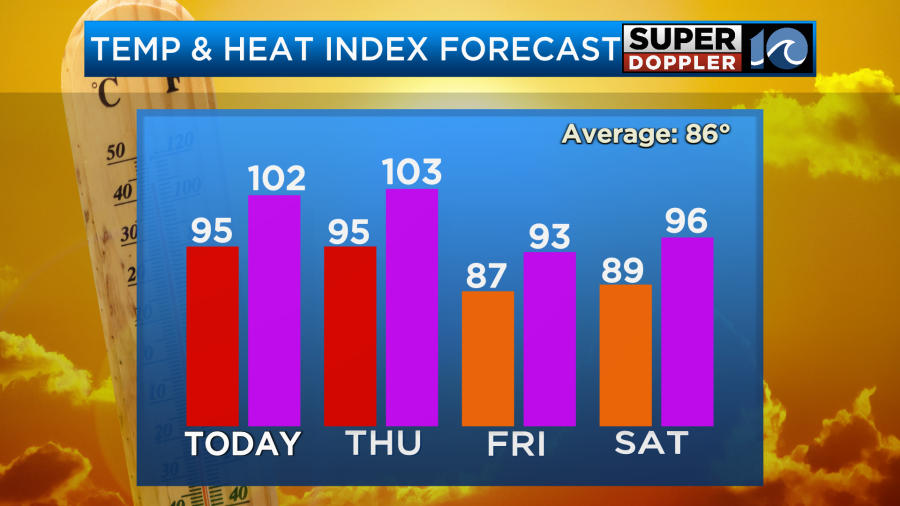
This will push our temperatures up into the mid-upper 90s this afternoon.
Dew points are in the mid 70s.
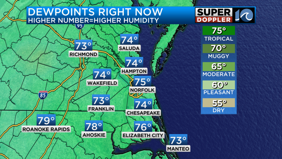
That is a tropical-type feel. It will help to create heat indices between 100 and 105 degrees this afternoon.
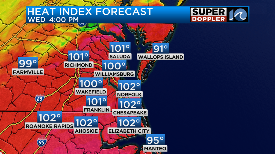
Be sure to stay hydrated. Take plenty of breaks in the shade. Also, wear light-weight, light-colored clothing. Luckily, there will be that breeze. That should help a bit in how it feels outside.
Tomorrow we will have very similar weather. We’ll have lots of sunshine, a southwest breeze, and high temps in the mid 90s.
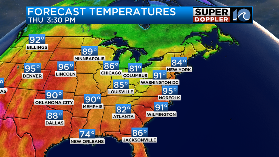
The heat index will be back up in the lower 100s.
The big difference tomorrow is that the cool front will be moving in during the evening. This will produce a line of showers and storms.
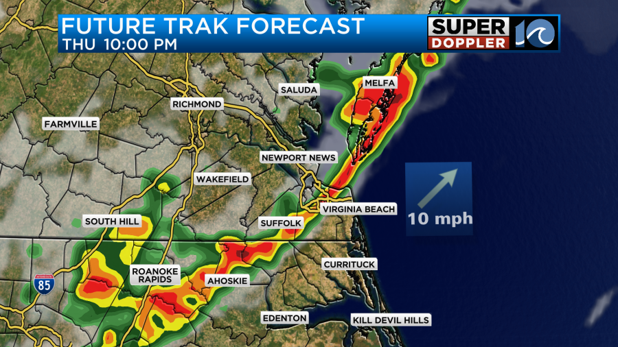
These storms could be strong to severe with strong/gusty winds and heavy downpours the main threats.
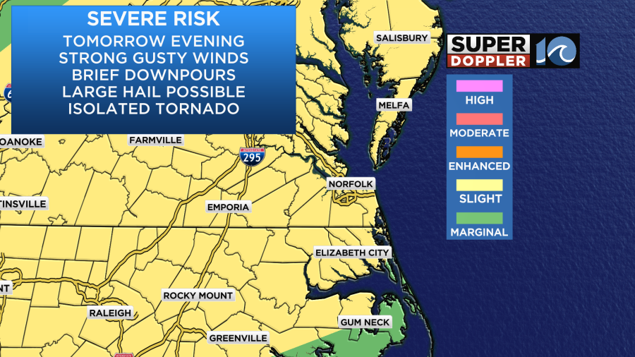
This line should drop to our south before 2am, but check back for updates to the timing.
This will cool us down and dry us out for Friday and Saturday. The humidity should drop to more comfortable levels for about 24 hours.
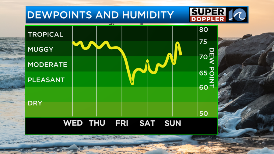
High temps will be in the mid-upper 80s both Friday and Saturday. No rain is expected. No rain is expected on Sunday either. However, the heat and humidity will bounce back. Highs will be in the 90s. The heat index will be over 100.
I’ll talk a little more about the weekend in tomorrow’s weather blog.
Meteorologist: Jeremy Wheeler


