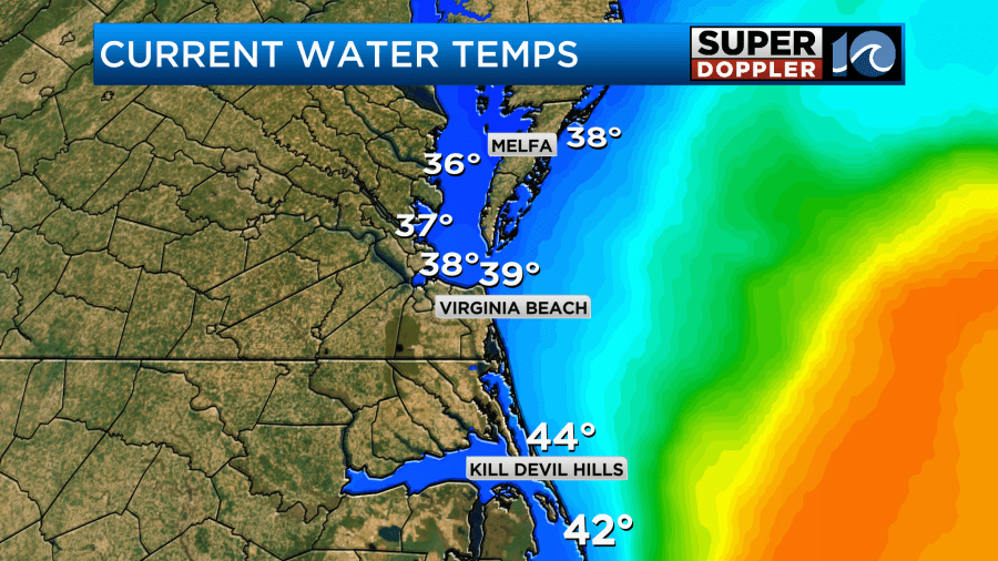
Temps can get tricky this time of year. Between now and early Spring the water temps are typically pretty cold. Last year was an exception. However, this year things are closer to average. Water temps on the Bay are in the upper 30s with low 40s over the ocean.
So if the wind changes slightly, and they come in off of the water, then you can get a big change in the air temperatures.
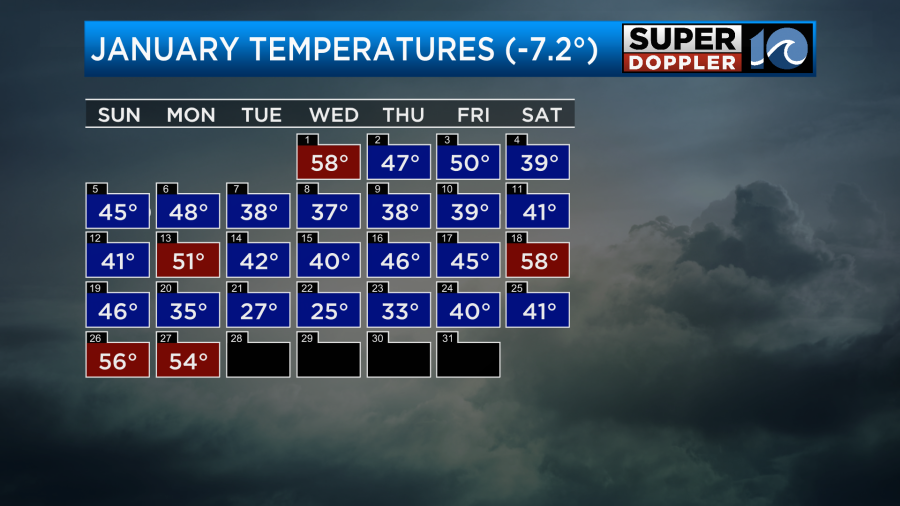
We are in the meteorological Winter right now. The lowest average temperature for the year is 50 degrees in mid January. Now we are approaching early February. So average temps are rising.

While we did have a long streak of cold air, we are now in a recent mild pattern.
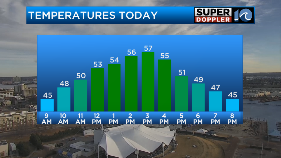
Yesterday we topped off in the mid 50s. The sun popped out in the afternoon, and it felt great! Today we will have more mild temps. Highs will rise to the mid-upper 50s, and we’ll have lots of sunshine.
We do have a cool front far offshore, but it really didn’t have much cold air behind it. So it was more dry air than anything.
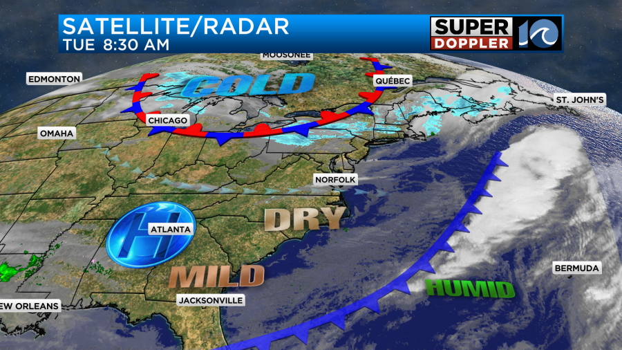
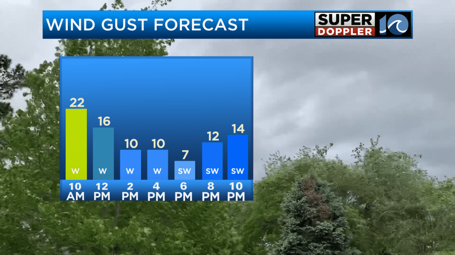
There is a stationary front near the Great Lakes that will help to create a lot of snow showers today up there and in the Northeast. None of that will affect us. (besides some delays with connecting flights). Locally we’ll have a west breeze today. Winds will gust to 20mph this morning, but they should settle down by the afternoon.
Tomorrow there will be an area of low pressure over the Northeast with high pressure to our southwest. This will create a stronger westerly breeze here. Winds may even gust up to 30mph for a time.
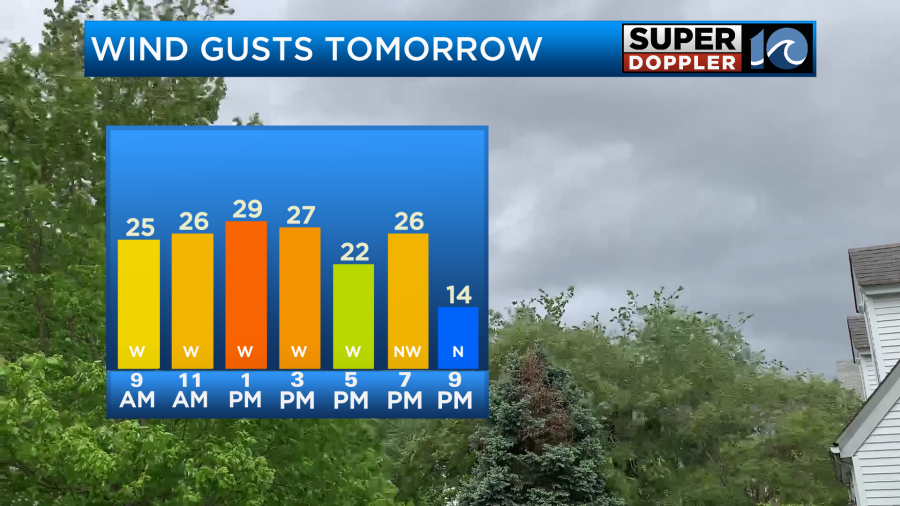
This should be a warming wind. We’ll also have lots of sunshine. So high temps will aim for the low-mid 60s.
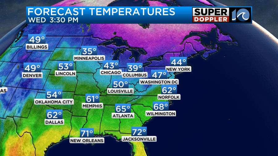
Both today and tomorrow it will be much cooler near the shore. So it may only be in the upper 40s both days on the Eastern Shore and over parts of the Outer Banks. If the wind changes a little, then temps may drop over cities along the southern Chesapeake Bay. We’ll see. Overall, tomorrow will be a dry, mild, and breezy day. Don’t get too used to it…
By Thursday the winds of change will arrive. Winds will turn out of the north/northeast as high pressure shifts around. This will cause high temps to drop to the 40s! Wow!
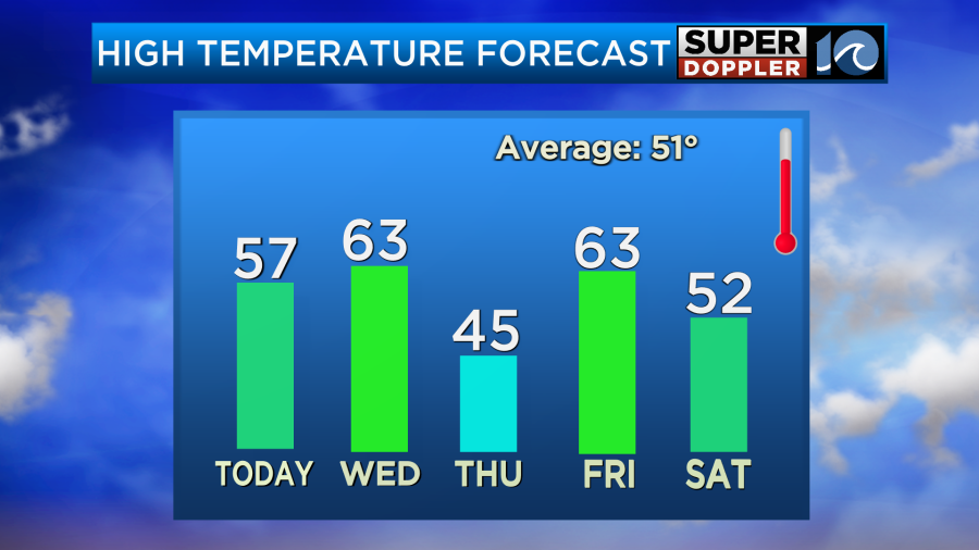
We’ll have lots of sunshine. As you can see though temps will quickly rebound. By Friday the southwest winds will be back. That will push our temps up to the 60s again. Some models are even suggesting that we’ll get close to 70. However, we will have moisture returning to the region as well. There will be increasing clouds. Then we’ll even have a few showers possible later in the day.
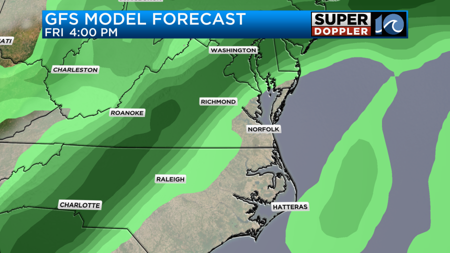
The models are showing a line of showers forming by Friday evening. It may even be heavy for a time.
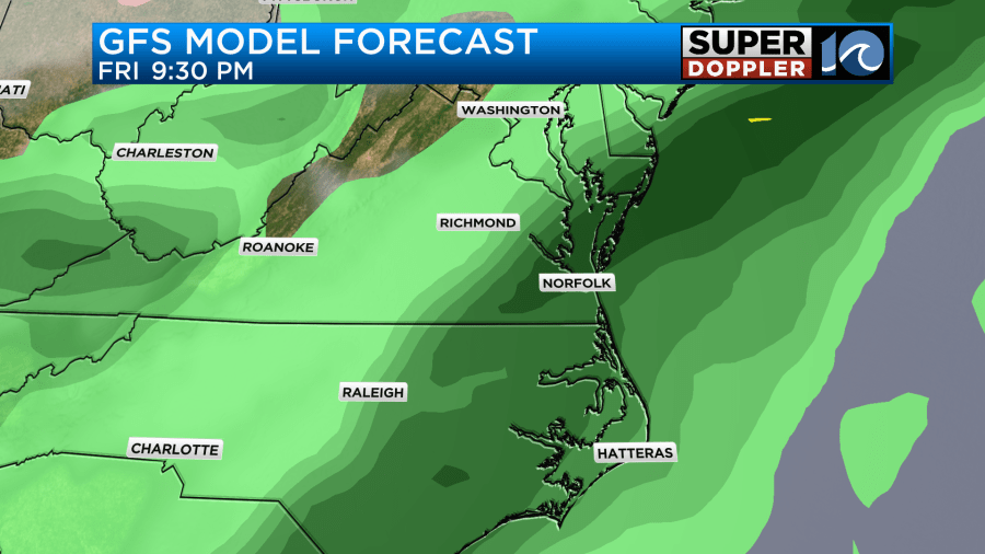
This will be as a cold front slides in from the north. The good news is that it looks like the rain will end by early Saturday morning. I’m not too confident in that timing yet, but the trend is good. As of right now I have clearing skies on Saturday with highs in the low 50s. The weekend forecast is a bit tricky. That’s partly due to the first topic of today’s blog. I’ll go more into the weekend forecast in tomorrow’s weather blog.
Meteorologist; Jeremy Wheeler