
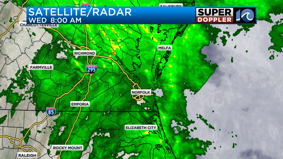
This morning we had a big area of rain that covered the entire region.
There hasn’t been a big change in the weather pattern since yesterday. However, there are some subtle changes. The stationary front to our south has turned into a slow-moving warm front. It is steadily creeping north along with a weak area of low pressure.
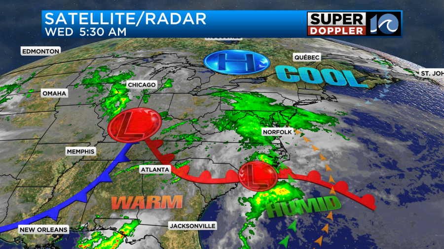
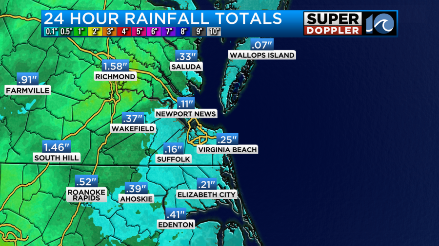
Moisture has been streaming north of the warm front since yesterday. The overunning pattern created more wet weather yesterday and last night. The rain up to this point has been very light. So amounts have only been about one or two tenths of an inch with higher amounts closer to I-95.
That will change today as the rain starts to pick up in our viewing area. We’ll have a lot of rain between now and the early afternoon. It could be heavy at times.
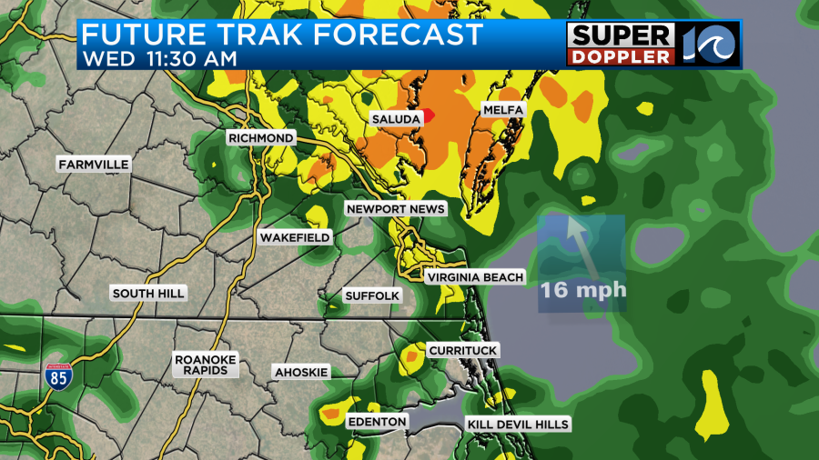
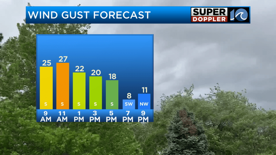
Winds will gust up to 25mph out of the southeast. This could make the rain feel heavy as well.
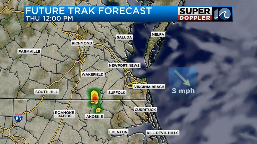
This afternoon there could be a small break before a second round of showers (and possibly some storms) roll through.
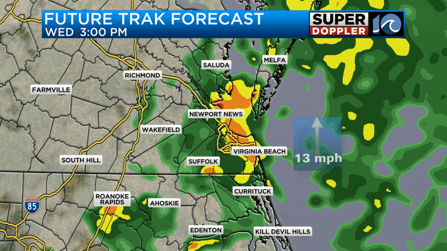
This could put down another quick half inch of rain over several locations. The good news is that the models are in fair agreement that the rain will taper off by the evening commute.
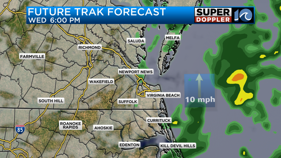
There may be some slight clearing towards the end of the day.
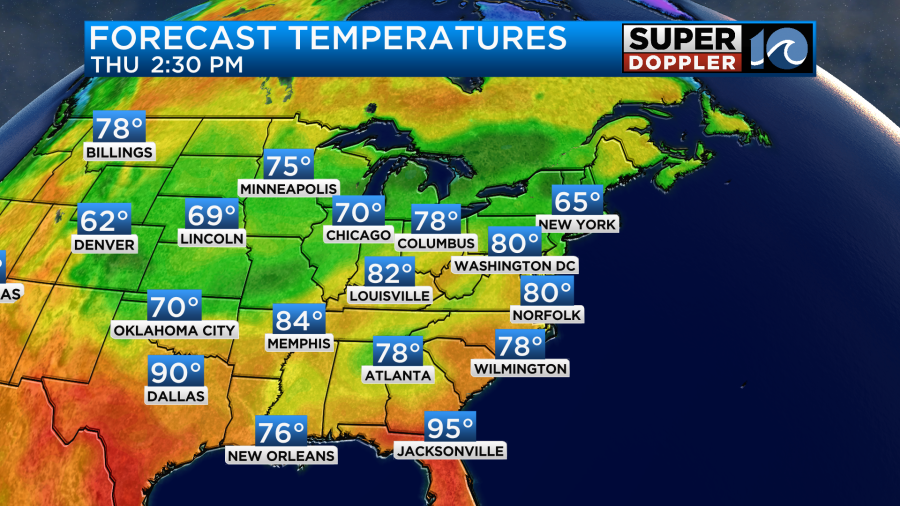
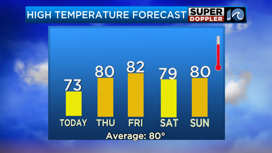
If it wasn’t for the southeast winds our high temps would probably only be in the 60s again. However, I’m pretty sure we’ll make it to the low-mid 70s.
Tonight the front may stall out and weaken over the region, but the surface low should push to our northeast. We’ll have quiet weather overnight into tomorrow with only an isolated shower possible. Then tomorrow we’ll have a mix of sun and clouds with only some isolated showers or storms during the day.
High temps should be able to perk up to near 80 degrees since there will be more sunshine.
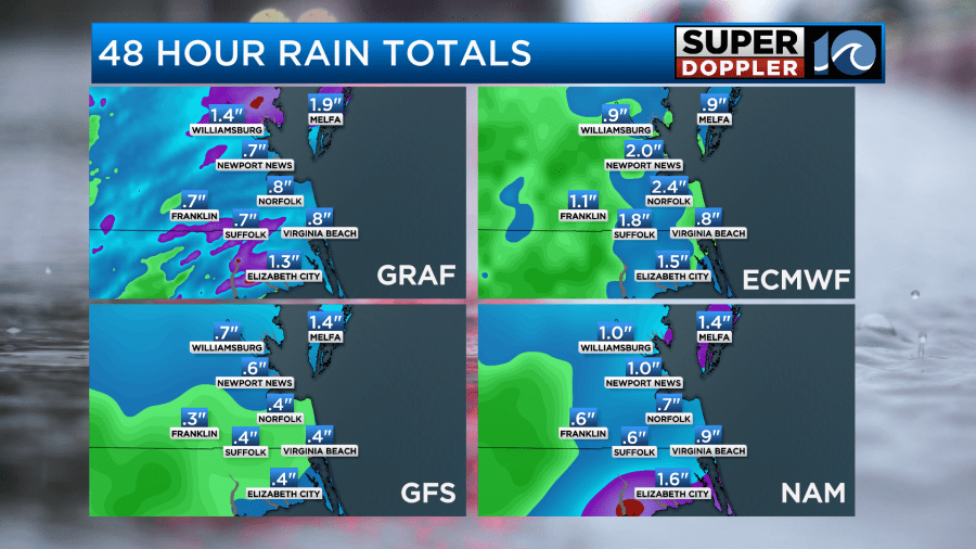
Over the next 48 hours we’ll have about a half an inch to one and a half inches of rainfall.
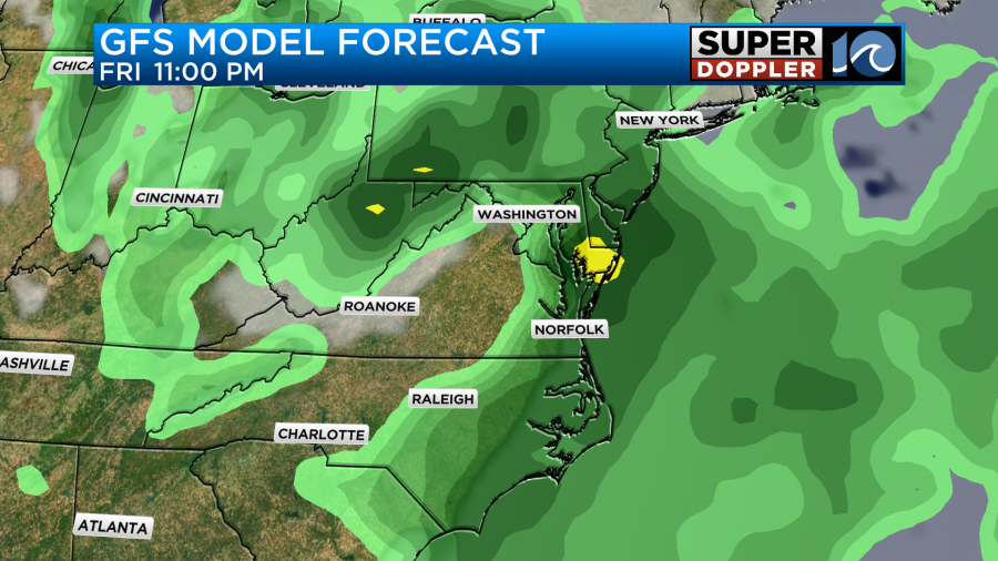
By Friday a bigger area of low pressure will form to our west. This will get closer to us during the day. There will be more scattered showers and storms, but at least the day doesn’t look like a washout.
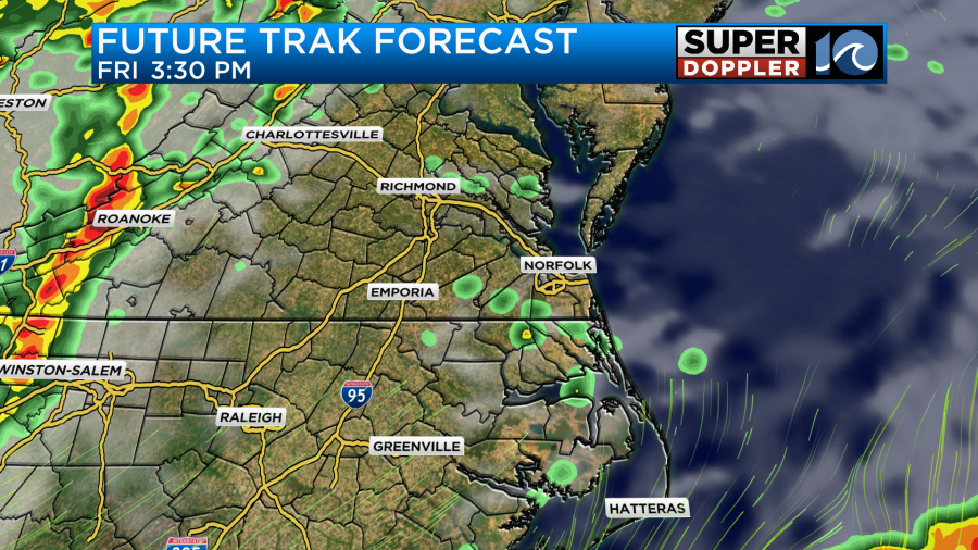
We’ll probably have a mix of sun and clouds Friday, but it could be flat out mostly cloudy. We’ll see. Either way high temps should make it up to the low 80s.
As the bigger area of low pressure moves through Friday night into early Saturday morning there may be some more heavy rain and thunderstorms.
It should move through by Saturday thereby dragging a cool front through the region. There may be a few lingering showers Saturday morning, but I think we’ll have drier weather for the weekend overall. I have us totally dry on Sunday with highs near 80. I’ll have more details on the long-term forecast in tomorrow’s weather blog.
Meteorologist: Jeremy Wheeler


