We have two weather systems that are impacting our weather this weekend. The first one actually moved close to the region late yesterday. A weak area of low pressure moved up from the south. It was wrapped in a blanket of higher humidity. We had rain develop over North Carolina. Then it moved up into Hampton Roads. We had the rain spread more into southeast Virginia during the overnight.
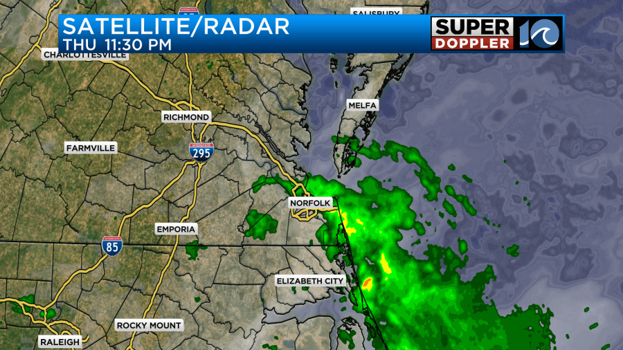
The showers slowly moved northeast this morning as the low rolled offshore. We did pick up a couple of tenths of an inch of rainfall over the last 24 hours. Some places over North Carolina and in Virginia Beach picked up a nice little amount of rain.
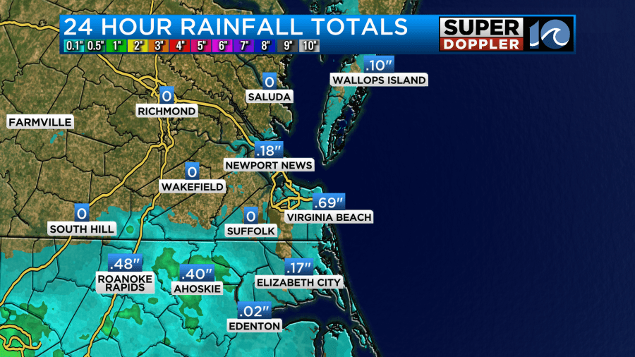
Norfolk had a little under a quarter of an inch.
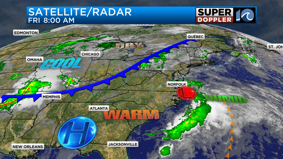
The low will very slowly push out to sea today. Meanwhile we are tracking the second weather maker well off to our west. That is a slow-moving cool front. I’ll talk more about that in a moment.
Our forecast today calls for a few of those wrap-around showers to drop down back into Hampton Roads later this morning into the midday hours.
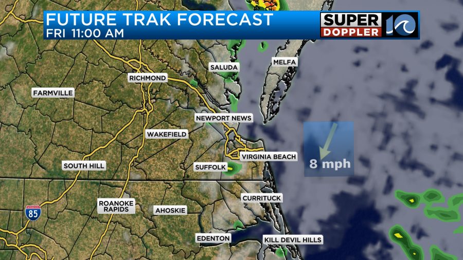
I’m hoping that the showers are limited for the Parade of Sail happening around midday, but some spotty showers are at least possible.
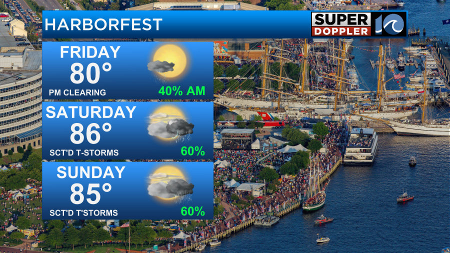
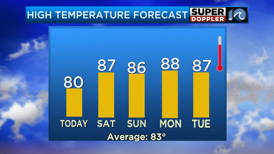
The models are more in agreement about clearing things out during the afternoon hours. We will develop a northeast breeze as we go into the midday and afternoon. Winds will run at 10-15mph with few gusts to 20mph. Those gusts are more likely near the shore. With the clearing we should be able to pop our high temperatures to near 80 degrees.
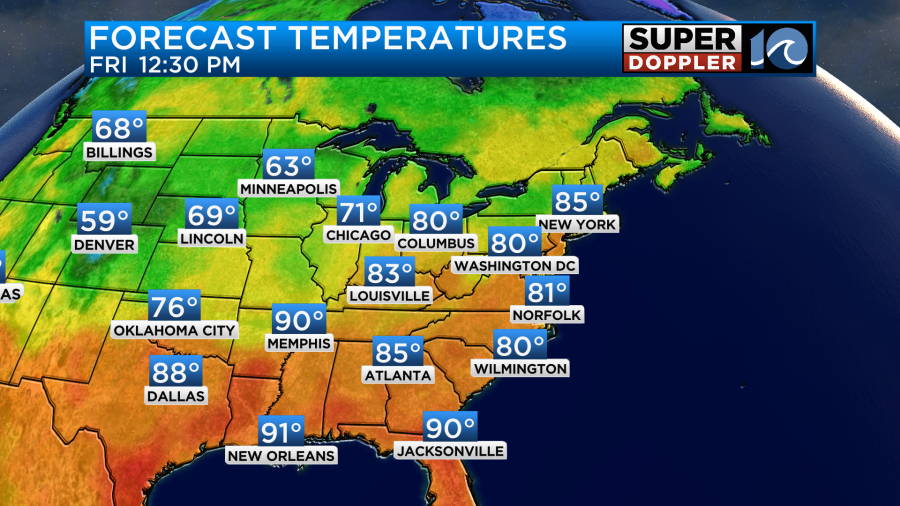
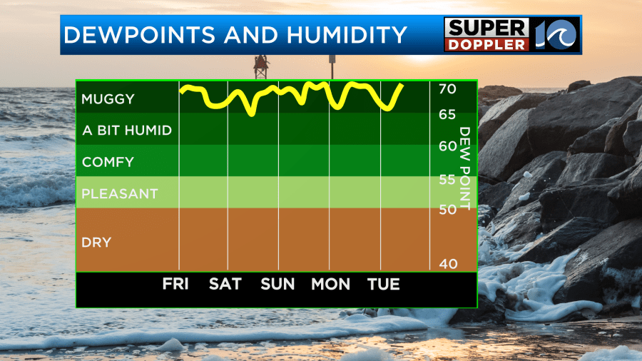
Keep in mind that is will be muggy with dew points well into the 60s. The breeze should help out a bit with that.
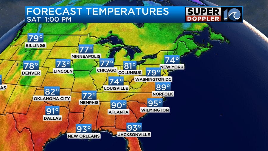
Tomorrow the cool front will slide closer to our region. We’ll have a lot of warm/humid air out ahead of it. High temps will be in the upper 80s.
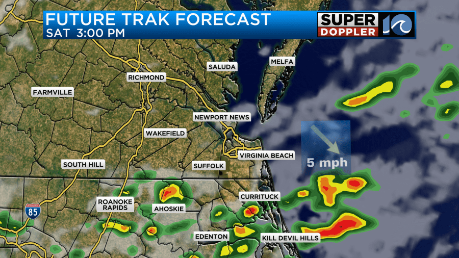
This will be fuel for a few rounds of showers and storms through the day. Unfortunately, the models keep changing the specific timing with each update. There is some agreement in bringing in a round of showers and storms late Saturday morning into the early afternoon.
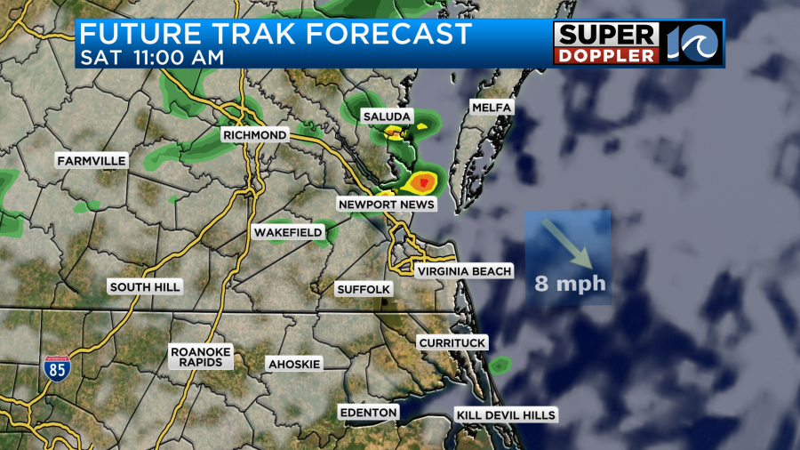
Future Trak then has more of a focus across North Carolina in the afternoon, but I think a few storms will still be possible in Hampton Roads.
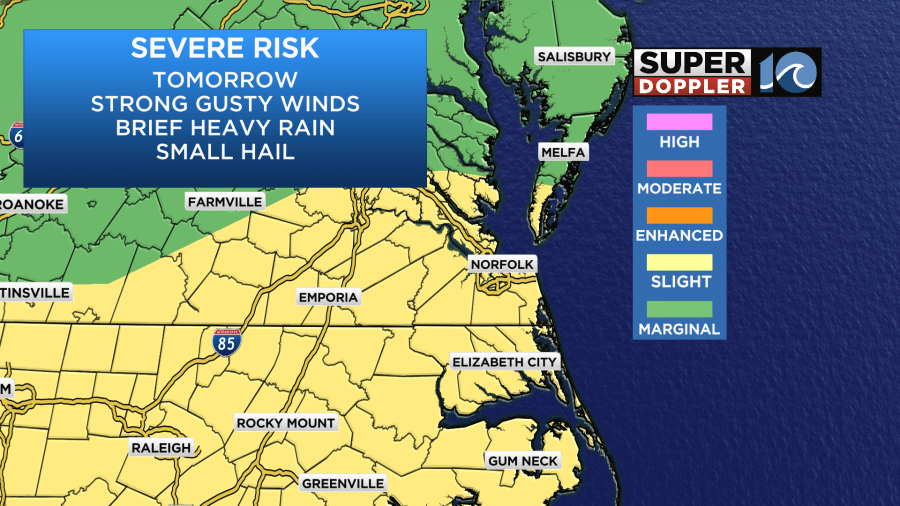
There is a slight risk for severe weather tomorrow for any of the storms that form. Strong gusty winds will be the main threat, but some hail and heavy rain will be possible.
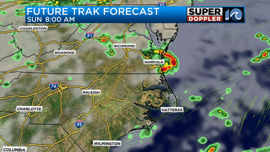
Otherwise, we’ll have a mix of sun and clouds Saturday. Winds will be light and out of the southwest. Unfortunately, the front will stay stalled out on Sunday. PROBABLY just to our northwest. This means that we’ll still be very warm and humid, and it means that we could get some more thunderstorms in the region. It’s hard to pinpoint the placement and the timing due to the exact placement of the front. Here is Future Trak during the mid morning.
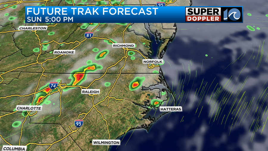
They have more storms continuing into the afternoon into the evening, but it doesn’t look like a washout.
High temps will be in the 80s.
The humidity will stay high over the entire weekend.
Due to the models having a tough time with the front and the storm placement, they are also having a big difference of opinion on the rainfall forecast.
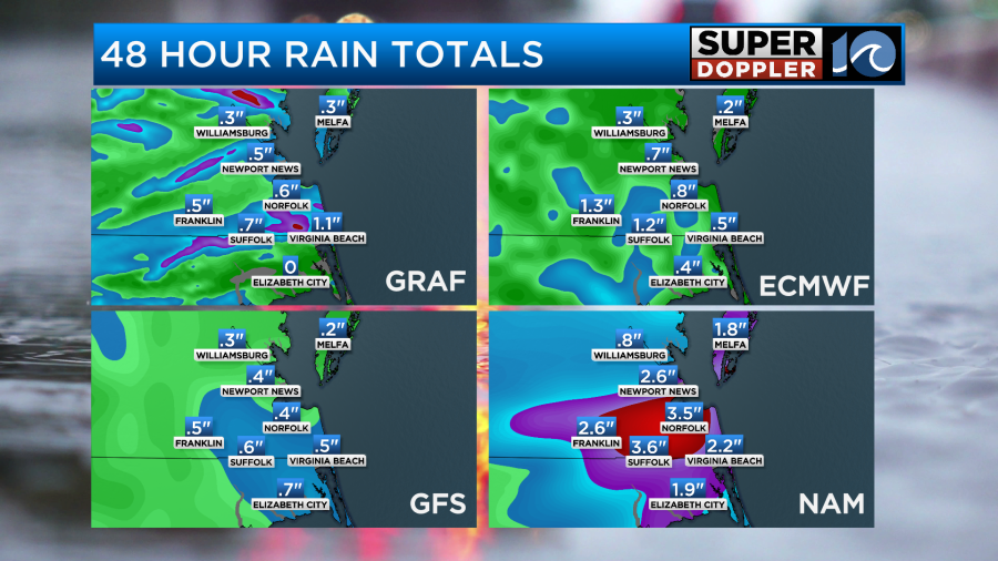
I think the NAM model is overdone, but I do think some isolated areas could get 1-2 inches.
We should get a break from the rain on Monday, but that is salt in the wound as far as the weekend forecast goes. Hopefully, there are a lot of long breaks between the rain this weekend. Especially as far as Harborfest goes. Have fun but be safe out there. Keep checking the forecast, and stay hydrated.
Meteorologist: Jeremy Wheeler