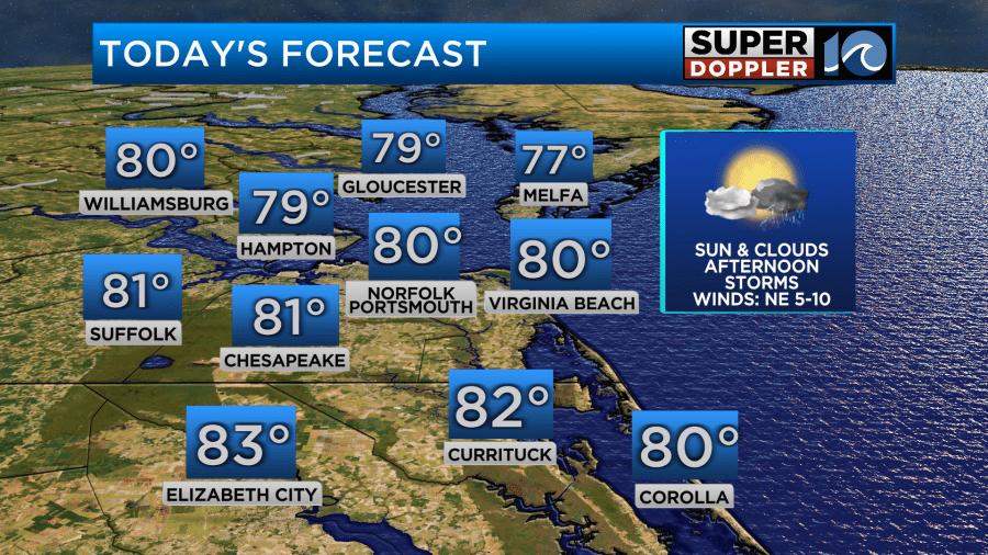
It has been a dreary start to the day across Hampton Roads with cloudy skies and patchy dense fog in spots. Throughout the rest of the morning and into the afternoon the fog will break apart and we may have a few peeks of sunshine but don’t expect much.
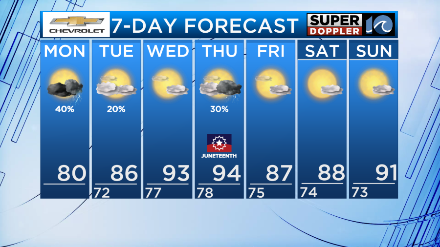
High temperatures will reach around 80 degrees which is a little below normal for this time of year. Despite the cooler temperatures it won’t feel like it since dew points are up which will make things feel like the upper 80s today.
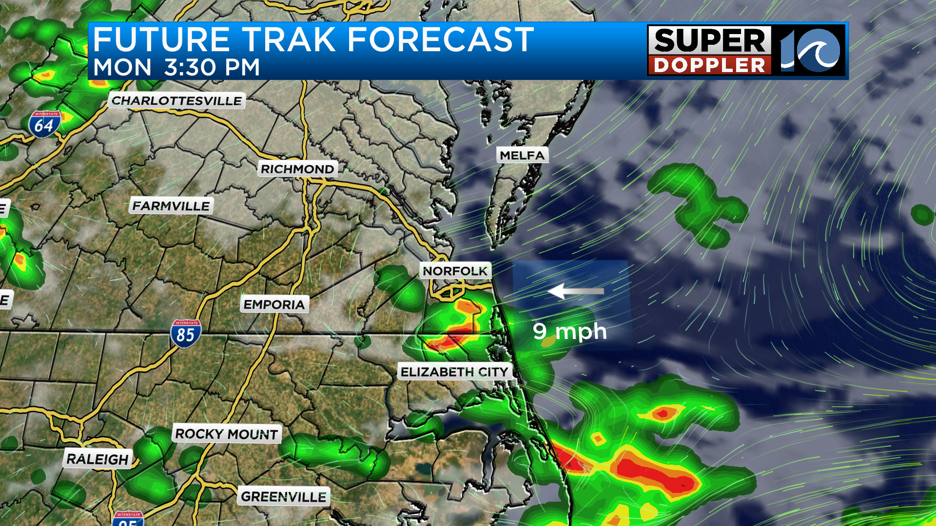
Along with the dreary weather comes another chance for heavy rain this afternoon. When some of the heaviest rain sets up we could get another 1-2 inches in isolated areas.
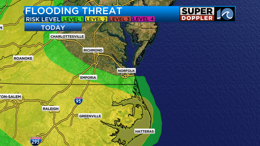
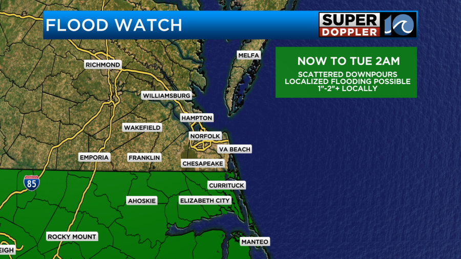
As a result, a flood watch is in effect until Tuesday morning at 2am.
The timing for showers and storms will be early in the afternoon around 1-2pm. It will be isolated at first before filling in across the southside and North Carolina by the mid afternoon.
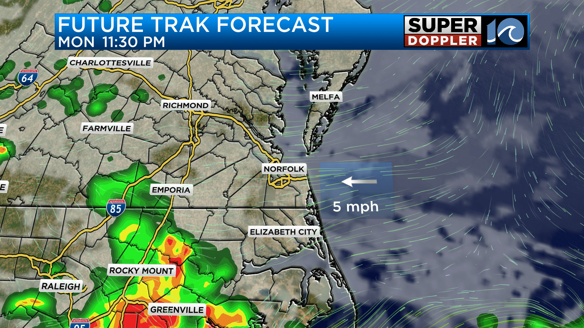
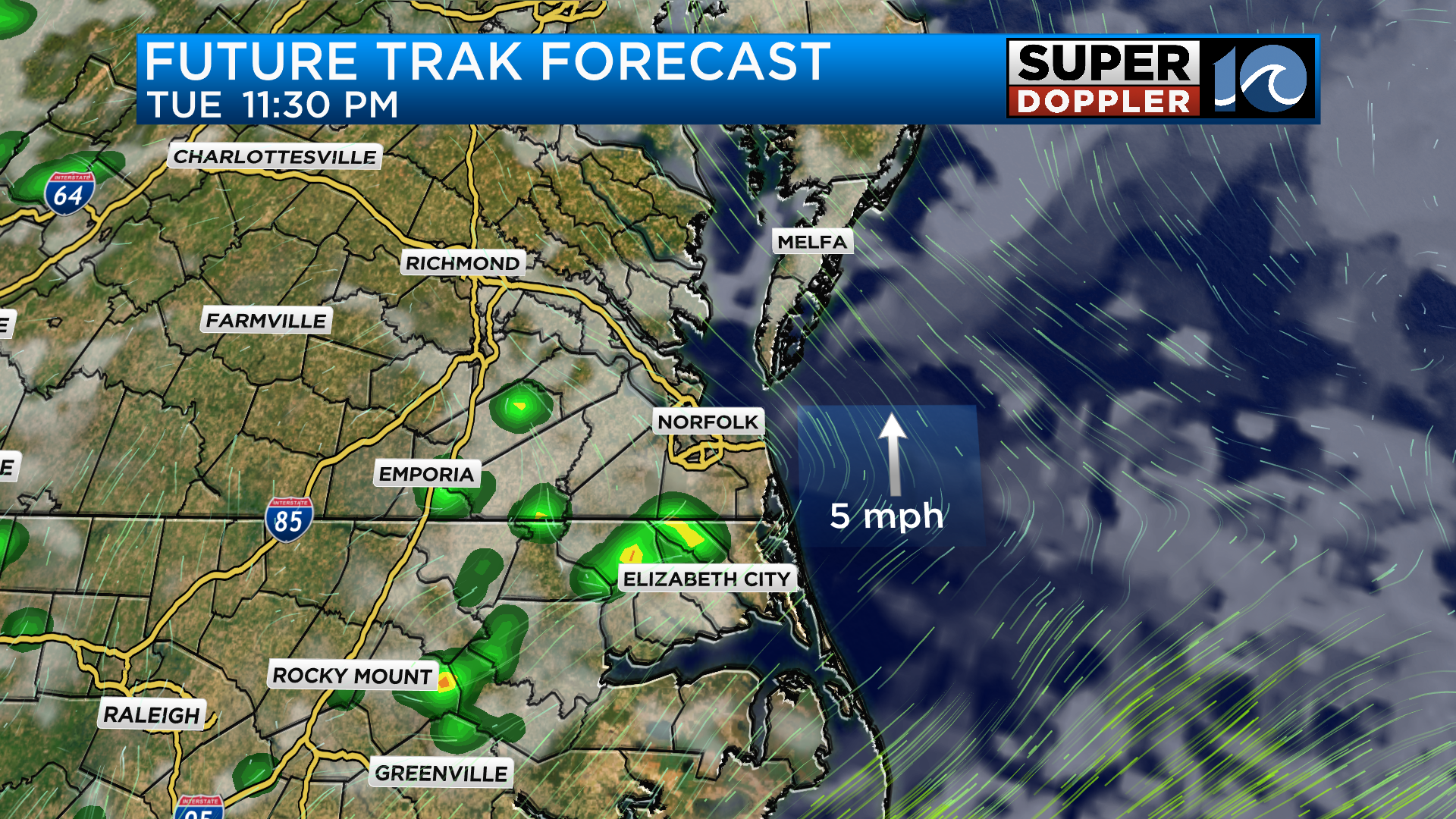
As we head into the evening hours a lingering shower or downpour will still be possible mainly across North Carolina. Heading into tomorrow morning, a few showers will be around bit otherwise it will be a cloudy start to the day.
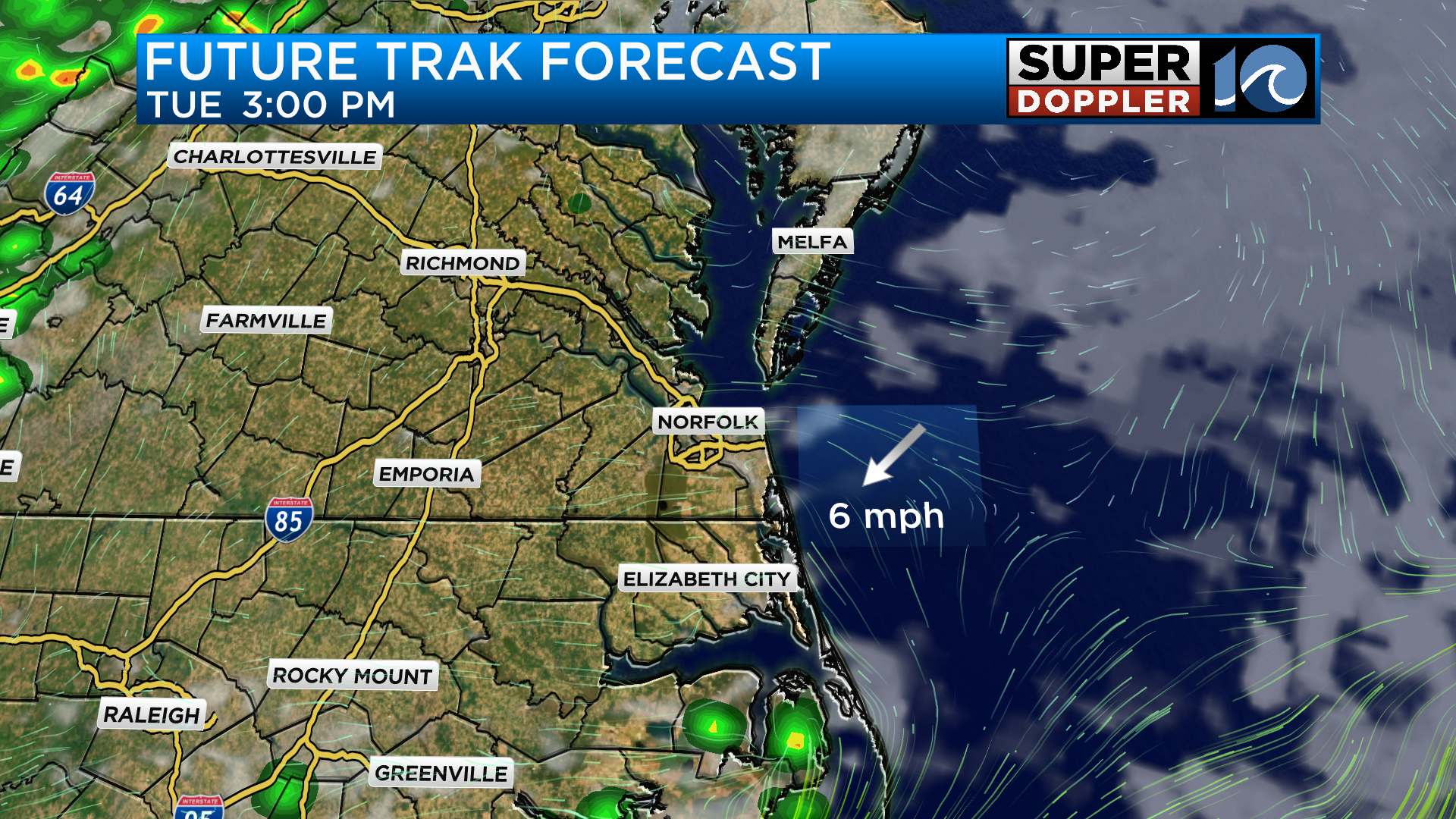
That will be the case until the afternoon when the stationary front starts lifting north pulling the clouds away from the area. With added sunshine, temperatures will rebound into the upper 80s but it will feel more like the lower and middle 90s especially across the southside and North Carolina.
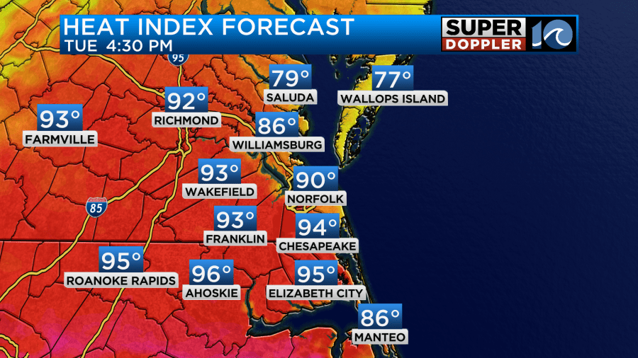
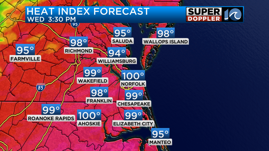
This heat continues to build on Wednesday as the stalled front continues pulling north. We will be dry with a mostly sunny sky from start to finish allowing highs to reach the lower 90s. Southwesterly winds will continue to bring in warm and humid air putting our heat index values into the upper 90s to near 100 degrees.
After a weak cool front moves through on Thursday, our weekend is looking dry with temperatures in the 80s on Friday and Saturday before we return to the 90s by Sunday.
-Meteorologist Brian Michigan 🤙