Earlier this week (Monday) we finally had a good soaking rain over the region after weeks of very little rainfall. Today will be the next round, but today there will be some heavy rain and thunderstorms as well.
Today we have a weak are of low pressure moving east along a stationary front.
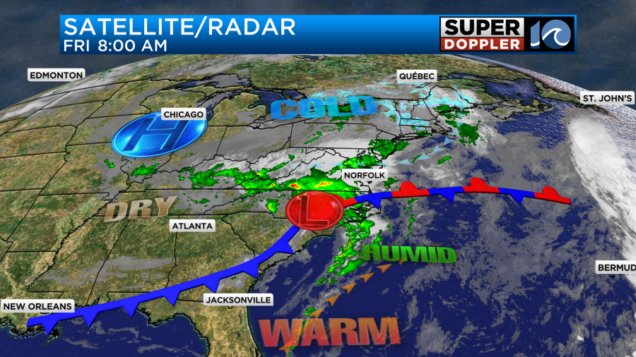
It is dragging a cold front behind it as it moves east. There is some warm, humid, and unstable air south of the stationary front. However, this probably won’t move much more to the north today. Meanwhile we already have a lot of moisture in the region. We have had some scattered rain showers already.
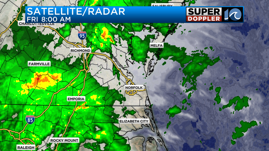
As I write this there is a large band of rain heading towards Hampton Roads. This band was forecast well by our Future Trak model yesterday. This band will move through between now and about 11:30am.
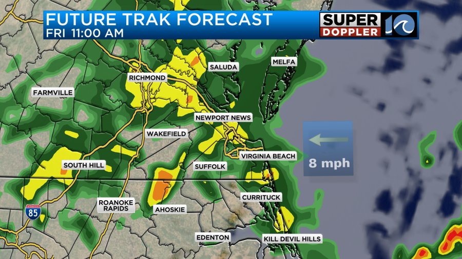
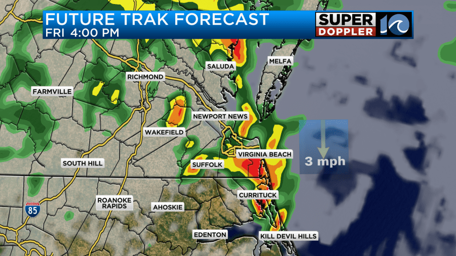
Heavy rain and a few storms will be possible through that time, but I think the threat for any severe weather will be limited. The rain may let up (a bit) between midday and the early afternoon. Then a second round of showers with some thunderstorms is expected later in the afternoon. This will be as the surface low moves through the metro area. Heavy rain and a few strong storms will be possible during that time.
There is a marginal risk for severe weather for about the southern half of the viewing area. Mainly for northeast North Carolina and the Southside, but the Peninsula is on the north edge of the risk.
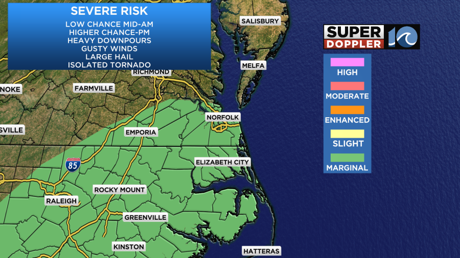
The freezing level is a little lower this time. So some hail may be possible. Luckily, there’s not too much wind shear (which causes upper-level storm support). So the hail should be limited. There will be some instability, but even that should be limited by the clouds and rain showers. Having said that we’ll have high temps aiming for the low-mid 60s today.
The general surface wind will be out of the east/southeast today. It will run at 5-15mph with gusts to 20mph near the shore.
By the evening the surface low will be moving out to sea, and the cold front will be pushing to the southeast. This will pull in some more stable air. However, the upper-level low will be sliding in from the west. You can see the large dip on the Water Vapor image below.
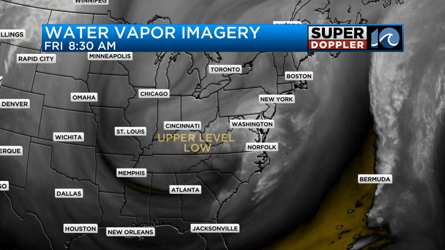
This upper-level low is huge. It will create cloudy skies and drizzly conditions basically from tonight through tomorrow evening.
So yes, I’m expecting a cloudy day tomorrow with drizzle at times. There may be a few rain showers as well. It is also going to be chilly. High temps are now aiming only for the low-mid 50s.
We’ll also have a north breeze gusting up to 20-25mph. It will not be a nice day! At least the pollen will get washed out for the next 48 hours. So there’s a silver lining.
By Sunday both the upper and low-level lows will roll out to sea. We should have some clearing after the morning. High temps will be in the low 60s.
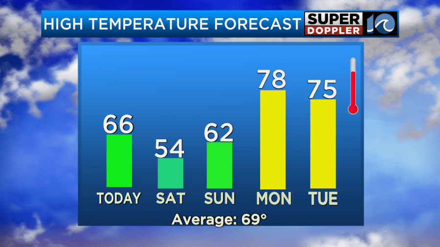
I wish we could fast forward the Monday forecast to Sunday. Monday will be mostly sunny with highs in the upper 70s.
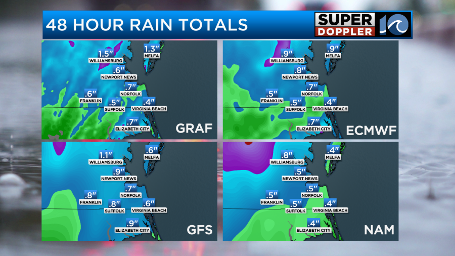
Finally, the rain totals… We are expecting about a quarter to three quarters of an inch. There will be some isolated areas of an inch or more.
Meteorologist: Jeremy Wheeler


