In the wake of yesterday evenings storms which brought gusty winds and pea sized hail to parts of Hampton Roads, some much nicer weather will be around during the daylight hours of your Sunday.
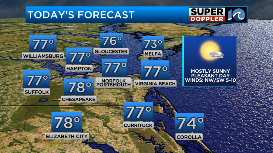
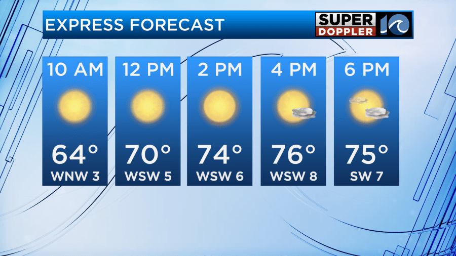
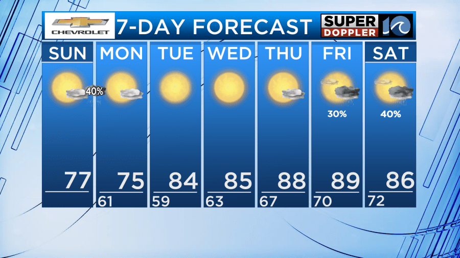
High pressure across the region will allow for abundant sunshine along with low humidity. It will be a great day to get outside and enjoy the many events happening across the area like the Jackalope Festival in Virginia Beach or Portsmouth Pride Fest. Highs today will be a few degrees below normal though, with highs in the upper 70s.
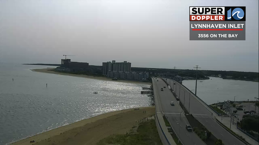
If you happen to look up during the day today, you may notice a bit of haze, that is upper level smoke due to the ongoing Canadian wildfires. The good news for today is that the smoke is very high up in the air so it should not impact our air quality at the surface. Here is good look at the hazy sky from our Lynnhaven Inlet camera this morning.
As we head into the evening and overnight hours, a lingering boundary to our south may allow for showers and thunderstorms to form. For our area, this will likely be between the hours of 9 pm through 3 am so well after sunset.
Some storms may be on the stronger side south of the state line with gusty winds and hail being the main threats.
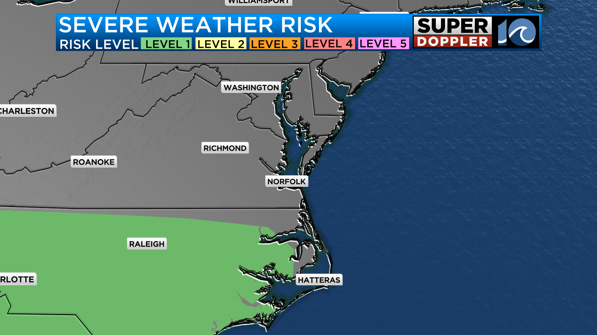
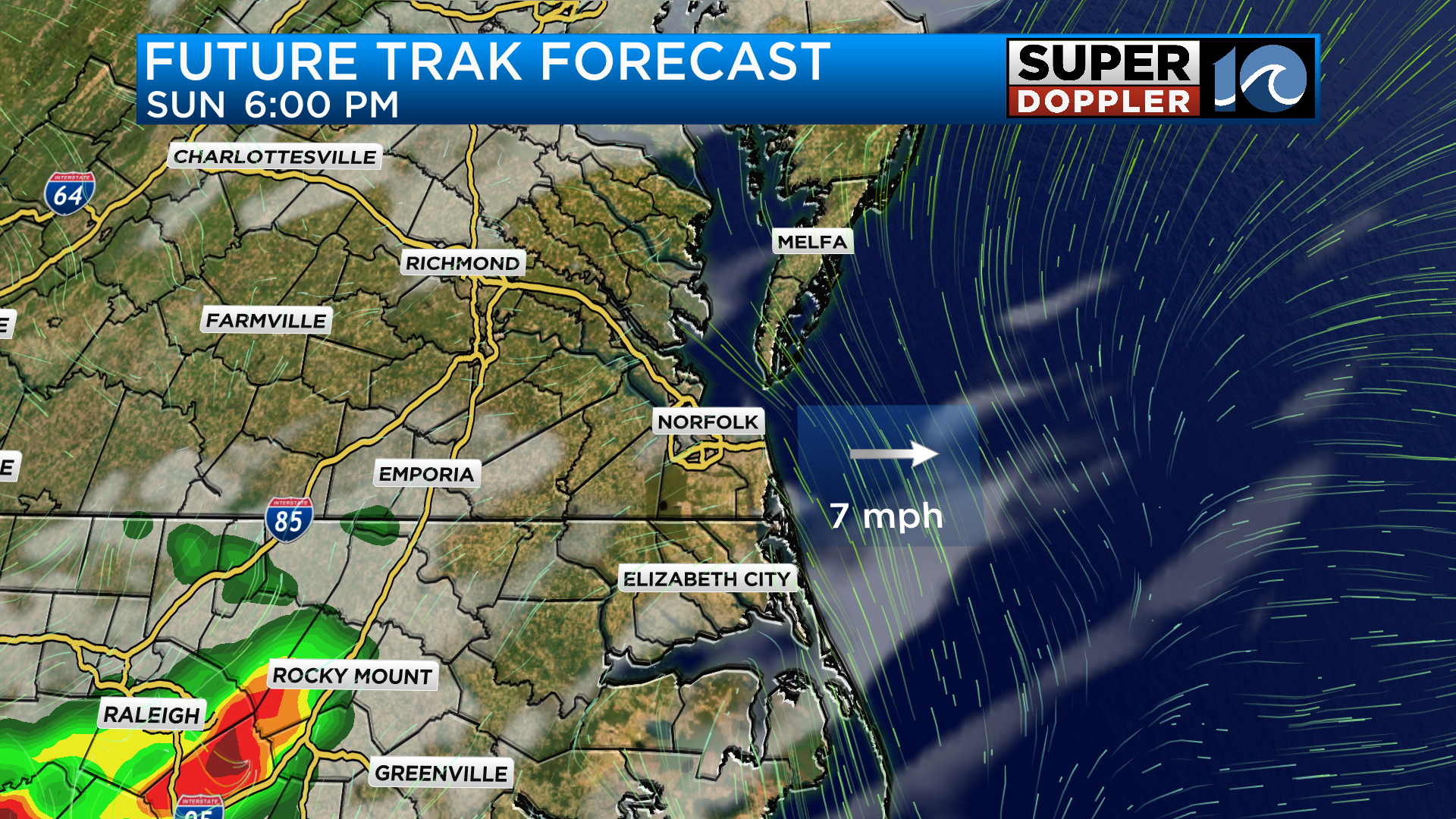
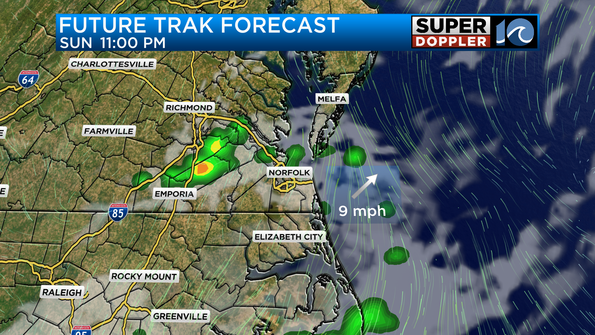
Across the Hampton Roads cities we could get a downpour or two and maybe a rumble of thunder but the chance for severe storms is low.
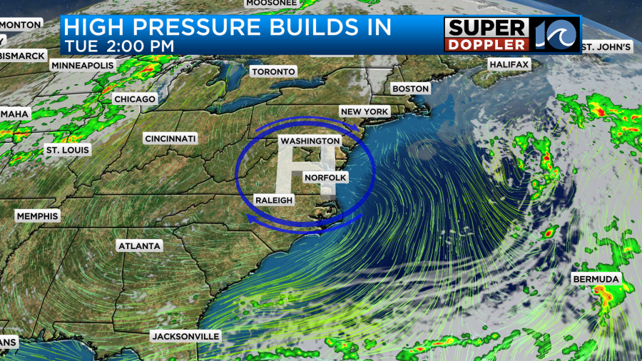
Coming during the start of the work week, high pressure fills back into the area. This will allow for pleasant weather to return. Monday will feature a north wind which will bring in cooler temperatures but as high pressure shifts east that will allow for more heat to lift into the region during the middle parts of the week.
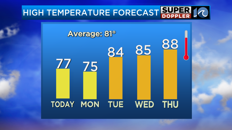
High temperatures Thursday could get close to 90 degrees. Friday will also be warm but the chance for rain will increase as our next system moves in.
Have a great Sunday!
-Meteorologist Brian Michigan