Today we will have one more decent day before the stifling heat and humidity return. Yesterday, was very nice. We had lots of sun, moderate humidity, and high temps in the mid 80s.

We still have a similar setup today. There is a stationary front to our south with high pressure to our north/northeast.
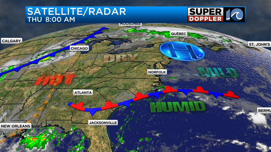
The front has created some scattered showers down along the Outer Banks. This will continue today. However, the rest of the region will have partly sunny skies with only a stray shower or two. We’ve lost the northeast breeze that has brought us the cooler/drier conditions as of late. Today the breeze will be light and out of the east/southeast. High temps will rise to the upper 80s this afternoon.
The dew points will rise a little more too. They will get into the low 70s. This will put the heat index up into the low 90s. However, that is really a typical Summer day here in Hampton Roads. It’s actually a degree below average. Meanwhile, they will be hitting 100s for temperatures over parts of the central U.S. The heat index out there around the southern Plains will be in the 110s.
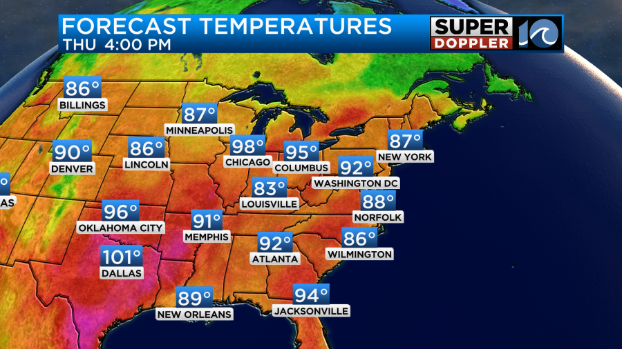
The heat will slide east tomorrow. High temps will rise to the mid 90s.
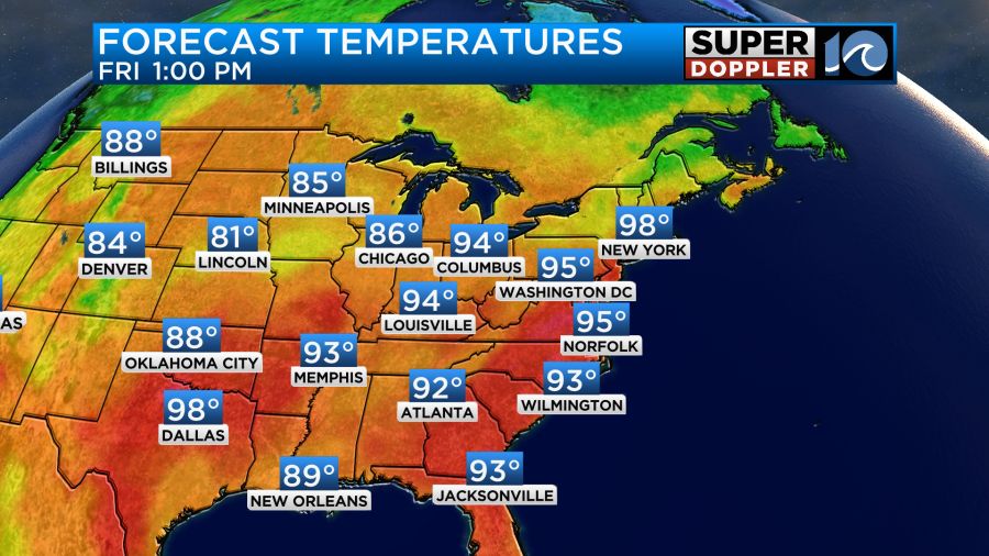
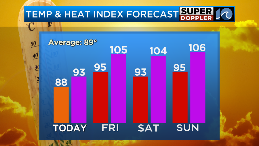
The heat index will be around 105 locally. There may be some heat alerts issued. Stay tuned. We’ll stay hot and humid through the weekend. High temps will be in the low-mid 90s. The heat index will be over 100.
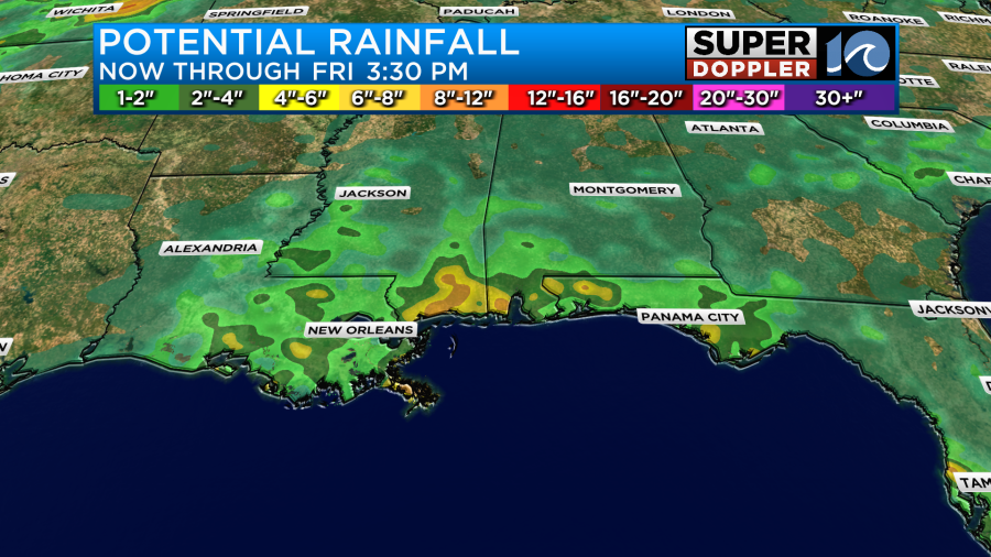
At least it looks like there won’t be much rain over the weekend. I only have some isolated PM showers or storms in the forecast for Saturday and Sunday. The latest model updates don’t have much rain really for the next 7 days. This will be tough on the gardens and lawns. Especially with the heat.
Once again we have a high threat for rip currents at the local beaches.
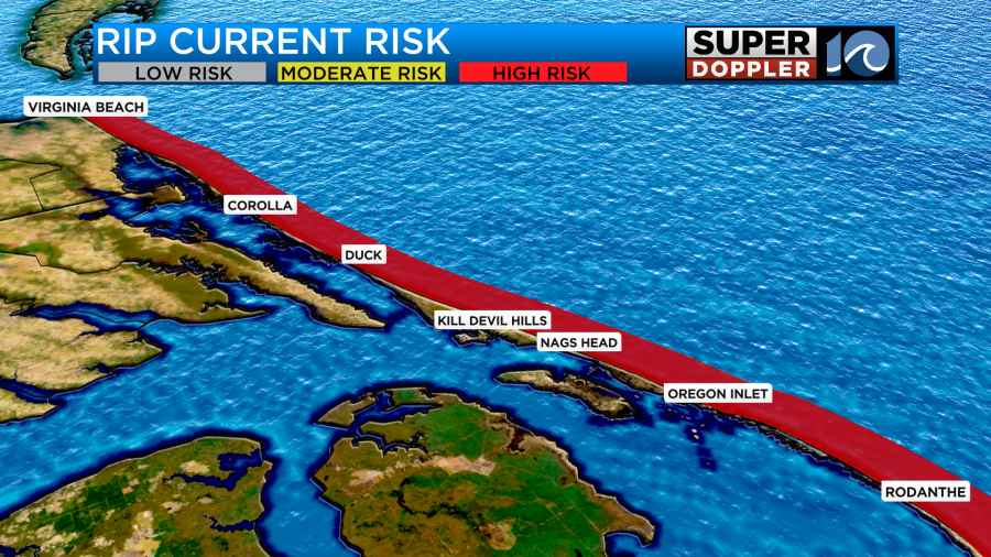
Waves will run about 2-4ft with 5-6 ft waves over the Outer Banks. There should only be experienced surfers in the water today.
We are still watching that weak area of low pressure rolling west along the Gulf coast. It only has a low chance of formation.
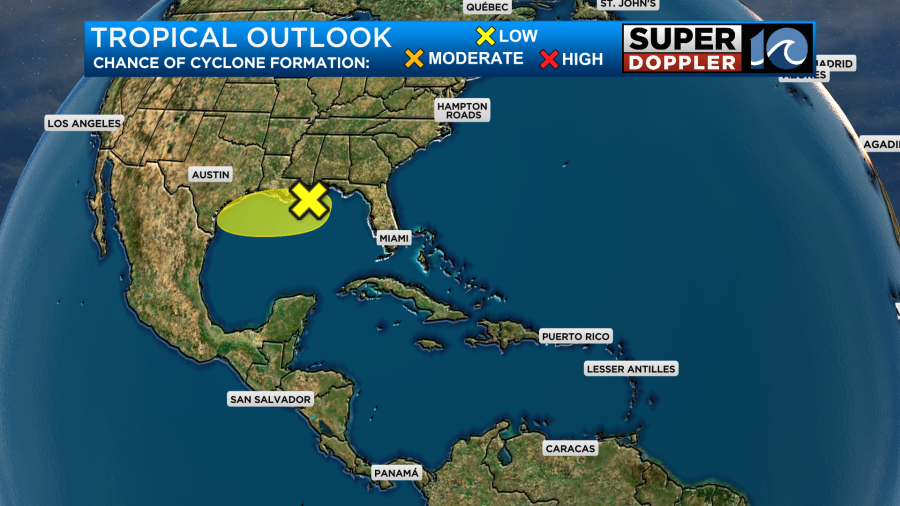
Whether it forms or not, it will likely just be a rainmaker. Heavy rain and flooding will be possible down that way.
We’ll keep an eye on it. Otherwise, the tropics are quiet for now.
Meteorologist: Jeremy Wheeler


