Before I go into the forecast, I do want to talk a little about yesterday. We didn’t have much rain in the area during the afternoon other than some isolated showers or storms. The forecast was more focused on a large cluster of showers and storms in the evening anyway. However, the big cluster of storms ended up being much smaller than forecast. It affected a few inland areas, part of the Peninsula, and the lower Eastern Shore.
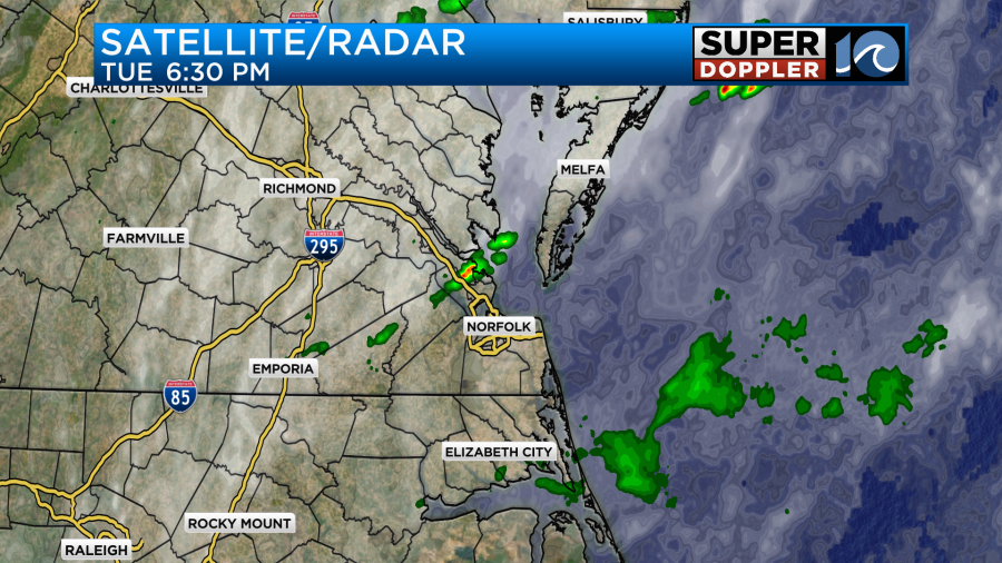
We ended up getting about a quarter to a half an inch in that affected area. However, the Southside flat-out missed-out. Norfolk is one of the main climate sites. It’s interesting to see how the rainfall has fared for the year so far.
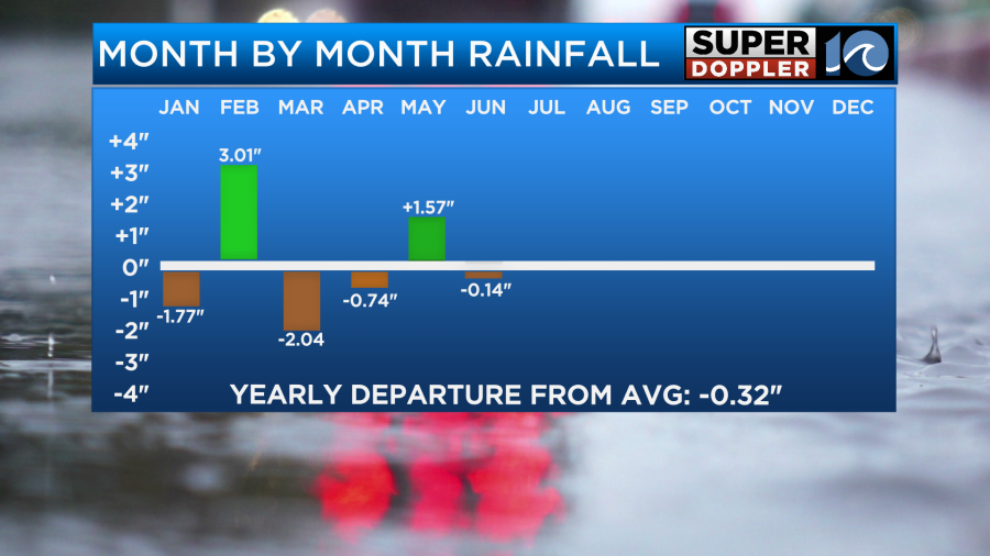
We’ve had a couple of very wet months, and a couple of pretty dry months. We are a little below average right now for the month of June and for the year. However, I live on the Southside, and I feel like we have had a ton of rain lately.
Yesterday evening a cool front (more like a dryline) moved into the region. Since then the front has stalled out.
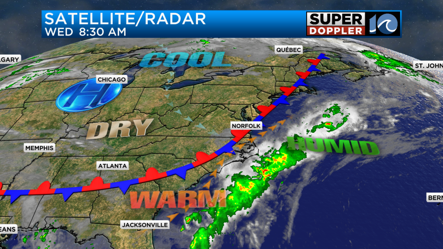
There is a little drier air in the mid-levels, but we are missing out on the much drier air just to our northwest. So we won’t have widespread rain today, but there will be some isolated showers and storms firing up in the afternoon. I will say that the models are kind of focusing on the Virginia Beach/Chesapeake area this afternoon.
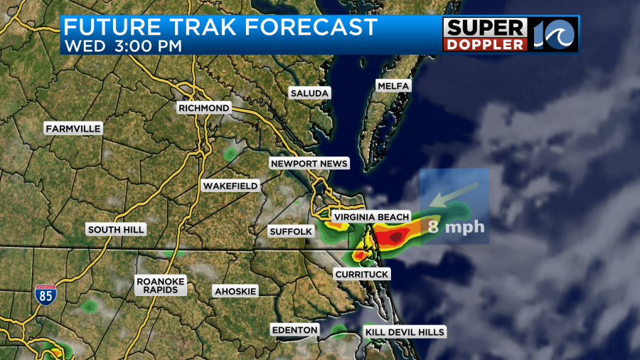
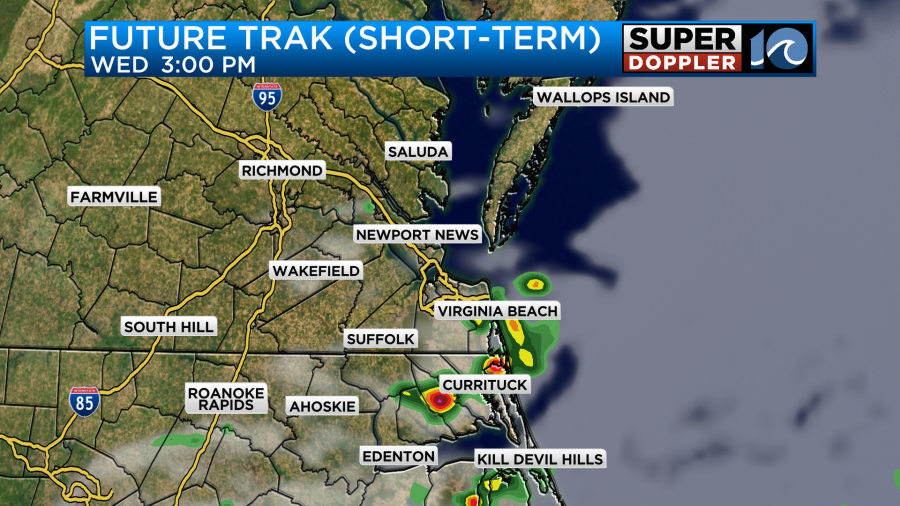
This is a little south of the front. So maybe they are onto something. Either way these should slip south by the evening. Winds will be variable at 5-10mph. High temps will be in the mid-upper 80s.
It will feel like the upper 80s to near 90 with the heat index.
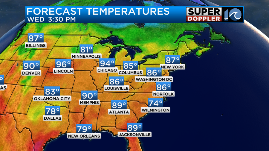
Tomorrow the front will fall apart. We’ll have mostly sunny skies for most of the day. We’ll have a light southwest wind. So high temps will aim for around 90 degrees.
However, the humidity will be rather high. Dew points will be around 70.
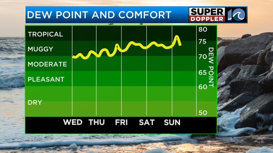
That will create a heat index in the low-mid 90s.
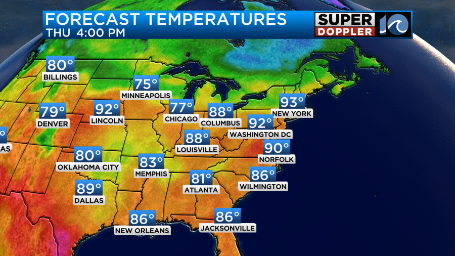
We’ll still be hot and humid on Friday. High temps will be near 90 again.
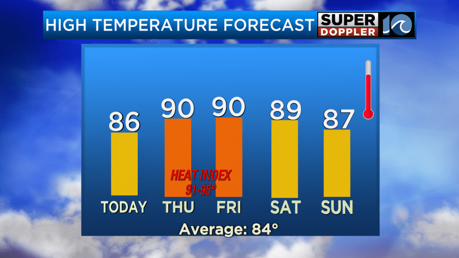
However, the deeper moisture will return on Friday at all levels. That will set us up for some scattered showers and storms in the afternoon.
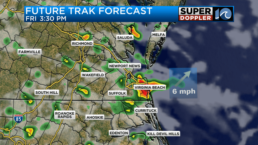
There could be some heavy rain over parts of the area. We’ll have similar weather over the weekend. There will be a little more clouds with scattered showers and storms each day. Luckily, the models aren’t showing a washout for the weekend. The timing of those storms will be difficult as they have been lately. So wait until we get closer to make any outdoor plans.
Meteorologist: Jeremy Wheeler