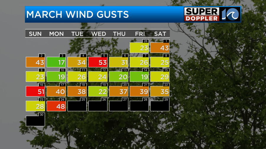
Lately I’ve talked quite a bit about the wind. It has truly been a breezy month.
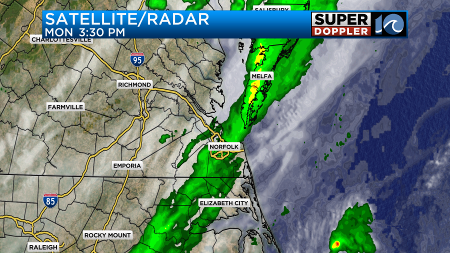
As you can see it was very windy yesterday. For a brief time gusts were above 40mph…again. Today we’ll finally catch a break. More on that in a moment. I do want to talk a little more about yesterday first. We did get a line of light rain showers over the region during the afternoon with a few more showers in the early evening.
The rain didn’t add up to much. Most areas had a tenth of an inch or less.
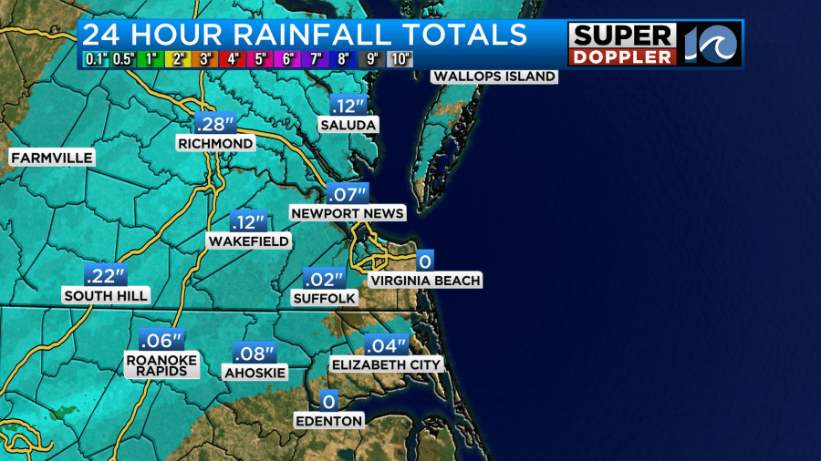
We picked up about a hundredth of an inch at Norfolk, and there was actually a Trace of rain in Virginia Beach.
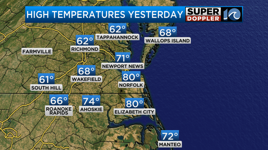
We had a little more rain last night, but it was even less. This was all ahead of a cold front. Before the front hit we ended up rising to near 80 degrees Monday afternoon.
Temps dropped through the afternoon and evening as the front slowly pushed east.
Today the cold front is pushing offshore. There is another small area of low pressure with some weak fronts near central Tennessee.
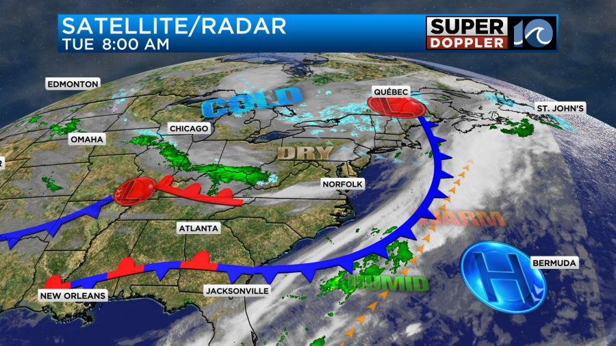
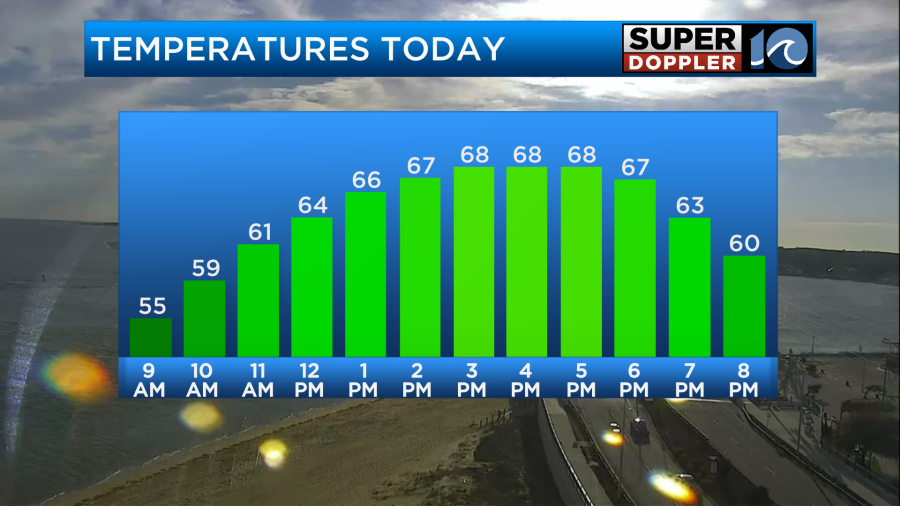
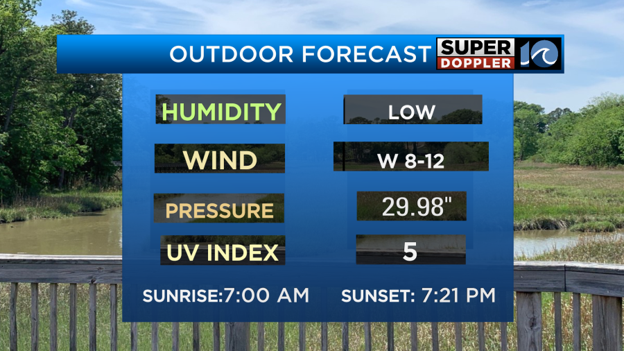
We’ll have a mix of sun and clouds today with LESS WIND! It will be very nice out! We’ll be dry with high temps rising to the upper 60s. There will be a few 70s inland and south.
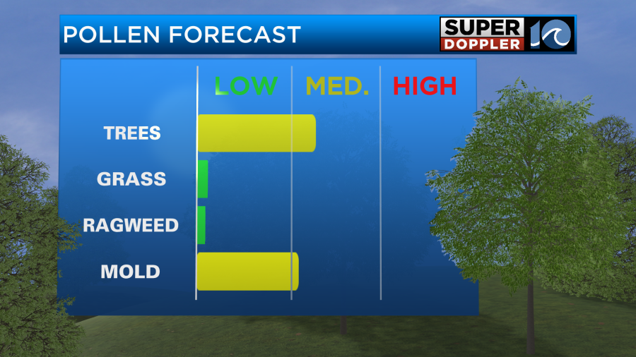
Pollen levels won’t be too bad. It is low-moderate for tree pollen and low-moderate for mold.
So get out and enjoy the weather today while you can.
By tonight that weak area of low pressure, that I mentioned above, will quickly sweep through the region. We may get an isolated shower by the early evening, but the bulk of the rain showers will fall tonight as the low slides through. A thunderstorm or two is possible.
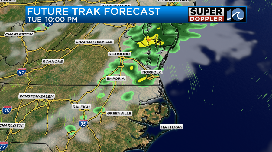
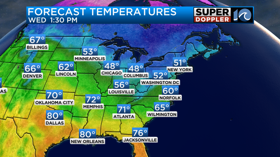
Rainfall amounts should be very light. The rain should end by about 3-4am. Then we’ll have clearing skies. We’ll be dry tomorrow, but the wind will be more out of the north/northwest and it will pick up again. We’ll have some gusts to about 20mph. That will keep the high temps closer to 60 degrees despite a good amount of sunshine.
A wind-shift is expected to move through tomorrow evening. This might create a stray shower or two, but overall we’ll stay dry. Then we’ll definitely be dry on Thursday, but It will be even cooler. High temps will only be in the upper 50s.
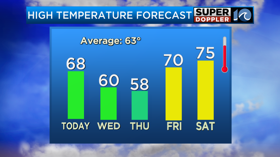
Luckily, we will warm up just in time for the weekend. Highs will be in the 70s Friday through Sunday. The weekend looks dry overall. For now though I do have some isolated showers on Sunday but a low chance. I’ll have an update on that in tomorrow’s weather blog.
In regional news…There are some wildfires burning over in the western Carolinas. Unfortunately, some of these are hitting the areas that were damaged/destroyed by hurricane Helene. Here is an update on that recent hazard. Carolina wildfires.
Meteorologist: Jeremy Wheeler