
Every day now it seems like we have some type of front sliding through the region. That is definitely the case today. Yesterday, was cold and damp all day as we sat on the colder side of a cold front. Highs were only in the mid 40s. This morning we were still on the cold side of the front, but it was turning into a warm front and approaching from the southwest.
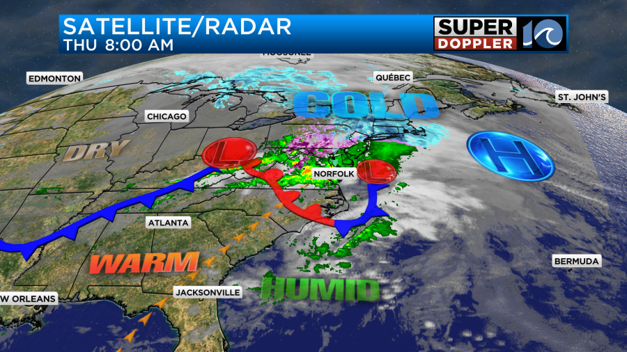
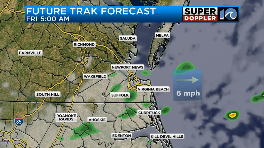
There was a cold rain over the area. Oddly there was a little instability. So there was even some brief heavy rain and an isolated thunderstorm.
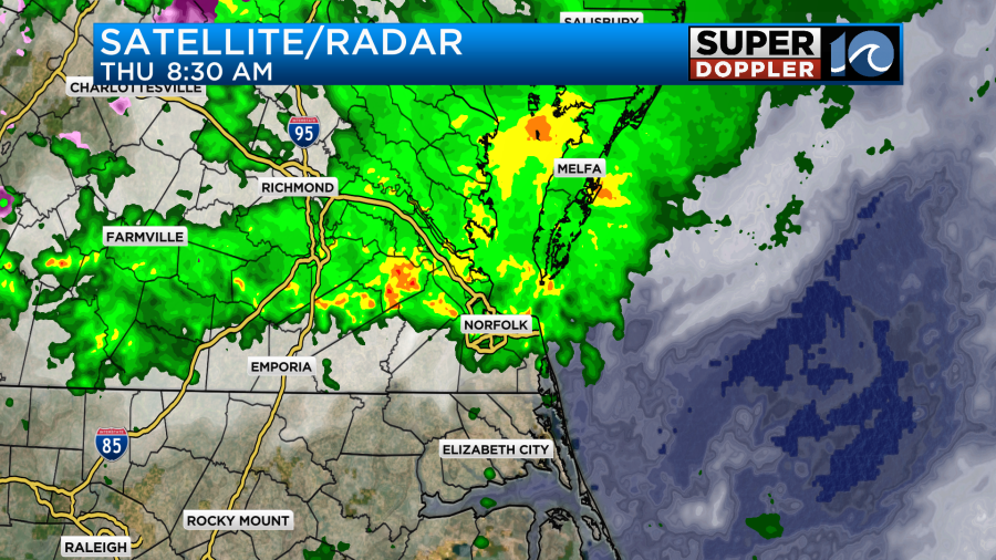
We’ll have rain during the morning, but the showers should wind down by midday.
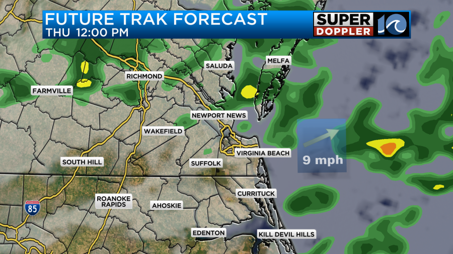
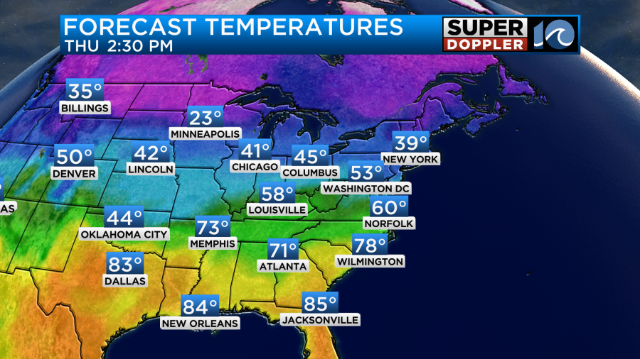
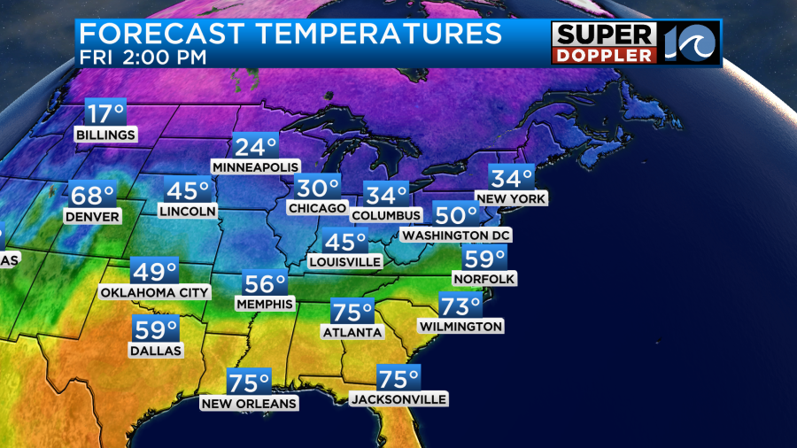
The warm front will lift to our north by the afternoon. So we’ll have some clearing and warming conditions. Winds will turn out of the southwest. This will help to push our high temperatures up to near 60 degrees.
It should be pretty nice out for a while this afternoon. By tomorrow morning the next in a series of fronts will slide through. This time it will be a cold front. It will create some spotty sprinkles or showers early in the morning. However, this should only last for a short time.
After 8am we should dry out, and we should stay dry through the day. We’ll have partly cloudy skies with a light northeast wind. High temps will warm to the upper 50s in the metro, but I think there will be some low 60s inland and south.
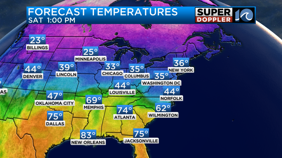
A warm front will develop to our south on Saturday. Warmer and more humid air will overrun the colder air in place. At the surface our high temps will only be in the low-mid 40s.
The overrunning effects will be lots of clouds with scattered rain showers at times.
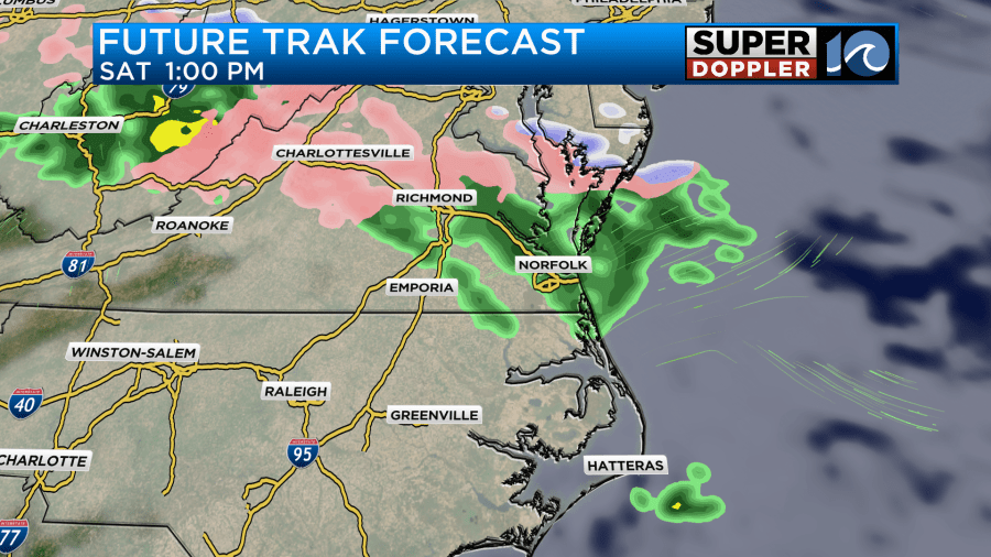
There may be a brief wintry mix north of the metro, but the majority of the precip will fall as rain. If there’s any frozen precipitation, then it would likely be a few sleet pellets. Warmer air will return on Sunday with high temps aiming for the upper 50s to near 60.
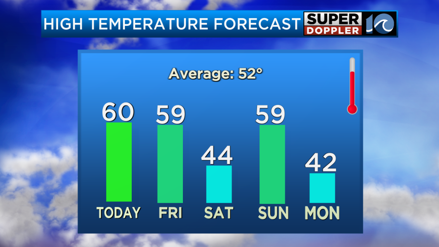
Things have improved for later Sunday with only an isolated shower possible. Things also look drier for the evening. However…. Another cold front (yes) is forecast to roll through by Sunday night. Then an area of low pressure will form to our south during the morning. This setup could allow for a wintry mix and some snow for form over the region for a time. The models are really disagreeing on the setup with the Euro later and wetter.
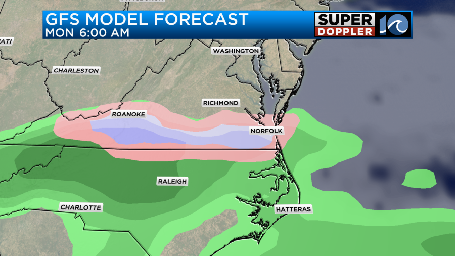
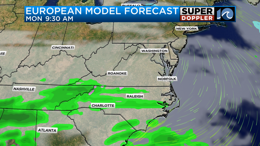
Either way we would likely warm up to the 40s during the afternoon. So it would become a chilly rain, but rain nonetheless. More precip is expected on Tuesday, and there may be a mix, but I’ll talk more about that in tomorrow’s weather blog.
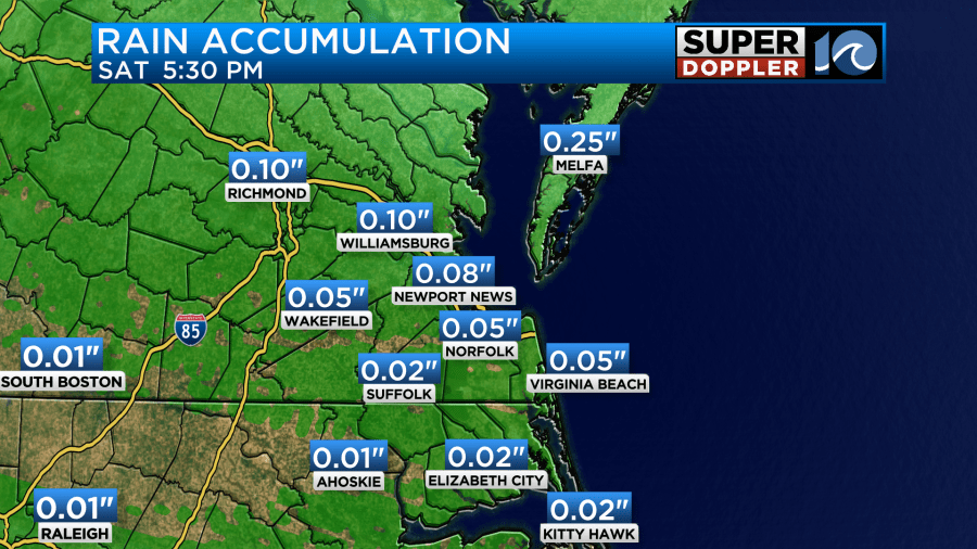
So far we have had about a tenth of an inch to two tenths of an inch of rainfall over the last 24 hours.
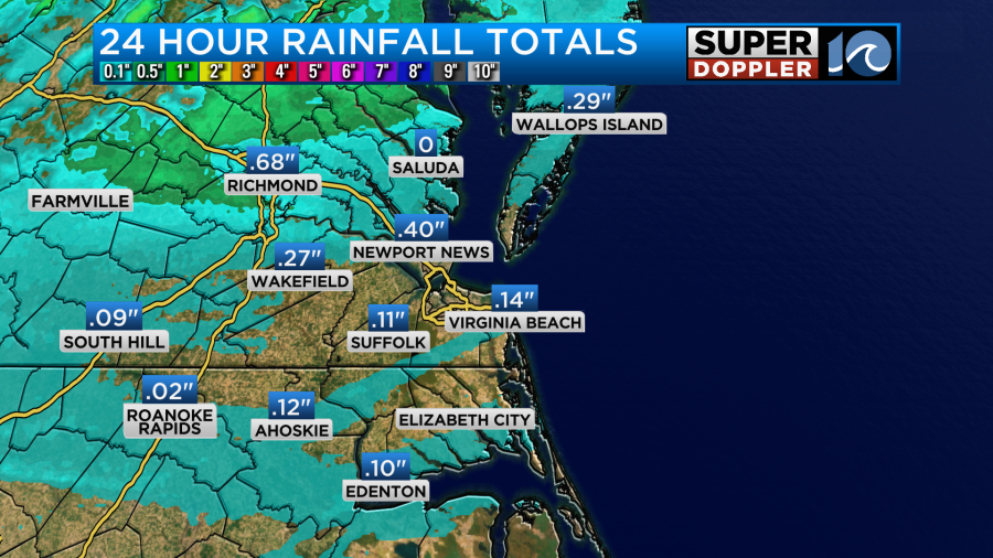
There was a little more on the Peninsula. We’ll probably only get another tenth of an inch today. Then we’ll get a little more on Saturday. Perhaps another tenth of an inch.
We definitely need a lot of rain. We had a big deficit for the last few months of 2024, and we had another deficit last month.
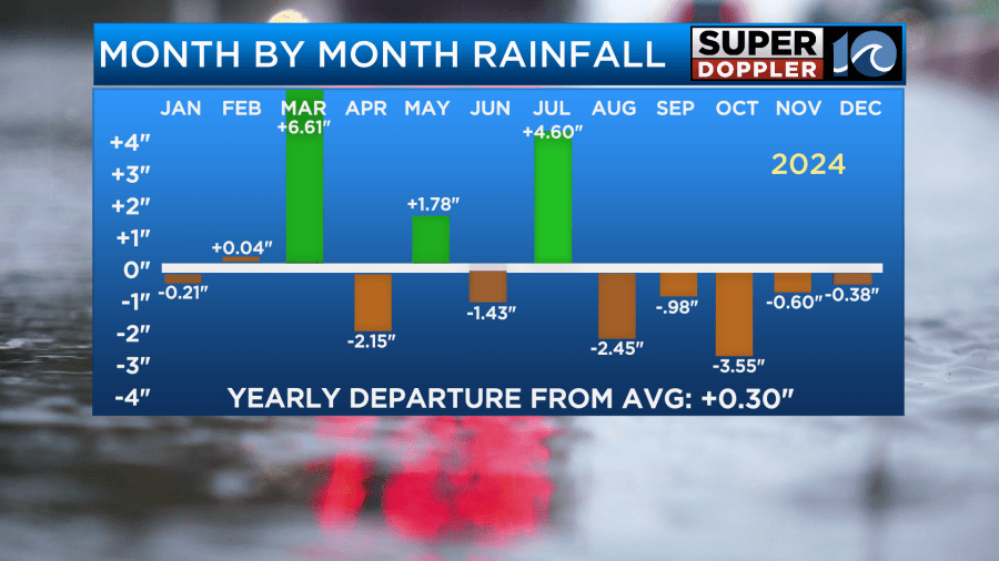
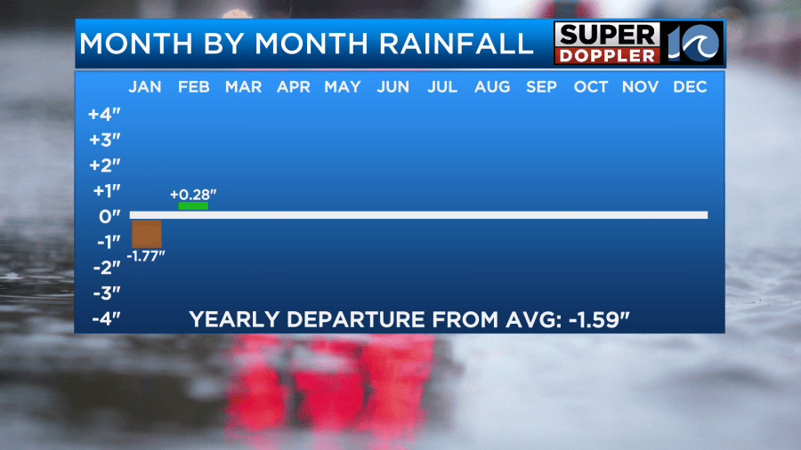
We will have a lot of rain over the next few days. So we could end up with a surplus for the month. We just need it to keep coming as we go into the growing season. Stay tuned for updates.
Meteorologist: Jeremy Wheeler


