This morning we had some calm and chilly weather. It was beautiful though with lots of sunshine. There were some high waves along the oceanfront. Check out the view this morning around Avon Pier over the Outer Banks:
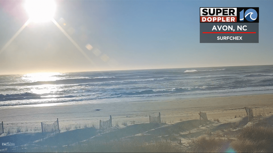
The waves will run about 5-7 ft today with a few 8 footers possible over the Outer Banks. Other than that we’ll have some pretty good weather today. We have the big area of low pressure offshore, but high pressure is building in from the west.
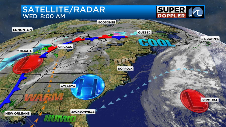
There is another big area of low pressure over the central U.S. There is a cold front attached to it. That will impact us tomorrow night.
Meanwhile, we’ll have lots of sunshine today with much lighter winds. There will be a light breeze out of the northeast then east. It will run about 8-12mph. This will keep things cooler near the shore, but we’ll warm up nicely inland.
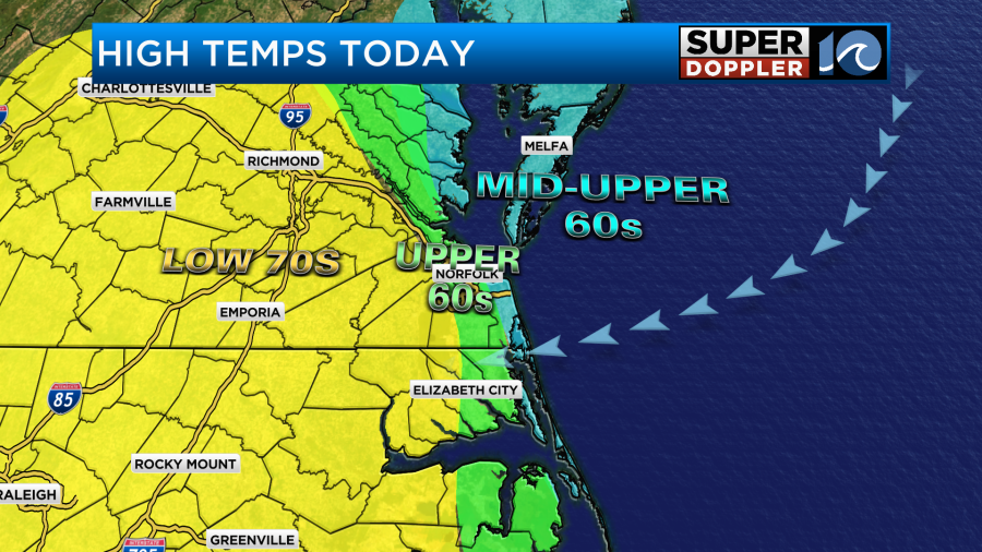
On the bigger picture. We’ll warm to the 60s today with a few 70s here. It will be pretty mild to our west as well.
However, tomorrow there will be a big cool down over the Midwest. Meanwhile, we will warm up ahead of the cold front.
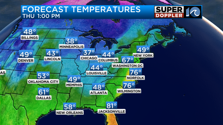
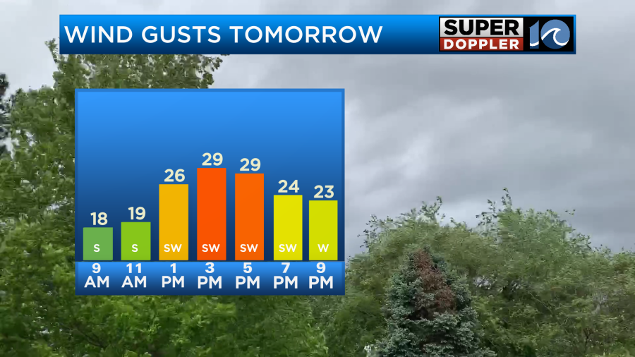
Highs will be solidly in the 70s. A big cause of that will be the southerly winds picking up. They will gust up to 25mph with a few higher gusts from time-to-time.
We will, however, also pull up more moisture. So clouds will increase through the day. There will be a few showers and storms in the afternoon, but they will probably be more inland and west through 3pm.
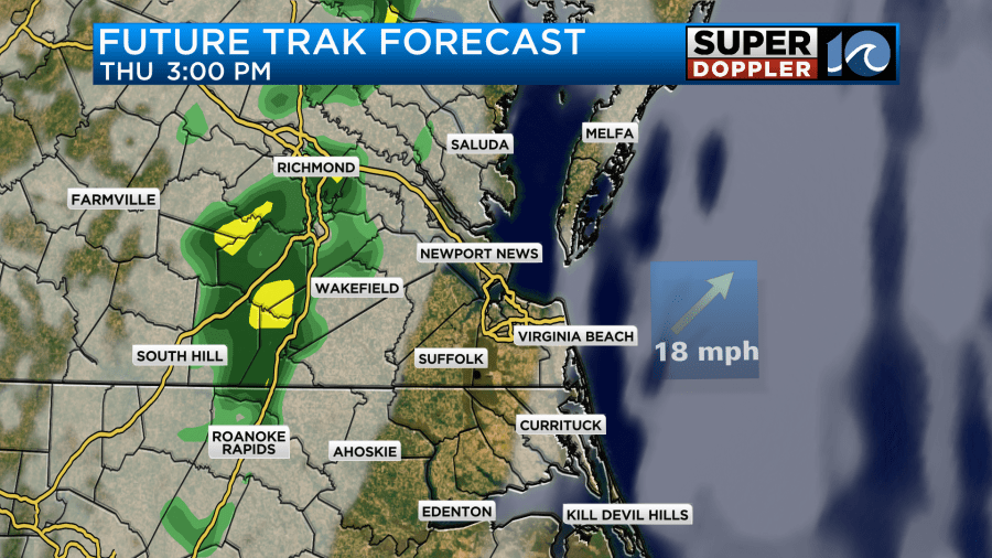
Some isolated showers or storms may slip through into the metro. However, it looks like the higher chance for rain will arrive in the evening.
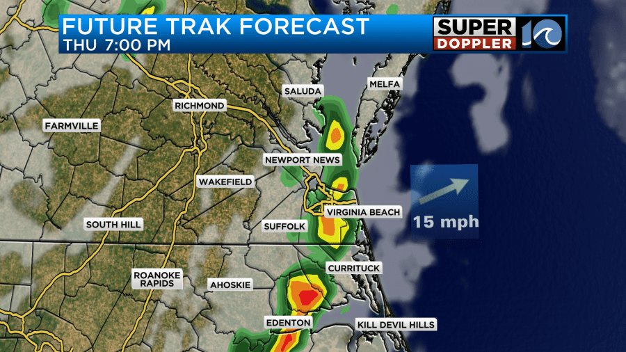
We’ll have some scattered showers and a few storms, but they will not be as bad as the last storms that we just had. The moisture looks less for one thing. Dew points will only rise to the low-mid 50s briefly. Also lapse rates (the rate of cooling with height) should be low.
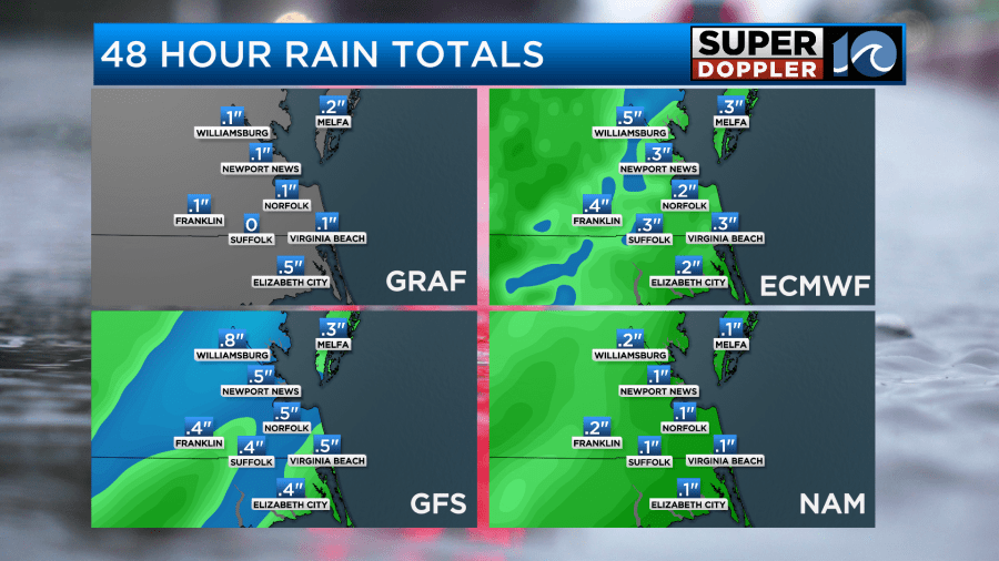
Rain amounts should also be less. We are only calling for a tenth of an inch or two this time.
After that we’ll dry out late Thursday night into Friday. We’ll be partly cloudy and cooler with high temps in the upper 50s Friday afternoon.
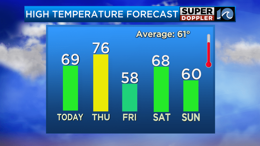
We’ll be dry and comfortable over the weekend. Highs will be mainly in the 60s. The models have been trending the temperature down for Sunday, but I’m holding onto 60 for now. Stay tuned for updates.
Meteorologist: Jeremy Wheeler