
There’s no doubt the weather was great this weekend! There was rain on Friday, but that was a good think in the long run. However, the last 2 days were dominated by much cooler/drier air. Today we will continue with that coolness and dryness. High pressure is to the north with a stationary front to our south.
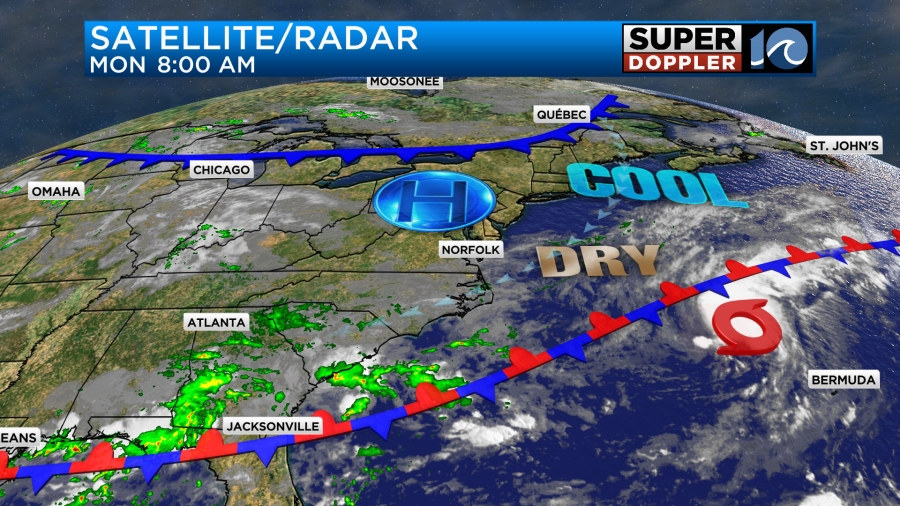
The newly formed tropical storm “Dexter” is out to sea, and it will stay out to sea. I’ll talk more on that in a moment.
Our local weather looks great for the next 2 days. We’ll be mostly to partly sunny. High temps will be in the low 80s.
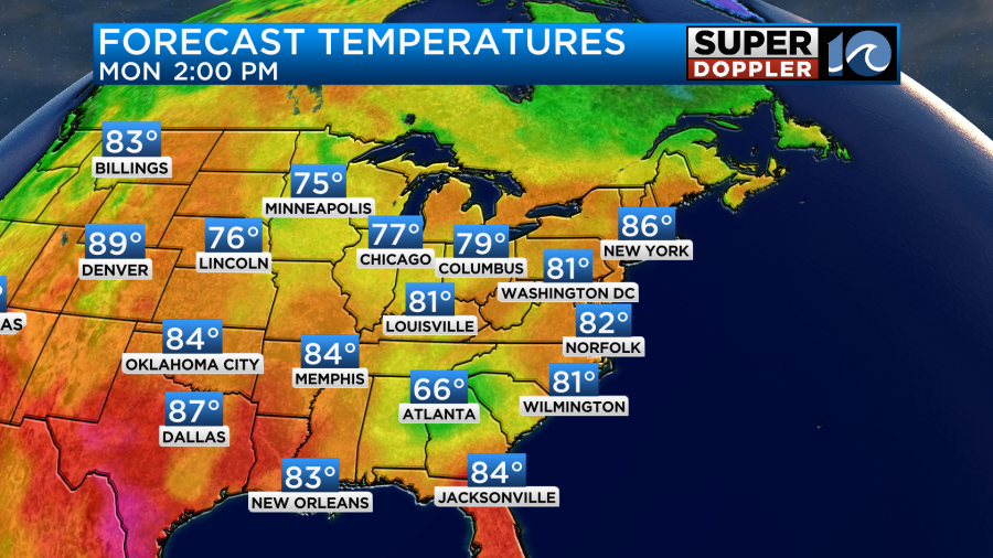
Dew points are in the 50s and 60s for the next two days as well. We’ll have a northeast breeze today at 5-15mph. Tomorrow it will run at 8-12mph. So enjoy this nice weather while you can. Open up the windows and get some fresh air in the house or apartment.
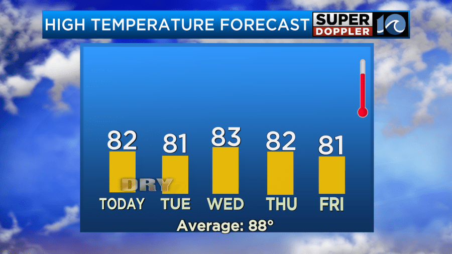
Through the week the temps will hold steady, but the humidity will climb.
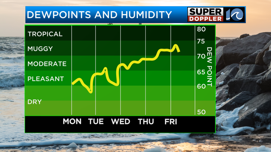
Humidity will be up to moderate by Wednesday, but between Thursday and Friday we’ll go back to muggy conditions. At least the temps won’t heat up. So that will help. However, there will also be an increased chance for rain showers later this week. It could come from a tropical system, but not from Dexter. Let’s talk about it…
Last night tropical storm Dexter formed over the Atlantic.
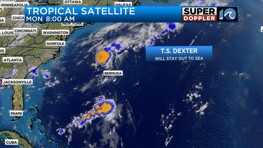
At the time of this writing it was about 255 miles north/northwest of Bermuda and moving to the east/northeast at 12mph.
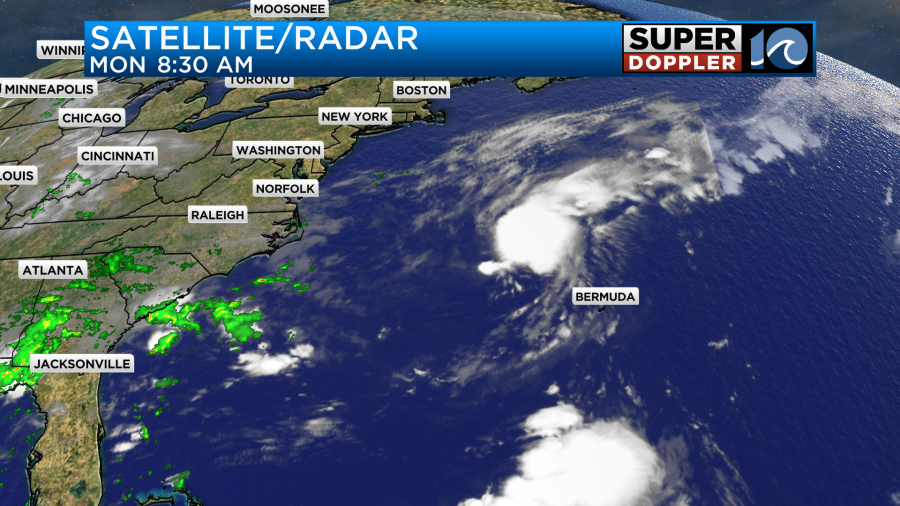
The storm is experiencing some moderate wind shear. This will probably increase a bit over the next couple days. Also, Dexter will move over some cooler ocean water. Hence, it could strengthen a little bit in the short term, but it should eventually weaken. The forecast calls for the system to remain a tropical storm through about mid-week. Then it looks like it will become post-tropical.
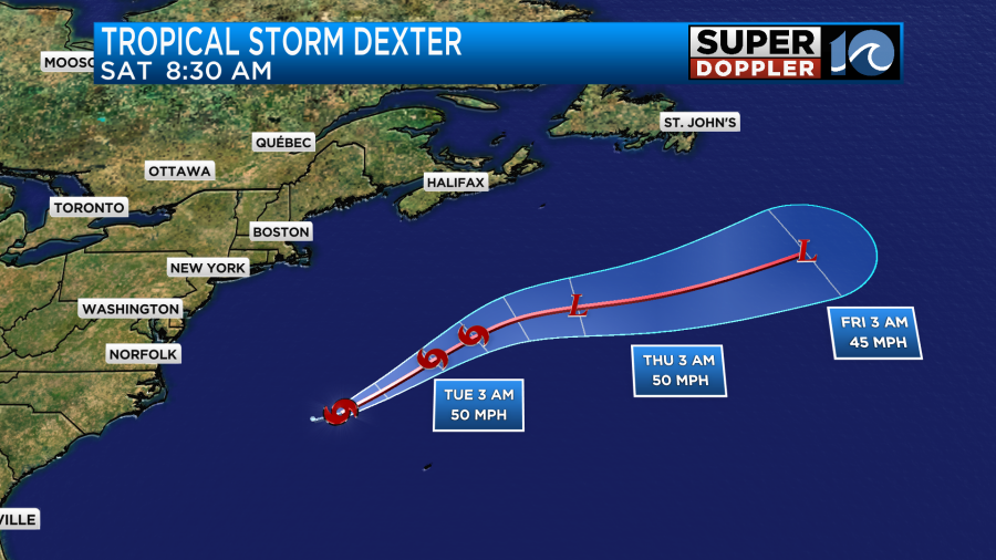
The forecast models are in good agreement in keeping the system far offshore.
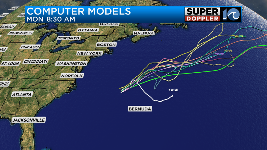
The European model has Dexter also staying far out to sea. However, it does show another weak feature forming between Wednesday and Thursday and moving onto the East Coast.
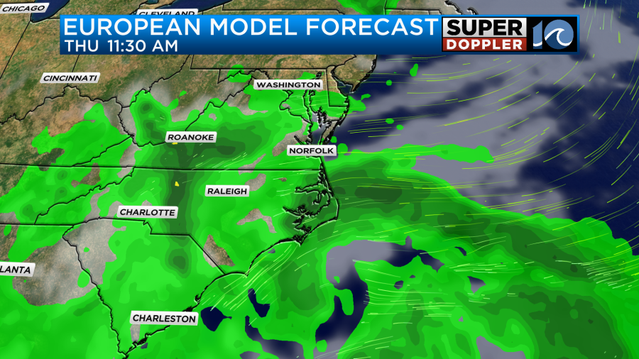
The Euro and GFS are in good agreement (so far) in keeping the system weak. However, they both have it increasing our moisture and rain chances over the region as we go between Wednesday and Thursday. After that we’ll see what happens. It will depend on the track of the low. I do have some scattered showers in the forecast, but this will depend on the track of the low. It does have a low chance at becoming tropical.
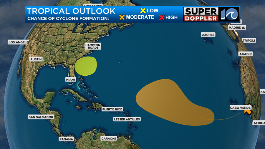
There is another disturbance that looks to move west off of Africa and out over the Atlantic later this week. It has a medium chance of formation as it gets over the central Atlantic. We’ll be talking more about it over the next couple of days. There’s not doubt that things are picking up in the Atlantic, but that should be no surprise as many forecasters (including me) said that things would probably pick up soon.
Meteorologist: Jeremy Wheeler


