Good Saturday morning! It will be a great day to get outdoors and enjoy a little preview of Fall, but stay out of the water.
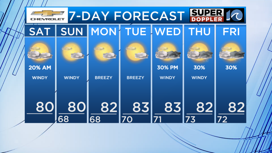
With a high pressure system to our north, a stationary front to our south, and neither planning to move anytime soon, we are in a wash, rinse, repeat pattern. We’ll get to enjoy cooler temperatures with highs in the low 80s each day throughout the entire week and overnight lows in the upper 60s to low 70s. On top of the cooler air, we also get to enjoy much drier air.
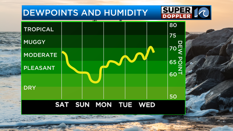
Dew points and humidity gradually drop throughout the day Saturday, stay at unnoticeable levels through Sunday, and remain low much of the week ahead. We’ll also stay decently dry as there’s slim rain chances this week.
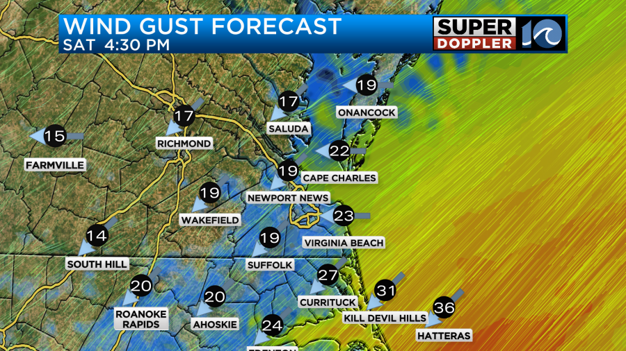
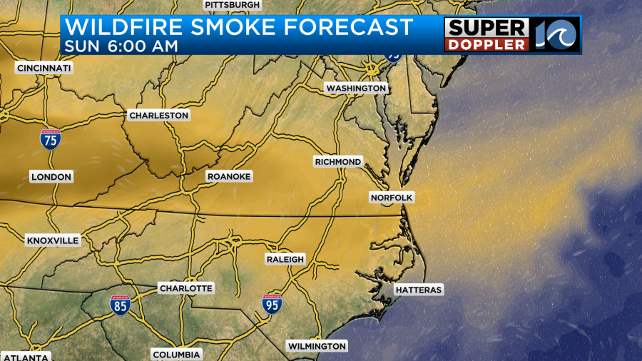
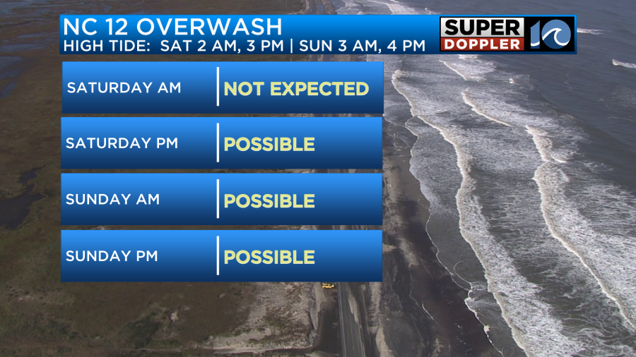
The trouble lies with the winds. We’ll have strong northeast winds 10-20 MPH gusting to 30 MPH today, tonight, tomorrow, and into the workweek. This will bring a dangerous surf, ocean overwash, tidal flooding, and usher in wildfire smoke from Canada into Hampton Roads. If you notice the sky looking hazy, that’s what’s causing it.
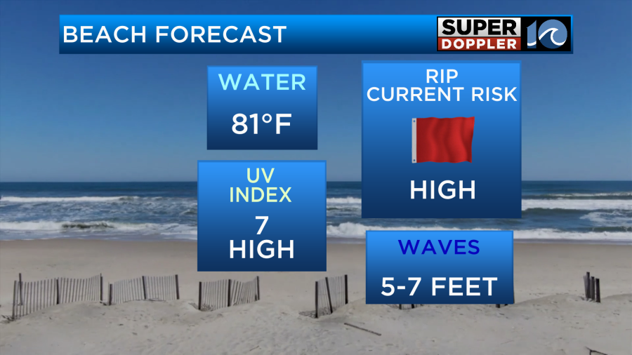
Along the shore, expect 5-7′ breaking waves. That puts us in high rip current risk and dangerous surf category. This could also create ocean overwash along NC-12.
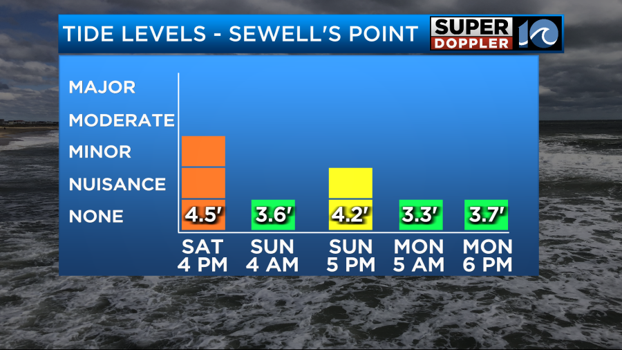
These strong northeasterly winds will also bring us tidal flooding. Expect 0.5-1′ of inundation. Minor tidal flooding during high tide 4 PM Saturday and nuisance tidal flooding during high tide 5 PM Sunday. If you come across tidal flooding on roadways, turn around and don’t drown your car. These waters are brackish and contain a mix of fresh and salt water, which will ruin your car if you drive through it.
Enjoy the weather outside this weekend on land and avoid the water!
– Meteorologist Kristy Steward