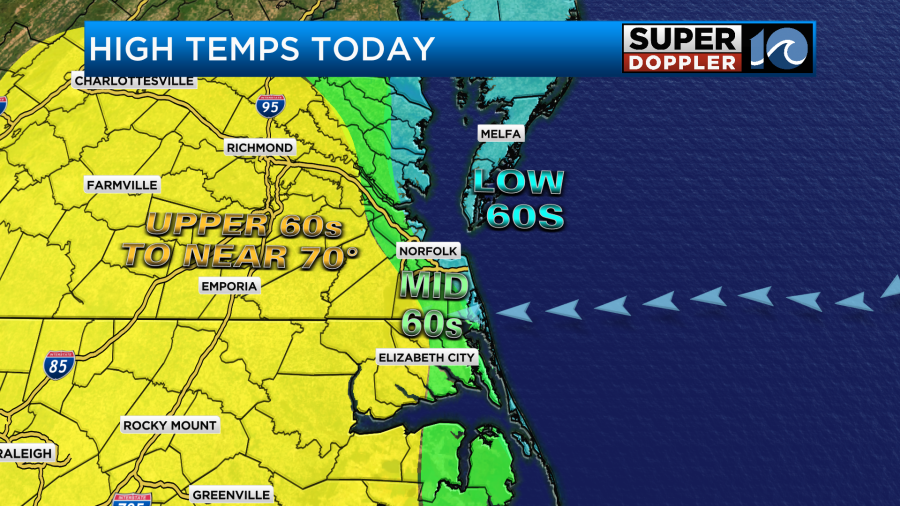
This morning was the coolest that we are going to be for the next 7 days. Temps started off in the 40s and 50s with a few 30s inland. It’s all uphill from here. Through the day today we will have some nice warming, but it will still be seasonable. High temps will aim for the mid 60s.
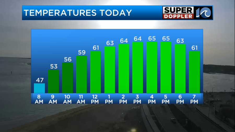
We’ll have partly sunny skies for most of the day with a light east breeze. It will run at 5-15mph. With the onshore breeze and water temps in the 50s it will be cooler near the shore and a little warmer inland.
We have high pressure to our north/northeast. There is a warm front developing to our south/southwest.
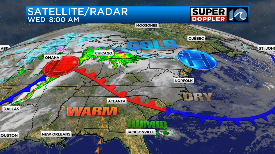
You may notice that there is a sharp line of showers and storms over the Plains states. That will move east today, and that area will see severe storms today. There is a high risk for severe weather over the Tennessee and mid-Mississippi River Valleys.
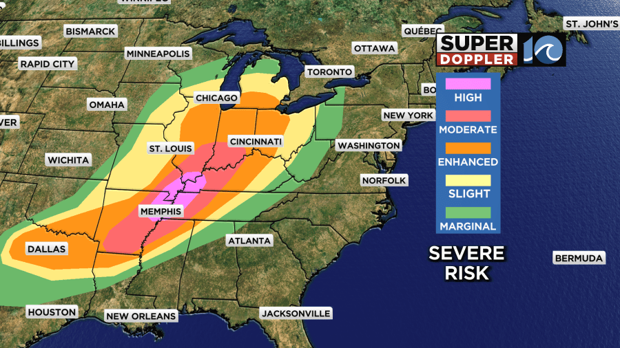
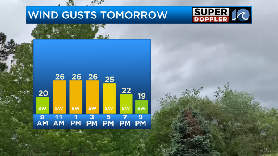
They could have multiple large tornadoes in the moderate and high risk areas through tonight. Luckily, we won’t be affected by that at all (weather-wise). Having said that the warm front will lift up from the south, and it will enter our region tomorrow morning. We’ll be mostly cloudy tonight and tomorrow morning as the front moves in. There may be a couple of sprinkles or stray showers in the morning, but overall we will stay dry tomorrow. We’ll have a southwest wind increasing. It will gust up to 25mph with a few gusts to 30mph.
These conditions will push our high temperatures up to the mid 80s by the afternoon.
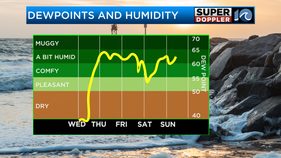
Average high temps are in the mid 60s this time of year. Not only will it warm up, but we’ll also increase the humidity. Dew points will rise to above 60 tomorrow, and they will stay up through the weekend.
Temps will stay up too. They will run in the 80s all the way through Sunday.
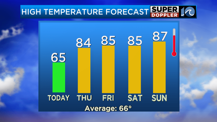
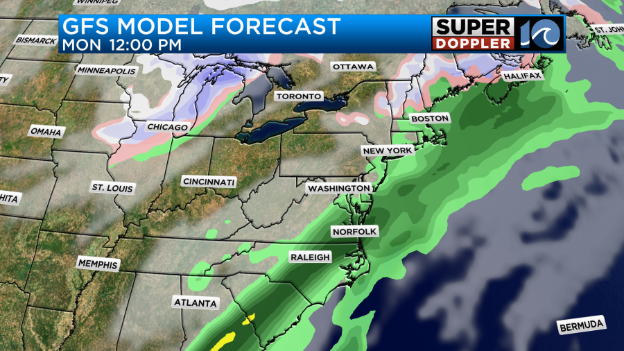
We probably won’t break any records, but it may get close. Record highs are in the upper 80s to low 90s this time of year. There won’t be much rain through the weekend. We may have a few showers late Friday into Friday night. There may be some isolated showers on Saturday, but we’ll be rain-free on Sunday. The next best chance for rain will be on Monday as a strong cold front moves in.
High temps will drop to the 60s.
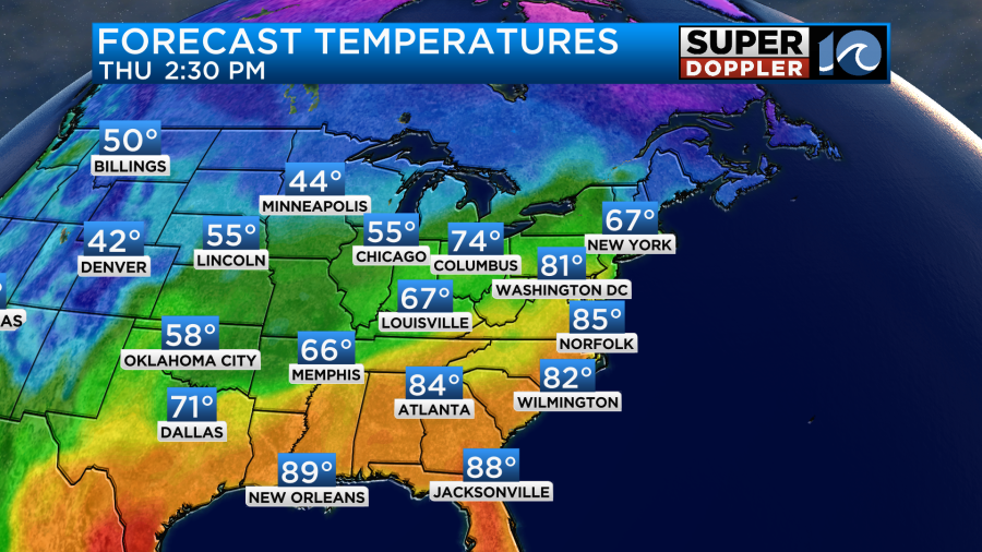
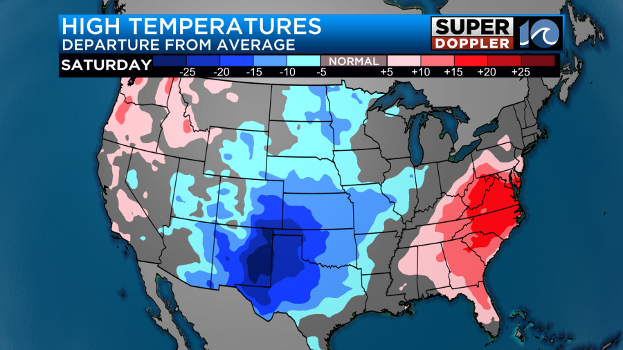
While we will be dealing with a lot of warm weather in the eastern U.S. over the next few days, they will be dealing with some unseasonably cold weather over the northern and western U.S.
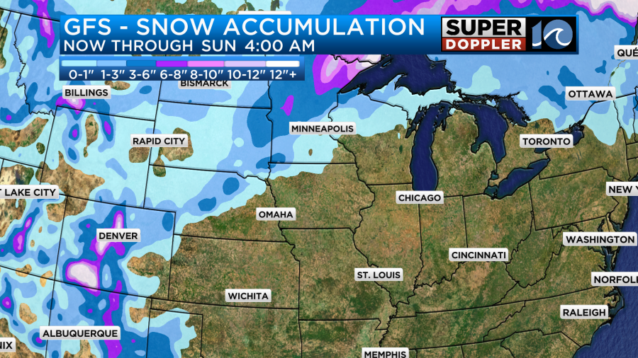
They will even be getting some snow in those areas. They could get up to a foot near the U.P of Michigan and possibly around Denver. Wow!
We do need some more rain here. Especially to wash out the pollen. Tree pollen will be at high levels for the next few days, and grass pollen will rise to moderate. Stay tuned for updates!
Meteorologist: Jeremy Wheeler