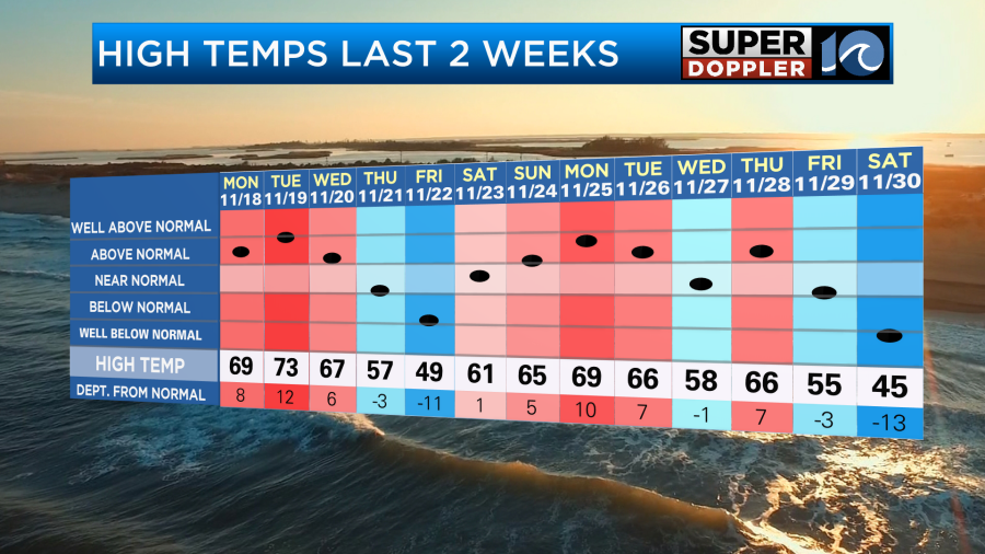
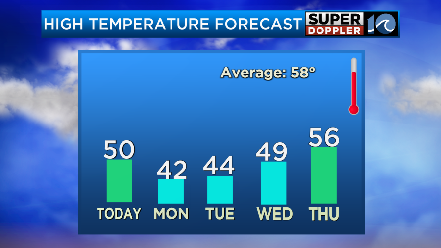
Locally, yesterday was chilly. High temps only made it into the mid 40s. This was well below average. We’ve had some ups and downs over the last couple of weeks, but we are in the middle some seasonably colder air.
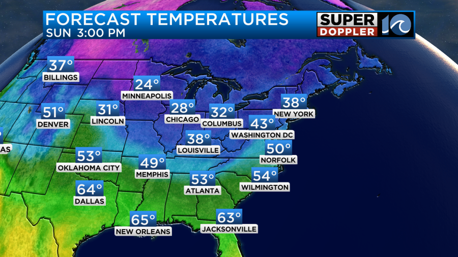
Today we won’t be as chilly in our area. High temps will be around 50.
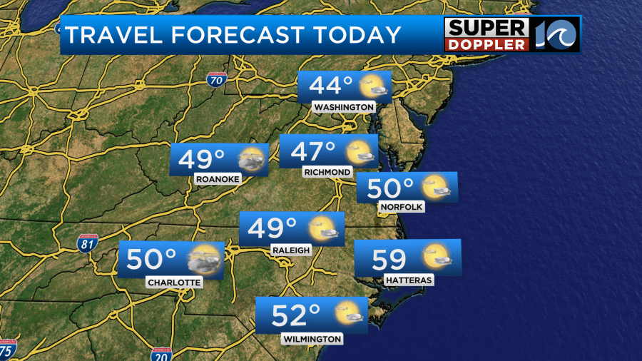
It should be good weather for travel in the region with partly cloudy skies. However, there may be some light precip late in the day to our west.
It should be good weather for travel over much of the country. The only real problems from weather will be the lake-effect snow machine up in the Northeast and Great Lakes regions.

It is in high gear with a few (feet) of snow near some of the Great Lakes within a 3 day period.
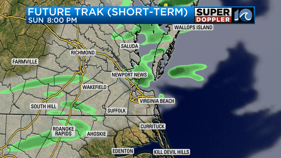
There will be some light precip to our west today. This is near a weak area of low pressure and a cold front.
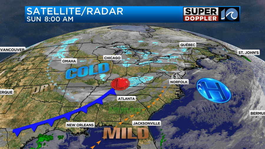
That weak system will slide over us tonight. More on that in a moment.
Locally we’ll be dry today with partly cloudy skies. Clouds will increase late in the day. There will be a light southwest wind which will run at 10-15mph.
Tonight clouds will increase. The low will be moving in from the west. So there will be some isolated rain showers at first. There will probably be some drizzle mixing in as well.
As the isolated precip continues into the overnight it’s possible that a few flurries will mix-in.
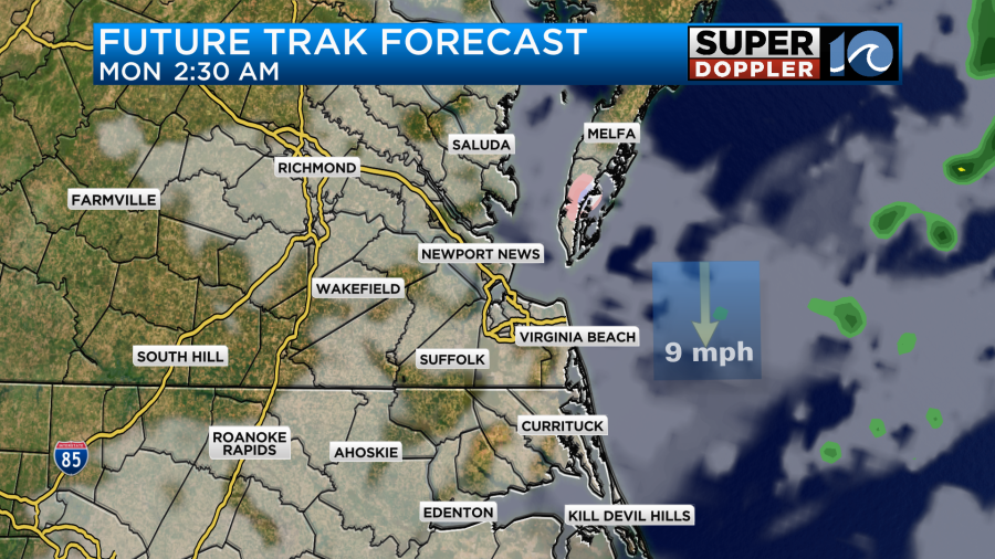
Temps will be in the 30s, but most temps will be above freezing. Also, the ground will be above freezing. So nothing will stick.
Tomorrow we are back in the cold as the cold front sinks to our south. High temps will only be in the low 40s as the winds turn out of the northwest.
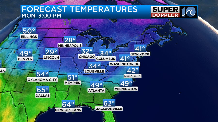
It should be good travel weather for a lot of the country again.
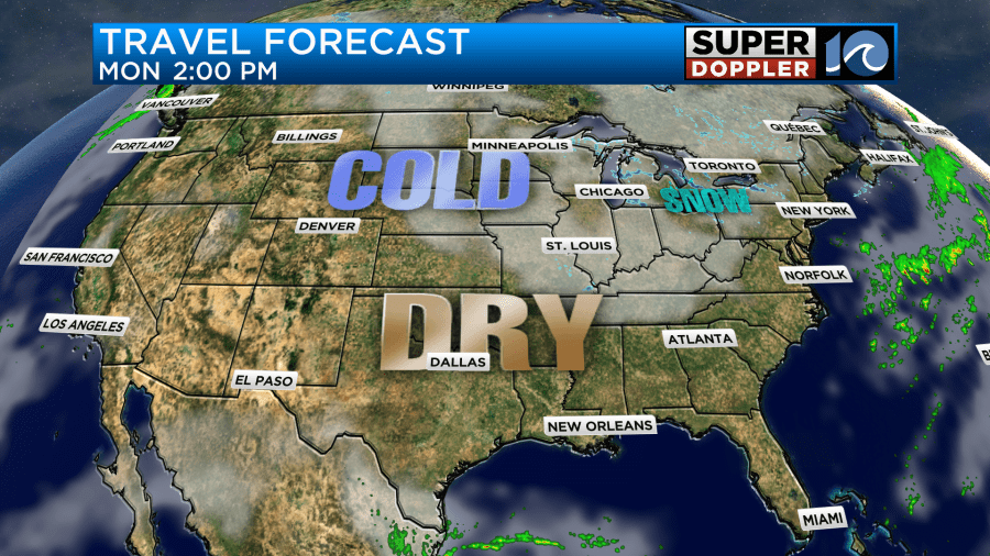
The exception will be over areas near the Great Lakes and Northeast due to the ongoing lake-effect snow.
We’ll be dry and chilly here for most of the week. Temps will be in the 40s most days. It will be in the 50s briefly on Thursday.
Hurricane season officially ended yesterday. We ended up with a busy season overall as expected. There were 18 names storms and 11 hurricanes.
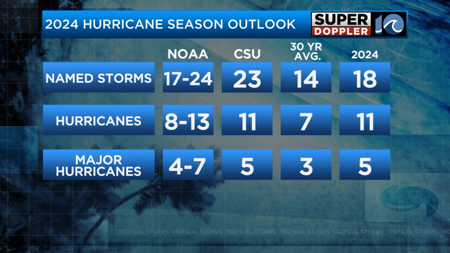
However, the season wasn’t that simple. There was a quiet period of a few weeks right around the average peak of the season. This made for a lot of head-scratching. Then October was both very busy and destructive. It became one of the deadliest hurricane seasons within the last 20 years. While hurricane season is officially over, it’s still possible that a storm or hurricane could form before the year ends. Water temps are still warm over parts of the Atlantic.

There is nothing out there right now, and there probably won’t be for the next week at least.
Meteorologist: Jeremy Wheeler