We went to Harborfest yesterday, and it was great. The rain in the late morning had moved out before we got there. It had cooled down the temps a bit as well. So it was pleasant at the Norfolk waterfront for a while. However, the temps started climbing again as we went into the afternoon. The rise in temps were halted though as more showers and storms moved into the region. Then last night we had another round of showers and storms move in. In fact, there were a couple of Flash Flood Warnings for the Peninsula with a couple of Flood Advisories inland. This was after midnight.
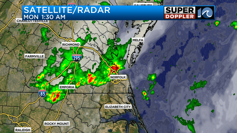
There was an area of low pressure near the region yesterday, and that was part of the focus for the storms. Over the last 24 hours we picked up about a quarter to three quarters of an inch of rainfall with the flood alerted areas getting about 1-2″.
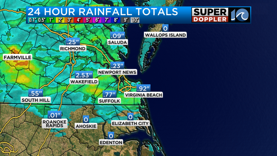
My weather watcher Scott in Yorktown had 0.92″. Norfolk had a little over a half an inch.
Today that low has moved off to our northeast.
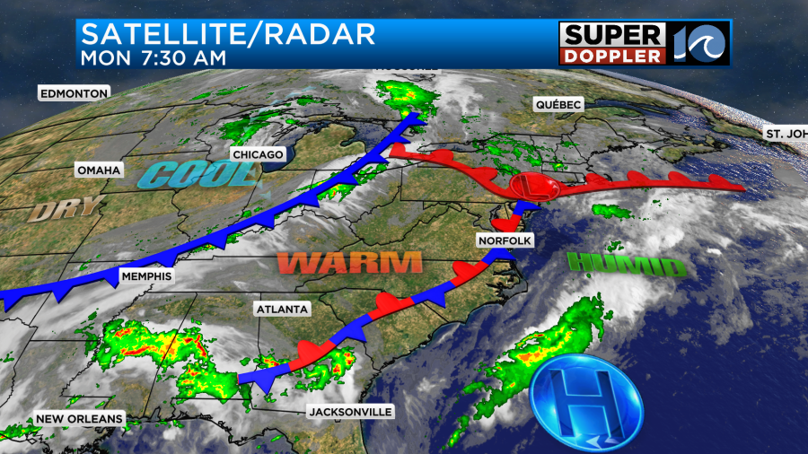
However, there is a stationary front that still lingers over our area. That may kick off a few pop-up showers and storms later today. There is a cool front to the west. That will play a part in tomorrow’s forecast.
During the day we’ll be partly cloudy for a while. Then during the afternoon there will be a few showers and storms popping up along the front.
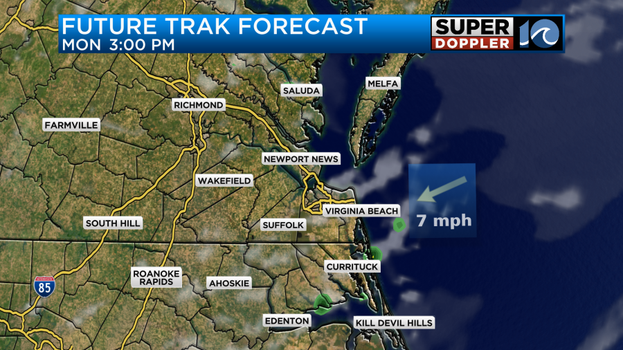
The HRRR model is often more aggressive than Future Trak. It has a few strong storms and later in the day.
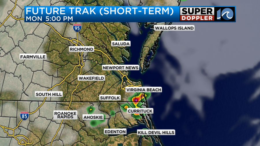
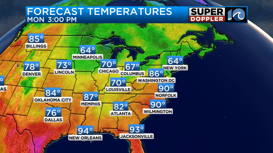
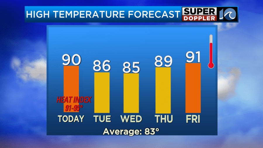
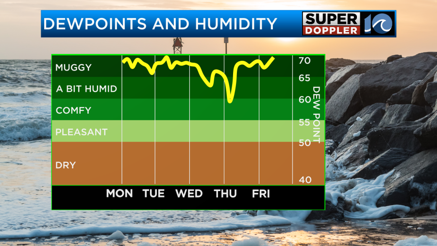
There is a lot of heat and humidity in the forecast today. That could be some fuel for a few of the storms. High temps will aim for 90 degrees this afternoon.
However, the dew points are in the upper 60s to low 70s. So it will feel like it’s in the low-mid 90s with the heat index.
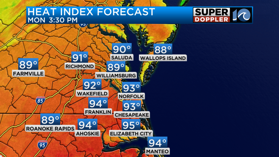
Be sure to stay hydrated. If there’s any kids heading out for a field day, then make sure they get plenty of breaks in the shade. They will need plenty of cool water or sports drinks.
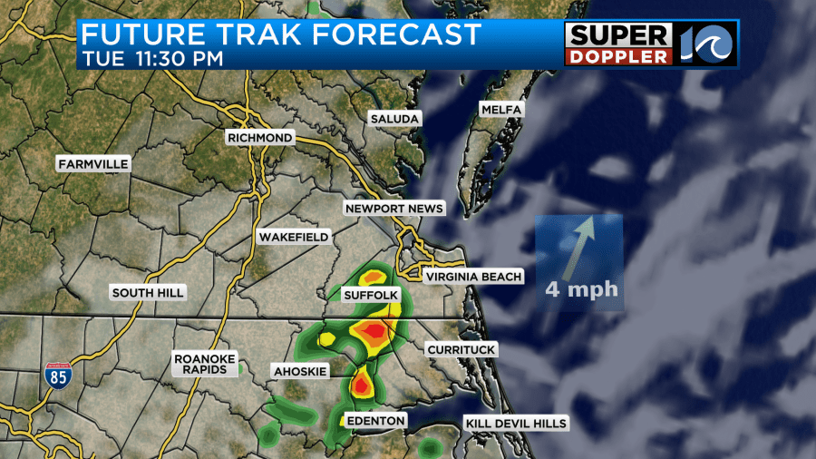
Tomorrow the cool front to the west will get closer to the region. It will move very slowly. So most of the day it will be to our west. However, it will be close enough to enhance the chance for rain again. Plus, we’ll still have a lot of humidity. Dew points will be around 70. It looks like there will be a few rounds of showers and storms through the day. There may already be some rain in the early morning. Then it looks like some scattered showers and storms will slide through between the late morning and afternoon hours.
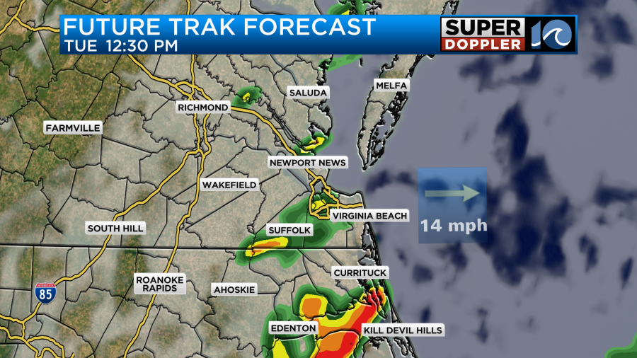
There may be a lull for a time after the late afternoon. (We’ll see). However, our model brings in a final round in the evening. That could also pack a punch.
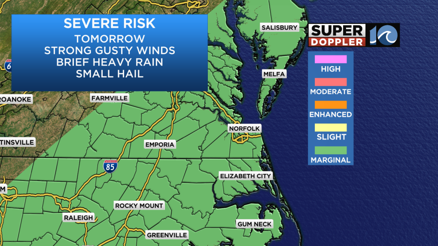
There is a marginal risk for severe weather tomorrow. The main threats are heavy rain and strong gusty winds. However, some hail will also be possible.
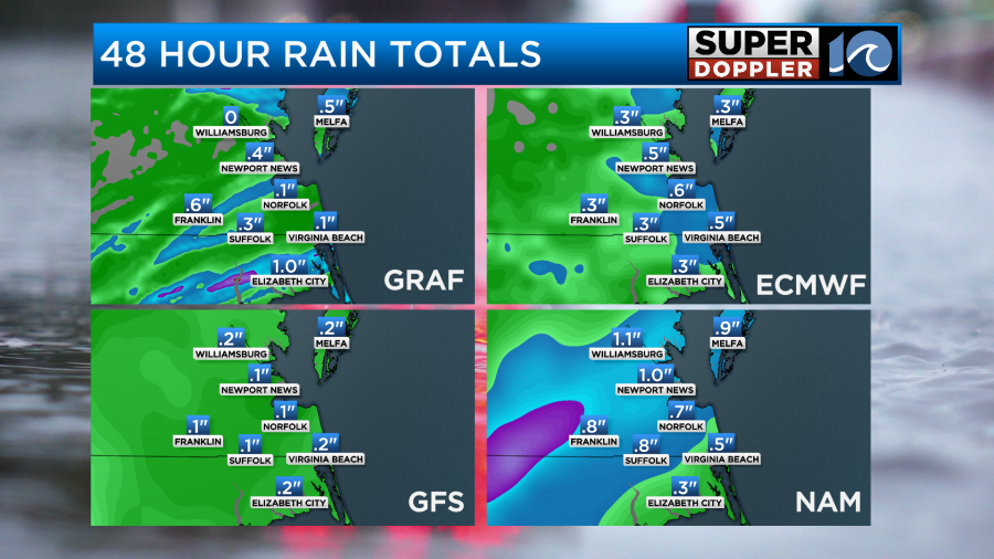
Rainfall amounts between now and tomorrow night will vary quite a bit. Some locations may get missed entirely. While some other isolated locations may get 1-2″.
A couple of showers may linger into Wednesday morning, but overall Wednesday will be drier. High temps will be in the mid 80s tomorrow and Wednesday.
The front is forecast to stall out near the area between late Wednesday and Friday. However, some slightly drier air should limit the rainfall.
Unfortunately, there may be some more scattered storms returning by next weekend. I’ll talk more about that in tomorrow’s weather blog.
Meteorologist: Jeremy Wheeler


