
This is becoming the Summer of floods for sure. There were more areas that got hit by severe flooding recently. The latest area to get hit was up in the Northeast. Parts of New York and New Jersey had more flash floods. Even some of the subways were flooded out in New York.
We had more flooding here, but it wasn’t on that level. Heavy rain fired up in some of our inland locations during the afternoon.
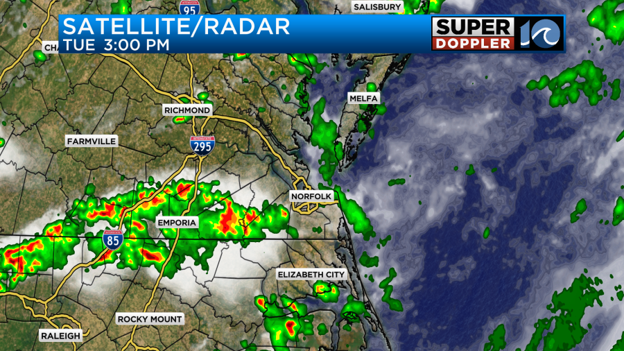
These storms put down a couple to a few inches of rain. Then they moved east by the evening.
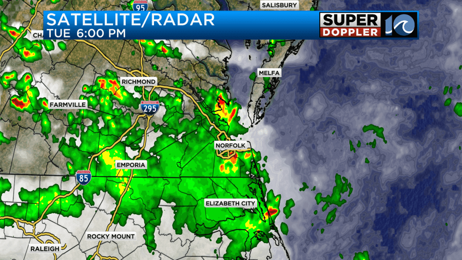
There was an almost widespread light rain that wrapped around the heavier downpours during that time. Then the rain fell apart during the later evening.
Some locations out towards Wakefield, Surry, and Capron looked like they picked up about 3-5 inches of rainfall.
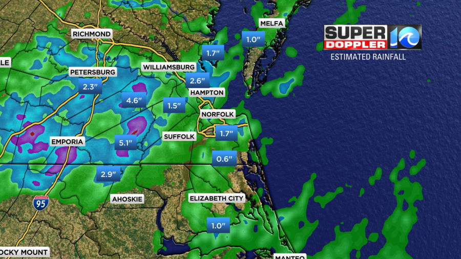
There were some pockets of 2-3″ in the viewing area, but there was a more widespread zone of a half inch to an inch (green area). The coverage of the rain was a little higher than forecast by the evening. I think the main reason for that is that the stationary front had drifted a bit more south than was forecast. There was also a large amount of deep moisture. Today that front has lifted to the north a bit.
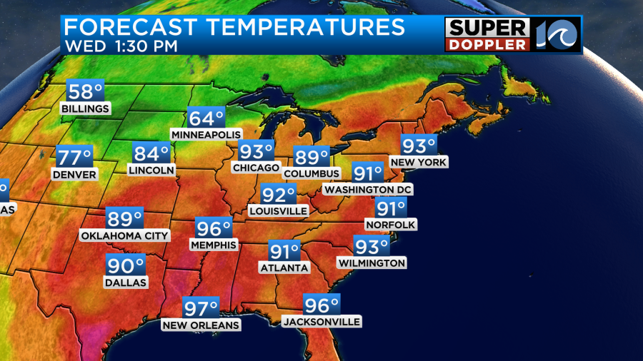
It will continue to lift a little more north today. High pressure will also build in a little more. This will allow for more sunshine to spread into the area, and that will in-turn allow the temps to heat up. High temps will aim for the low 90s this afternoon.
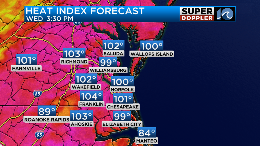
The heat index will be around 100 degrees.
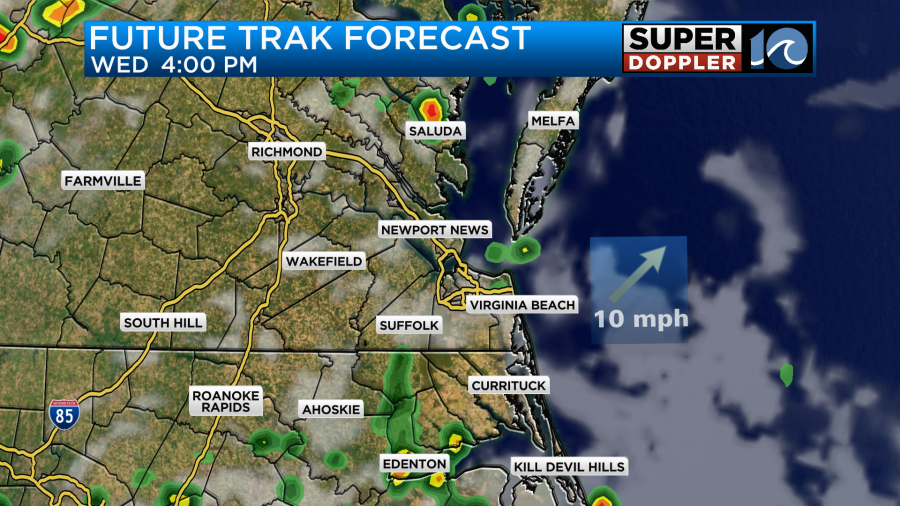
With all of the heat and humidity there will be a few showers and storms during the afternoon and evening, but there should be much less coverage than yesterday.
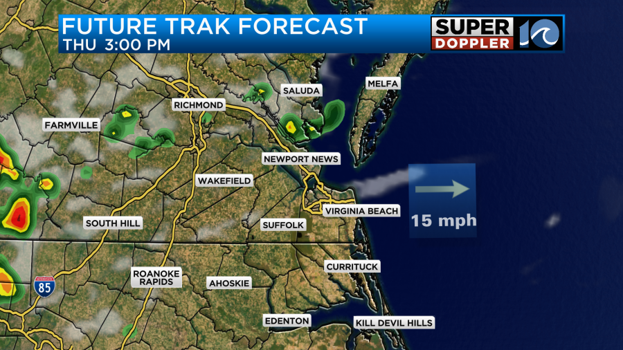
Tomorrow an upper-level ridge (rise in the weak jetstream) will push west into our area. This will likely help to limit the rain showers to just some isolated pop-ups.
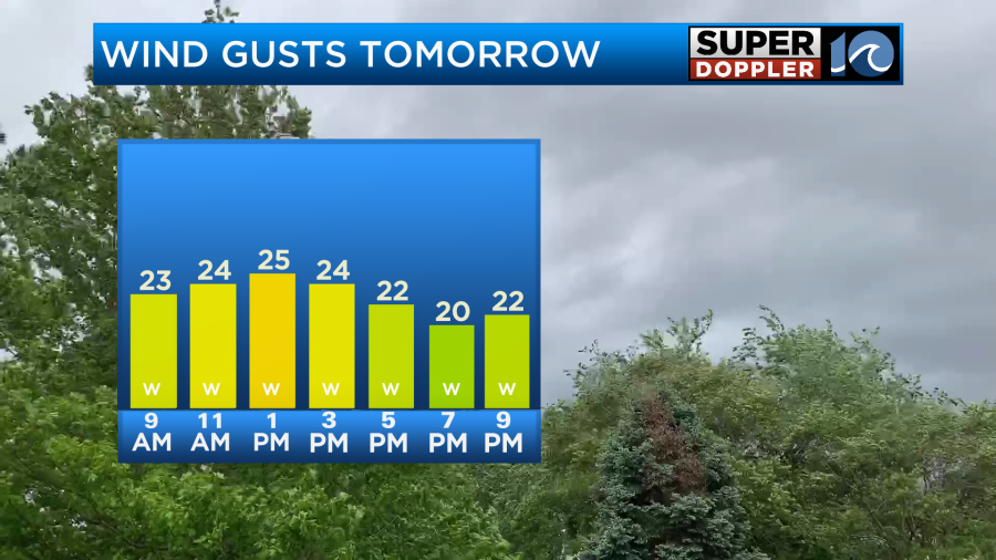
We’ll be mostly to partly sunny for most of the day. Also, the breeze will pick up out of the southwest. Gusts could be up to 25mph for a while.
This will push our high temperatures up into the mid-upper 90s.
The heat index will be near 105 degrees. Heat Advisories may be issued by the National Weather Service for this later today or tonight.
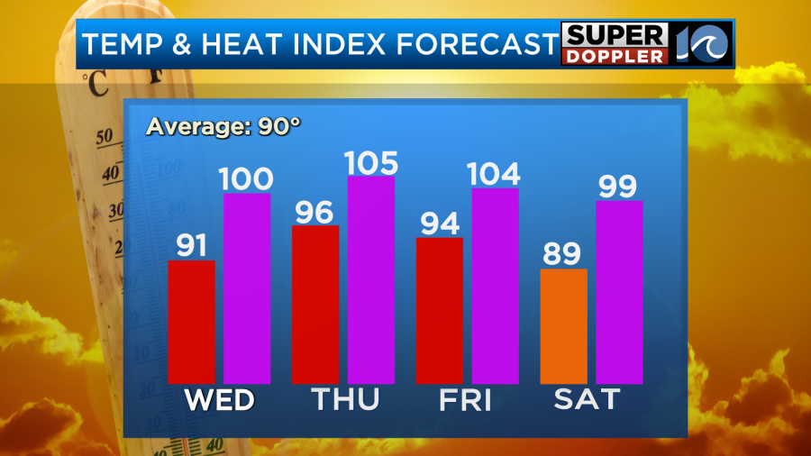
We’ll stay very hot and humid on Friday with high temps still close to the mid 90s. The heat index will also be near 105 again. However, we’ll probably have more clouds with a higher chance for scattered PM storms. The models have a cool front near our region going into Saturday. For now I have partly to mostly skies with scattered showers and storms. Temps may dip slightly, but it will still be very muggy. I’ll talk more about the weekend in tomorrow’s weather blog.
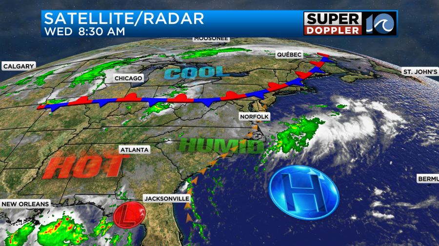
Meanwhile, we are tracking that area of low pressure near the Gulf of America, It is over land and moving west.
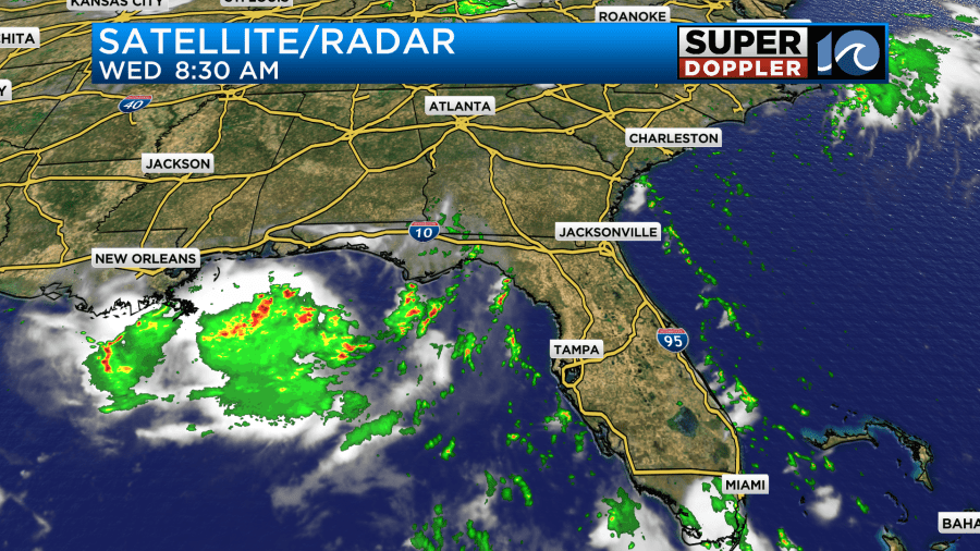
As of this writing it is still very disorganized. The bulk of the models have it staying over land over very close to the coast. A couple have it going more over the water.
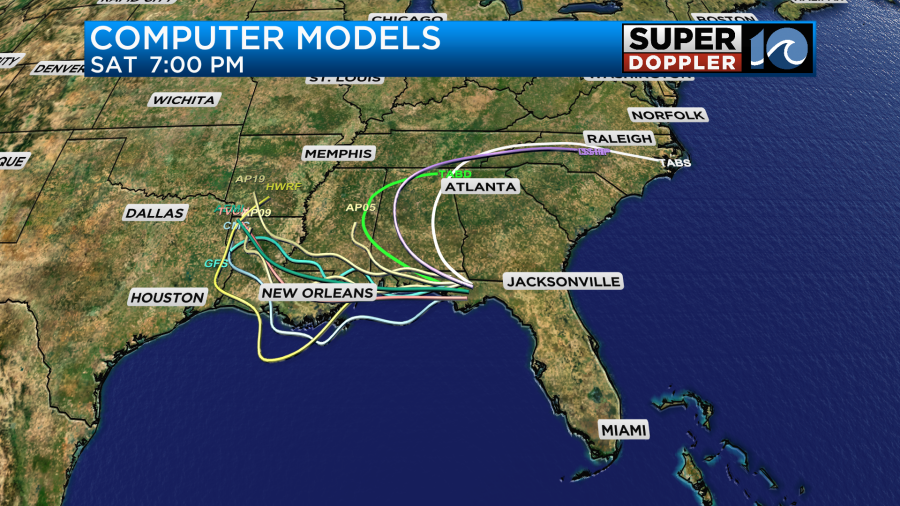
If it does move more over the water, then it could strengthen. It does have a medium chance at becoming tropical.
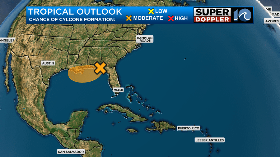
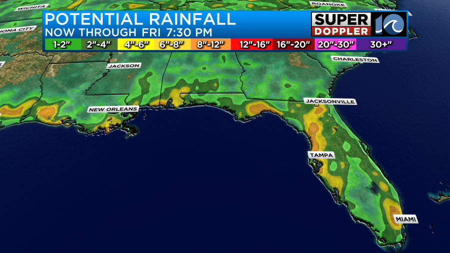
However, I feel like this will be more of a rainmaker than anything. Whether it becomes tropical or not, it could put down over 8 inches of rain over the next 3 days.
Either way it should stay down to our south. Hopefully, we don’t get that slug of tropical moisture though. Course we are already very humid. So maybe it wouldn’t be much different as we go into the weekend.
Meteorologist: Jeremy Wheeler


