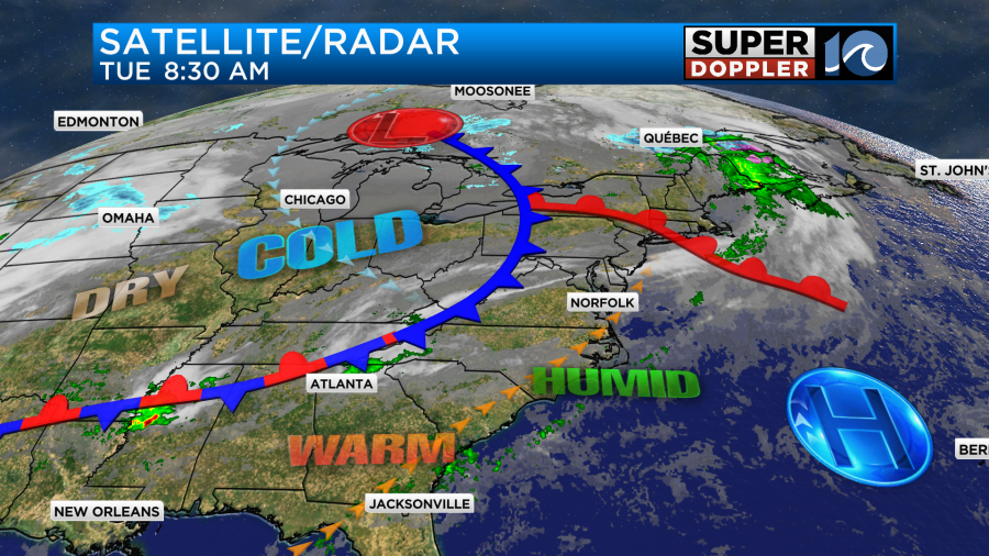
Yesterday was tough. There was a stationary front that stayed to our south through the entire day. This kept the fog and clouds over the region, and that kept the temps in the 50s. Today we’ve already had better conditions. We started this morning with a mix of sun and clouds. There were no showers, and the fog was fairly isolated.
The front has moved to our north now. We’ll be in the warm zone today.
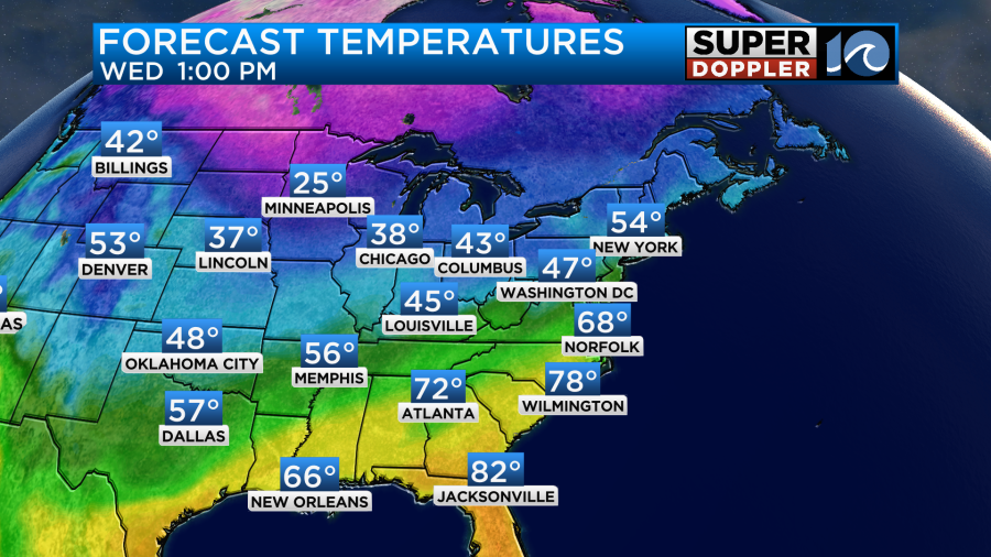
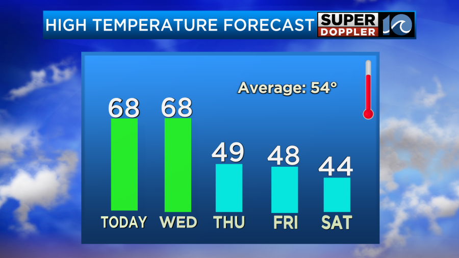
Winds will be more out of the southwest through the day. Between that and the occasional sunshine we should warm up to the upper 60s this afternoon.

There will probably be a few 70s mixing-in as well.
While we will have more sunshine, there is also a lot of moisture in the air. Dew point are rising through the 50s. So there will also be some isolated rain showers coming in from the west. This could happen at any time of the day from the late morning onward. It should be a decent day at times. It will definitely be a good time to open up the house and get some fresh air. It will also be a good day to go for a walk outside. Just keep an eye on the WAVY weather app to see if any showers pop up.
Tomorrow we’ll have similar weather. We’ll have isolated rain showers possible with a mix of sun and clouds. Temps will warm again into the upper 60s with a few 70s.
The front will actually stall out just to our north tomorrow. We’ll stay on the warm side through the evening. However, it will make a final push to our south Wednesday night. That’s when we will have our highest chance for rain. Our Future Trak model has backed off the rain a bit, but the other models still show a big area of showers.
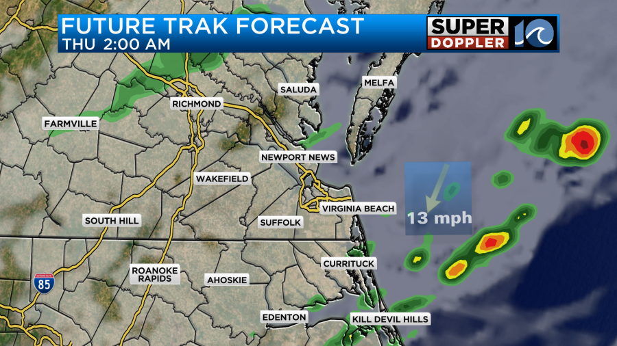
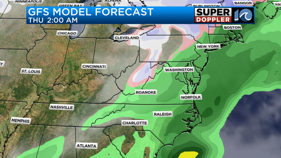
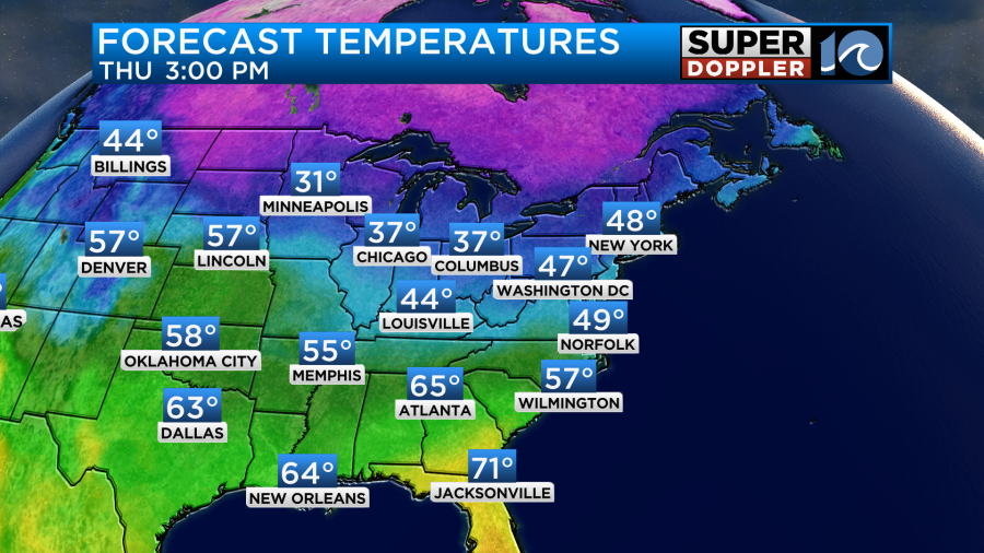
Either way we will cool down on Thursday as the front sinks to the south. High temps will only be in the upper 40s.
We’ll stay cool/chilly Friday into Saturday. Highs will be in the 40s.
There will be an offshore low forming between Friday and Saturday. It may throw a little moisture back our way. So there is a low chance for some showers during that time. The low is forecast to jet north quickly (far offshore). However, the north winds will increase on the back side. This will affect our region with some cold weather. High temps may only be in the upper 30s on Sunday. Stay tuned for updates.
Meteorologist: Jeremy Wheeler