
We will see our temperatures climb to the 40s and even near 50 in a few spots today. That warmth will be with a bunch of sunshine for today and tomorrow.
High pressure will keep our sunny pattern and warmer temperatures for the beginning of the week. The snow will mostly melt away from our yards today and tomorrow. The amount of snow we’ve seen this February is much higher than in years past. From this last storm alone, we had 11.0″ fall in Norfolk, where the records are kept.

February is usually not our snowiest month, that goes to January where the 30 year average is 3.2″ Remember, we can still get snow in March, so stay tuned for the couple of weeks ahead to see if we will get one more chance of snow before Spring arrives.
Some rain is on the way for the end of the week. The timing is looking like late Thursday as a cold front move in from the northwest.
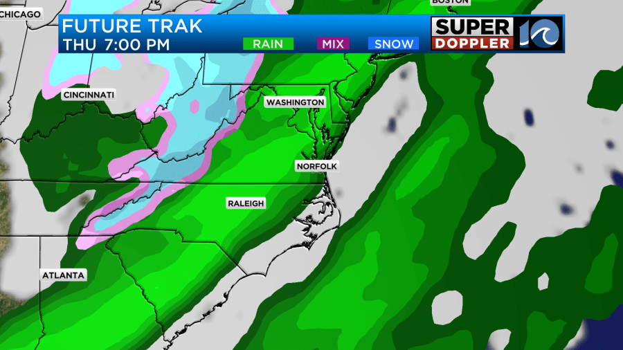
The timing for this front is looking later on Thursday. Also, the strength of the front doesn’t look to be very strong, so while there could be some heavy rain as it arrives. The risks for severe weather do not look to be there as it looks now. Enjoy your Sunday!


