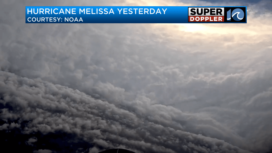
Hurricane Melissa is going to be historic in a really bad way. It is the strongest hurricane to hit the island of Jamaica on record. Even stronger than hurricane Gilbert in the late 1980s. Yesterday, the hurricane hunters flew into the eye of the storm.
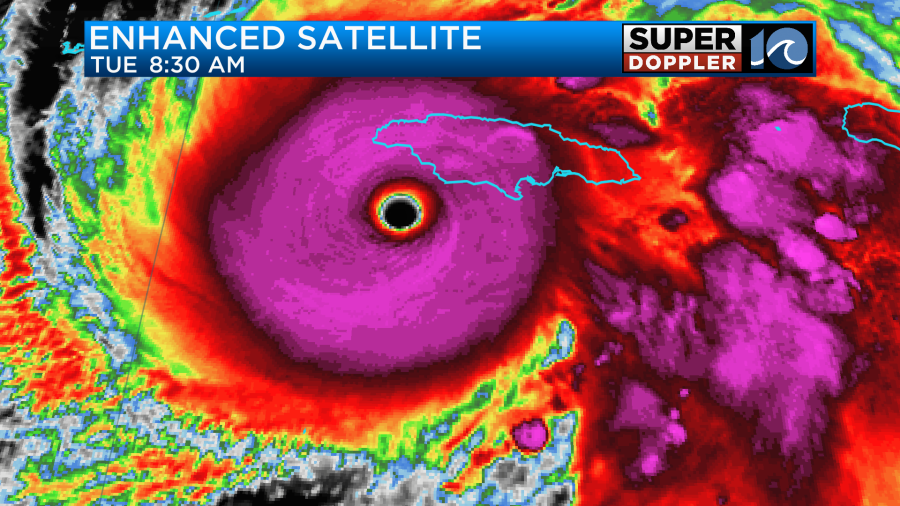
The eye was still just as sharp on the satellite as yesterday. The hurricane was a strong category 5 this morning.
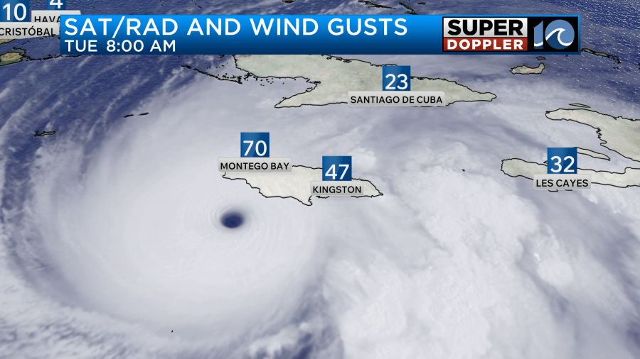
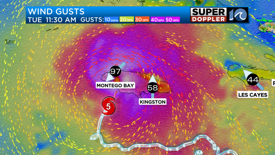
Winds were already gusting to 70mph around Montego Bay, and the eye was still a couple of hours from hitting the southwest coast.
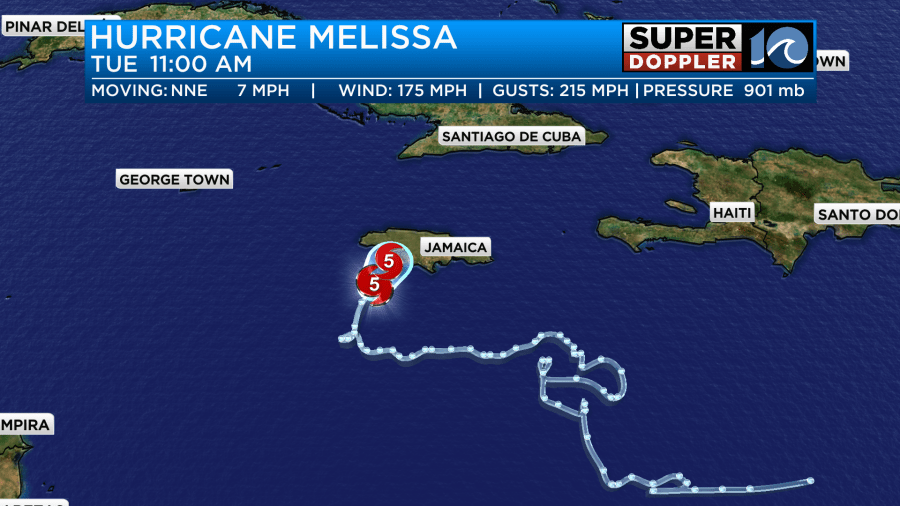
Around the center of the storm the sustained winds were 175mph. The GUSTS were over 210mph.
Winds will be very strong over the western part of the island as the eye traverses land.
However, it may be strong over in the higher terrain of the eastern part of the island as well.
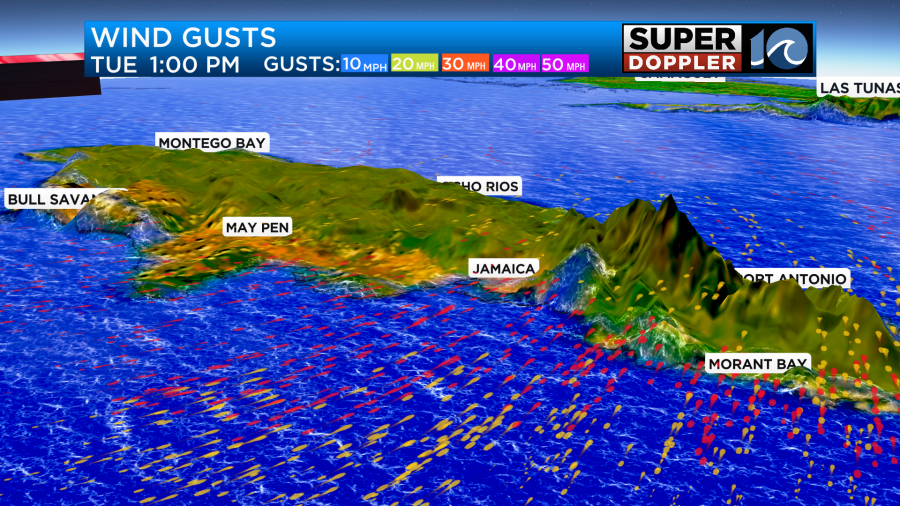
Some of the highest elevations are between 6,000 and 7,000ft. So winds up there could be over 100mph.
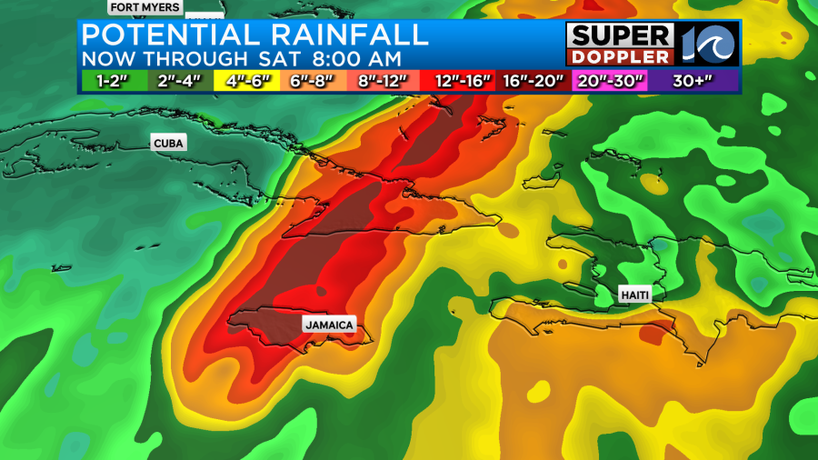
This terrain will also cause mudslides. Rainfall will be about 15-20″ with some locations receiving more than 30″.
There will also be a huge storm surge down there. So a lot of infrastructure will be likely damaged, and that could last for a while.
After hitting Jamaica Melissa is forecast to roll over eastern/central Cuba as a category 4 storm.
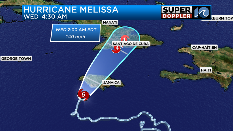
They will also have strong damaging winds and flooding rains. It will be rough there for a while, but they should have a shorter duration than Jamaica as the storm picks up some speed. After that point the storm will move over parts of the Bahamas. It could then affect Bermuda as a category 1 hurricane.
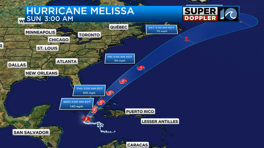
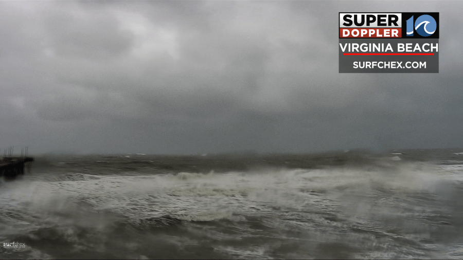
Luckily, the storm will stay far east of the United States. We’ll probably get some ocean swells from it in a few days. However, we have our own issues here. We already have some big waves at the oceanfront.
This is from an offshore low that will pass just to our south today.
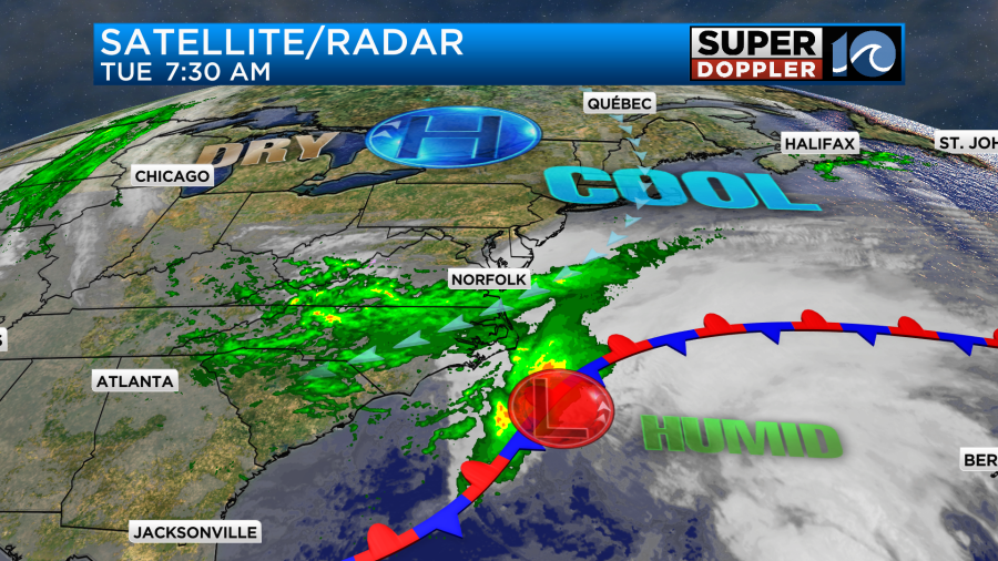
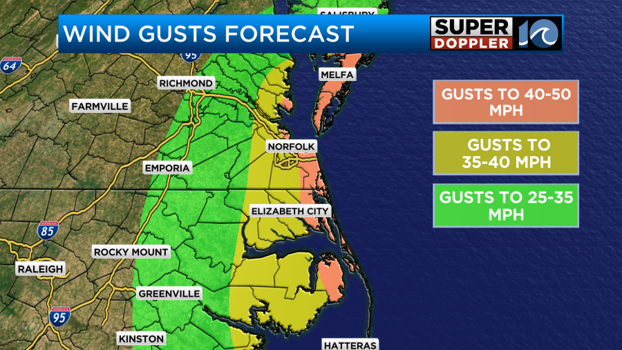
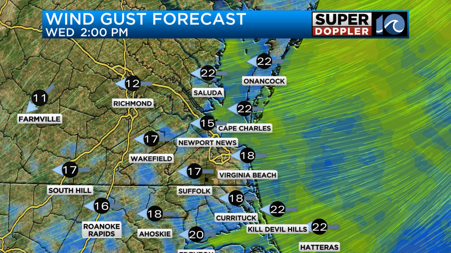
The low will stay offshore. However, the combination of the low to the south and the high to the north will produce strong northeast winds through the day. Gusts have already been over 40mph over some coastal locations.
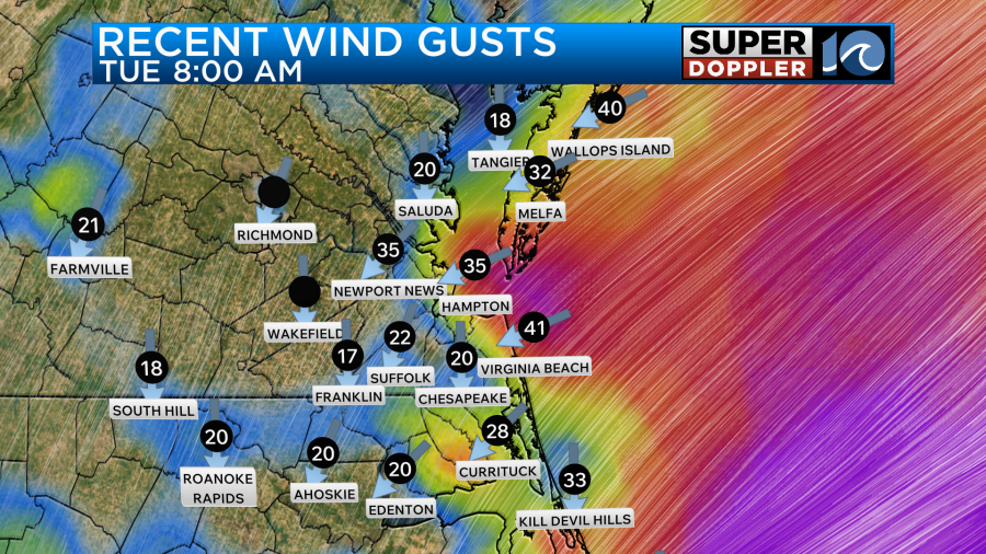
These types of winds will be possible through the afternoon with a few gusts to 50 even possible near the shore.
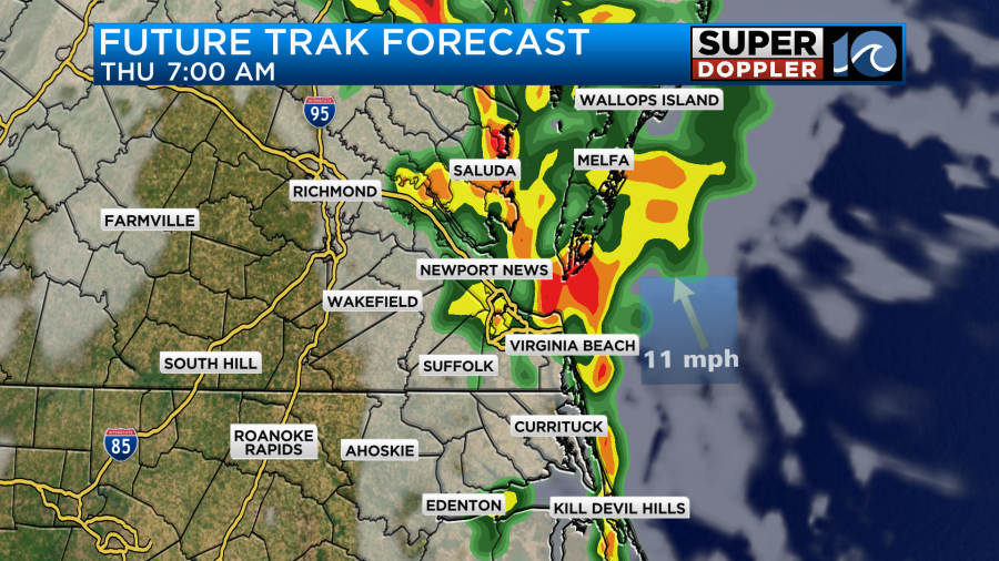
Rain showers will be on and off through the day. More on than off.
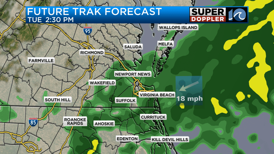
However, the showers will taper off by the evening.
We’ve already had about a half inch to an inch of rainfall.
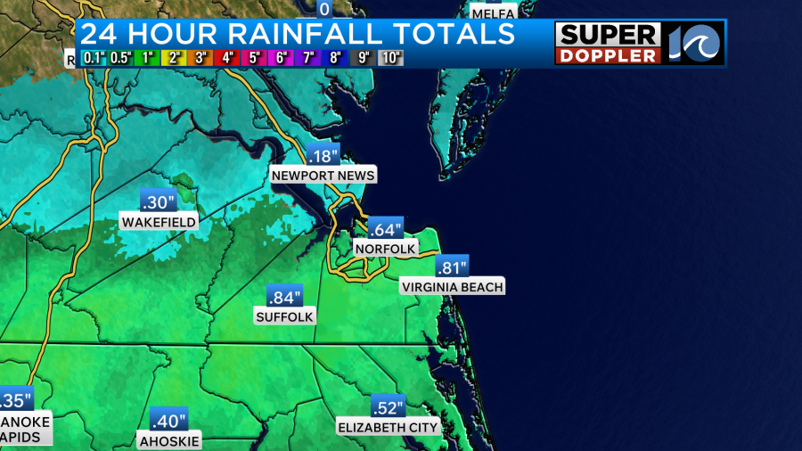
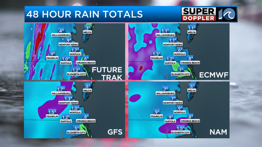
We could see another half inch of an inch of rainfall. So in total we could get about 1-2inches.
This will all keep the temps down today. Highs will only be in the upper 50s to near 60 degrees.
Tomorrow the low will be farther offshore. However, some moisture will wrap in behind it. We’ll still have some northeast breezes. Though they won’t be as strong as today.
We’ll have a mix of sun and clouds. There will be a few showers, but they will be very scattered. Highs will be in the mid 60s. By Thursday another area of low pressure will be moving in from the west. This low will pass just to our northwest during the day. We’ll have a cold front swing through as well. These will create some scattered showers (and possibly a few thunderstorms) Thursday morning.
However, a much drier air mass will sweep in by the afternoon. So we should clear things out. Highs will be in the 60s. Luckily, we will be dry for Friday. We’ll be partly sunny with highs in the mid-upper 60s during the day. So we’ll likely be dry with low 60s by the evening. It will be a little breezy. I’ll have a lot more details about the Halloween forecast starting tomorrow.
There will be some minor to moderate tidal flooding today over the area.
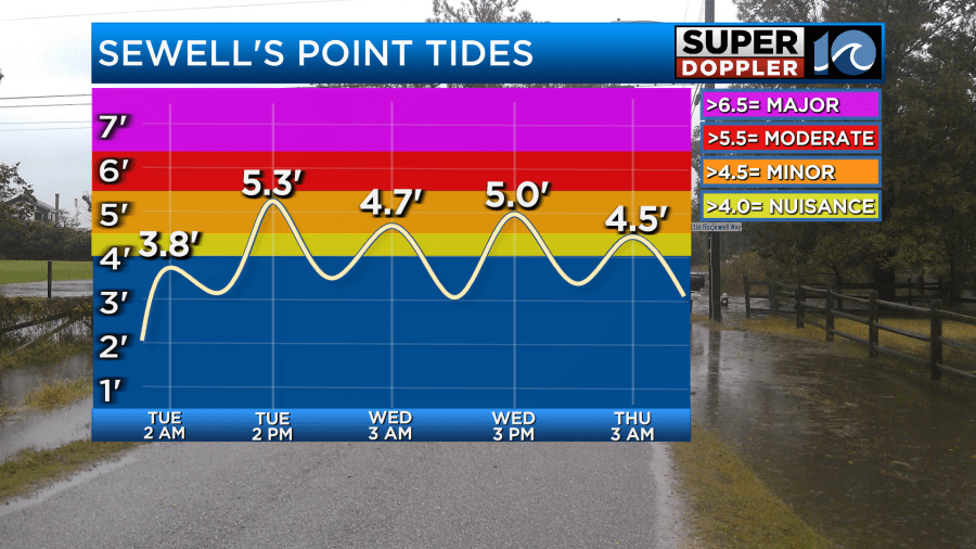
The tide this afternoon at Sewell’s Point is forecast to be about 5.3ft. This puts it on the edge between minor and moderate. However, I think a problem that we’ll run into is poor drainage. So some streets may have standing water due to that effect. There will also be some ocean overwash along the Outer Banks.
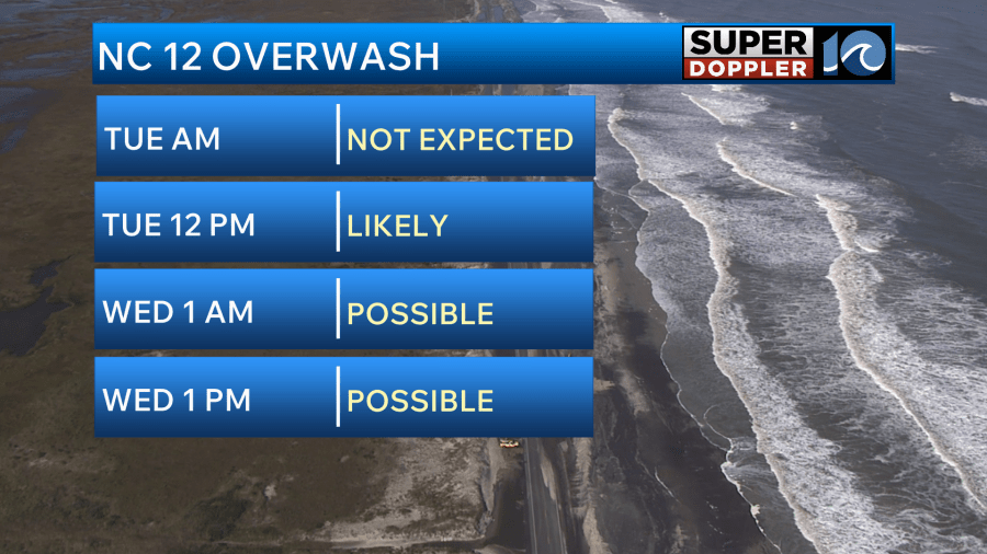
Waves are running over 10ft down there. There will probably, and unfortunately, be some more beach erosion along the Outer Banks.
Stay tuned for updates on all of this, and be careful out there today!
Meteorologist: Jeremy Wheeler


