Yesterday, we finally got a lot of rain closer to the metro area. It was needed by many. However, some locations had a little too much rainfall. Scattered showers had formed already by the mid-morning. Then we had scattered storms and heavy showers during the midday and the afternoon.
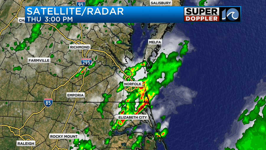
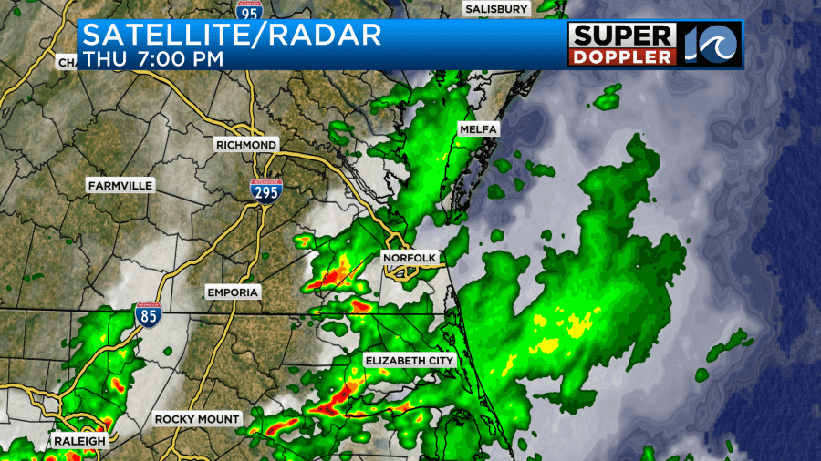
The showers drifted around a bit. So by the evening the heavy rain was more inland and south.
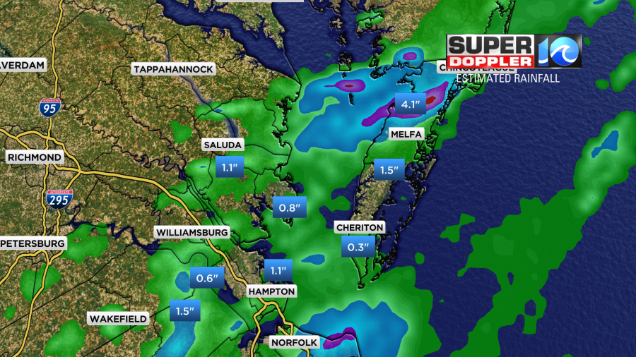
Rainfall totals varied. There were a good 1-2 inches over the Southside and northeast North Carolina. Some locations picked up about 3-4 inches.
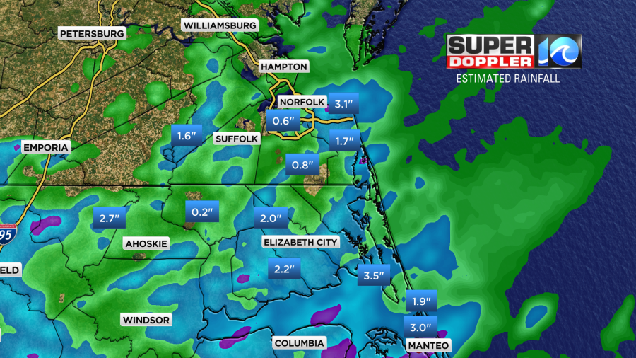
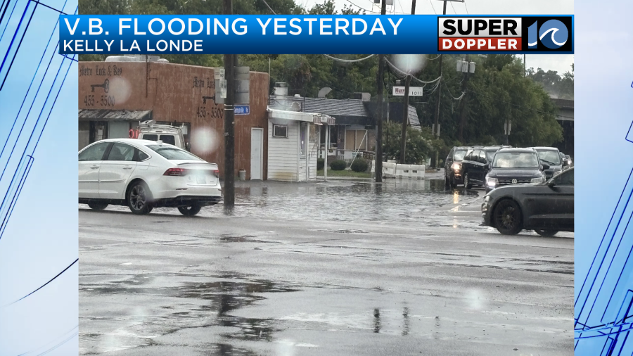
There were Flash Flood Warnings issued for several locations. Virginia Beach had some flooding on the north end.
There was also some heavy rain up on the Eastern Shore. It looks like over 4 inches fell up in northern Accomack county.
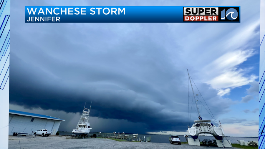
There were also some strong thunderstorms. This was a photo sent in from Wanchese. It shows a shelf cloud with a dark rain shaft behind it.
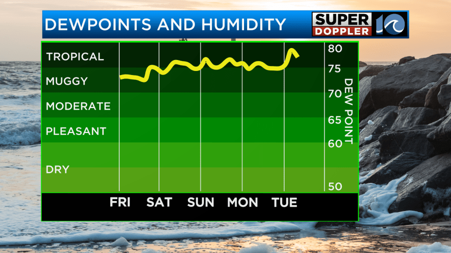
Yesterday, there was a weak upper-level disturbance on top of us. There was also a weak boundary that fell apart at the surface. Today that upper-level low will push out to sea. That should help to decrease our rain chances. There’s no big weather features around us, but there is a lot of humidity.
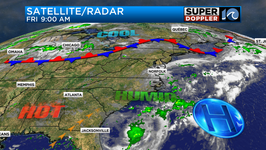
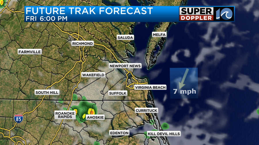
We had a lot of clouds this morning as the upper level low slowly pushed east. However, we should have some clearing today. We’ll have a mix of sun and clouds. Again, there will be a few showers and storms popping up this afternoon.
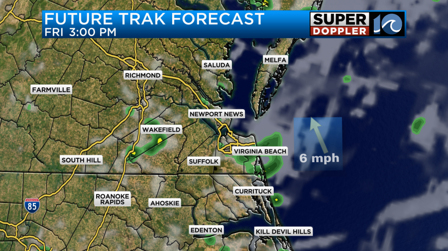
While the coverage should be less than yesterday. There will still be a couple of isolated downpours. These should decrease by the evening.
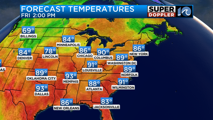
High temps will aim for the upper 80s to around 90 degrees.
The heat index will be in the upper 90s to around 100.
We’ll almost do a repeat tomorrow. Highs will be in the upper 80s to near 90. The heat index will be near 100.
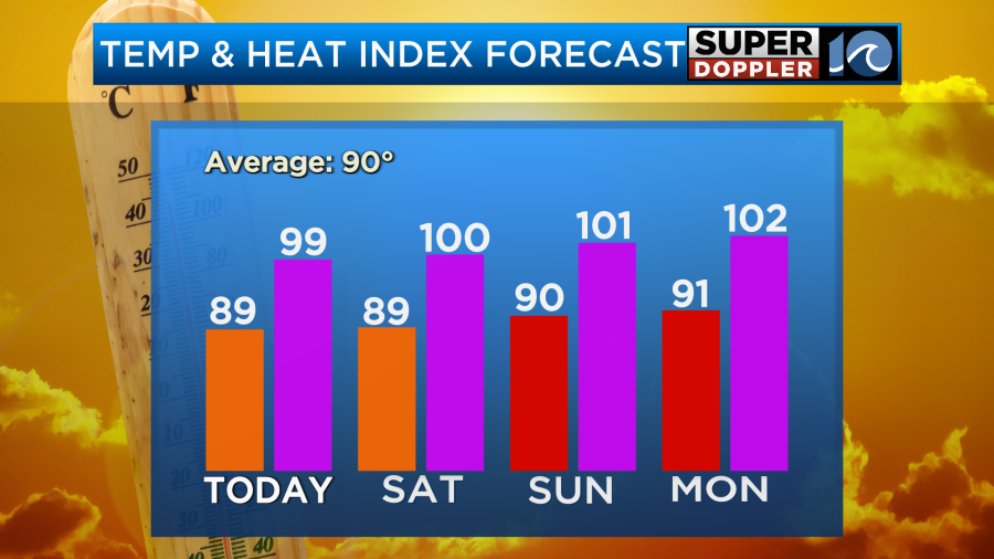
For now I’m thinking that we’ll only have some isolated showers or storms on Sunday, but there will probably be a higher chance for rain early next week. High temps will likely stay around 90 degrees. The humidity will likely stay high as well.
At least the tropics are still quiet.
Meteorologist: Jeremy Wheeler