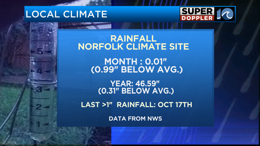
Let me start this blog by saying that we really need some rain. I know it’s not the growing season, but we are really hurting for rainfall in the short and long term. We haven’t had rainfall over an inch since October 17th. We are down about an inch for the month so far, and we are down about 0.3″ for the year.
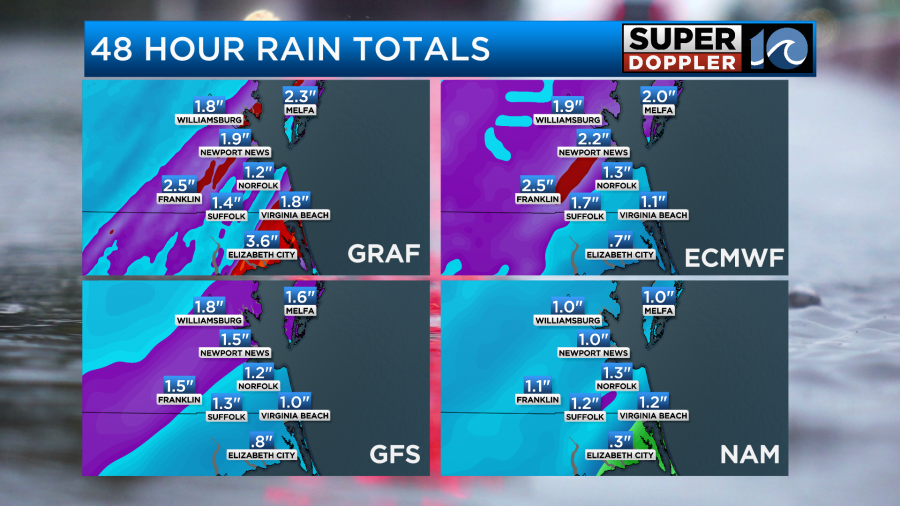
The good news is that we have a good shot at getting a nice soaking rain over the next 36 hours. The models are forecasting about an inch to an inch and a half with some locations possibly getting over two inches.
Here’s the setup…
Today we have a warm front to our north with a cold front to the west.
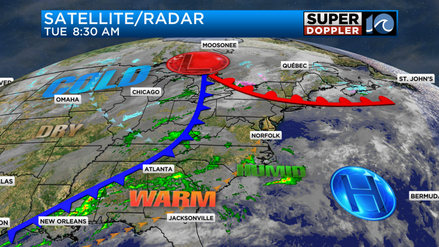
So we are well into the warm zone today. We have a light southwest wind that will continue through the day. This has been pulling in a lot of moisture, and that will also continue today. Moisture will continue to build into tomorrow.
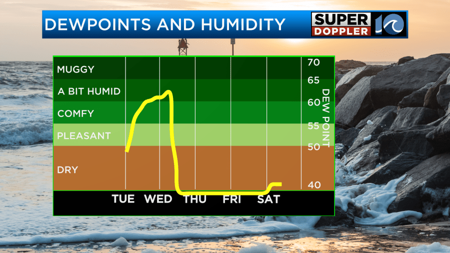
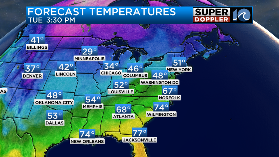
Today it will be warm and a little humid. High temps will rise into the mid 60s.
We’ll have lots of clouds with a little sun at times. However, there won’t be much rain. We had a few showers this morning.
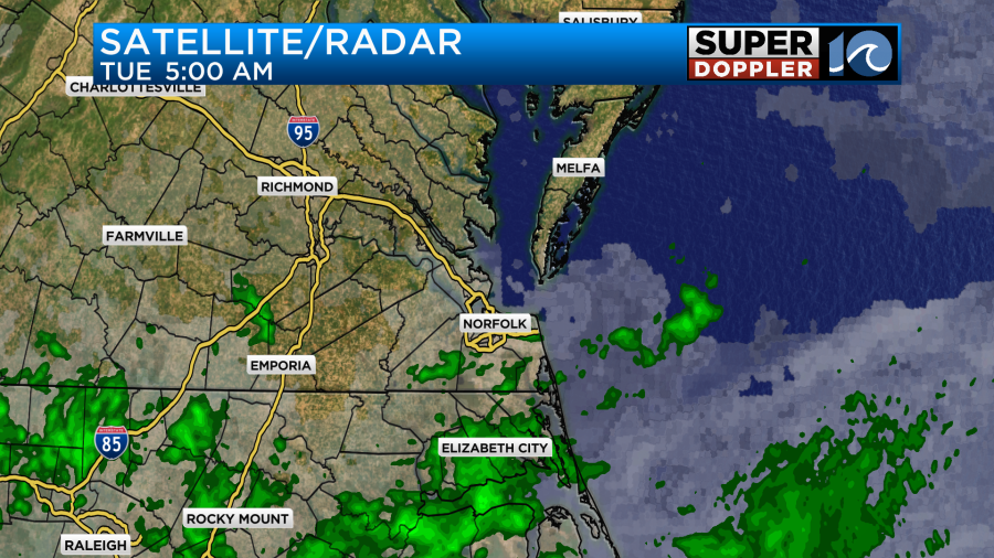
Beyond this morning the showers should be pretty isolated through the day. So there will be some time to get outside and enjoy the mild temps. A few more showers may move in later in the afternoon and evening.
By tomorrow the deeper moisture will funnel into the eastern U.S. The strong cold front will be moving in from the west. Winds will gust up to 35mph out of the southwest from the early morning through the midday hours.
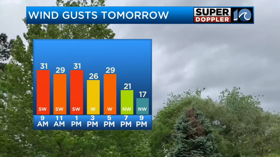
Winds will turn out of the northwest when the front arrives in the mid-afternoon.
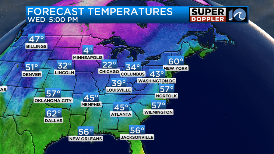
Temps will top off near 70 degrees or in the low 70s before the front gets here. Then temps will fall to the 50s by 5pm
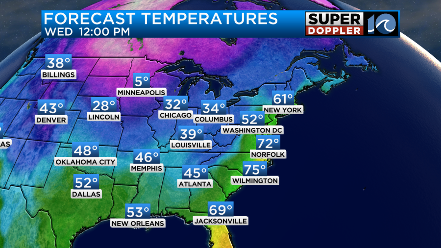
This is a big contrast to the single digit temps expected in Minneapolis tomorrow.
As far as rain goes… It will be on and off through the morning. There will be several rounds.
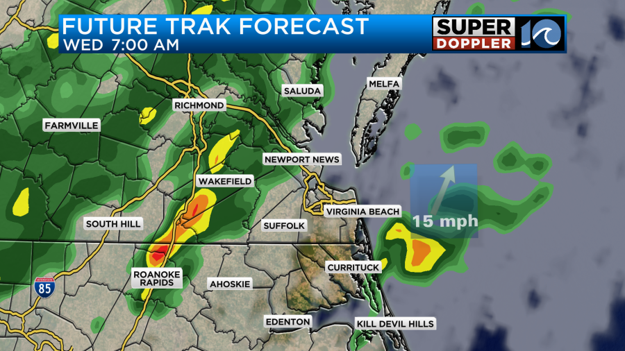
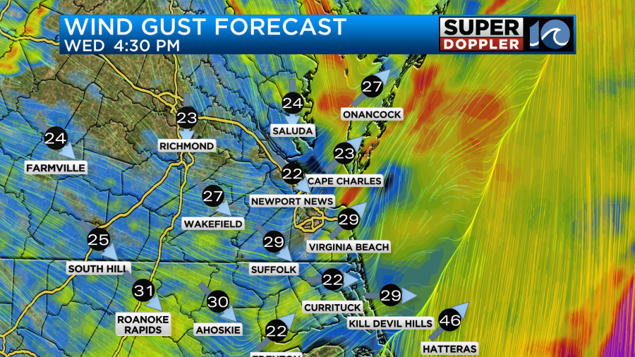
However, a big area of rain is forecast to develop later in the day.
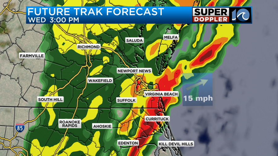
This is when some thunderstorms are expected to form. There will already be strong gusty winds. Plus, there will be some instability. This will create some decent fuel for the storms. As of today there is a marginal risk for severe weather forecast for Wednesday.
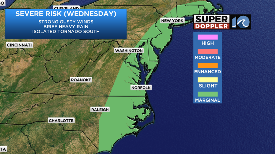
Strong damaging winds will be the main threat along with heavy downpours. Be sure to lock down your holiday decorations today. Keep in mind that an isolated tornado to the south will also be possible.
The rain will start to taper off tomorrow evening. Then we’ll dry out after 6pm. Temps will fall to the 30s tomorrow night, but they should stay above freezing. Then we’ll be much colder and drier heading into Thursday.
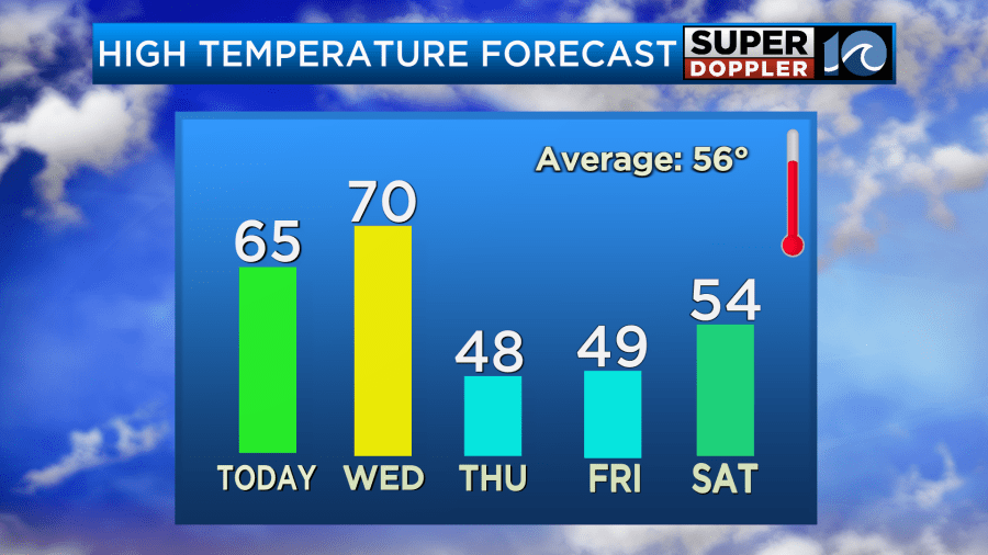
We’ll have some cold air Friday morning with lows in the 20s and 30s. We’ll only warm to the upper 40s during the afternoon despite fair skies. We will, however, warm up on Saturday to the 50s. We’ll have a mix of sun and clouds. There will be increasing clouds on Sunday with some scattered rain showers returning. At least high temps will still be in the 50s.
Stay tuned for updates to this active forecast.
Meteorologist: Jeremy Wheeler