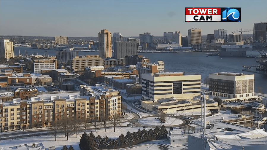
It was still a snowy scene this morning over the area.
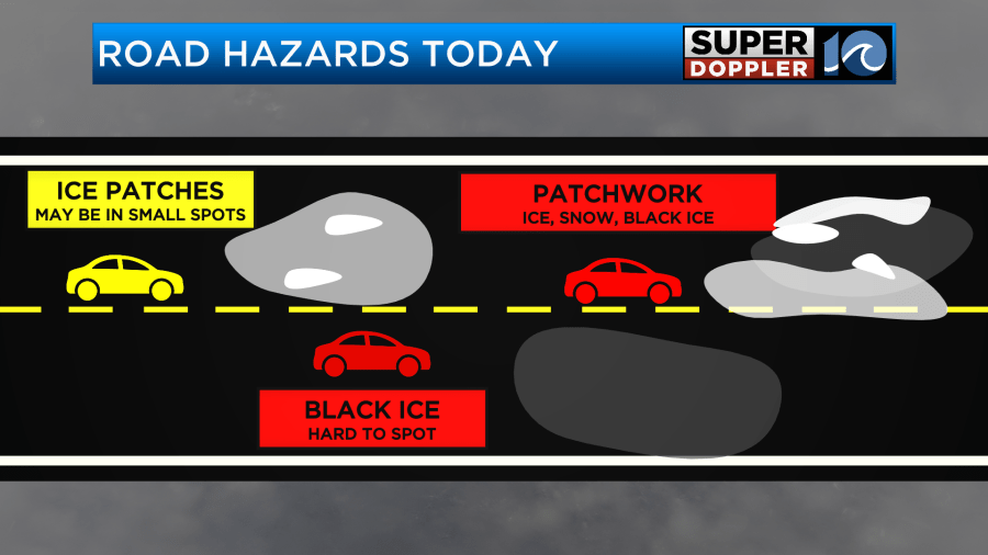
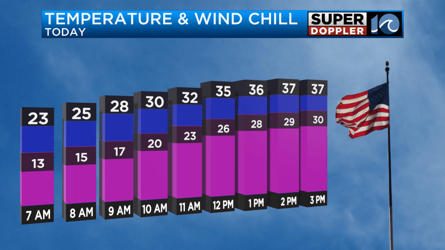
Temps were rough. We bottomed out in the teens and 20s, but wind chills were in the single digits. Yesterday, there was some melting on the roads. Especially on the primary roads which were treated. However, the temps were cold enough that there was a big re-freeze. So there was a patchwork of snow, ice, black ice, and salted dry spots.
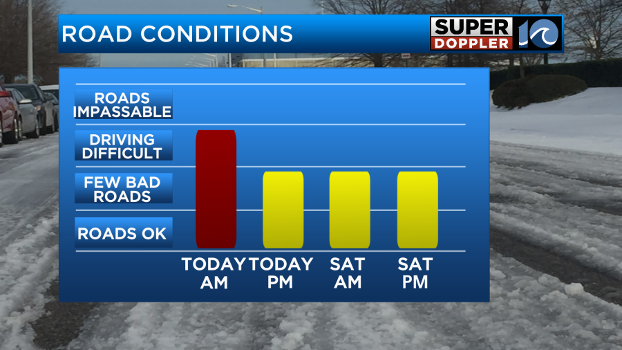
Road conditions will be tough this morning for that reason. However, there will be some more melting and drying as we go through the day. So conditions will improve a bit.
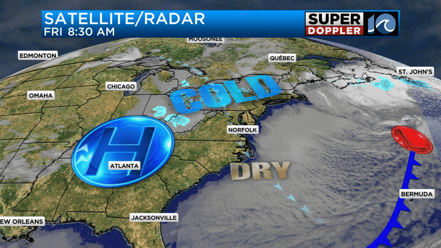
High pressure is building into the region. So we’ll have lots of strong sunshine through the day.
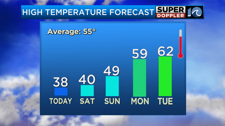
However, we’ll also have a breezy northwest wind. It will gust up to 25mph at times. This will keep our high temps in the upper 30s. That will be above freezing, but it will feel colder with the wind chill. That will make it feel like the 20s later today.
Tonight we’ll be cold again. Skies will be clear, and winds will lighten up. This will let temps drop down to the teens and 20s again.
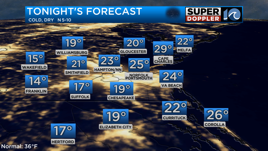
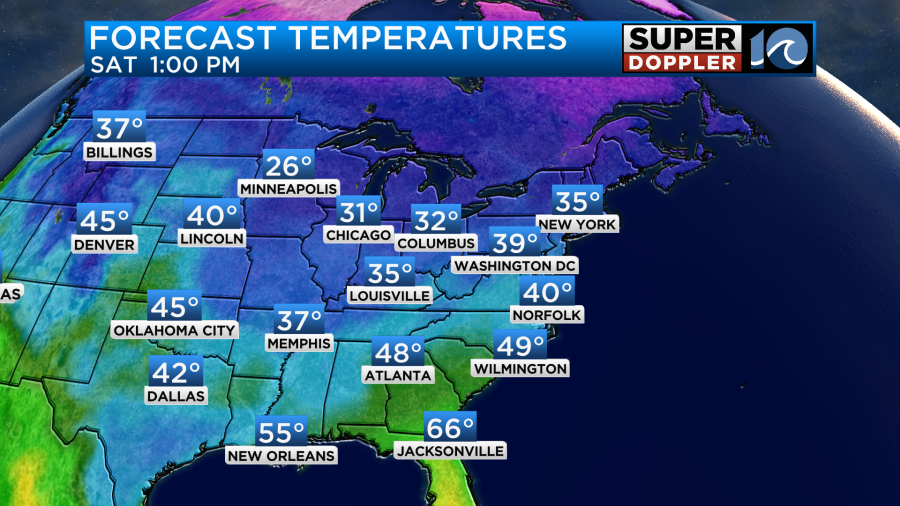
With the snow on the ground it acts to make things even colder sometimes. So I can’t rule out a couple of single digit lows by Saturday morning. The good news is that we should be able to warm up tomorrow. Winds will be lighter and variable. So despite being partly cloudy we should be able to warm up to near 40 degrees.
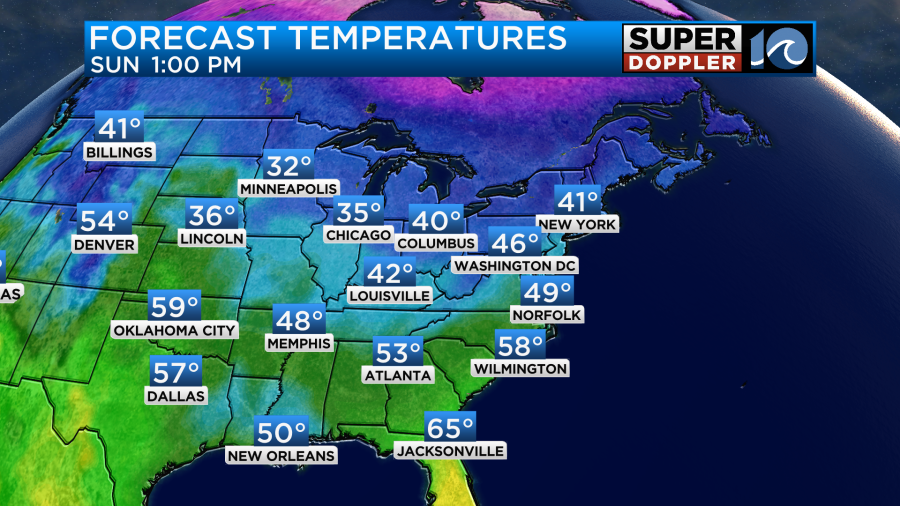
We’ll continue to warm up going into Sunday. High temps will rise to the upper 40s.
We’ll be mostly sunny. It should be a nice day overall. We’ll warm up even more Monday and Tuesday. Highs will be in the 50s and then possibly in the 60s.
I’m looking forward to highs in the 50s and 60s with some sunshine. Have a good weekend.
Meteorologist: Jeremy Wheeler


