There’s no doubt that the tropical forecast has changed DRAMATICALLY over the weekend. That is why folks need to keep checking back for updates. While things have changed big-time for the better. Imagine if the forecast had shifted the other way. Let’s talk about it.
As of this morning, Imelda was a tropical storm slowly gaining strength near the Bahamas. Meanwhile, hurricane Humberto was churning a few hundred miles east of Imelda.

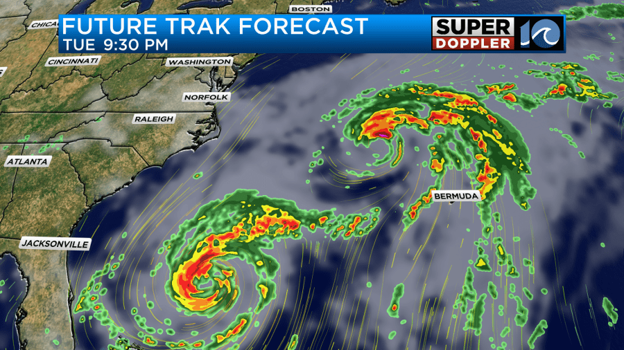
Over the weekend Humberto had made it to category 5 status, but it was a category 4 this morning. Humberto is a strong hurricane, but it will stay out to sea.
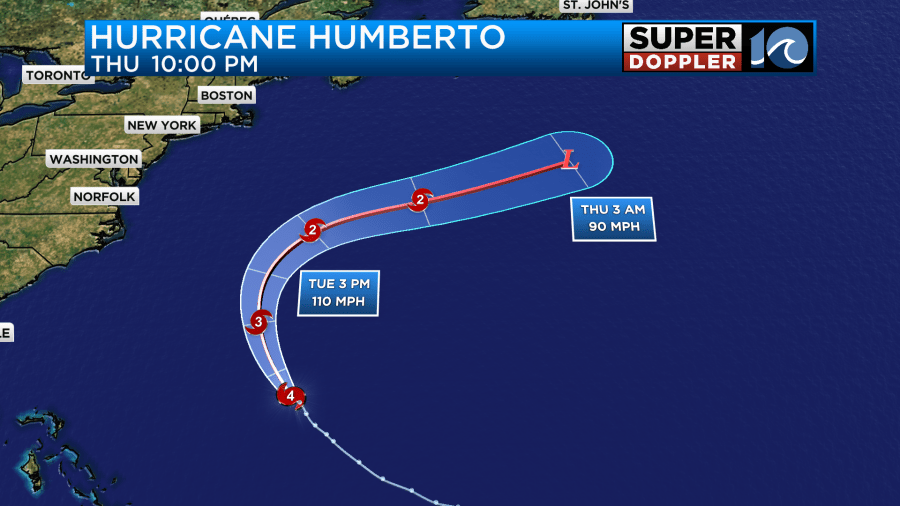
This part of the forecast has not changed much over the last few days. It should pass around Bermuda. It will move off to the northeast in 1-2 days. However, it’s the track of Imelda that has had the biggest change. The track now calls for Imelda to move to the north over the next 24-36 hours. Then it will take a sharp turn to the east.
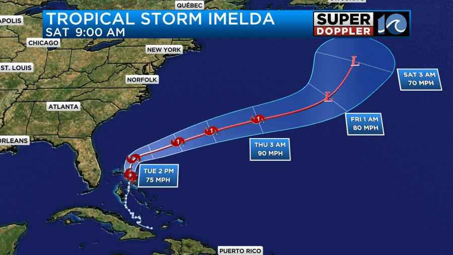
During that time it will likely strengthen into a hurricane, but it probably won’t get above a category 1.
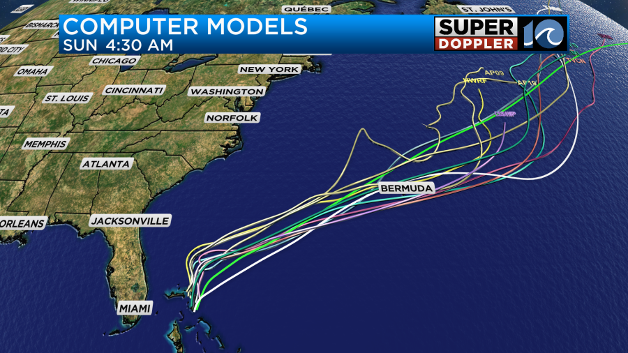
The models are in good agreement now in keeping Imelda out to sea.
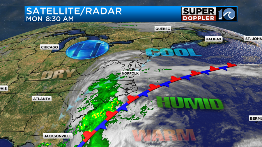
There are a few reasons for this. First off there is a stationary front along our coast with a big area of high pressure to our northwest.
Also, Humberto is forecast to help enhance a weak trough (dip in the jetstream) to the northeast of Imelda. This should help to pull the system to the northeast/east. Finally, there is the Fujiwara effect. Now I think that will happen as they two systems get closer to each more than initially, but this is when the two systems influence the weather around them. This literally pulls the two systems around each other. So there is probably a little bit of that at play here.
With the new tracks we are not expecting much rain. There were a few showers around here this morning. We’ll have mostly cloudy skies today with few rain showers from time to time as we do through the day.
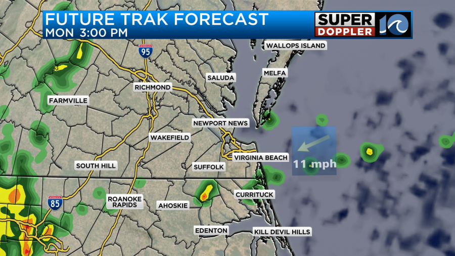
There will also be some pockets of drizzle out there as well. This will be the same case tonight into tomorrow morning and possibly midday.
By the time we get to Tuesday evening we’ll have some drier weather slide into the area. We’ll have a little clearing by then as well. Then we’ll have a mix of sun and clouds on Wednesday with no rain. We’ll be much drier later this week.
Now while we won’t have any direct impacts from these tropical systems. We will have some indirect impacts. Today the winds will be light and out of the northeast. We’ll have a few gusts to 15mph. However, tomorrow with Imelda to our south and the strong high to the west. The northeast winds will increase later in the day.
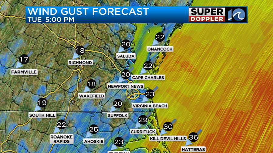
Winds will gust up to 25-30mph near the shore. There may be a few gusts to 35mph along the Outer Banks. These types of winds will continue Tuesday night into Wednesday morning.
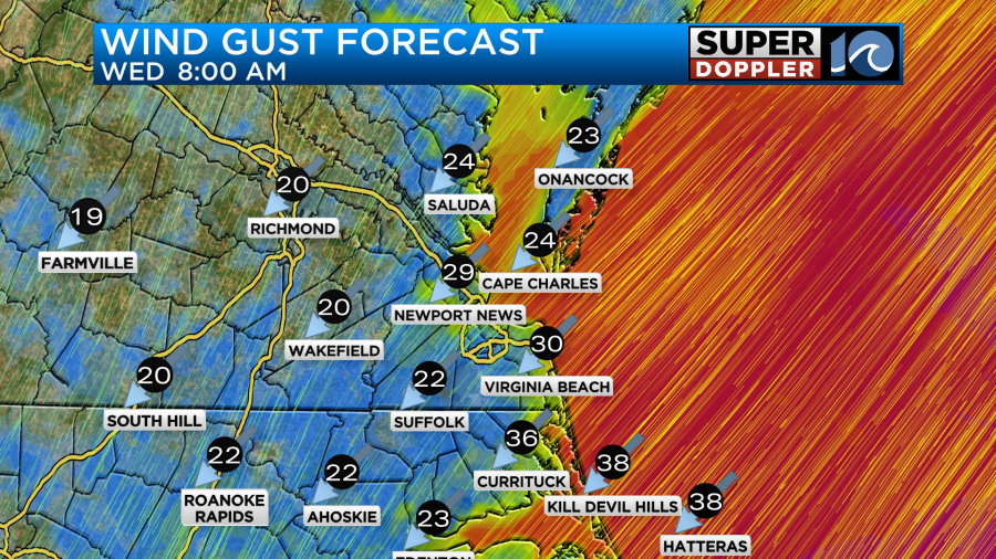
The winds should taper off though late Wednesday into Wednesday night. It will still be a little breezy on Thursday. These winds shouldn’t cause too many problems. However, there may be some minor tidal flooding in the region by the time we get to Wednesday evening.
Rainfall will be light! Locally, we will only get a couple tenths of an inch.

So there won’t be any flooding from rainfall alone. That is also a huge change from a couple of days ago.
There will be some fairly big waves coming from the ocean. The ocean will definitely be churned up for a while. It goes without saying that the rip current risk will be high for a while as well. Waves could reach up to 5-7ft around Virginia Beach. They could reach up to 10ft along the Outer Banks. Luckily the tide shouldn’t be too high. However, there could be some ocean overwash in some spots between Tuesday night and Thursday morning. Stay tuned for updates on that.
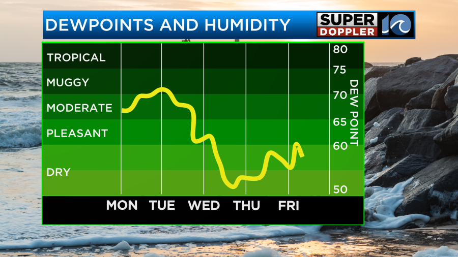
Otherwise, we should have some nice weather later this week. Highs will be mostly in the 70s for the next few days, but it will be in the upper 60s on Thursday. Lows will drop to the 50s from Thursday morning into the weekend. I can’t wait. At least for that humidity to drop. I’ve had too many bad hair days lately… (crickets chirping)
Meteorologist: Jeremy Wheeler