Yesterday we had a few thunderstorms with some heavy downpours pop up over the area. At first is was a small cluster.
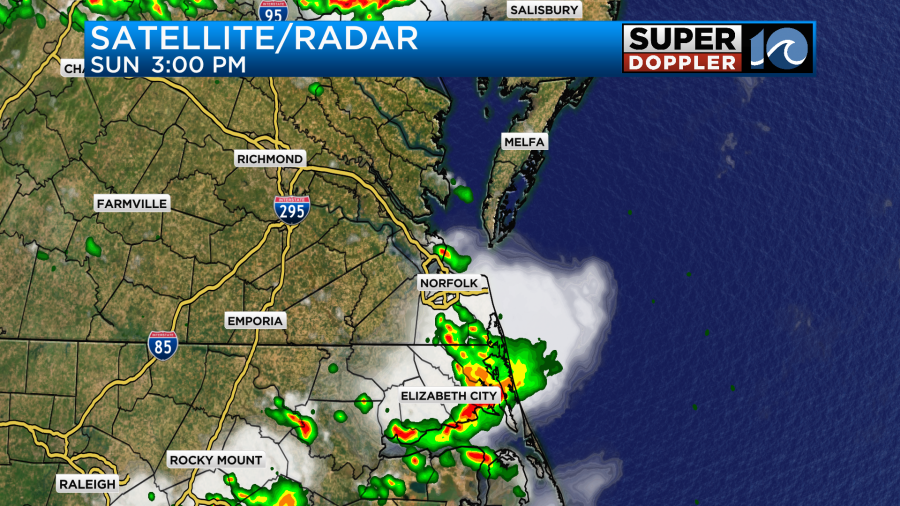
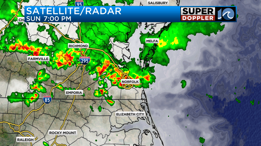
Then a bigger batch came in from the north during the evening. This hit an outflow boundary that popped off of the first batch. This caused them to blow up over a large part of the region.
The 24 hour (recorded) rainfall map doesn’t do it justice, but here it is:
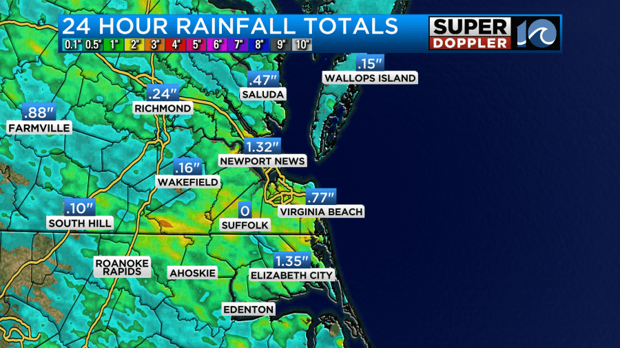
While Newport News recorded 1.32″. Fort Eustis recorded almost 3 and a half inches. NAS Oceana recorded about three quarters of an inch, but parts of the city had about 1-2 inches.
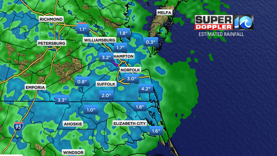
The radar estimated rainfall seems to have captured the amounts better.
In terms of rainfall and flora we needed this. The grass was starting to hurt a little, and I’ve even seen some trees wilting. This is probably due to heat stress as well as a lack of recent rainfall.
Unfortunately, there was also some severe weather. There were numerous strong wind gusts along the Bay. However, there were also a few wind damage reports away from the water.

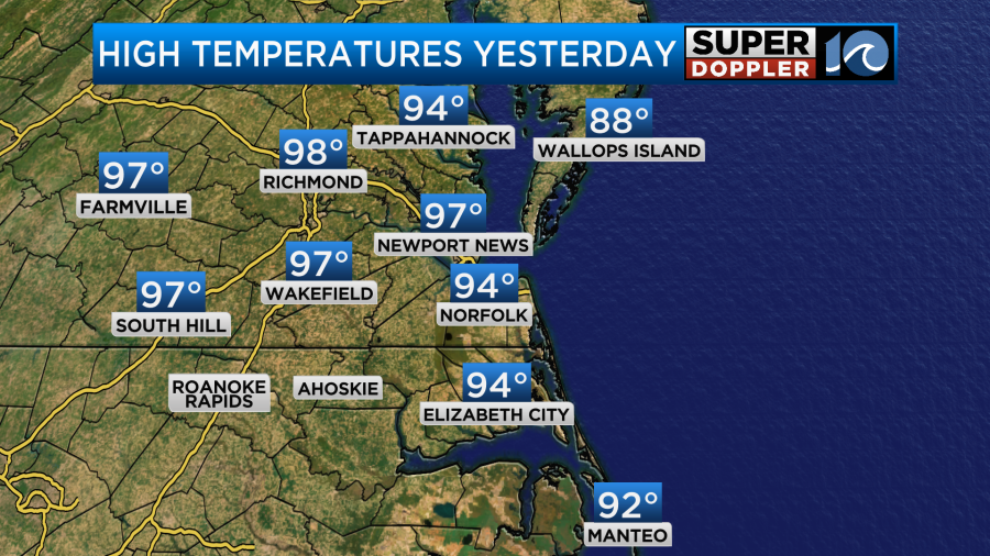
There was a report of large hail in northern Virginia Beach. Then there was an interesting report of some lightning that knocked some trees down around the Lago Mar area of Virginia Beach. There weren’t any big weather features around to cause this, but there was lot of heat, humidity, and instability. High temps were in the 90s before the rain arrived.
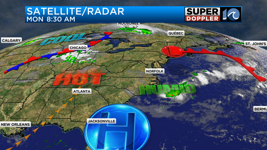
Today we have high pressure to our south. A cool front has fallen apart to our north.
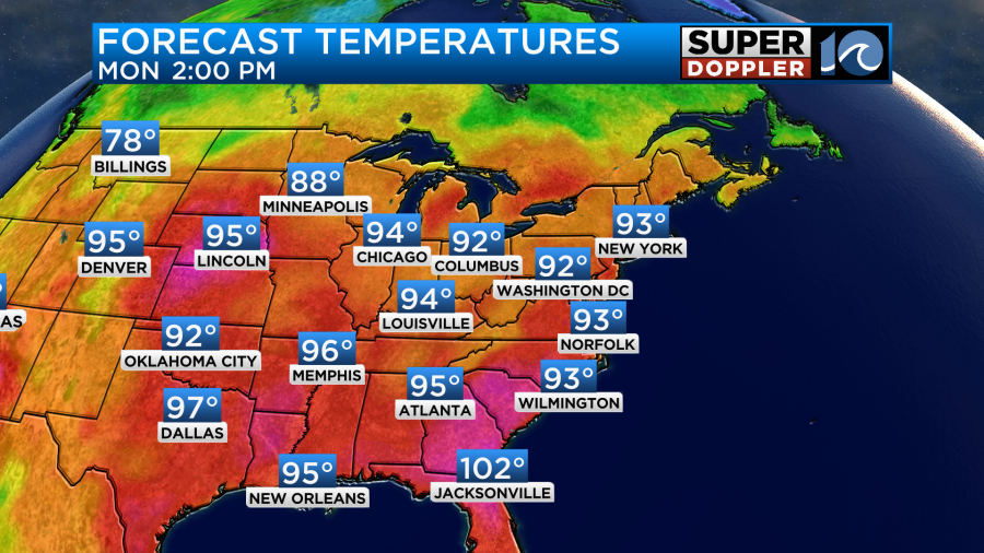
We’ll have partly cloudy skies today with a very light north breeze. High temps will aim for the low-mid 90s.
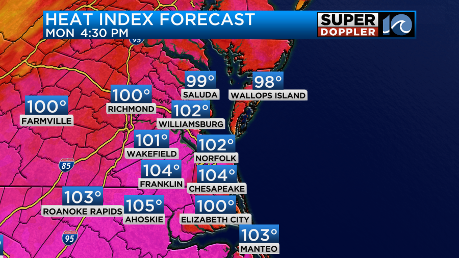
However, the heat index will be back up to around 105 this afternoon.
We’ll be partly cloudy with only some isolated showers or storms forming.
Over the next couple of days we probably won’t see much rain. High temps will aim for the mid-90s Tuesday and Wednesday with heat indices into the 100s.
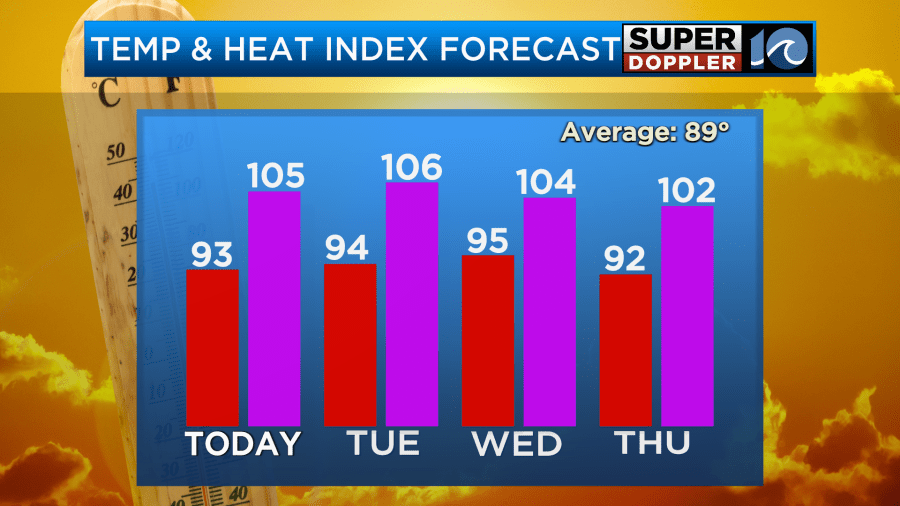
By Thursday we’ll have an increasing chance for showers and storms as a cool front slowly approaches from the north. Highs will still be in the 90s though, and it will still be humid.
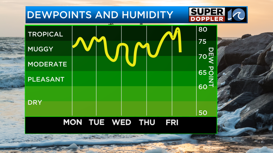
However, this decently strong cold front will slowly drop to our south on Friday. Humidity will eventually drop, but there will be some on-and-off showers and storms. High temps will drop to the low 80s. After that we could be in for a much cooler and drier next weekend. I’ll talk more about that in tomorrow’s weather blog.
One thing I want to mention before I go… There is a very large area that will be affected by the extreme heat today and tomorrow. Heat alerts cover almost the eastern half of the country.
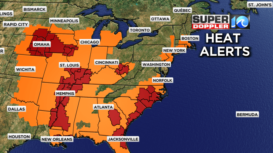
There are also some large areas in the Extreme Heat Warnings. That is the biggest area that I’ve seen in a long time covered by the higher-level heat alerts. Rocky Mount and Raleigh Durham, NC are in one of those areas.
Meteorologist: Jeremy Wheeler


