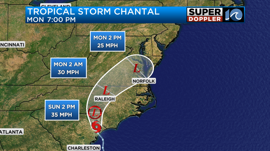
Early this morning, Tropical Storm Chantal made landfall along the South Carolina coastline near Myrtle Beach. During the time of landfall, the storm had maximum sustained winds of around 50mph with gusts possibly as high as 70mph. Over the next 24-36 hours it is forecast to weaken over land as it moves north into Hampton Roads.
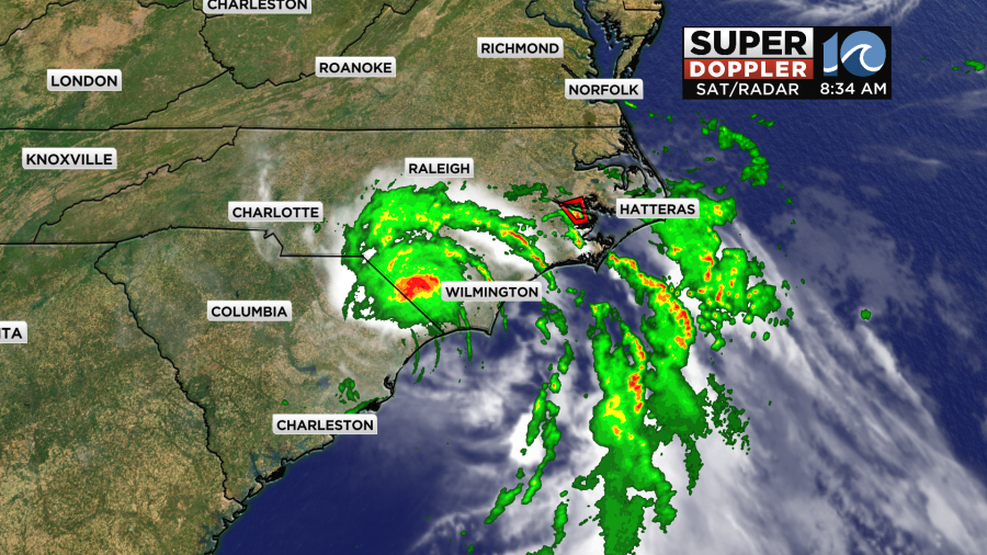
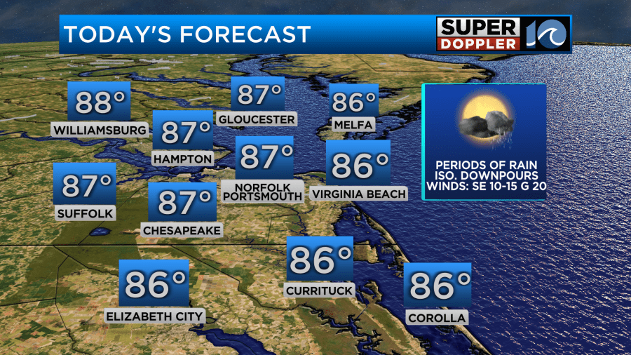
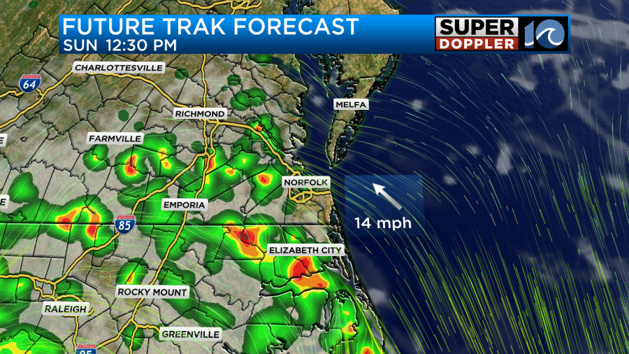
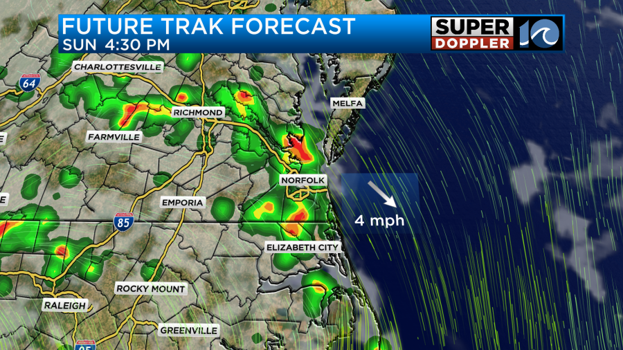
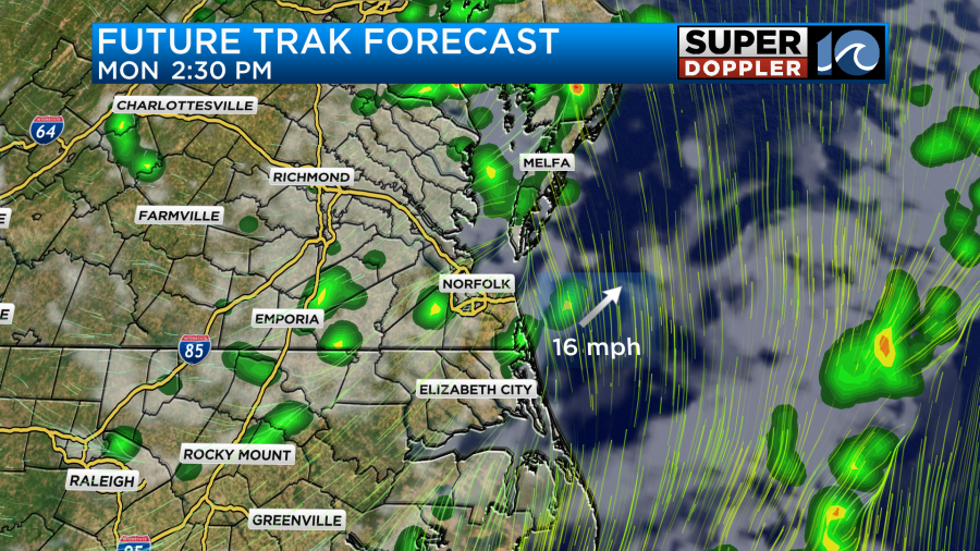
For us locally, a few rounds of potentially heavy rainfall will be possible as the outer rain bands rotate in during the afternoon. In North Carolina, the clouds and the rain will be more numerous especially along the Outer Banks and locations around the Pamlico sound.
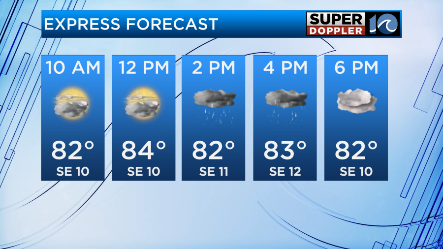
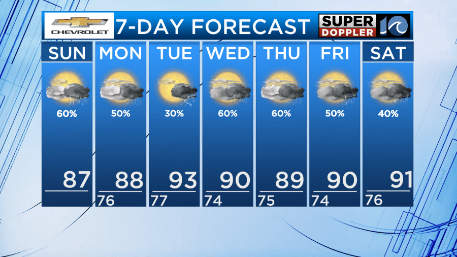
High temperatures will be back into the middle and upper 80s for areas that get the most sunshine. This will likely be for the southside and peninsulas as rain will take longer to fill in. As for winds, it will be breezy from time to time, especially along the coastline where winds may gust as high as 25mph. This southeast wind direction will also increase the humidity making it feel more uncomfortable compared to yesterday.
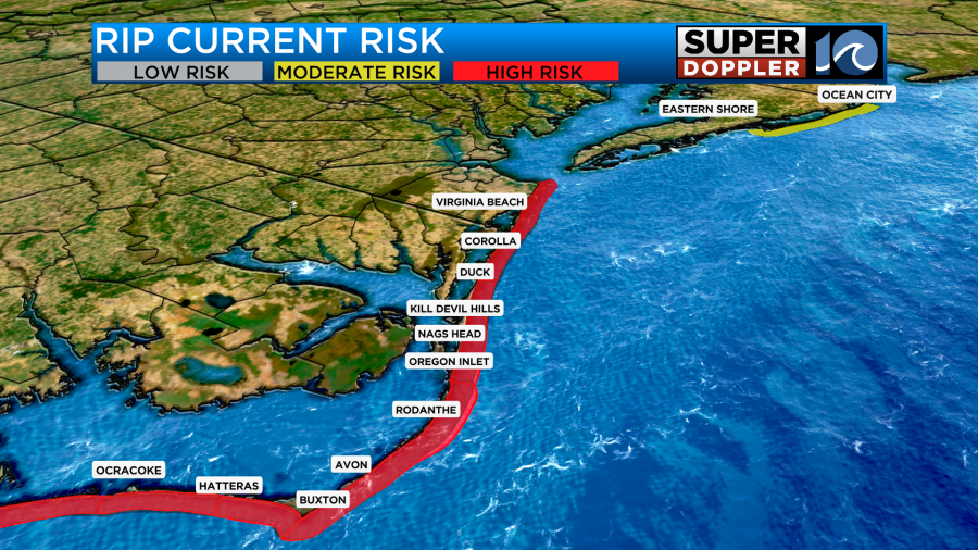
With this steady onshore wind around Chantal, the ocean will be dangerous for swimmers. A high risk for rip currents is in place for Virginia Beach and all Outer Banks beaches. The beaches of northern Accomack county and into the Ocean City, Maryland will be a little calmer.
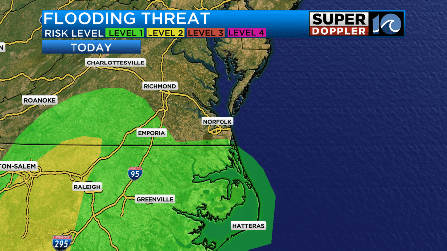
Let’s time out this rain going forward! The most widespread rain will be across eastern North Carolina and for the outer banks since they are closer to the storms center. As we head through the midday hours, outer rain bands will be able to lift north near the state line and potentially for the southside. Then, the chance of rain will start to becoming more numerous across Hampton Roads for the rest of the afternoon. Scattered downpours may cause localized flooding for low-lying areas with poor drainage.
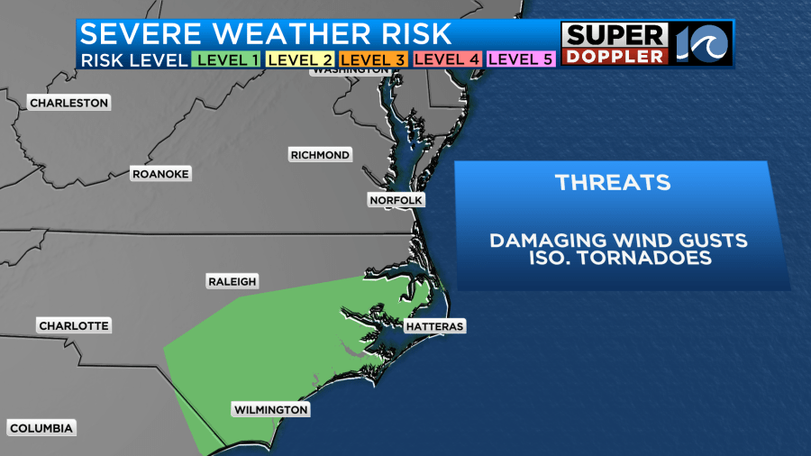
Another risk we will need to watch for is the potential for brief tornadoes. This will be more likely south of the Albemarle sound but we will still need to be on the lookout since we are on the east side of this system where tornado development is typically favored during landfalling storms.
As we head into the beginning of the work week, Chantal will weaken and become post tropical as the center passes through parts of the area. At this point, the storm will not longer be tropical but the impacts remain the same.
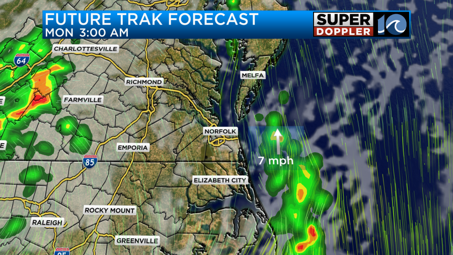
Scattered downpours will once again be possible for the day on Monday as rain bands continue to rotate through. Rainfall amounts during Chantal’s remnants may be around 1-2 inches at most with most locations receiving around a half inch of rainfall.

After Chantal passes through late on Monday, we will get a slightly drier day on Tuesday before daily afternoon storm chances return for the middle and end of the week. This will be due to a stalled front across the region so the heavy rain threat will likely continue for the next 7 days.
Stay Safe!
-Meteorologist Brian Michigan 🤙