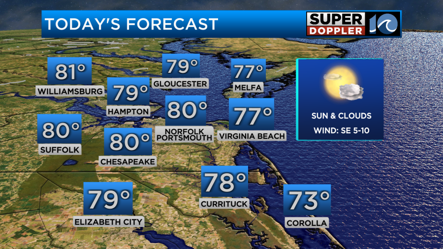
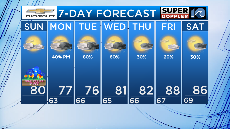
Happy Mother’s Day! Luckily, the heavy rain in the forecast is holding off until the work week so enjoy a warm and dry day, great for those outdoor plans with Mom.
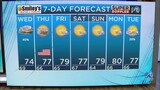
The only difference between today and yesterday will be the thicker cloud cover overhead. Otherwise, temperatures in the upper 70s to near 80 degrees. Humidity will build a bit during the afternoon, but it shouldn’t feel to sticky until the work week.
There is a chance for a shower in North Carolina but the coverage will be limited and any rain that falls will be light.
A broad area of low pressure remains across the deep south producing heavy rain and strong storms. The reason for the slow movement of this system is because it is cutoff from the jet stream. This means that as the storm drifts north, heavy rainfall will be able to occur over a longer period of time. We will have to watch out for flooding over the next few days due to this prolonged heavy rainfall chance.
As we head into the day on Monday, cloud cover will remain overhead as the system moves closer. Isolated showers early will become more widespread and steady during the late morning and afternoon for areas closer to I-95.
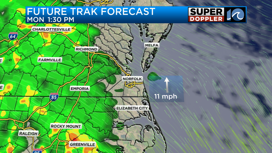
The coastline will likely stay dry through the daylight hours of Monday. During the evening and overnight hours though, a few showers will be possible.

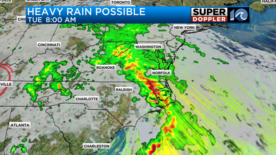
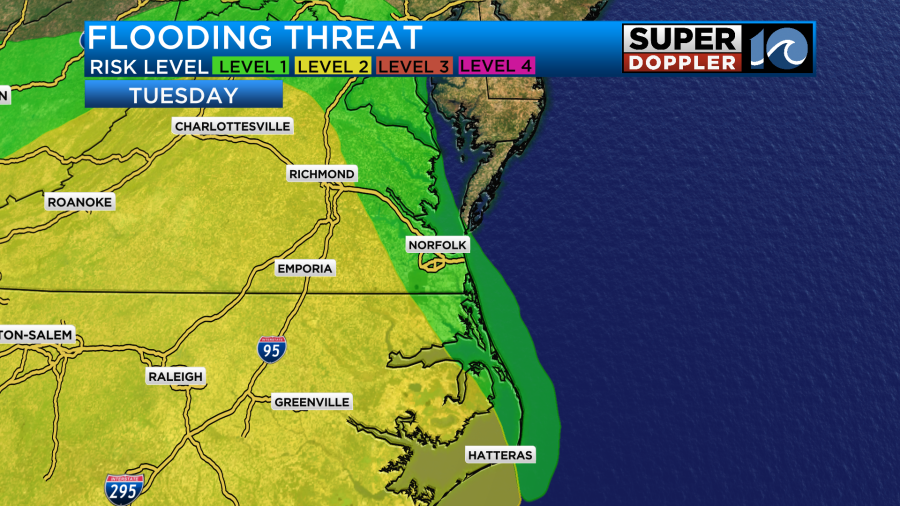
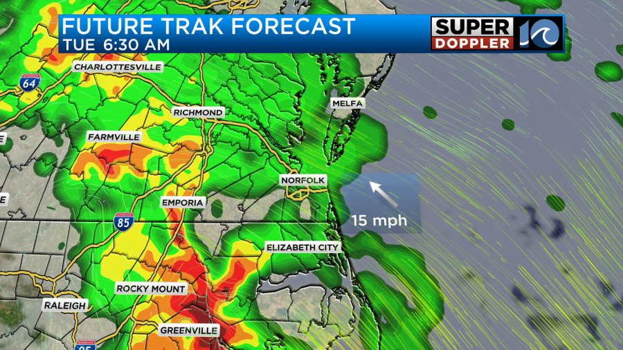
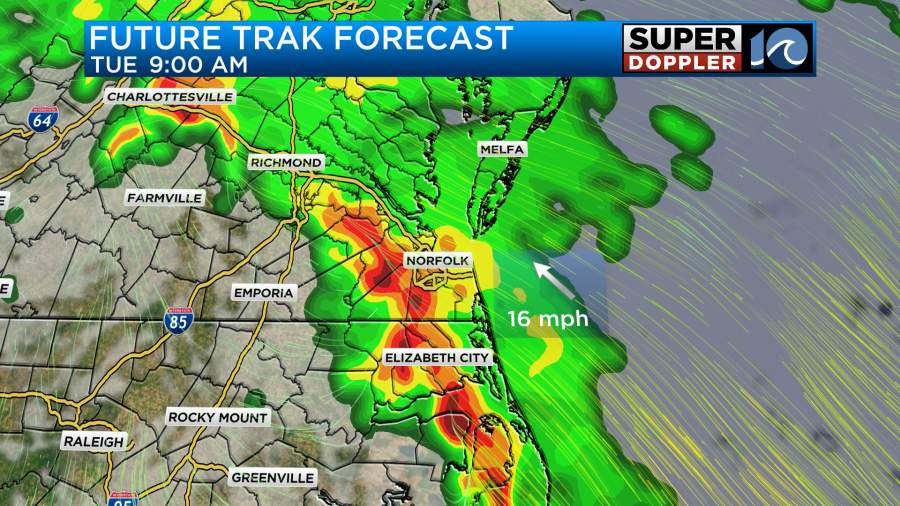
During the late overnight hours on Monday and into Tuesday, rain will start impacting the Hampton Roads cities. As of now models indicate a strong band of rain moving into the region from west to east during the morning hours. This rain will be heavy at times and as a result the Weather Predication Center has issued a level 2 out of 4 flooding risk for a portion of the area. This means heavy rain could cause problems on our roadways and for low-lying areas with poor drainage.
On Wednesday, low pressure to our west will continue to drive in deeper moisture from the south and waves of rain into our area. Widespread showers and thunderstorms will develop again during the daylight hours with scattered downpours here and there.
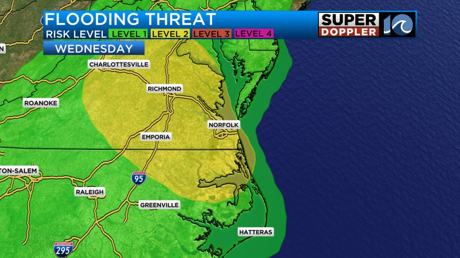
The highest flood threat will shift northeast a bit during the day on Wednesday and this includes the Hampton Roads cities. Before this system moves out, a good portion of the area may see over 2-3 inches of rainfall.
-Meteorologist Brian Michigan 🤙