
Recently there has been a lot of rain over big sections of the country. There was some very heavy rain around Petersburg yesterday and last night. It was so bad that there were water rescues. Our radar estimates that they had about 7-8 inches up that way in the last 24 hours.
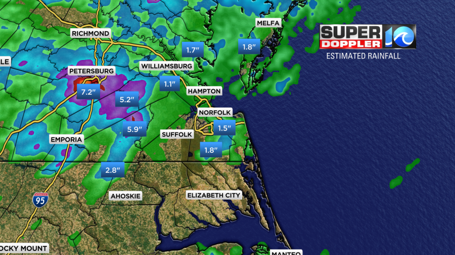
We have also had some heavy rain here. Yesterday there was a flare-up of some showers and storms over Virginia Beach and Norfolk.
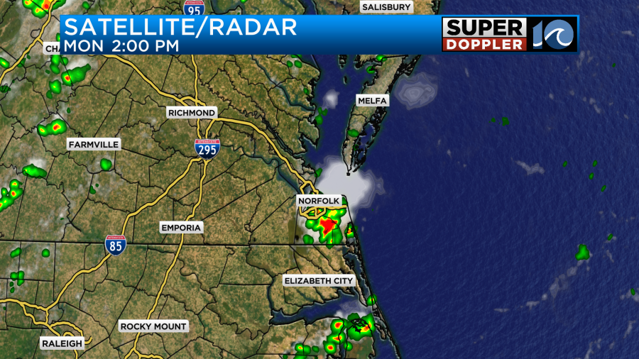
There were Flash Flood Warnings from those storms. Then they spread out and weakened over time. There were only a few showers later in the day. However, last night a big band of heavy rain and storms slid into the region from north/central Viriginia.
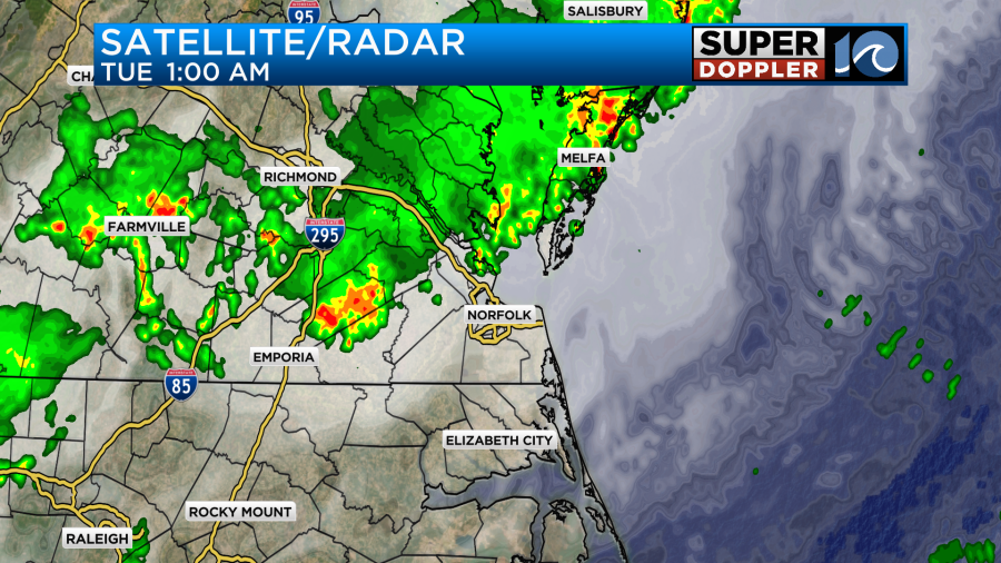
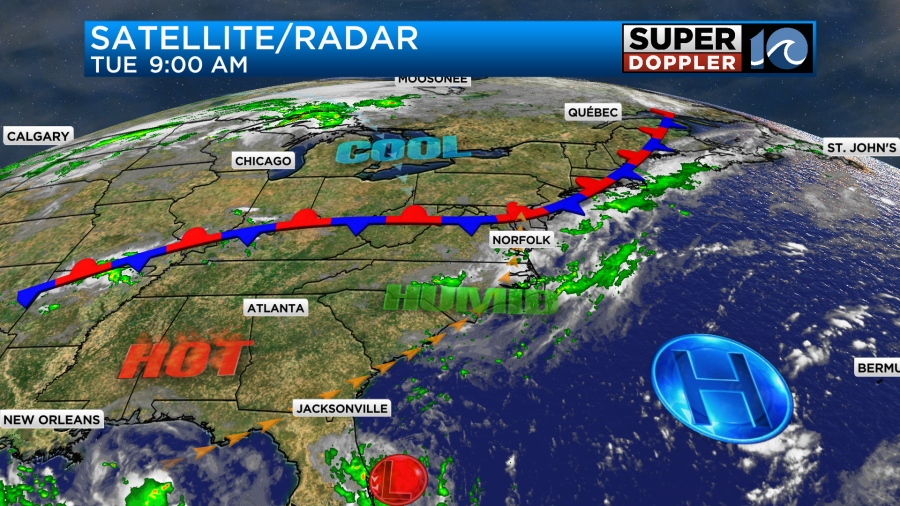
These created a few Flash Flood Warnings inland. Luckily that rain moved out and lightened up. Light rain slowed down a lot of the morning commuters. There aren’t any big surface features near our region, but a stationary front did creep a bit more to the south over the last 24 hours.
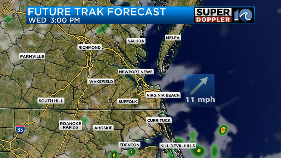
There has been a huge amount of deep moisture in the region over the last couple of days. Maybe longer. So today the morning showers will decrease down to isolated/spotty showers through midday. We should have a little clearing, but probably not too much. We’ll then have some scattered showers and storms re-firing later this afternoon.
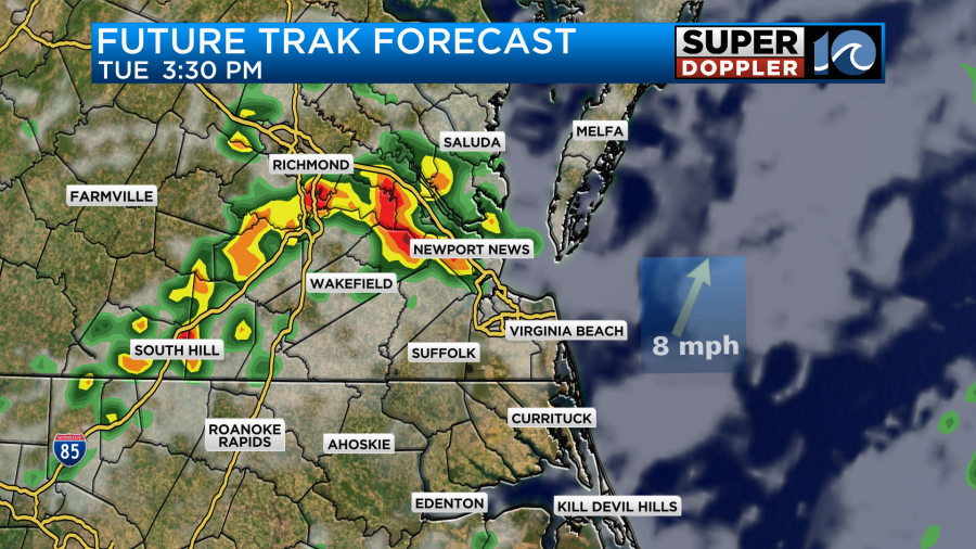
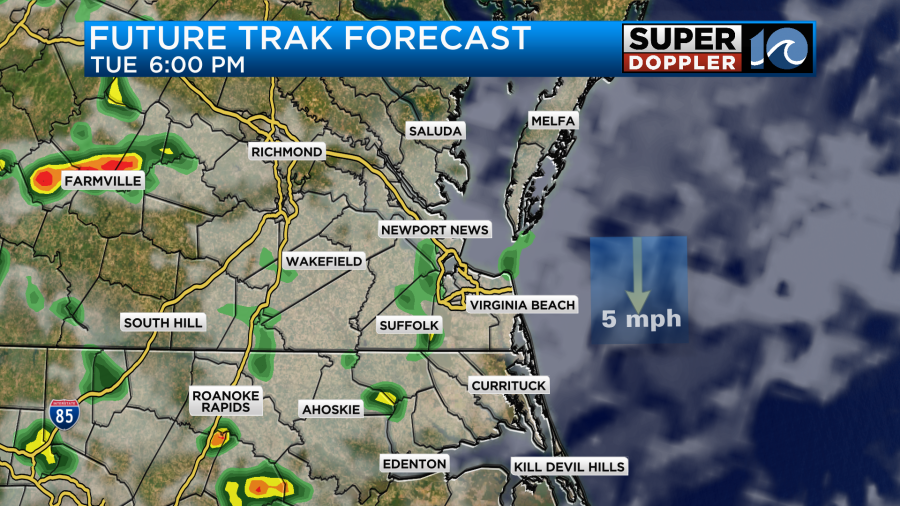
They will probably be able to kick off any old outflow boundaries from this morning’s storms. There could easily be some heavy downpours out there between the mid-afternoon and the early evening.
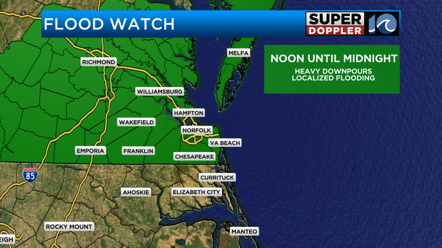
Amounts will vary widely. There is a Flood Watch in Effect for all of southeast Virginia.
Things should then wind down after about 7pm.
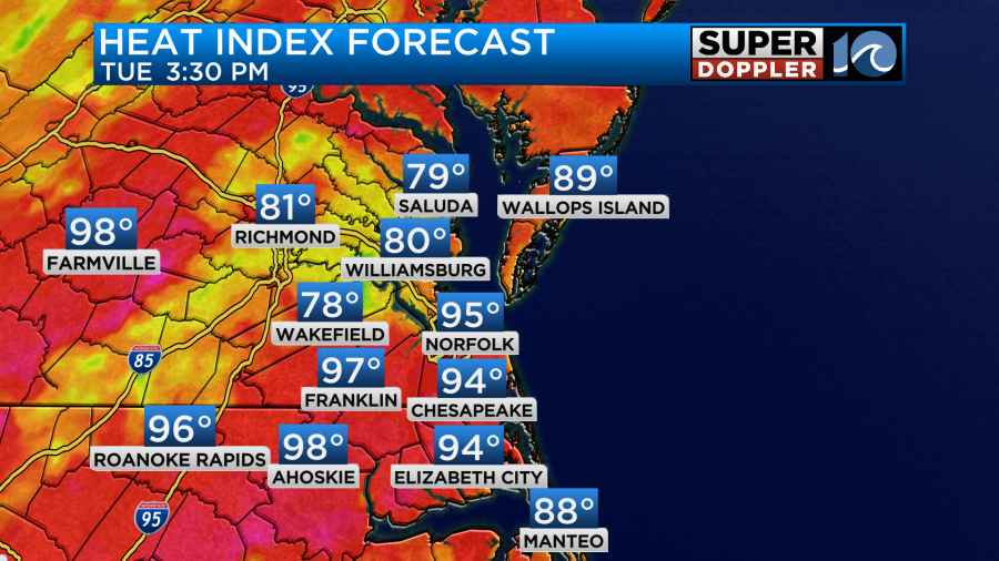
It will be hot and humid, but maybe not too bad depending on how thick the clouds stay. For now I have the afternoon temps aiming for the upper 80s. There’s enough humidity to make it feel like it’s in the mid-upper 90s.
Tomorrow the front will slide north a bit. High pressure will slide west a bit. So we should have more sun and less chances for rain.
High temps will be able to get into the low 90s. The heat index will be around 100.
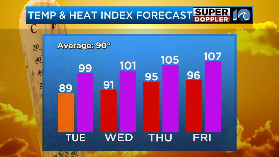
The temps will rise even more later this week. They will be able to reach the mid-upper 90s. The heat index will be around 105 or higher. This will be due to more sun and even less rain. An upper level (high/ridge) will slide west off of the ocean (which doesn’t happen often). It will then move even more west over the weekend. That will allow a few afternoon storms to return, but hopefully it will create a bit more of an onshore breeze with some SLIGHT cooling. We’ll see.
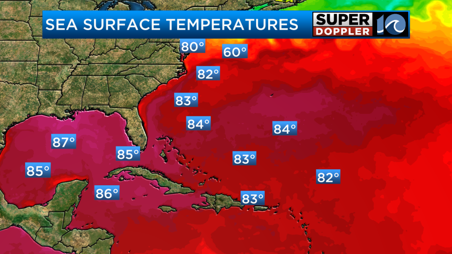
Meanwhile, there is a weak area of low pressure traversing the Florida Peninsula. This will move west and get into the Gulf. At that point it will have a medium chance of becoming a tropical depression or storm.
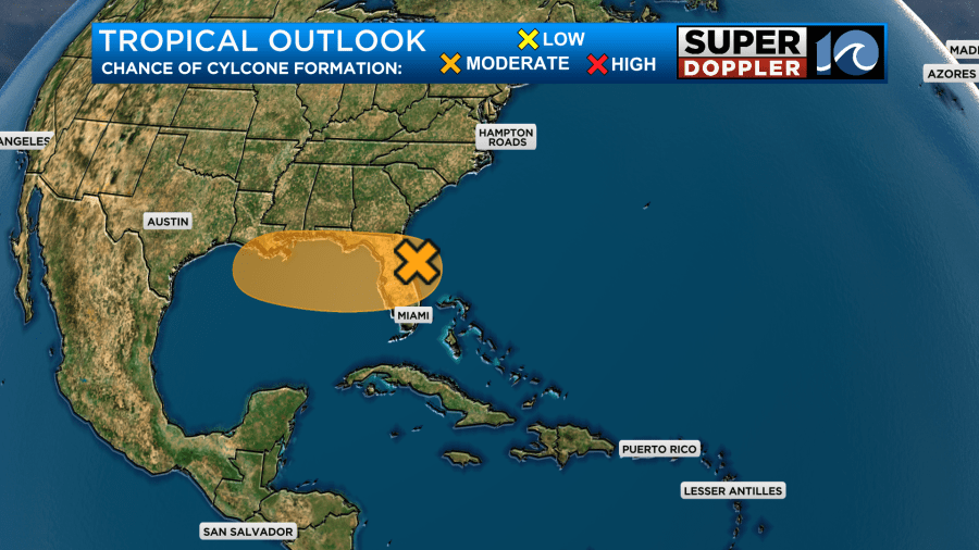
The models have it generally moving west along the coast and then moving north.
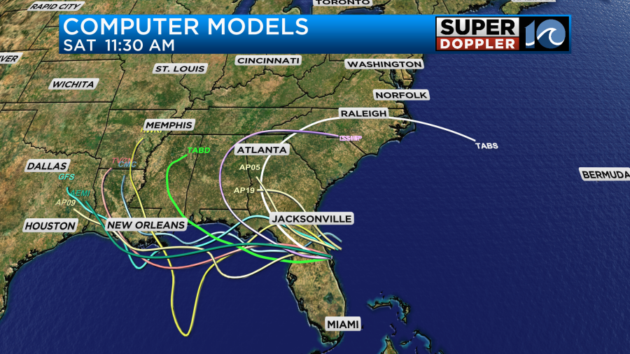
We’ll watch this feature closely for our neighbors to the southwest. Water temps are definitely warm along the Gulf and the west/central Atlantic.
Meteorologist: Jeremy Wheeler


