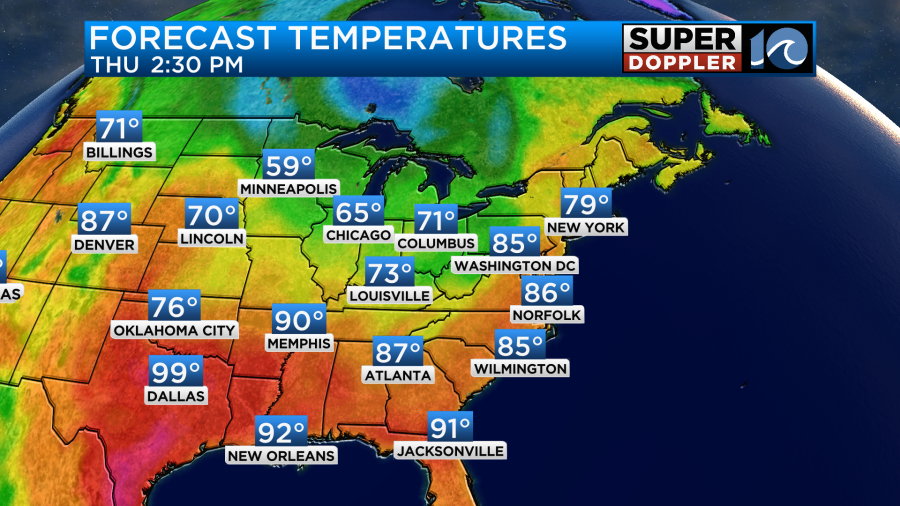
We had another nice day yesterday. That makes about…what? 4? 5 days in a row? High temps made it into the 70s again with some 80s inland. Today we are going to have a lot more 80s on the map as we get into the afternoon.
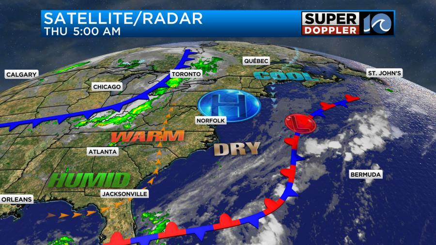
We have a small area of high pressure that is sliding east. There is a stationary front offshore (still), and there is a cool front over the Ohio River Valley.
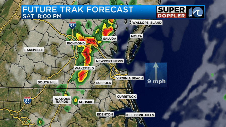
We’ll have fair skies during the day. Winds will be light and out of the south. That combo will help to boost the afternoon temperatures. I’m not expecting rain during the day aside from a stray shower. However, there will be a cluster of showers and storms pushing towards our region this evening. Some of these may make it into locations north/northwest of Hampton Roads.
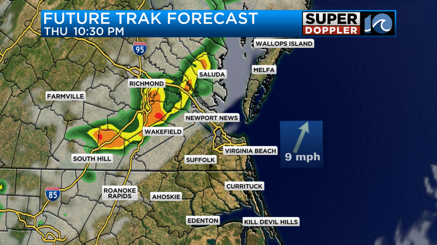
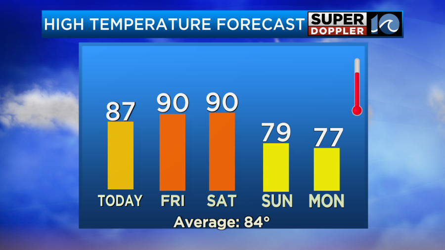
However, many of them will fall apart as they move east. So there may only be some isolated showers or storms in Hampton Roads tonight. Either way these will all fall apart overnight. Then we’ll have quiet weather going into tomorrow morning. Friday will be hot, more humid, and quiet. High temps will be around 90 degrees.
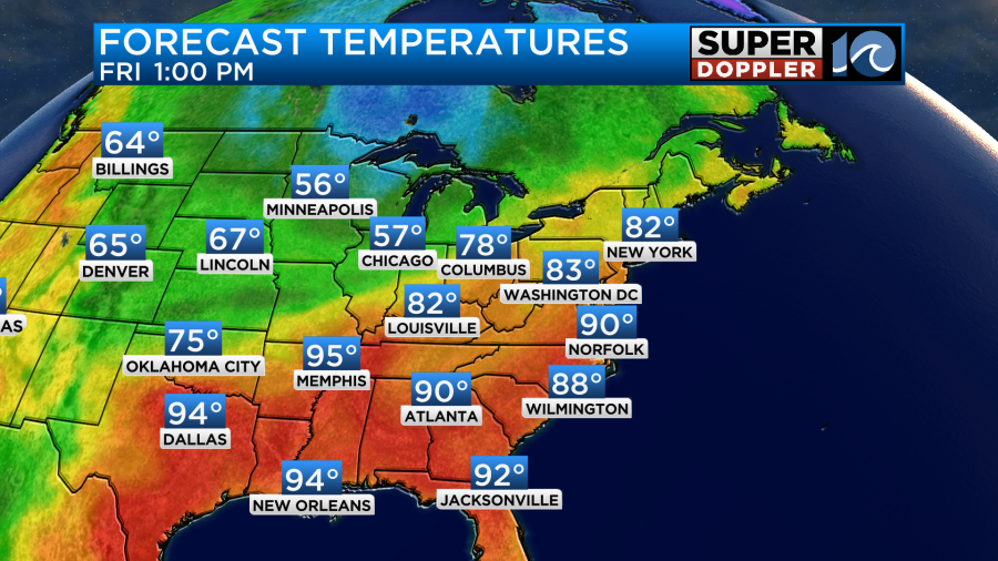
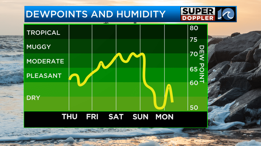
The humidity will go up a little tomorrow. So the heat indices will actually be in the low 90s. However, the humidity will be even higher on Saturday with high temps still around 90 degrees.
There may be some isolated showers or storms popping up during the day, but there will be a higher chance for rain and some storms by Saturday evening as the front closes in.
Scattered showers will continue from Saturday night into Sunday morning. After the front arrives temps will sink to the upper 70s, and the humidity will drop sharply. The rain should end by the afternoon. We’ll stay cool going into early next week with highs in the 70s.
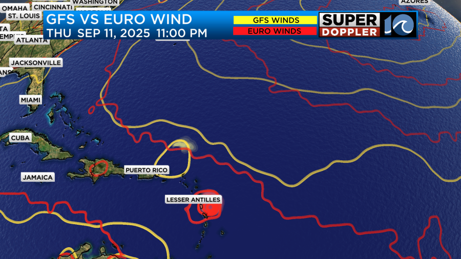
We are still tracking that area of low pressure over the east/central Atlantic. It is moving generally to the west.
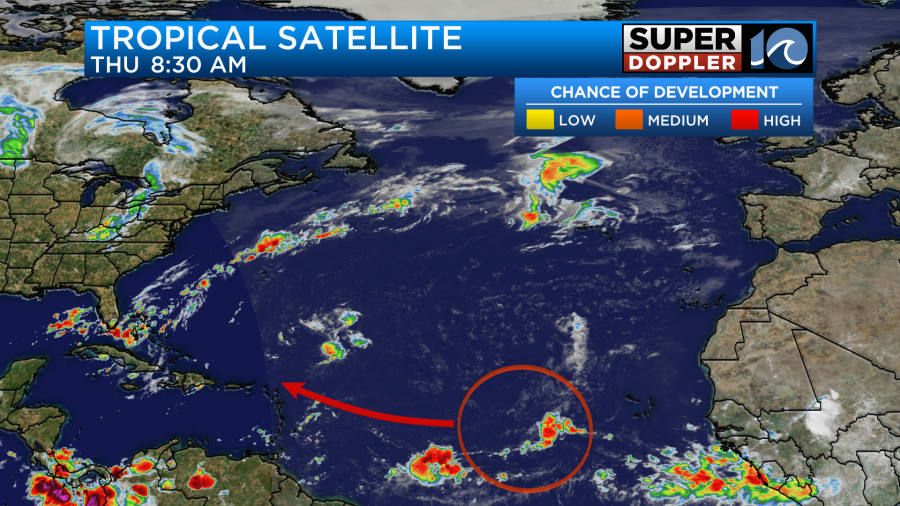
It still has a high chance of formation over the next few days. The GFS and European models have it forming into a weak system over the next day or two. Then it has the feature moving towards the Lesser Antilles in a few days. They both keep it pretty weak through that time. The Euro is still more to the south, but the GFS is not that far to the north.
This is really far out in time. So stay tuned for updates.
Meanwhile, many eyes are on a hurricane over in the eastern Pacific. Hurricane Kiko was a category 4 this morning, and it was on a westerly track.

This has a decent shot at hitting the Hawaiian islands. Luckily, a lot of weakening is forecast over the next 5-6 days.
I will usually mention a tropical system in the Pacific when they threaten a big land area. However, I’m a little more vested now that I’ve visited there. (trip last year). Anyway, we’ll have to check back for updates on that.
Meteorologist: Jeremy Wheeler


