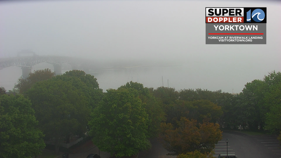
Yesterday was a nice day. The humidity stayed down the entire day. We had partly cloudy skies with highs in the 70s. However, today the humidity and temps will start to climb back. This morning we had enough moisture for some large areas of fog.
High pressure has shifted a bit. Now it is a little more to the east. We still have a stationary front offshore with another one to our north.
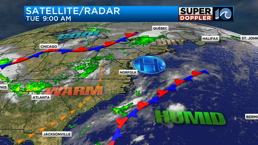
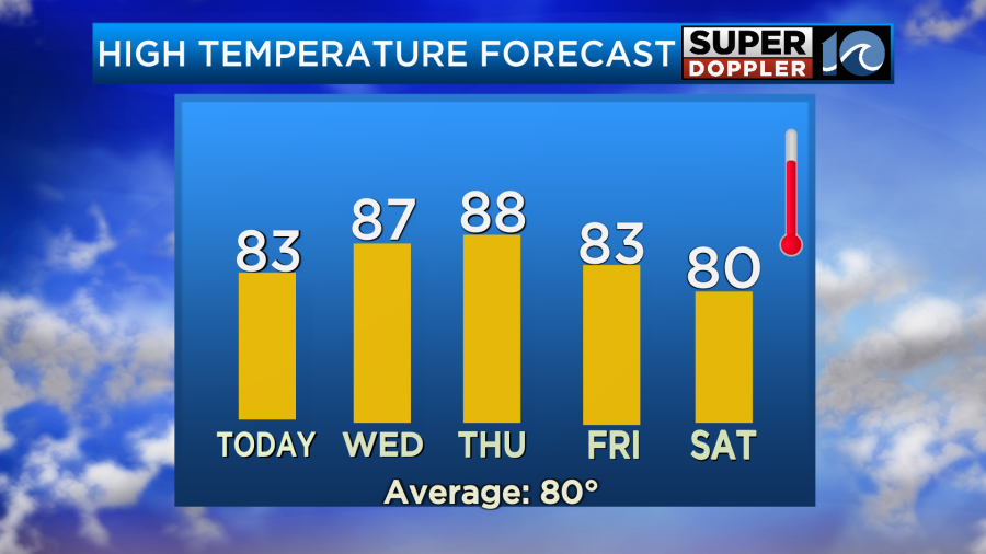
With the high more to the east we are developing a light south wind today. That will help to push our high temperatures up into the low-mid 80s this afternoon.
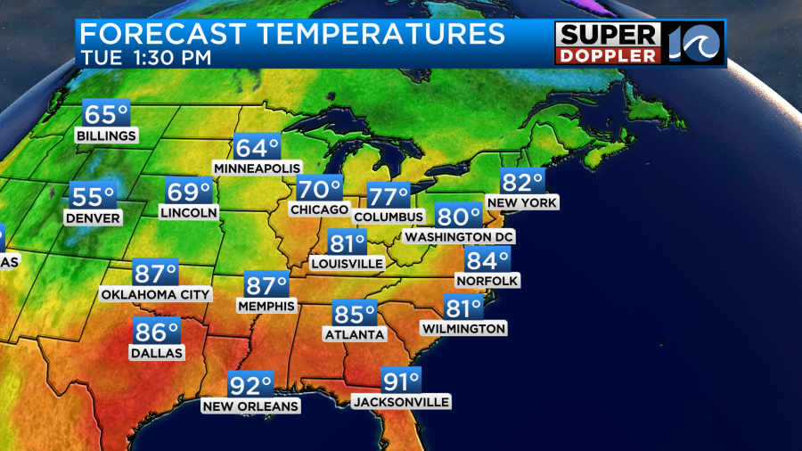
Notice that they have cooled down in the Midwest.
We’ll be partly cloudy for most of the day. The humidity will rise a bit as well. By tomorrow the wind will be just a touch stronger and more out of the southwest. We’ll be partly cloudy for most of the day again. That will allow high temps to reach up into the mid-upper 80s.
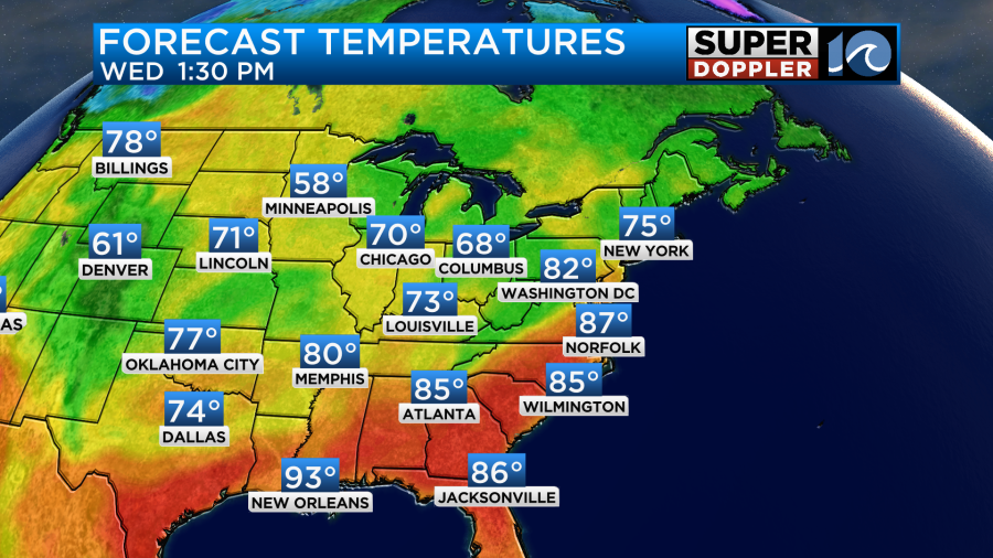
Unfortunately, the dew point will climb even higher tomorrow.
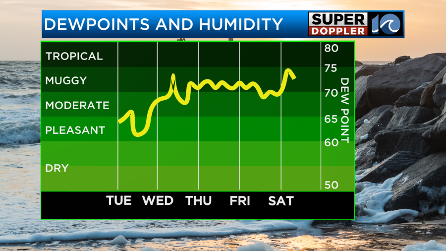
In fact…It is going to be downright muggy for several days. The dew point will be around 70 through at least Saturday. With the higher humidity will come some rain chances. By Thursday we’ll have some scattered showers and storms. They will be mainly late in the day, and possibly holding off until the evening. Before the storms arrive the high temps will aim for the upper 80s. It may hit 90 in a couple of inland/southern locations.
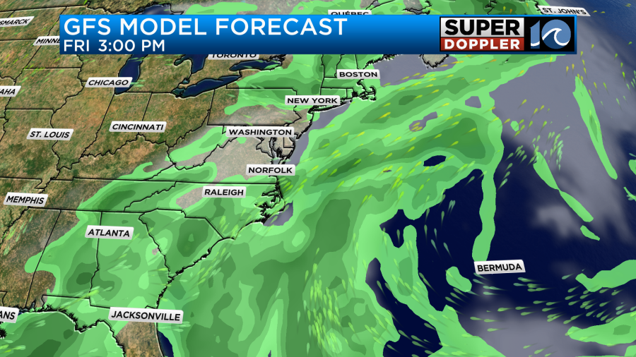
We’ll have a high chance for rain and thunderstorms on Friday as the cool front slowly slides through the area.
High temps will be closer to the low 80s. The front may linger a bit on Saturday. For now I have mostly cloudy skies with a few scattered showers. However, the Sunday-Monday forecast will depend heavily on what happens in the tropics. Let’s talk about it.
Hurricane Gabrielle luckily missed the island of Bermuda (as expected). However, it did make it up to a category 4 storm.
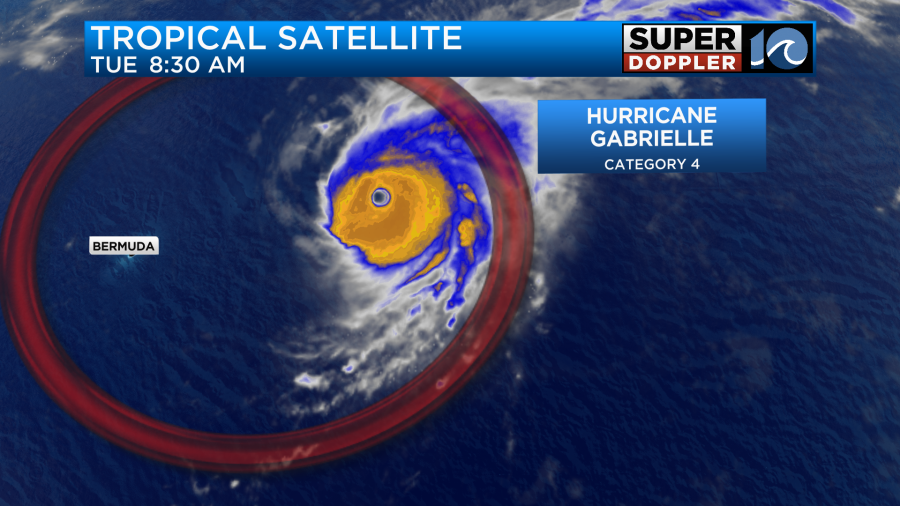
The eye was still very sharp. The sustained winds this morning were up to 140mph. The hurricane will keep moving to the east/northeast over the next few days.
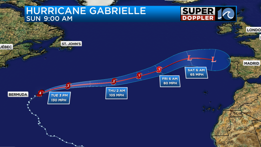
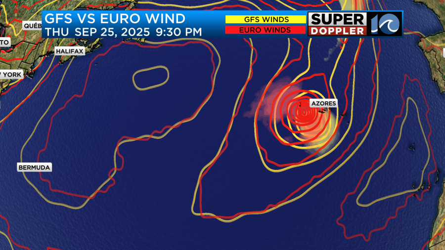
This will take it over cooler water, and the wind shear will increase. The hurricane will weaken gradually, but it may remain a category 1 as it possibly hits the Azores islands. The GFS and Euro have it running right through that region on Friday morning.
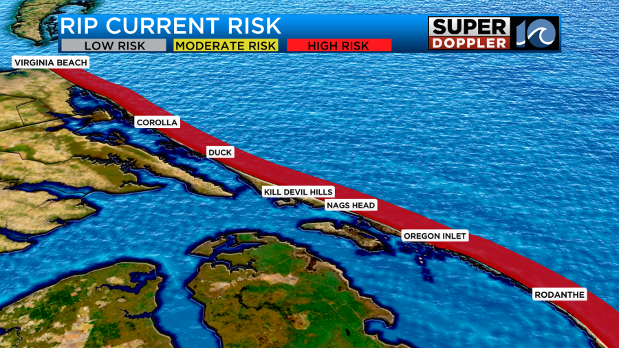
Locally, we will continue to have some waves from Gabrielle for at least another day or two. There is a high risk for rip currents at all of the local beaches today.
Then there are the tropical trouble twins. (I made that up). The 2 tropical disturbances in the middle of the Atlantic are moving to the west/northwest.
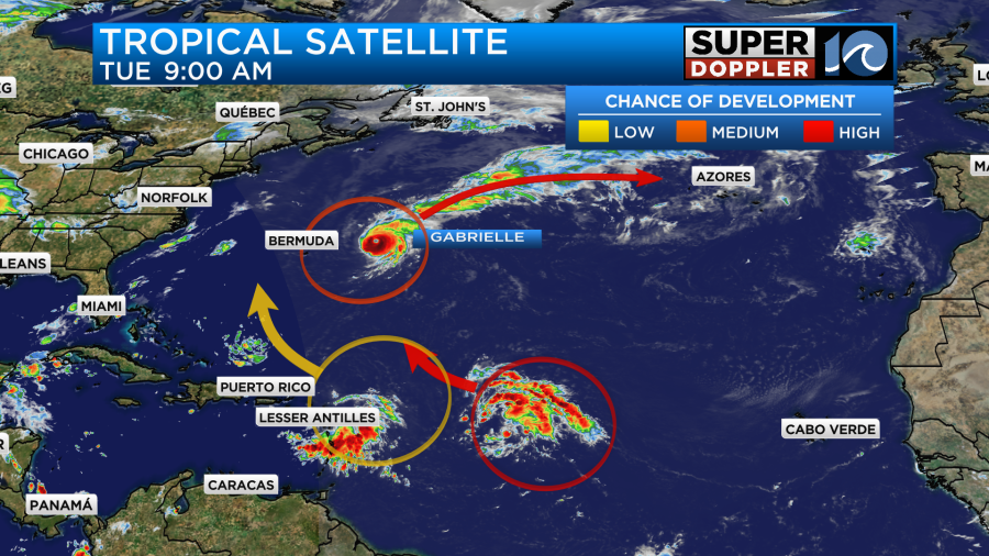
They are still disorganized. However, they both have a medium to high chance of formation over the next 2-5 days. Yesterday, the GFS had the western feature turning into a tropical storm right near our coast by Sunday. I didn’t mention it because I knew it could change big-time. It did. Today the GFS doesn’t have that feature at all. However, it does develop the eastern disturbance into at least a tropical storm as does the European model.
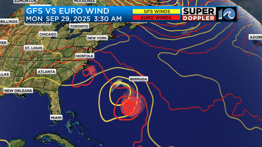
However, now the Euro model does have that western disturbance moving up to our coast between Sunday and Monday. It does look like the GFS has the stationary front in place over our area. So that would probably keep any feature out to sea. The bottom line is that we need to get another 12-24 hours of model updates before we can make a good forecast. I am heavily vested though as I will be working at the Neptune Festival on Sunday. Weather pending of course. Stay tuned for updates.
Meteorologist: Jeremy Wheeler