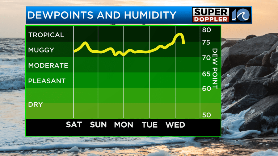
The heat is ON across Hampton Roads this weekend and along with that heat comes the humidity. Dew points for the next several days will be in the 70s which will make it feel quite uncomfortable outside so stock up on some water, ice, or get yourself an umbrella if you plan on being outside this weekend.
The umbrella will also come in handy for when storm chances increase during the afternoon hours for the next several days. Heavy rain will be the biggest concern as flooding will be possible for some areas.
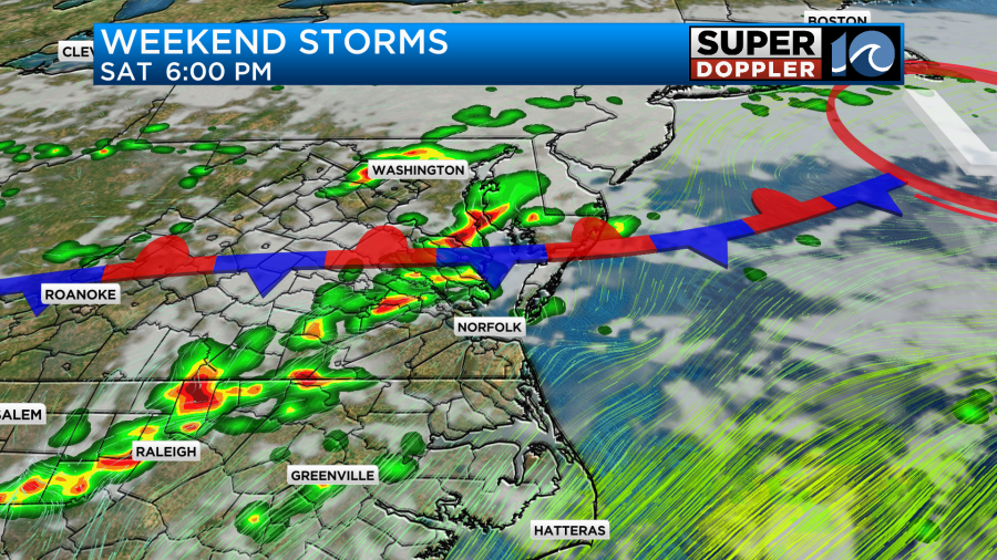
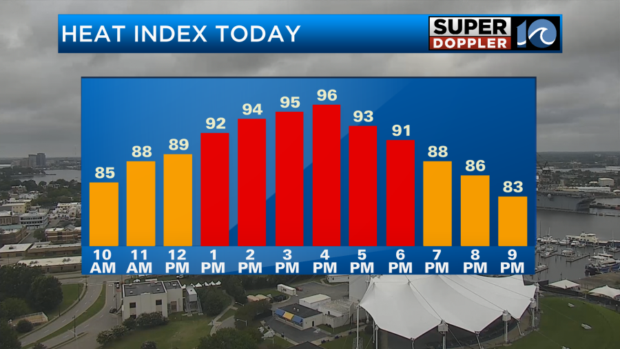
Let’s start with the heat and humidity of today. A stationary front to our north is separating the cooler and drier air in the northeast from the warm and humid airmass currently over Hampton Roads.
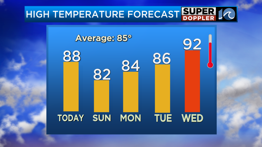
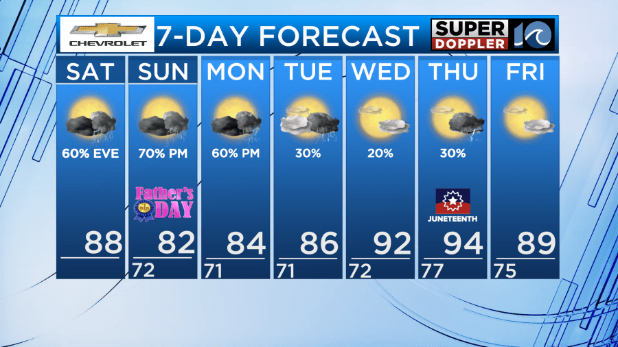
High temperatures on the southside of the front will be in the upper 80s and with winds out of the south and southwest, humidity will remain elevated making it feel more like the mid 90s today. Unfortunately, there will not be much of a breeze to cool us down as winds will only be running 5-10mph.
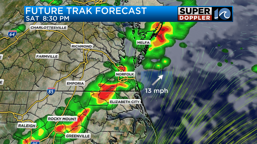
Now along with the heat and humidity comes a chance for thunderstorms. In order for storms to form you need heating near the surface of the earth, moist air, and a way for that air to rise. This weekend our forcing will come from the stationary front as it drifts south overtop of us.
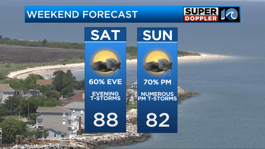
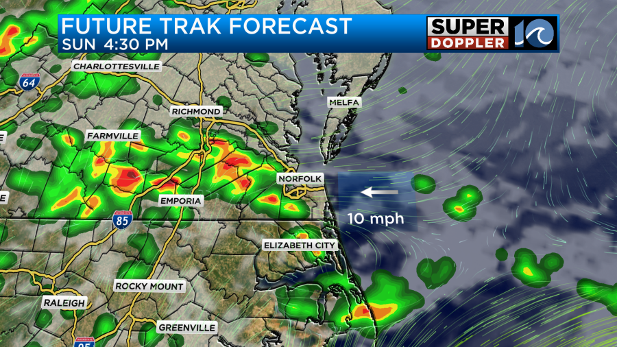
During the day today, storms will become scattered during the late afternoon around 5pm and move east becoming more widespread by 6-8pm. It is at this time when our area will see some of the heaviest rain which could add up to over an inch in some spots.
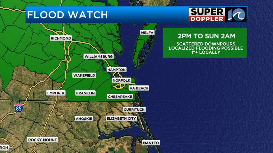
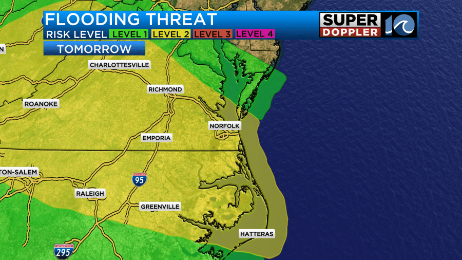
As a result, a flood watch goes into effect starting at 2pm and it lasts until 2am Sunday morning due to the risk for excessive rainfall.
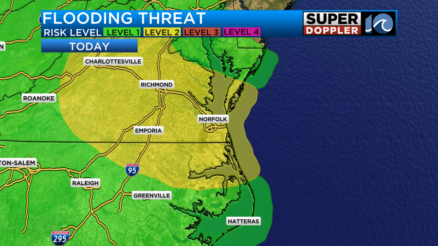
This excessive rainfall risk is at a level 2 for the entire weekend.
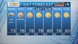
Rain chances will taper off as we head into early Sunday morning but with clouds lingering overhead, our temperatures will remain mild in the 70s overnight. This will set the stage for another warm day on Sunday with highs back in the 80s. As of now, I am forecasting a high of around 82 but if we get more sunshine than the current computer model guidance is suggesting then we will likely get warmer than that.
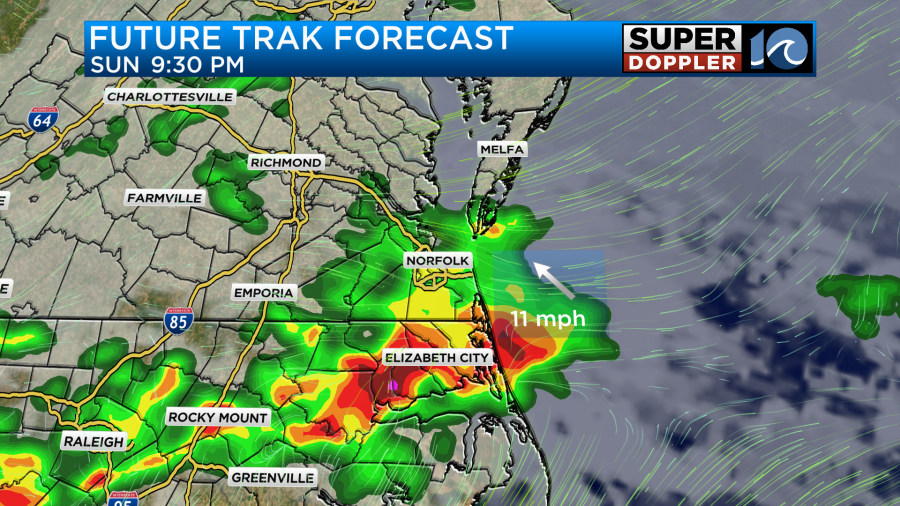
Regardless, more storms will be on the way Sunday afternoon after 2pm. Some storms could even be strong at times with heavy rain and damaging winds being the primary risks.
Rain showers and thunderstorms will continue Monday afternoon as the stationary front remains nearby to start the work week. However, as we head into early Tuesday the front will start drifting away from the area which will lower rain chances through the middle of the week.
As rain chances drop the temperatures will rise once again due to southerly winds. Highs Wednesday and Thursday are expected to be in the lower to middle 90s with heat indices possibly between 95 and 100 degrees!
Stay cool and dry this week!
-Meteorologist Brian Michigan 🤙