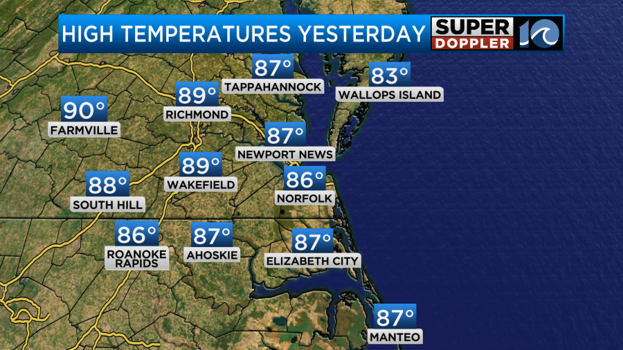
I knew I was running out of time. Over the past couple of weeks I had to work on some gutters up on the second story of my house. I needed my son’s help with the ladder. I didn’t want to get up there when it was a million degrees. So I knew that my best shot was over the last 3 days. Yesterday, he was off of work. So we made our move. It was still hot up there. I even got a subtle burn from the roof. But I got the job done. I also cut my grass. All this to avoid working during the hottest days. Yesterday’s high temps were in the mid-upper 80s.
It was the last decent day that we’ll have had for a while. Enter today….
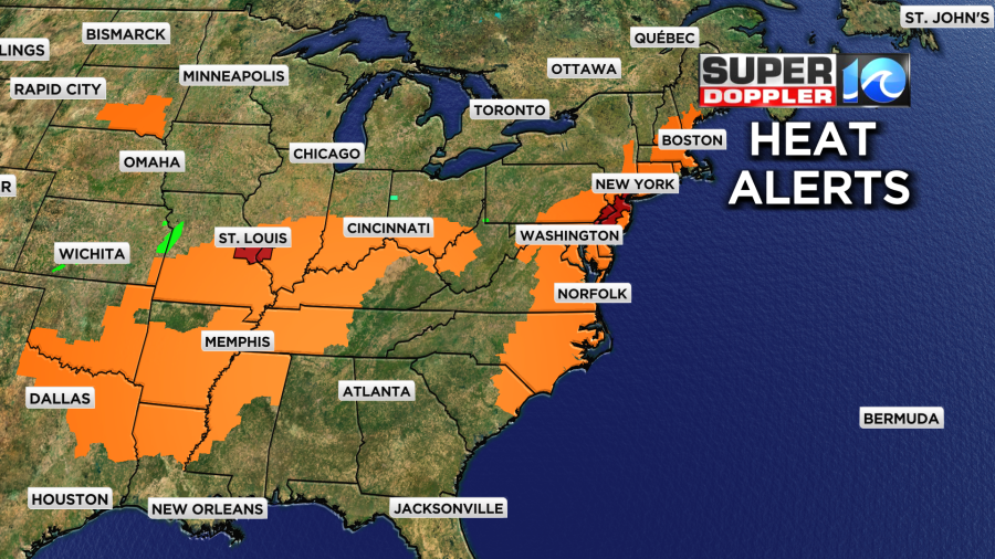
The heat that has been building to our west is finally spilling east. There are heat advisories for a large chunk of the central and eastern U.S.
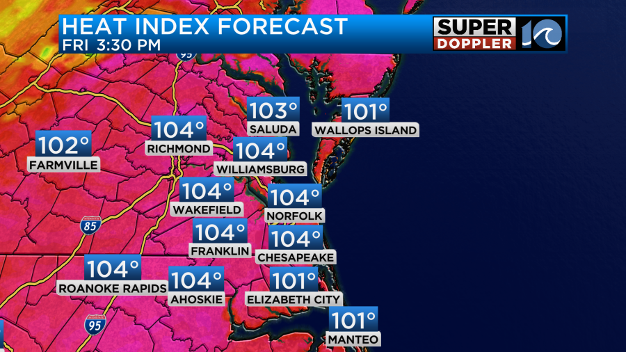
We have a Heat Advisory here today into the evening.
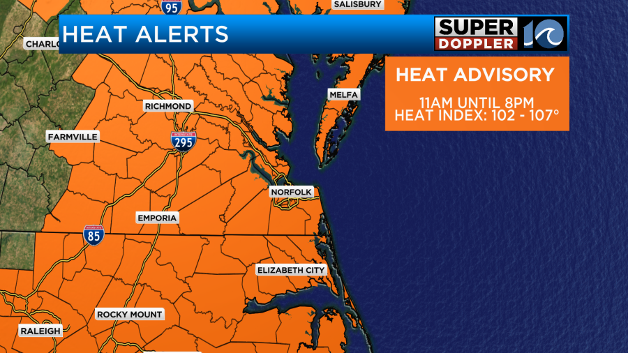
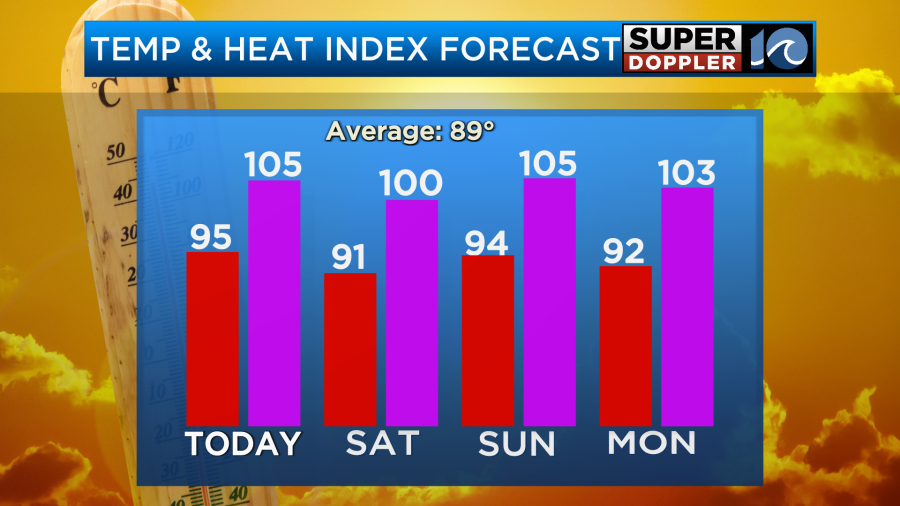
High temps will aim for the mid 90s during the afternoon, but the heat index will run closer to about 105 degrees.
The stationary front has fallen apart to our south. High pressure has shifted offshore. There is a cool front to our north.
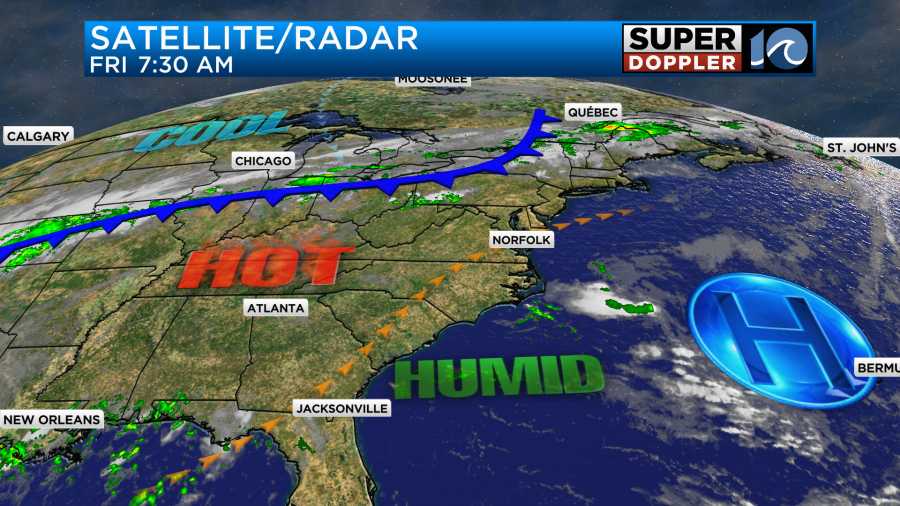
We’ll have lots of sunshine for a while with a few more clouds by the afternoon. Winds are going to be very light. They’ll be out of the southwest for a while, but they may turn out of the north for a bit. There may only be a stray shower in the whole region this afternoon.
Tomorrow the cool front will slide down into our area and stall out. Winds will turn out of the northeast for a bit. This should drop the temperatures a bit. At least in the metro. However, it will probably stay hot over most of northeast North Carolina. Even if the temps do dip a little. The heat index will still be near 100 degrees.
As the front comes in it will probably kick off some isolated showers and storms. These will then push south into the late afternoon.
There is some wiggle room here for the exact temperatures and heat indices. If the front stalls out a little sooner or later, then that will affect the high temps. However, it will be hot and humid either way. On Sunday the front will push back north as a warm front. This has the potential to create some scattered showers and storms.
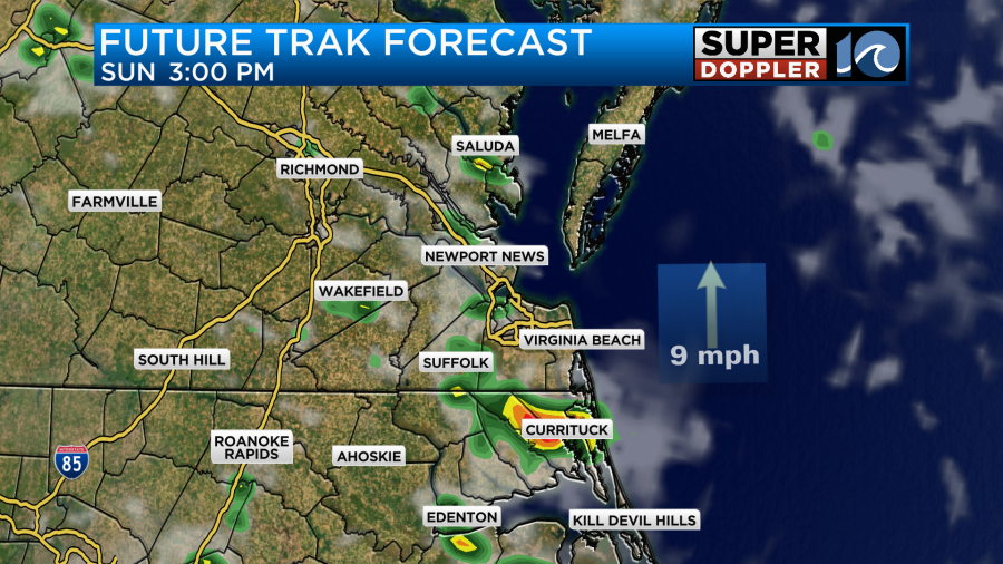
I think there will be enough sunshine to push the temperatures up into the low-mid 90s. If the storms increase a little more, then maybe temps will be more in the low 90s. We’ll see. There’s no doubt that the humidity will be very high Sunday into early next week.
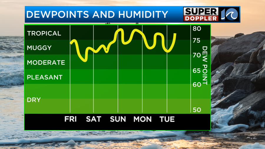
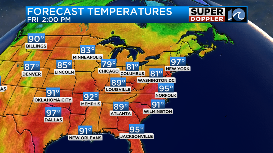
High temps will be in the 90s. The heat indices will be over 100 through the middle of next week. However, there may be a nice cool down by the end of next week. Stay tuned for updates.
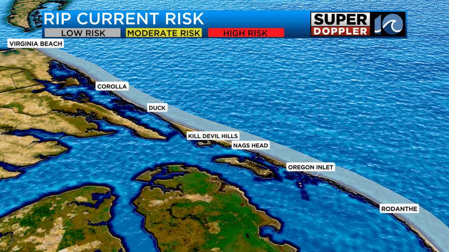
Good news in the beach forecast! The rip current threat is low for today.
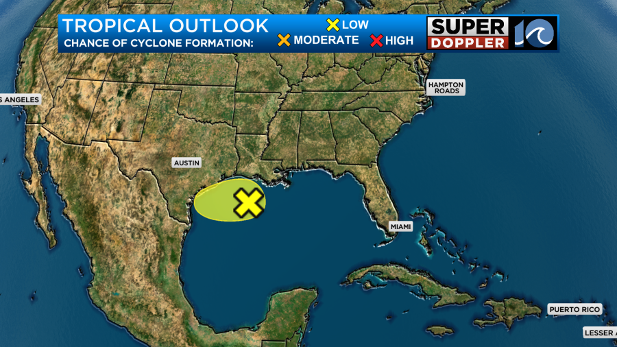
The feature over the Gulf Coast is still a disorganized area of low pressure. It will pretty much just bring some heavy rain to coastal Louisiana and Texas.
Meteorologist: Jeremy Wheeler