
Before I go into the forecast I want to recap this month’s climate. Many will remember how hot this Summer has been. However, I mentioned it before…The temps alone don’t really tell the story. These are the high temperatures for the month so far.
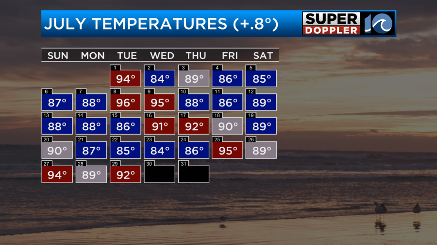
As you can see. There were many days when we had high temps in the 80s. Which were below average. It was the heat index and the high humidity that has been the problem for the past few months. I feel like it’s been muggy since late May. So while we have been in the 80s and 90s this month, the heat indices have been in the upper 90s to lower 100s. THAT is what has made this Summer rough.
As far as rainfall goes… We are actually a bit below average (technically).
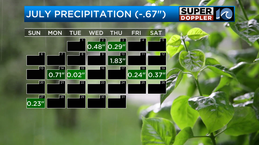
Keep in mind that Norfolk only recorded about a quarter of an inch during the last rainfall. Even though much of the region had a solid 1-2 inches. So I’d say that we are doing pretty good in the very short-term despite what the calendar shows.
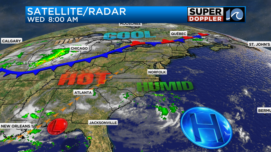
We won’t have much rain today. There may just be a stray shower or storm like yesterday. High pressure is to our south/southeast with a cool front developing far to our north.
We’ll be mostly to partly sunny today. There will be a light southeast breeze developing. High temps will aim for the low-mid 90s.
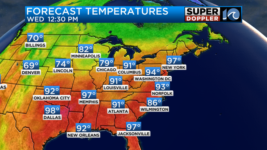
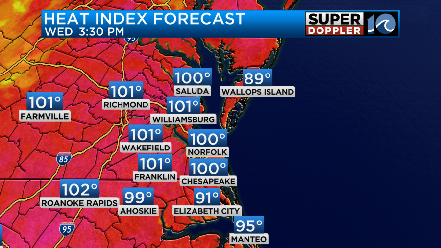
The heat index will be in the upper 90s to lower 100s.
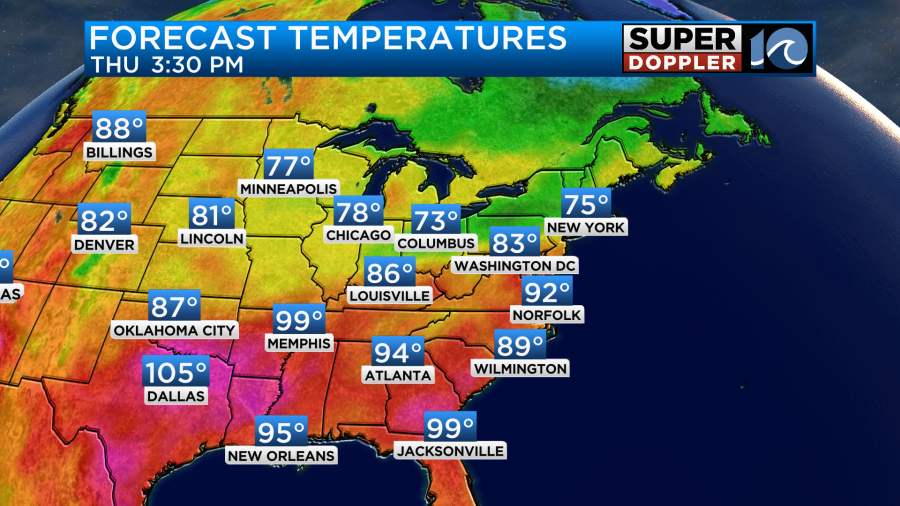
Tomorrow the front won’t be here yet, but it will be closer. They will cool down to the 80s around the D.C. area, but we will still be in the low 90s here.
The heat index will be back up around 100. However… Tomorrow we will have some scattered showers and storms in the afternoon.
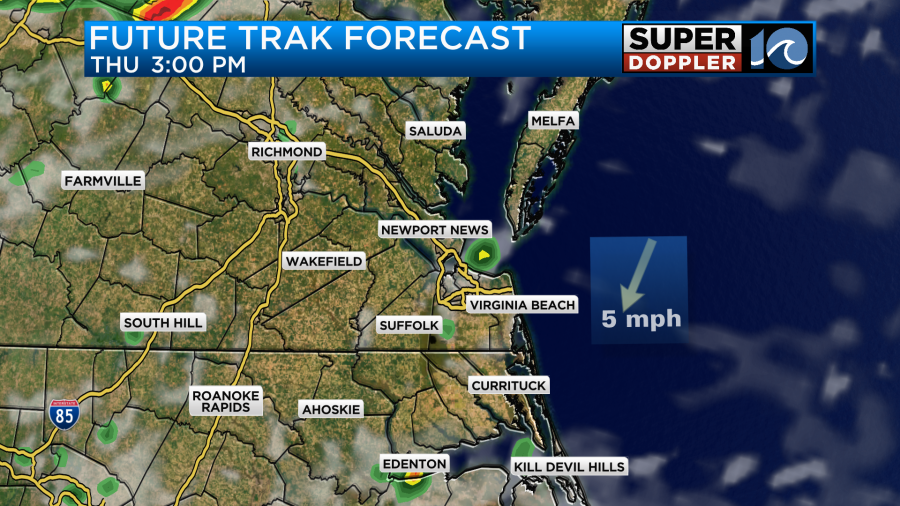
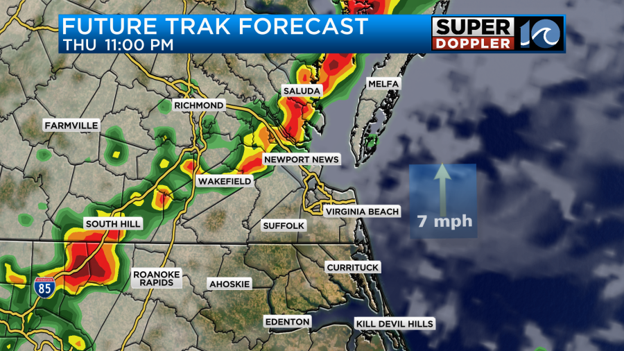
This may cool down some of our temperatures, but the chance for rain is 40%…Not 100. There may be a bigger area of rain and storms during the evening, but Future Trak has them falling apart as they arrive.
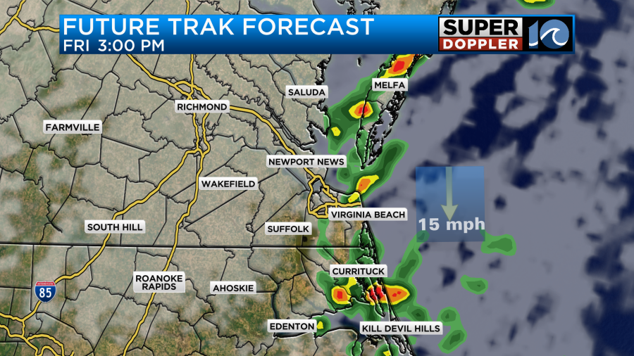
By Friday the cool front will be slowly sinking south through the region. This will bring us lots of clouds, scattered rain showers, and a big cool down. High temps will drop to the 80s.

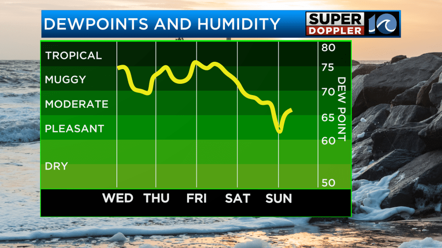
At least the humidity will slowly drop through the day.
The rain coverage is disagreed upon by the models, but they all show at least some scattered rain showers. Here is Future Trak’s forecast:
Some models suggest a more widespread (but lighter) rainfall. Almost like a drizzle. Here’s the latest GFS:
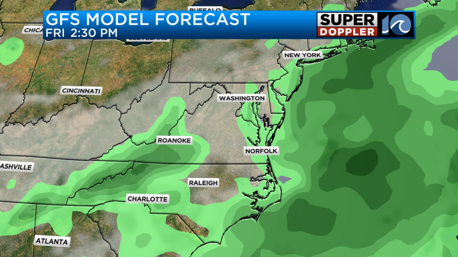
Either way it will be cooler, and there will be a lot of clouds.
The front will slowly sink to our south on Saturday. It will eventually stall out, but hopefully not too soon. For now I have a few showers possible Saturday morning with drying and clearing through the day. Dew points will be in the 60s (see muggy meter above) for the whole weekend. High temps will be near 80. Low temps will be in the 60s and 70s. It should be very nice out! The cooler temps look to continue into early next week as well.
In world news…More extreme flooding has happened around the world. This time China has had more severe and deadly flooding. At least 30 people have died around Beijing. Here is an article with more information. Deadly China Flooding.
In other news… A recent study from the University at Albany found that forecasts improved dramatically when Hurricane Hunters flew into and measured conditions in hurricanes. They compared situations when the G-IV Gulf stream was used as opposed to just surface observations and satellite. The forecasts showed a 24% increase in accuracy when the Hurricane Hunters were used. Here is the article with more information: Hurricane accuracy study.
Meteorologist: Jeremy Wheeler


