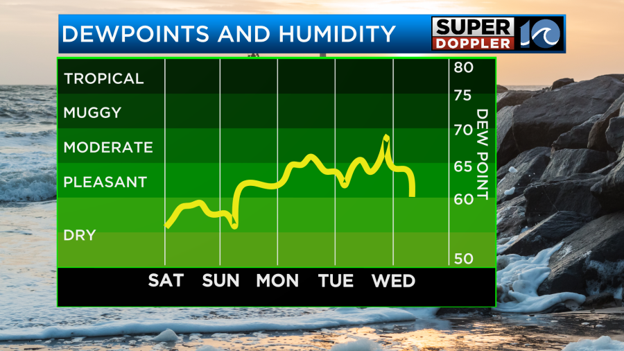
Happy Saturday! High pressure is staying overhead for a few days, keeping us dry and sunny. Temperatures and humidity will gradually rise each day until a cold front passes through midweek.
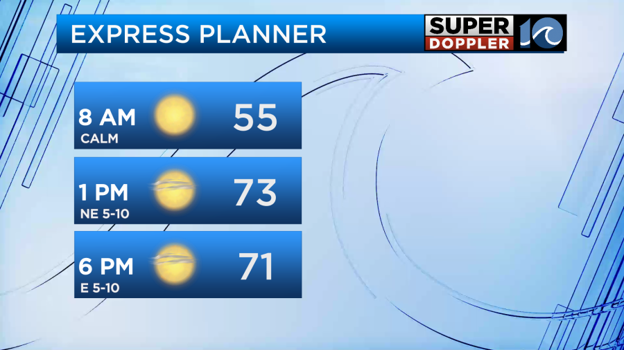
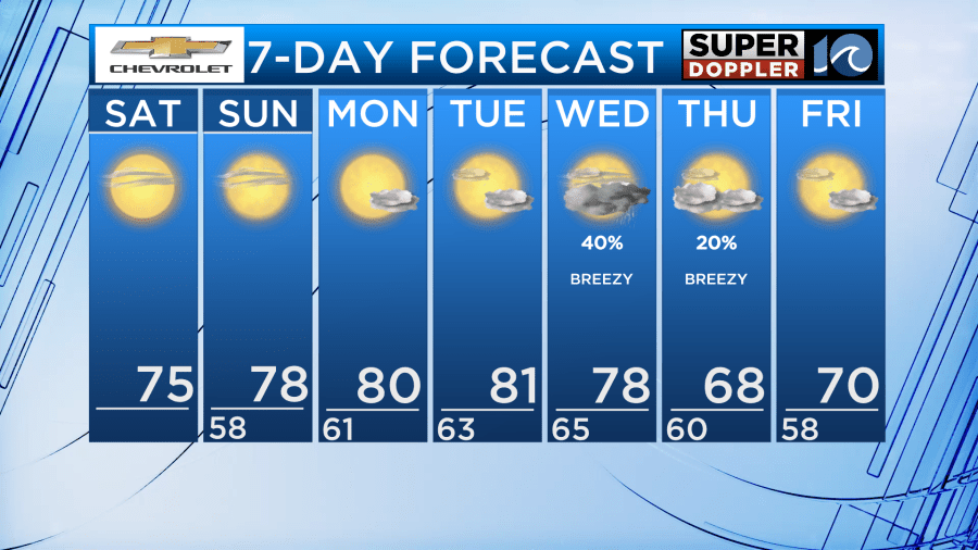
This weekend will be great for any outdoor plans! Tons of sunshine both days. High temperatures Saturday in the mid 70s. Tonight will cool into the 50s and patchy fog could develop inland. High temperatures will reach the upper 70s Sunday. We do still have a high rip current risk in the Atlantic with 3-4′ waves both days.
Monday and Tuesday stay dry with lots of sunshine. High temperatures warm into the low 80s and we’ll notice a touch of humidity in the air.
A cold front arrives Wednesday. Around it, we’ll likely see some scattered rain showers and breezy winds. Behind it, temperatures and humidity drop.
Clouds clear out Thursday and winds remain breezy behind the front. Low humidity returns along with high temperatures in the upper 60s.
A mix of sun and clouds continues as we head into next weekend. Temperatures in the low 70s Friday.
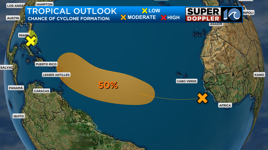
In the Atlantic, there’s a wave off the coast of Africa that has a 50% chance of formation in the next 5 days. We’ll continue to watch this for development.
Enjoy this great weekend!
– Meteorologist Kristy Steward