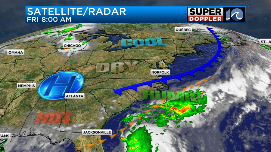
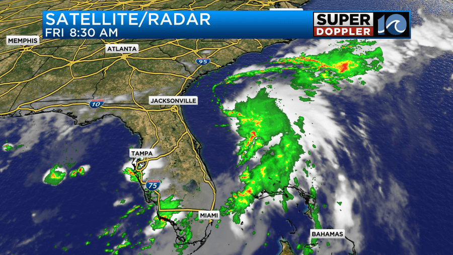
We are looking at some of the best 4th of July weather that we’ve had in years. This morning a cool front was dropping to our south.
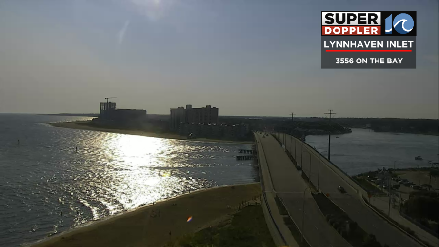
It was beautiful outside. We had lots of sun with the north breeze picking up over the water.
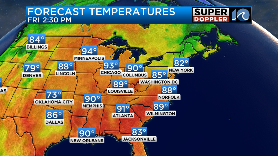
We’ll have lots of sunshine through the day as the cool front sinks to our south. High pressure will build into the region. The wind will stay up out of the north/northeast. It will run at 8-12mph. There will be a few higher gusts near the shore. This will help to drop our humidity as we go into the afternoon. Dew points will drop to the 60s. That feature will make it feel great later today. High temps will reach into the upper 80s with a couple of 90s inland.
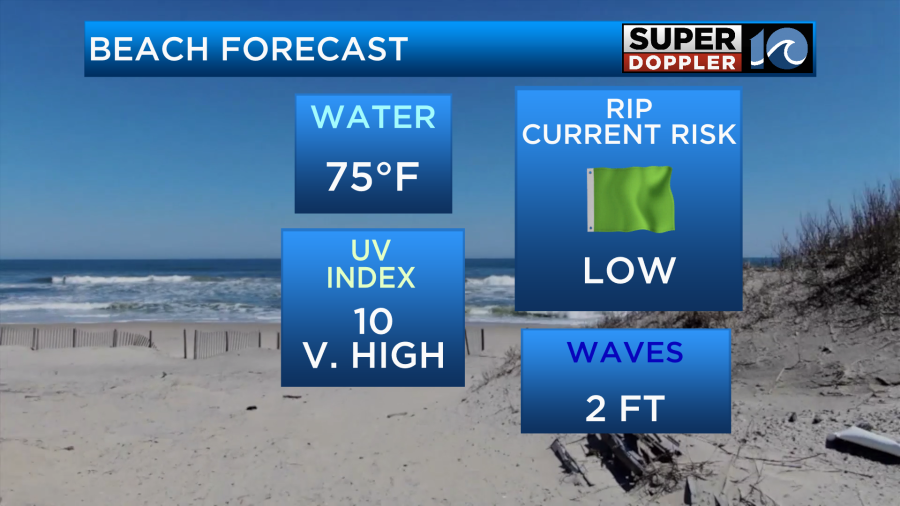
The beach and boating forecasts look great as well.

The forecast for this evening also looks great for the fireworks.
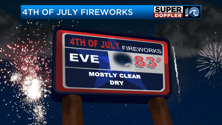
We’ll have light and variable winds along with mostly clear skies. Be sure to put on some bug spray this evening as the mosquitoes have been pretty rough lately.
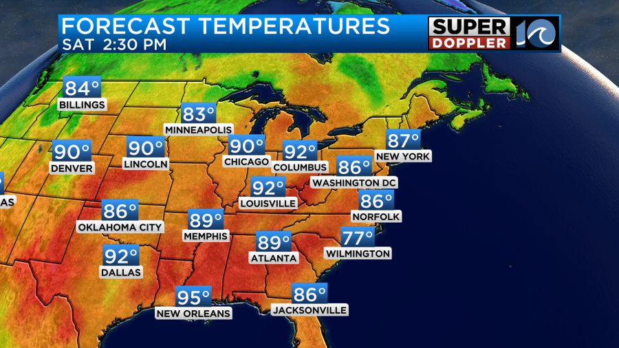
Tomorrow we’ll have more great weather. Skies will be mostly sunny. We’ll start off the day with low temps in the upper 60s to low 70s. Then high temps will be in the upper 80s again with a couple of 90s inland and south.
The humidity will be even lower on Saturday. It will feel great!
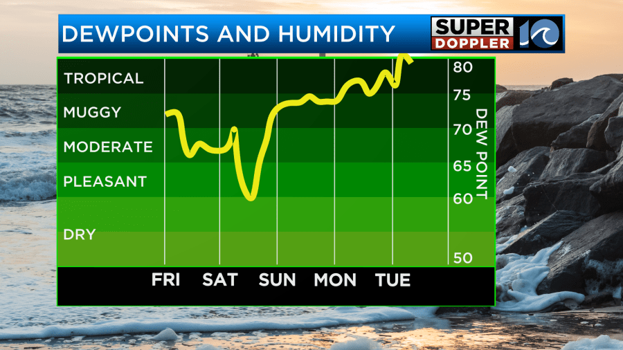
It should also be good weather in the evening for any fireworks during that time. However, as you can see above…The humidity will bounce back on Sunday. Big time! This could literally be some tropical moisture. An area of low pressure has finally formed off the coast of Florida.
It is not a tropical system yet. However, the National Hurricane Center has a medium chance of it becoming tropical or subtropical over the next couple of days.
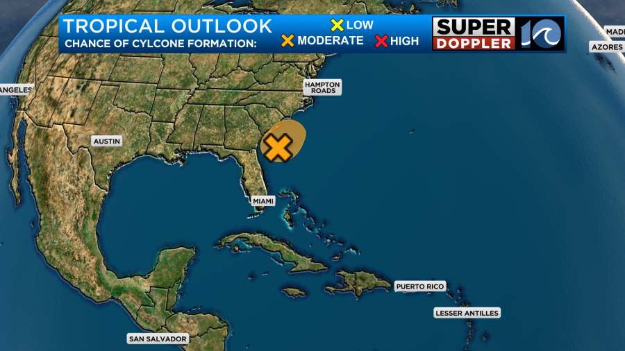
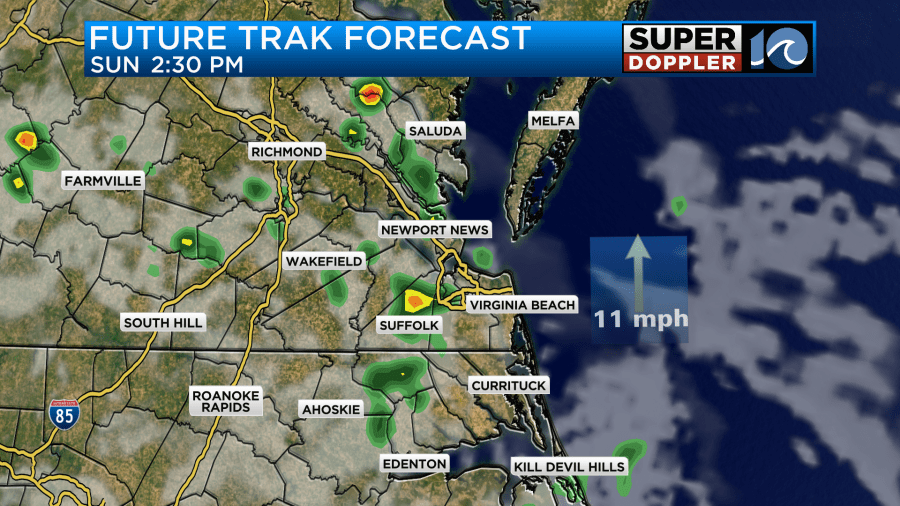
The models don’t have it strengthening much. In fact they mostly keep it weak and to our south. However, they do have deep moisture pushing north into our region from Sunday into Monday. Our Future Trak model has a couple of rain bands coming up from the south on Sunday.
The GFS and European models are broader. However, they both have a good amount of rain showers over the region.
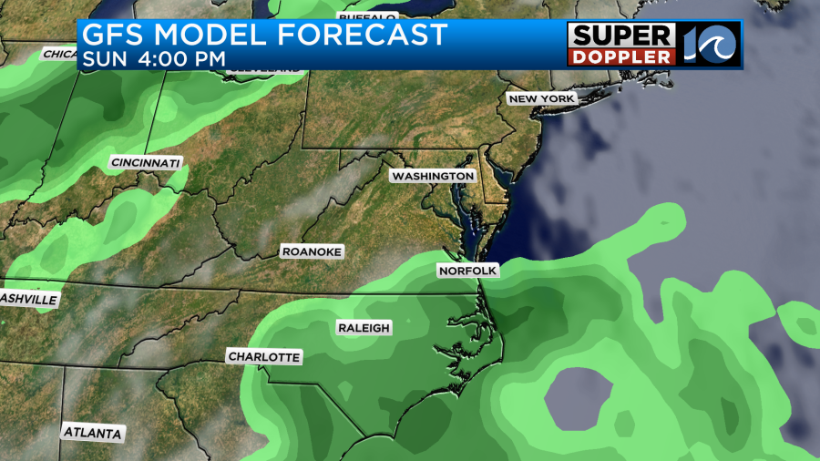
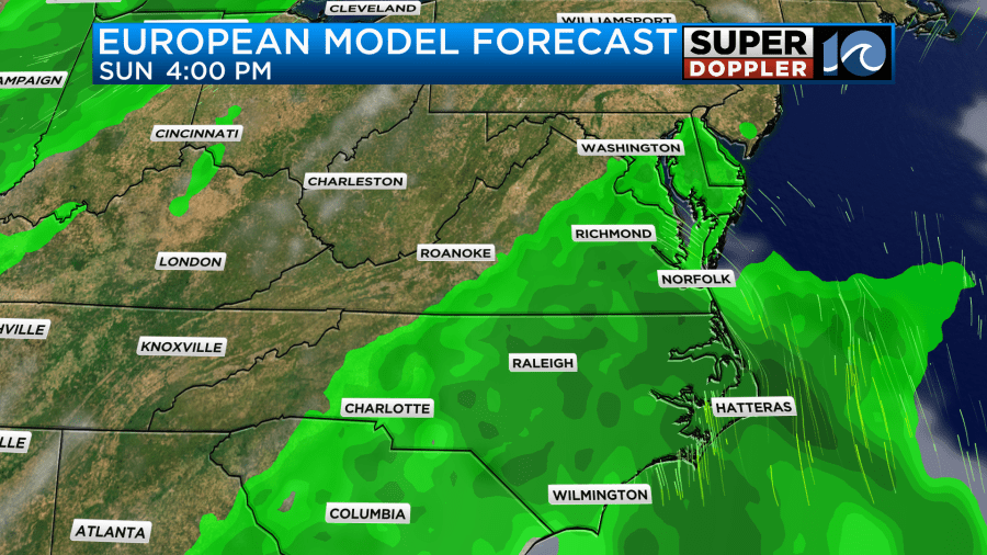
They have similar weather on Monday with even more rain showers. High temps will be in the upper 80s to low 90s, but that will depend on the eventual clouds, rain coverage, and wind speeds. So please check back on the forecast over the weekend.
Meteorologist: Jeremy Wheeler