Happy Sunday! Almost everything gradually increases as this week goes on — temperatures, humidity, and rain chances.
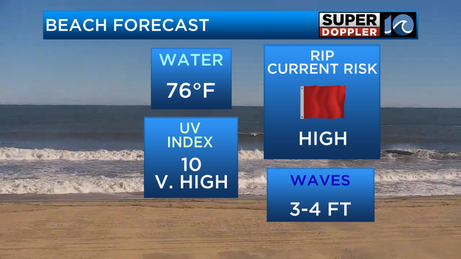
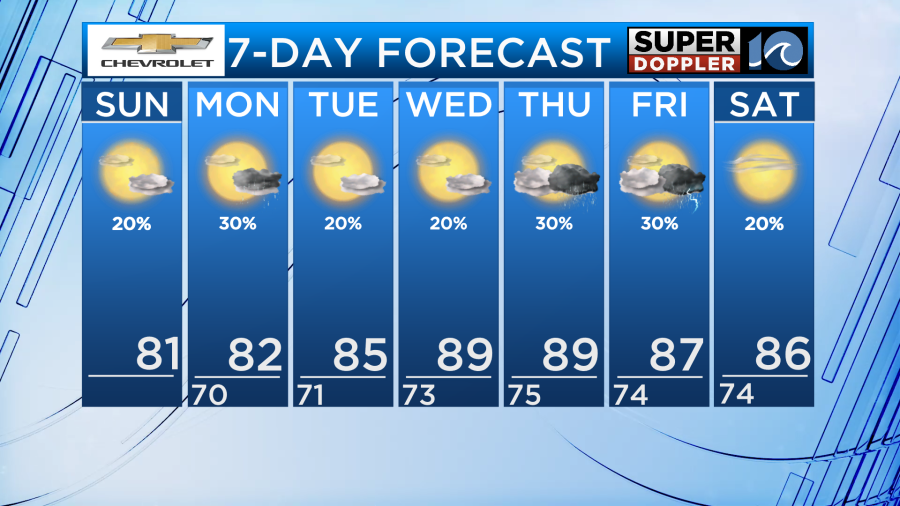
Sunday will be another pleasant day. High temperatures in the low 80s with a mix of sun and clouds. This afternoon and evening, we could have a few stray showers pop-up, mainly across northeastern NC. A lot of locations will remain dry. A light breeze with northeast winds becoming east 5-15 MPH. Still a rough surf with a high rip current risk and 3-4′ breaking waves.
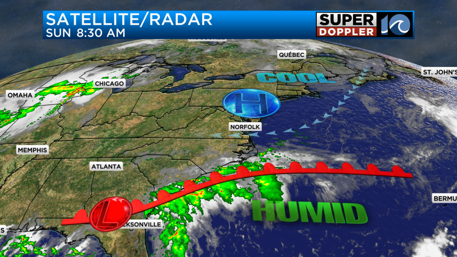
A warm front down south will lift north and reach around the Outer Banks Monday before it stalls. This will bring us isolated to scattered showers Monday, with the best chance for rain being across NC. High temperatures will still be in the low 80s, but it will be a touch more humid outside.
The high pressure system to our north will slide south and begin to weaken, opening the door for a few disturbances to form over us later in the week. Temperatures will gradually rise to the mid 80s Tuesday and upper 80s Wednesday. Humidity also continues to gradually rise each day. Mid-week will be mostly dry, just a few pop-up to isolated rain showers Tuesday and Wednesday.
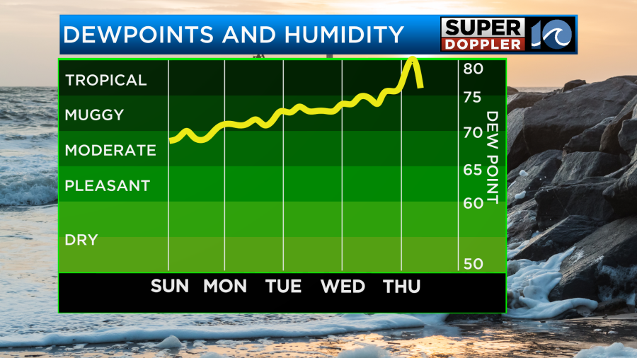
Rain chances increase a bit more to isolated/scattered showers with a few rumbles of thunder possible Thursday and Friday as that disturbance develops. Temperatures remain in the upper 80s to end the workweek and humidity will rise a bit more. It will feel like summer has returned.
Next weekend looks decently dry and slightly cooler with highs in the mid 80s as the disturbance dissipates.
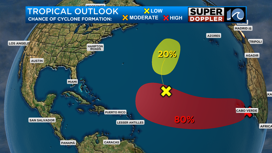
In the Atlantic, the area being watched off the coast of Africa now has an 80% chance of becoming our next named tropical system over the next 5 days. It’s too early to tell if we could have impacts from it, but we will of course continue to monitor and keep you updated.
Enjoy the rest of your nice weather weekend!
– Meteorologist Kristy Steward