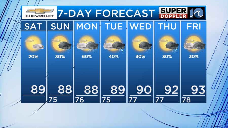
This weekend will have a little bit of everything that summer-time has to offer across Hampton Roads like the heat, the humidity, and a slight chance for storms. Despite the rain chance, don’t let that scare you from being outdoors at the beach and pool because most will likely stay dry.
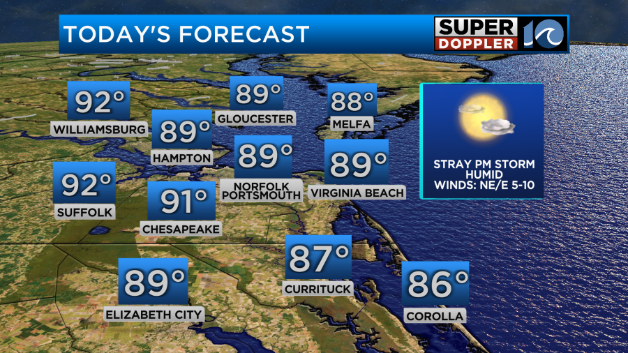
It will be a warm day across the area with plenty of sunshine overhead. High temperatures will be in the upper 80s to lower 90s with the cooler temperatures residing near the coastline. This is due to the onshore wind we will have blowing off the cooler Atlantic ocean.
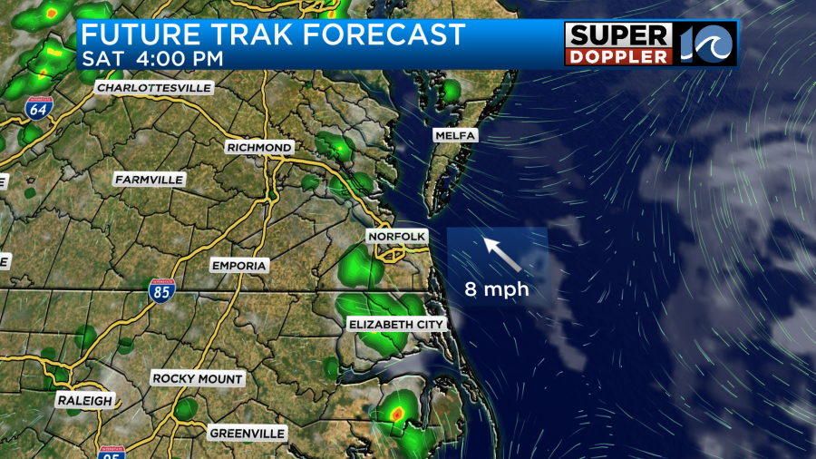
There will be a chance for isolated storms today for areas near the coast as the sea breeze comes ashore but those storms will be very isolated in nature.
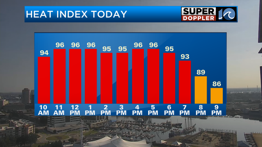
With high humidity today it will make our air feel a bit uncomfortable. The heat index will be in the upper 90s for most but a few areas may feel like around 100 degrees at times. The best advice for today will be to stay hydrated and in the shade if you are outside for long periods of time. If you are at the beach or pool, take breaks in the water to cool off every now and then.
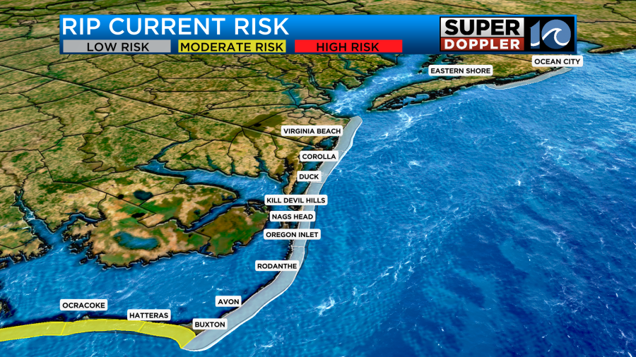
As for the beach, our rip current risk is low for Virginia Beach and south through the northern OBX. From Hatteras to Ocracoke, side shore winds will likely cause swimming conditions to be a little more challenging to pay attention to lifeguards.
As for walking the dog, try to do so during the early more or evening hours for the next several days to keep their paws safe from hot concrete.
Now, let’s talk more about the rain chance for the next several days.
High pressure is nearby so widespread storm chances are not expected. However, with the heat and humidity out there, any afternoon sea breeze could be enough to spark an afternoon storm or two.
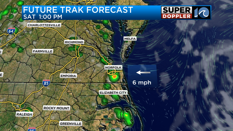
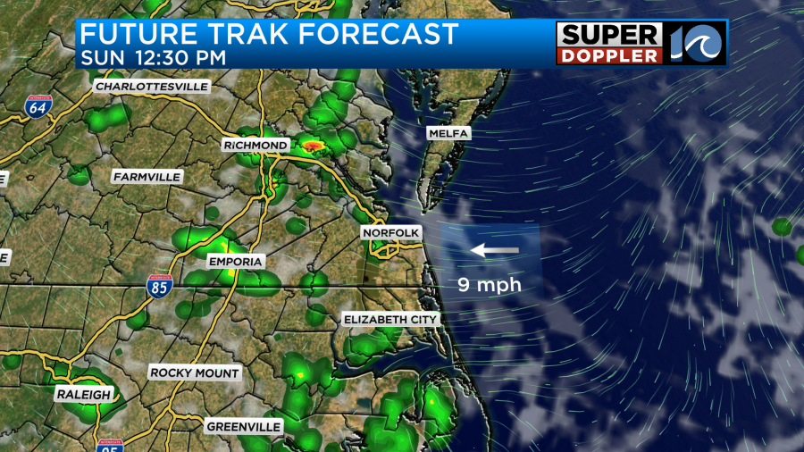
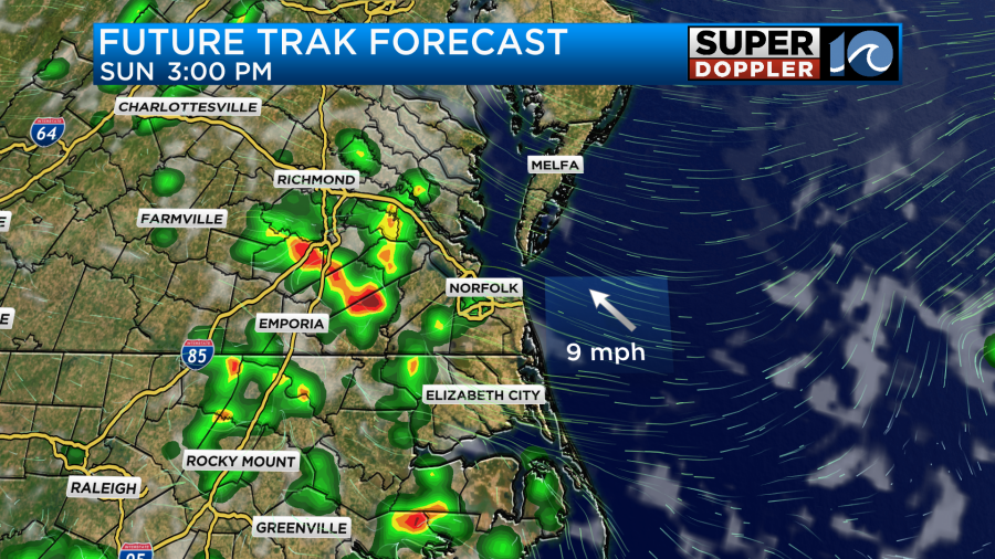
For today, the timing will likely be from around 1pm until 6pm for isolated storms along the sea breeze. These storms are not likely to be severe and any storm that does form will be short-lived. The main impact will be brief heavy rain. On Sunday, the impacts look the same with afternoon storms firing up between the hours of noon and 7pm. Showers may be a little more numerous on Sunday as we tap into some more unstable air ahead of an approaching front but storms will likely not be severe. The best chance for strong storms Sunday into Monday morning will be for interior Virginia.
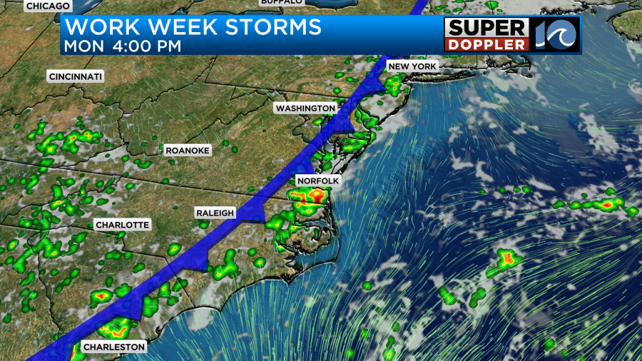
As we head into the work week our rain chances are not over just yet. A cold front will slowly move in from the west and stall nearby. This stalled front will allow for a daily chance for rain as we head through the work week. There will not be any washout days over the next 7, in fact, each morning is looking dry with varying levels of sunshine. During the afternoon keep the eye to the sky and keep checking back in for updates.
-Meteorologist Brian Michigan 🤙