
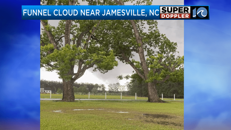
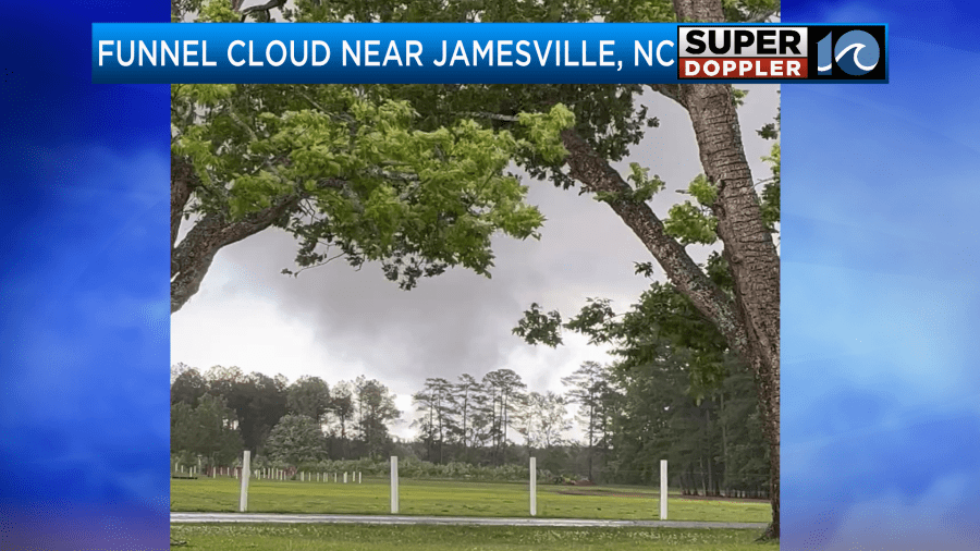
Yesterday we had 2 reported funnel clouds near the edges of the viewing area. One of them likely turned into a tornado at one point. We did have some video of the funnel cloud near Jamesville, NC. Here are a couple of screen shots from that video:
Apparently, there was some other video that the National Weather Service viewed that did show a touchdown. However, there was no damage reported. Therefore, we’re not sure if they will go out and survey that area. The other funnel cloud happened just west of Middlesex County.
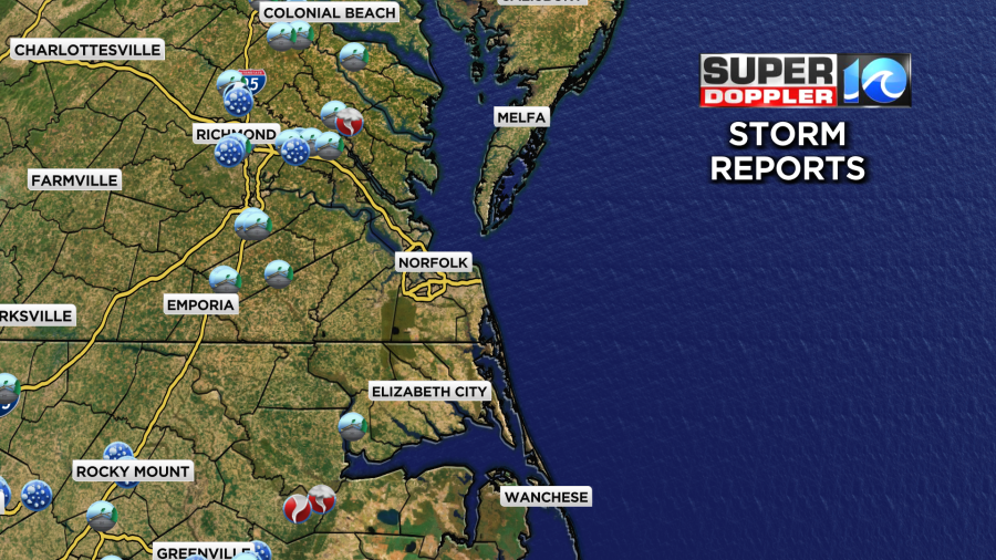
There were a few wind damage reports up that way, but no report of a touchdown where the funnel cloud happened. There were some wind damage and hail reports on the edges of the viewing area, but nothing for most of the viewing area. There were some very heavy downpours yesterday evening along with the strong storms.

As the storms moved east in the evening they weakened slowly.
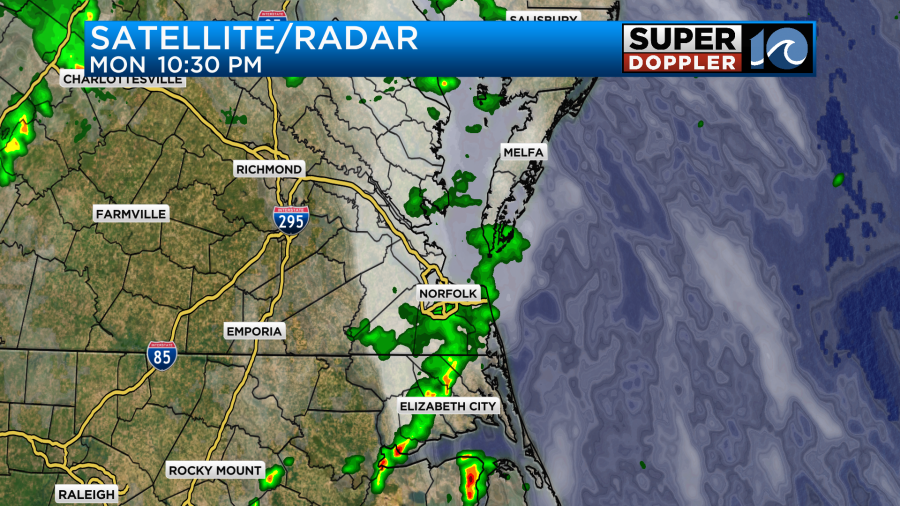
So the metro area didn’t get much rainfall. The heaviest rain was near the damage reports.
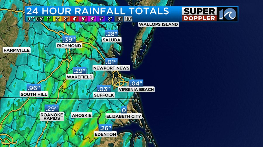
This all happened east of the slow-moving cold front. Today that front has moved offshore.
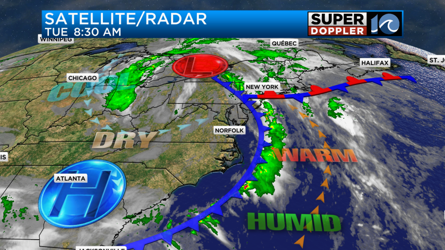
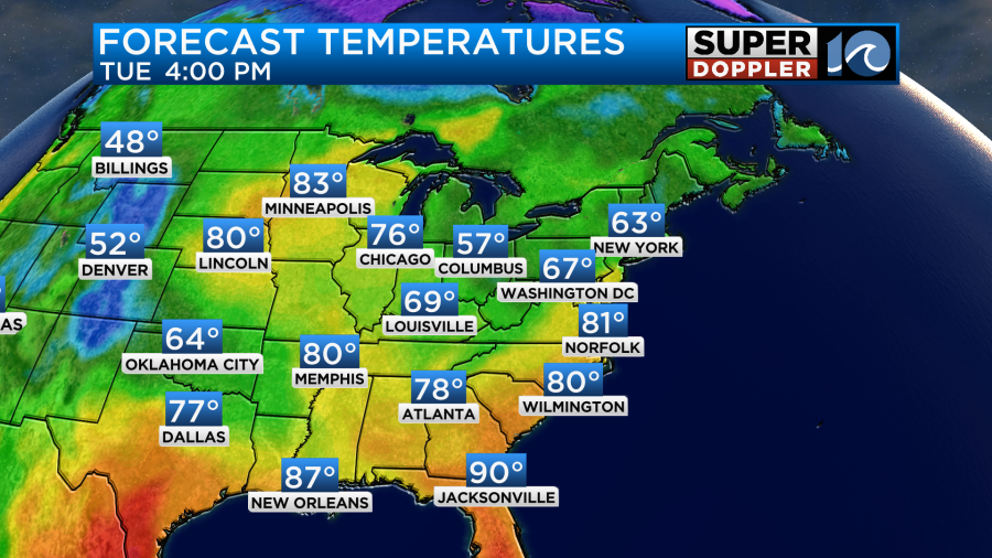
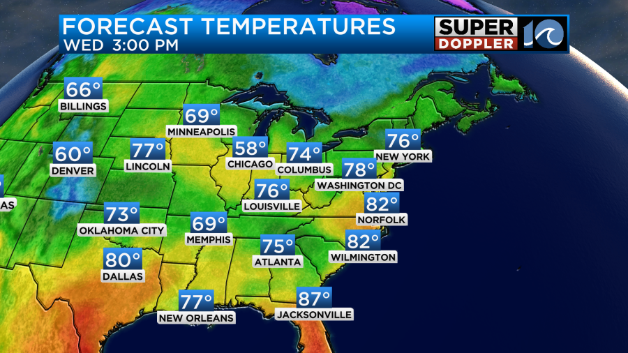
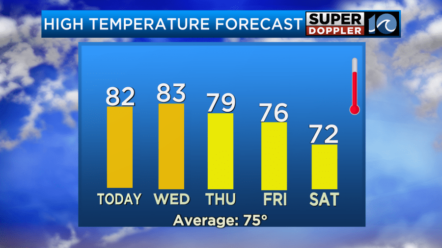
We’ll slowly dry out today. We’ll be partly cloudy with a light southwest breeze. High temps will aim for the low 80s.
I would keep us totally dry, but remember…That upper-level low is still overhead.
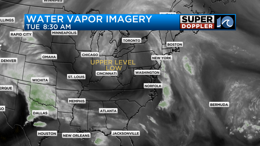
Sometimes the models don’t handle these situations well. So I am calling for some isolated showers or storms to form during the afternoon.
Humidity will drop today, but we’ll be even drier tonight into tomorrow.
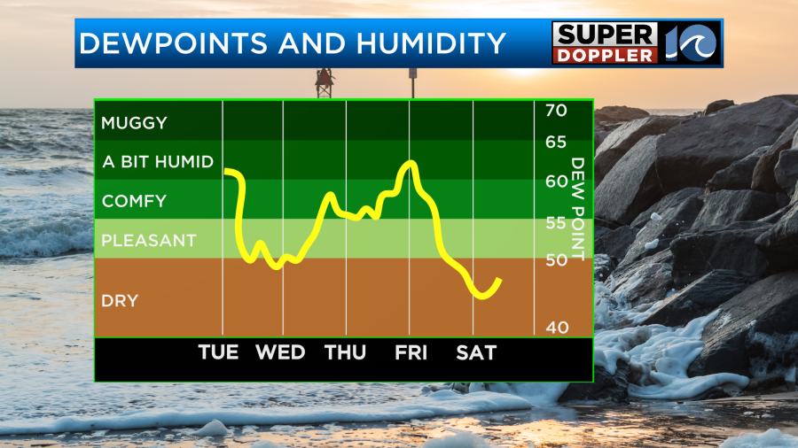
We’ll be mostly to partly sunny tomorrow with highs in the low-mid 80s.
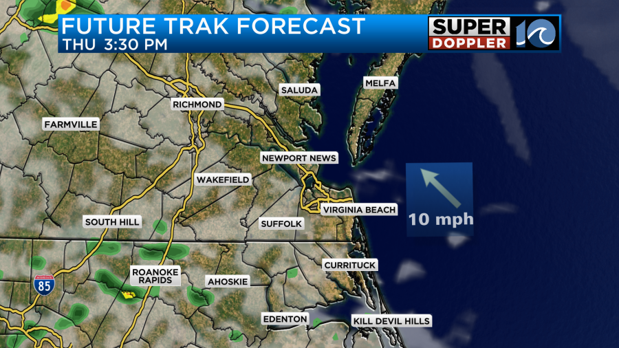
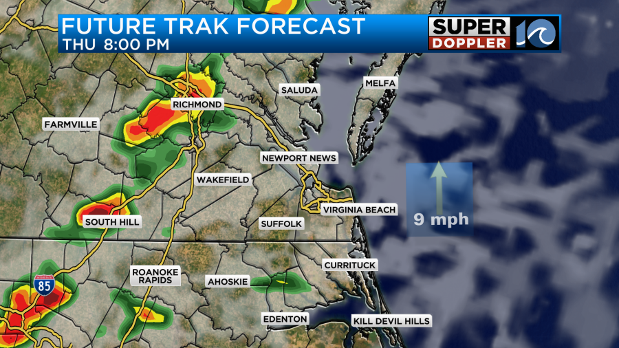
By Thursday moisture will start to return. We’ll have some isolated showers or storms in the late afternoon with a higher chance for rain and storms in the evening.
High temps will drop to the mid-upper 70s.
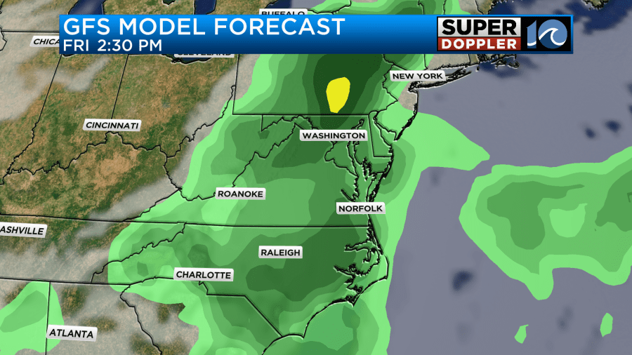
A cold front will slowly move through the region Thursday night into Friday. This will produce more scattered rain showers and a few storms. It could be pretty wet for a big part of the day.
After that we’ll have a cooler/drier weekend. I’ll have more details on the rain for later this week in tomorrow’s weather blog. Same bat-time… Same bat-channel.
Meteorologist: Jeremy Wheeler


