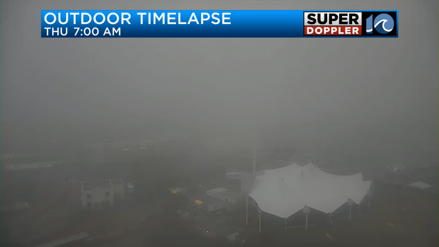
This morning we had some thick fog in the region.
There were numerous accidents on the roads as the fog lowered the visibility, and some rain created a lot of wet roads.
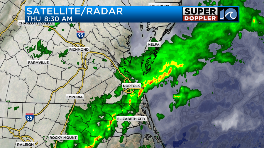
We had a lot of moisture moving up into the region along with a warm front that was near the coast.
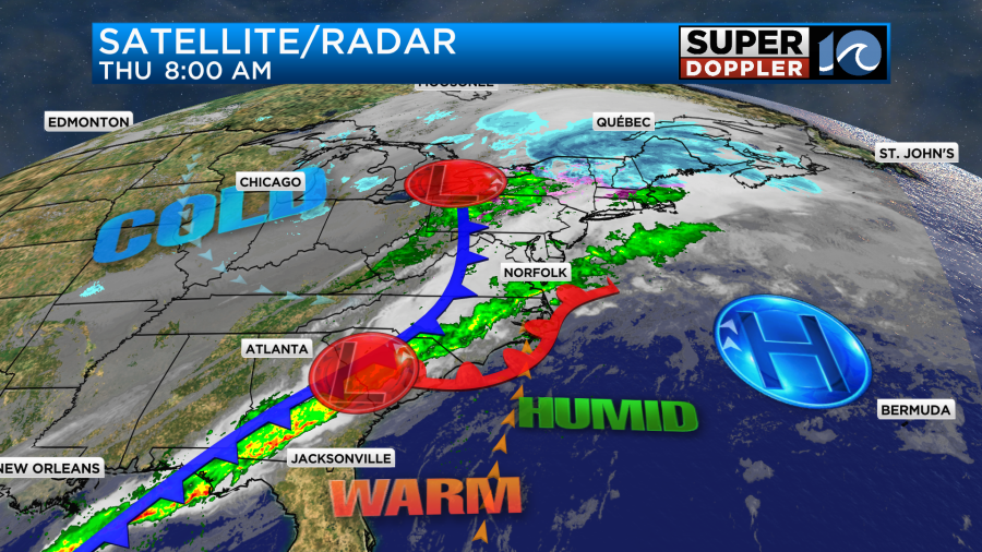
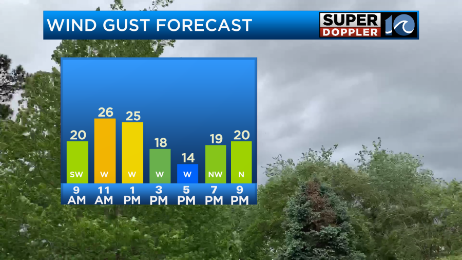
There will actually be a lot going on today in terms of our weather. A warm front will lift up from the south to a point. Then a cold front will swipe in from the west. Winds will pick up from the south for a time this morning, but then winds will start gusting from the west.
We’ll have scattered rain showers this morning up through midday.
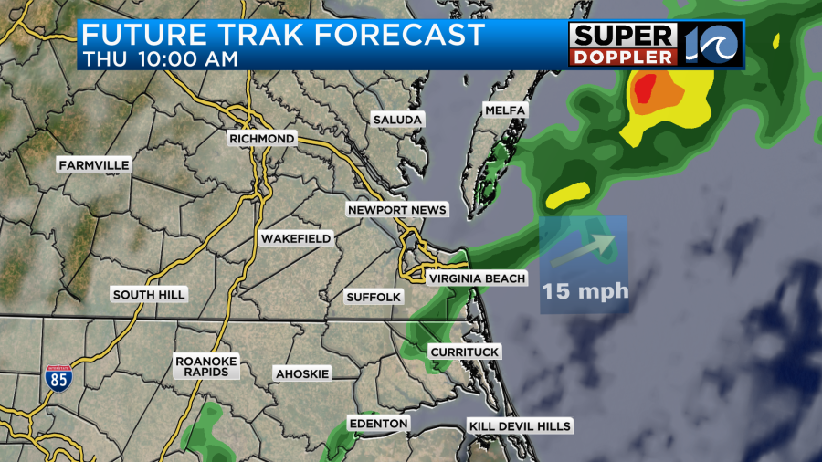
It may be more in the way of scattered drizzle with a few showers by noon. However, the rain will end this afternoon. Drier weather will come in from the west. So we should have some clearing late in the day.
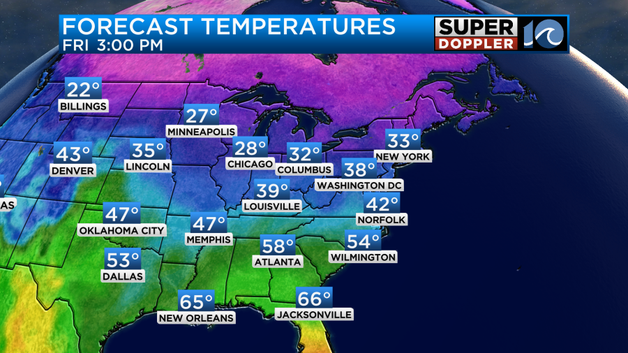
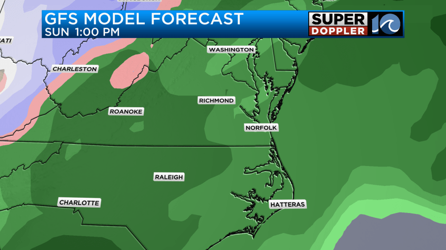
Temps will be tricky. The front will only make it so far north before that cold front arrives. The models definitely show warming over the southern areas, but they keep it much cooler north of the metro.
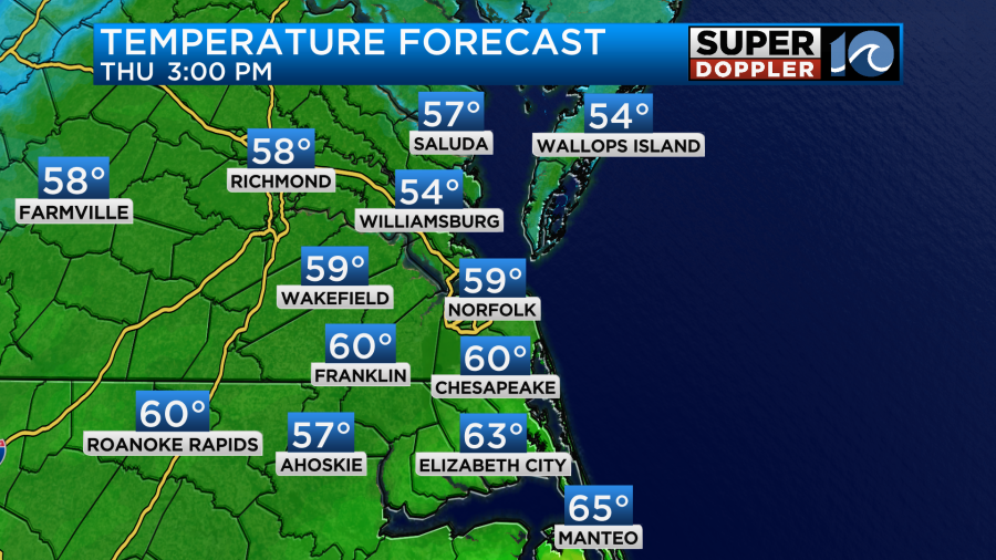
I have a similar forecast but not as warm as the model over North Carolina.
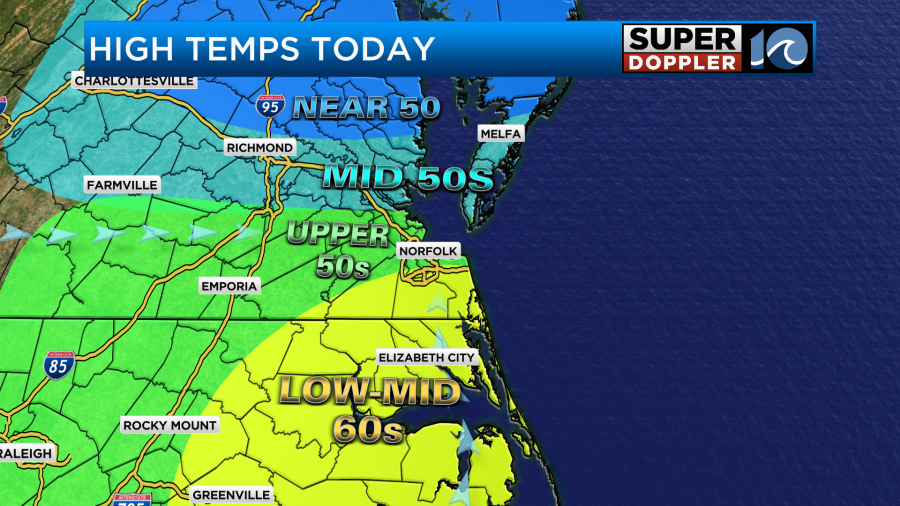
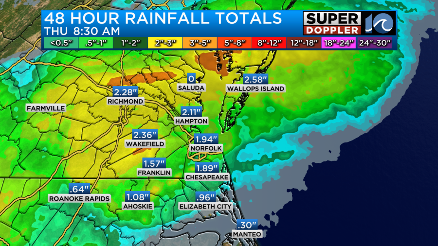
I agree that a few mid-upper 60s could happen along coastal North Carolina. Temps may even fall a little this afternoon. Before the rain ends later today we will probably pick up about a tenth of an inch with a quarter of an inch in spots.
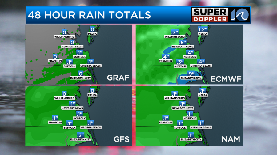
This is on top of the 1-2 inches that we have already had over the last 48 hours.
This will surely help out the regional drought that is happening. However, the update just came out, and there is still some areas of severe drought.
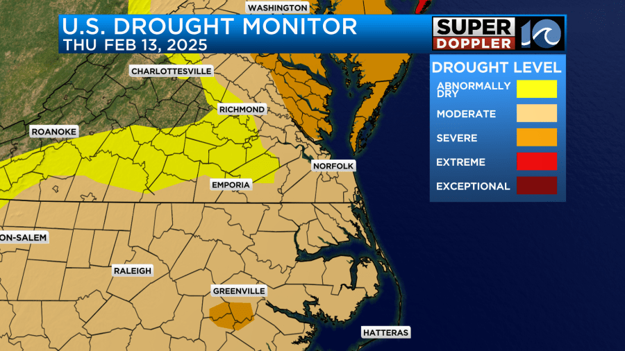
Keep in mind that it may not include the rain that we’ve had over the last 24 hours. So that will go into the next update.
Anyway, as we go into the evening we’ll dry out some more and clear out. We’ll be mostly clear tonight with low temps dropping down into the low-mid 30s. There may be a little patchy ice tomorrow morning. Through the day Friday we’ll have lots of sunshine. There will be a steady northeast breeze though keeping the high temps down in the low-mid 40s.
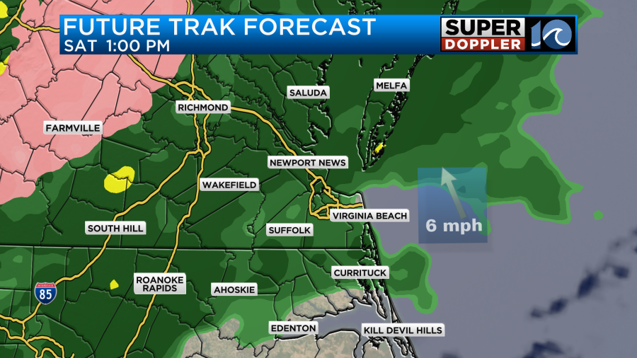
By Saturday warm/humid air will push back north into the region. High temps will warm to at least near 50. It may even get into the low-mid 50s. However, clouds will thicken up through the day, and we’ll have rain returning by the afternoon.
We’ll be mild on Sunday with high temps in the 60s, but there will be a lot of rain showers on and off through the day.
We’ll be dry and cooler early next week. High temps will be in the 40s. We’ll have another system impact the region next Wednesday. I won’t go into much detail because the models are split, but let’s just say that there could be a wintry mix for some of the region that day.
Meteorologist: Jeremy Wheeler


