
Over the last few days I feel like there’s been more of a focus on storms than heat. That is going to briefly change today. However, we’ll go back to a storm focus later tomorrow.
First off… I was looking at a graphic this morning, and (I’ll admit) it shocked me a bit. It was the past 2 weeks high temperature graphic. Take a look!
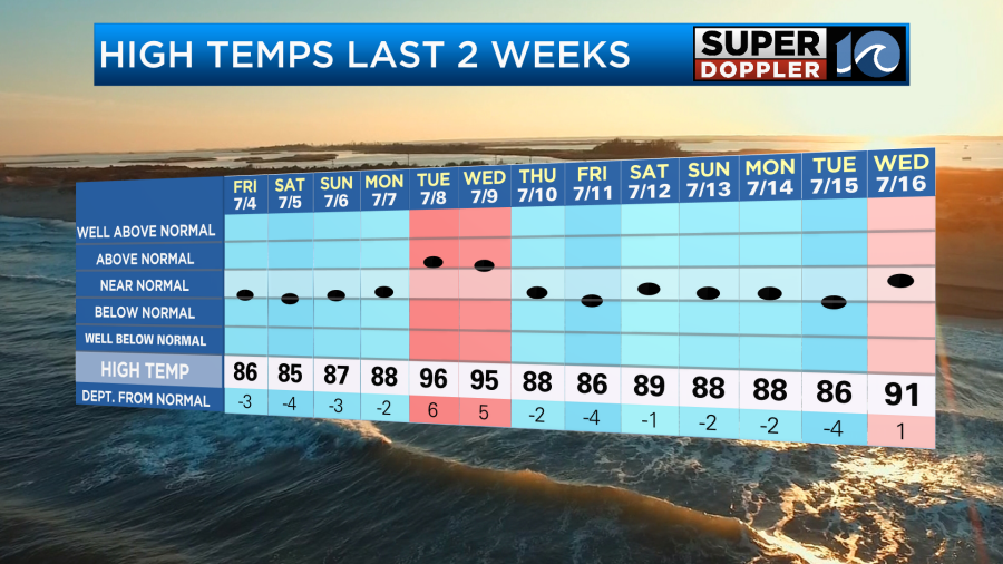
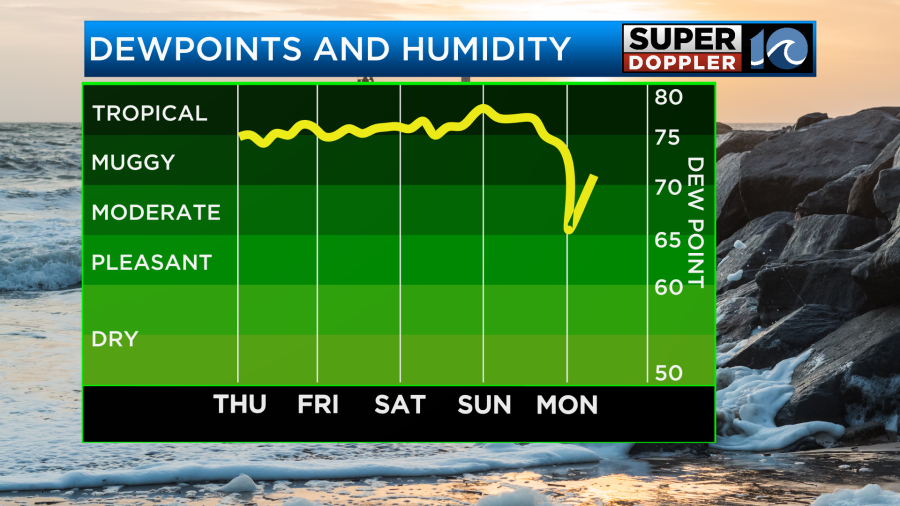
I remember being hot and humid and sweating pretty much every day for the past month. However, if you saw that graphic alone, then you would think that it’s been relatively cool. Technically, we have been below average. However, this is a great example of “it’s not the heat, it’s the humidity”. The heat index or the “feels like” temperatures have been in the upper 90s to around 100 most days. Also, Norfolk is located very close to the water. Many other locations have had high temps in the 90s. Finally, the average high has changed over the years. It used to be in the 80s. Now it is near 90.
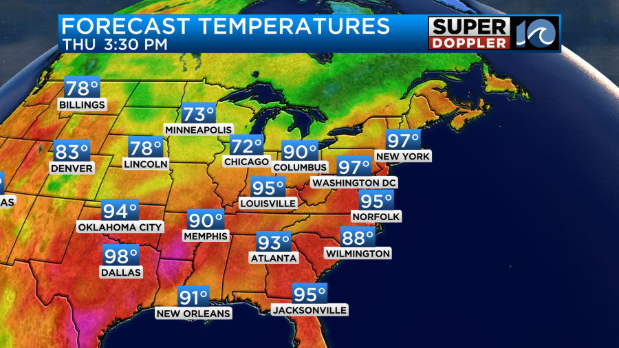
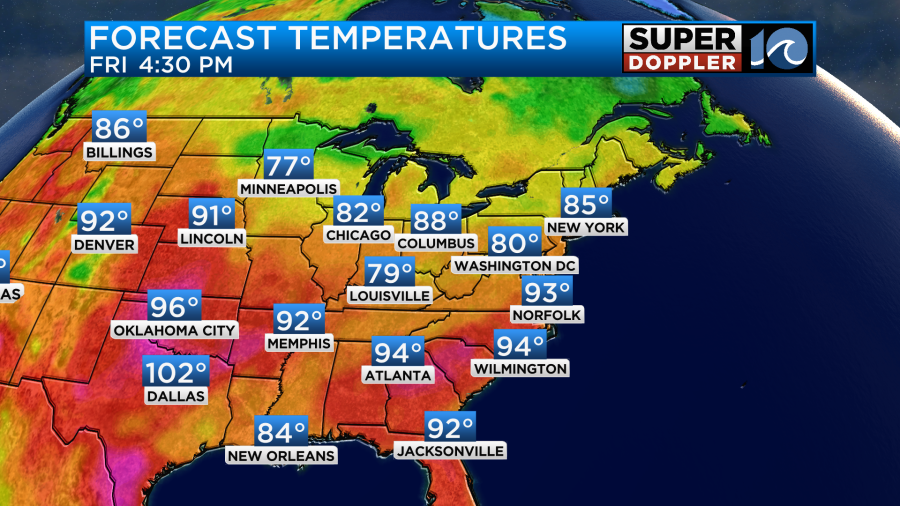
With that said. Today we are going to heat up back above average. High temps are going to aim for the mid 90s.
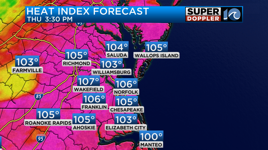
The heat indices will be running between 105 and 109 degrees.
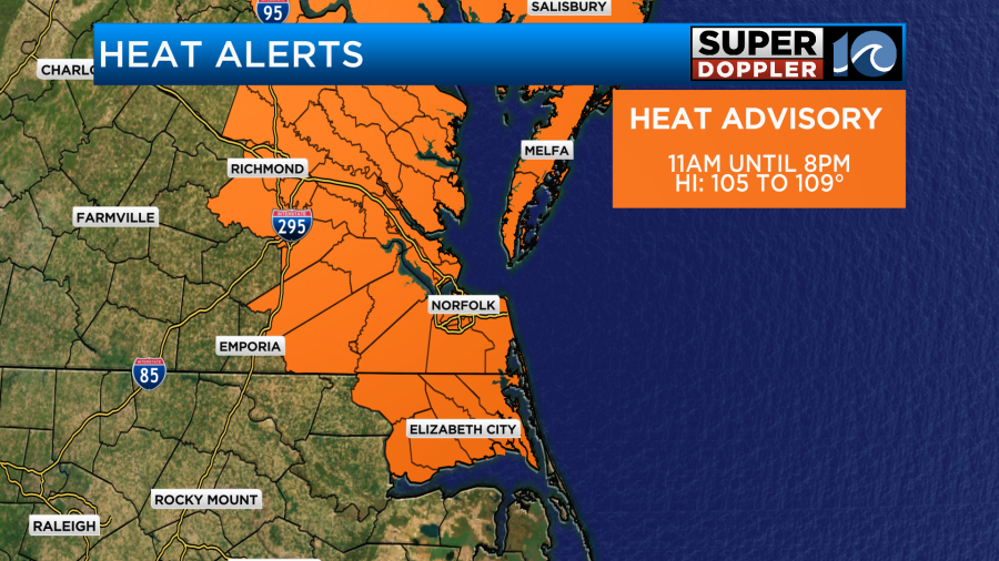
Heat Advisories are in effect today.
High pressure (and an upper-level ridge) are actually sliding west front the Atlantic. This will help to give us a good amount of clearing today. It should suppress most of the rain showers and storms.
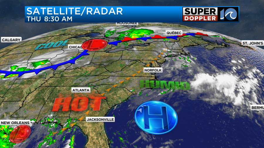
So we’ll only have some isolated showers or storms later this afternoon into the evening.
Tomorrow a cool front will be sliding down towards our region. The high will be pressed to the south. We’ll be partly cloudy for a while, but then some scattered showers and storms will form during the afternoon.
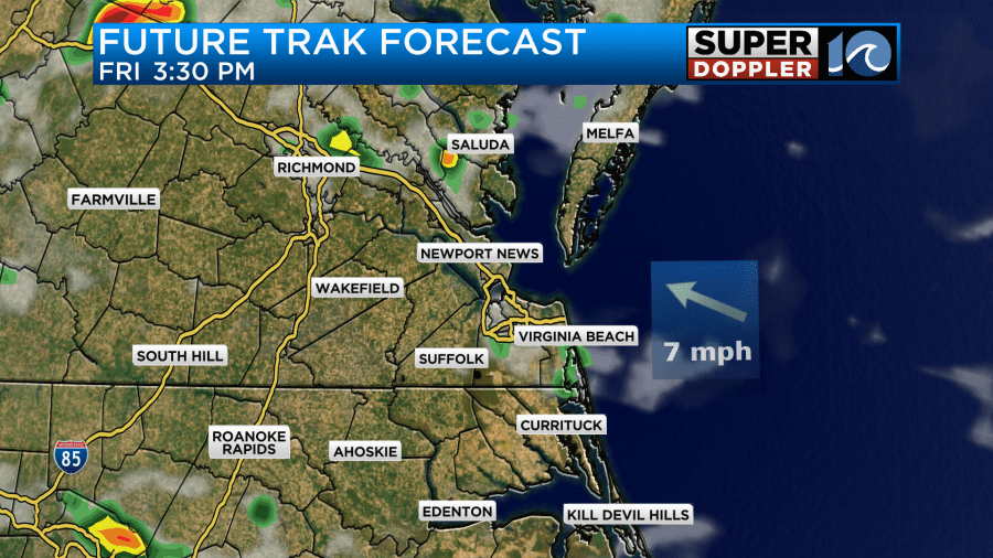
We’ll have a westerly then a northwesterly breeze. High temps will be more in the low 90s.
If the storms crank up more or earlier than expected then we may only be near 90 degrees. Either way the heat index will be over 100 degrees.
The cool front will probably stall out to our north, but the storms that form ahead of that boundary will keep going. We may have some strong to severe storms tomorrow evening as they drop to the south.
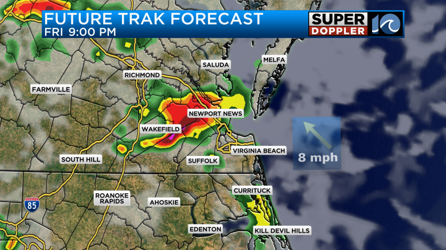
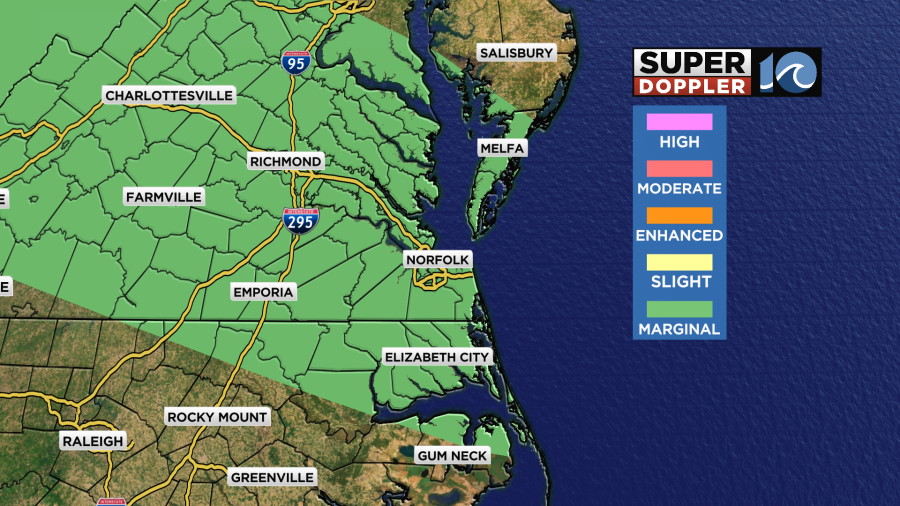
Strong gusty winds and heavy rain will be the main threats. Some small hail will also be possible. The risk for severe weather is marginal, but there could be an upgrade tomorrow.
The front will stay stalled out just to our north between Friday night and Saturday. We’ll have a mix of sun and clouds. There will be scattered storms during the afternoon and evening. Heavy rain will be possible. High temps should be back down in the upper 80s, but the heat index will be in the upper 90s to near 100.
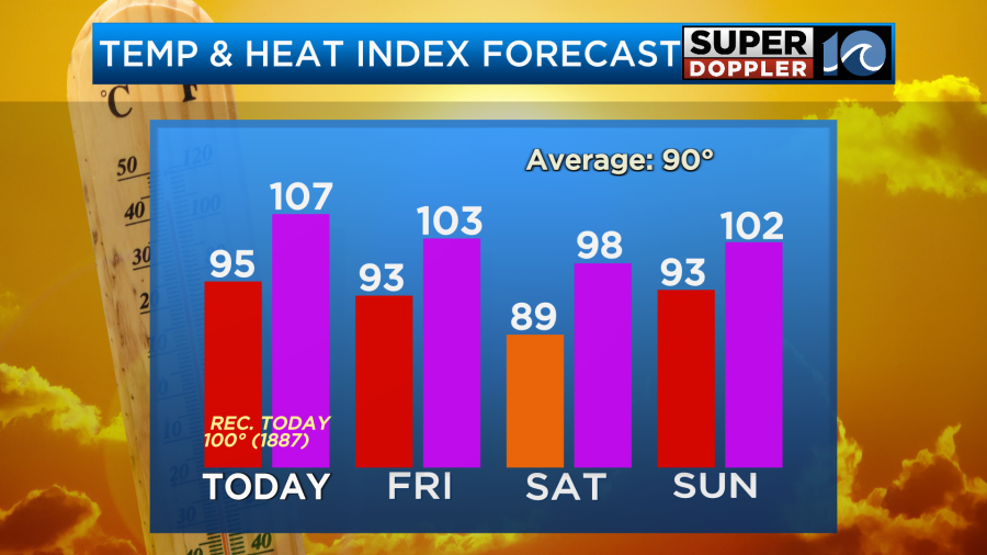
We should have less of a chance for rain on Sunday as the front rises back to the north. High temps will also rise back into the low-mid 90s. The heat index will likely be over 100. The humidity won’t break over the weekend. However, the models are starting to hint at a slight cool down and dry out early next week. We’ll see.
We have been tracking that coastal low down across the Gulf Coast over the last couple of days. That feature is still rolling slowly to the west. It is also still fairly disorganized.
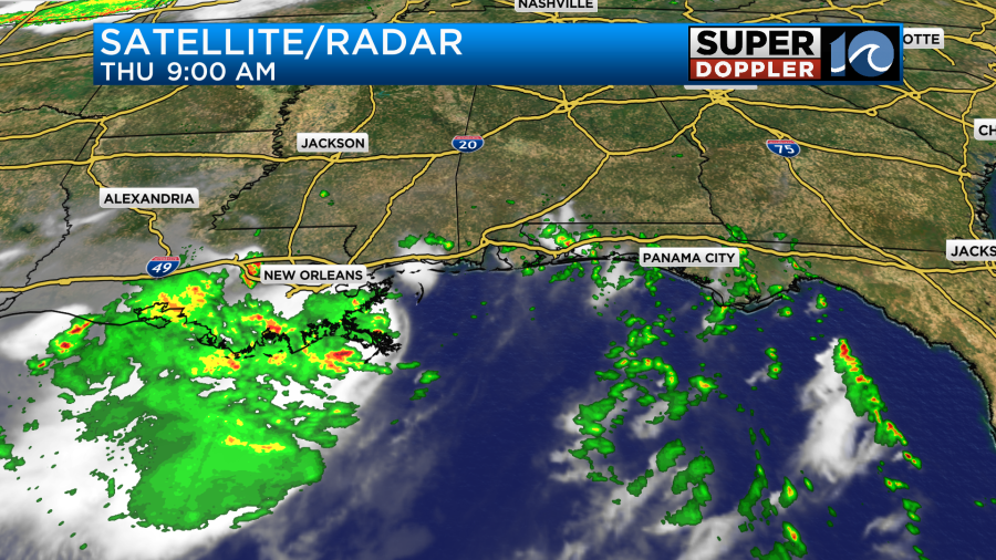
It is running out of time and real estate for the chance to strengthen. It only has a low chance of becoming a tropical depression or storm now.
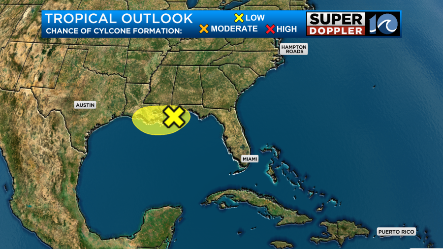
Regardless, the feature will produce a lot of rainfall over coastal Mississippi and Louisiana.
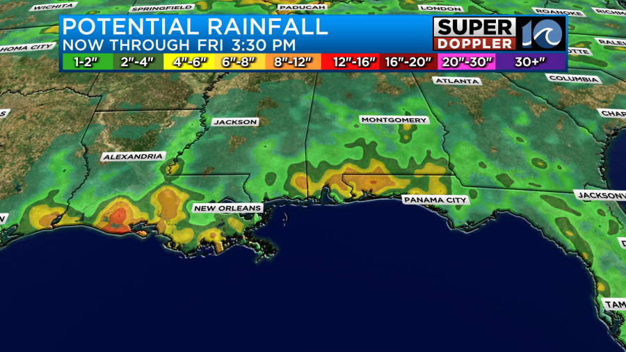
It should move north and fall apart over the next 24-48 hours.
Meteorologist: Jeremy Wheeler


