Over the last 24 hours we have had a big area of rain move into our region. Luckily, it didn’t rain much yesterday during the day, but last night a solid area of light-to-moderate showers arrived. It made for a messy commute this morning.
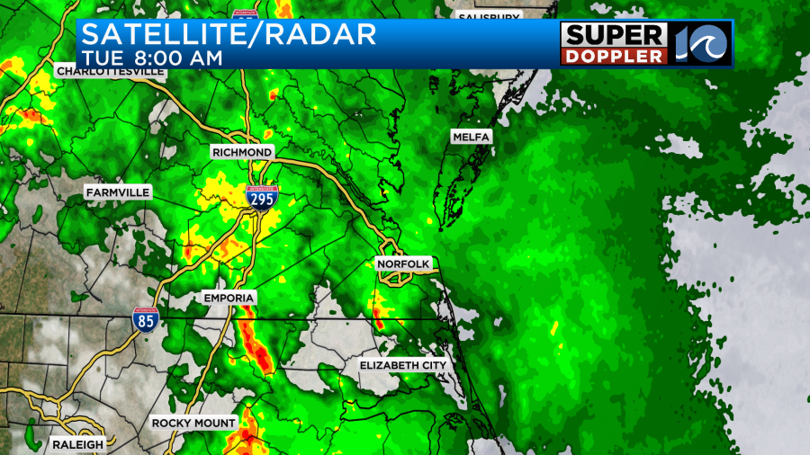
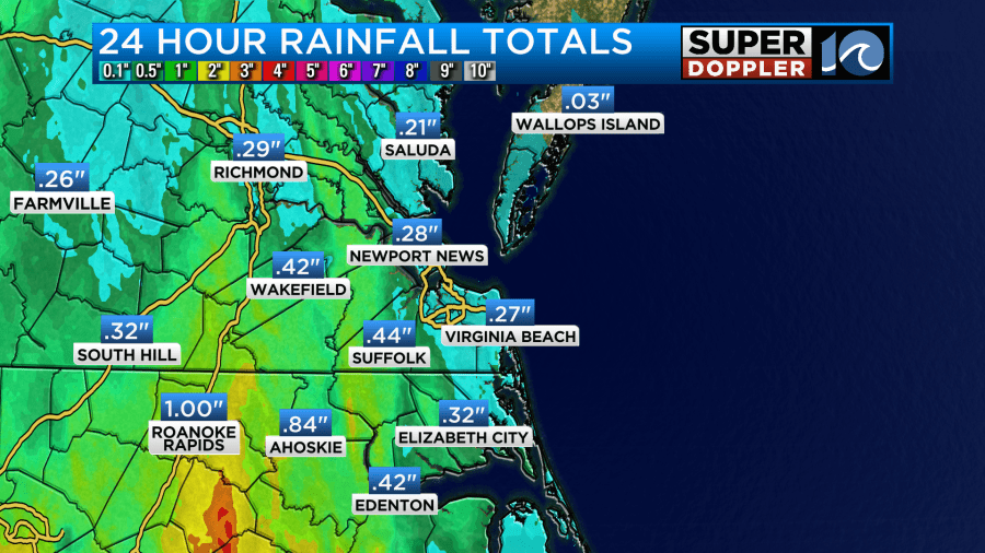
There were a few heavier downpours embedded within the big area of rain. We have had a couple tenths of an inch of rainfall for a lot of the region. There have been some higher amounts over inland parts of North Carolina and Virginia.
At the surface we have a warm front lifting to the north. There is a cool front to the west along with an area of low pressure.
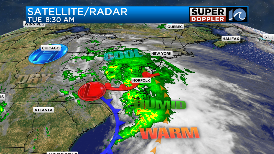
We have a southeast wind gusting up to 25mph, and that is pulling up a lot of deep/rich moisture.
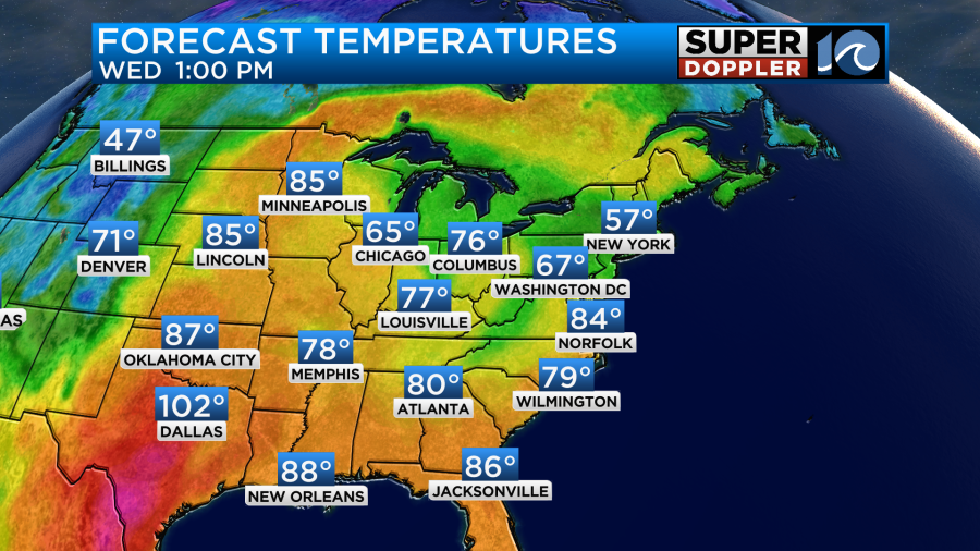
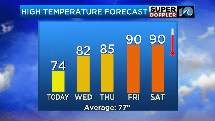
Despite some gusty southeast winds, we won’t warm up much today. Highs will only be in the low-mid 70s. That’s mainly due to the clouds and the rain. Normally, that would mean that we’ll just have a wet day with gusty winds. However, today there are a couple of quirks in the atmosphere. So there actually could be a few strong storms and isolated tornadoes in the region.
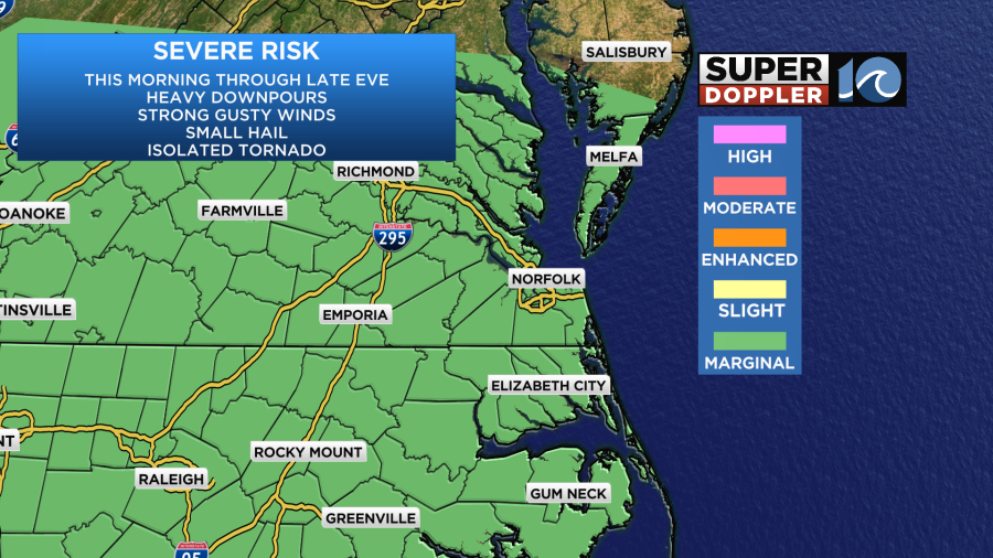
One part of that is that there is a strong upper-level low overhead.
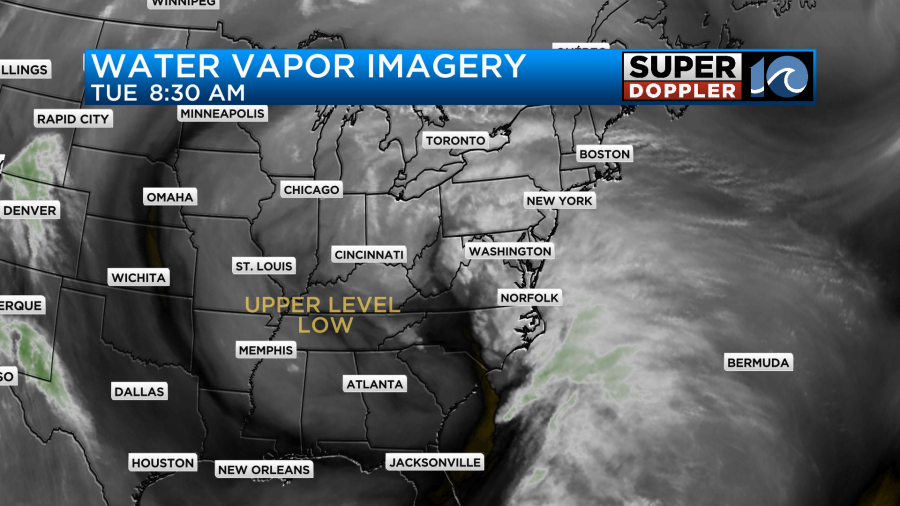
We are on the eastern edge of this large feature. This is basically a spinning pocket of much colder air aloft. The relatively warmer air below makes the air a bit unstable. Also, the southeast winds at the surface today can create some local helicity (spin with height). So that’s why we could see a few strong storms and isolated tornadoes today. The cloud decks are also very low. That can also aid in creating a quick spin-up tornado.
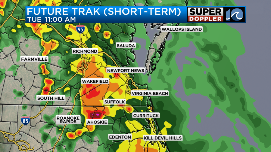
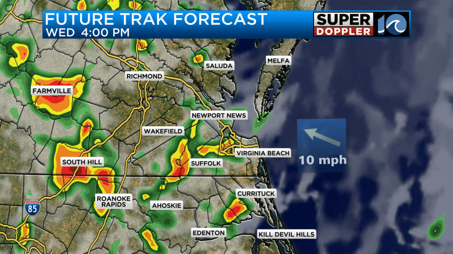
Our model has widespread rain between now and midday.
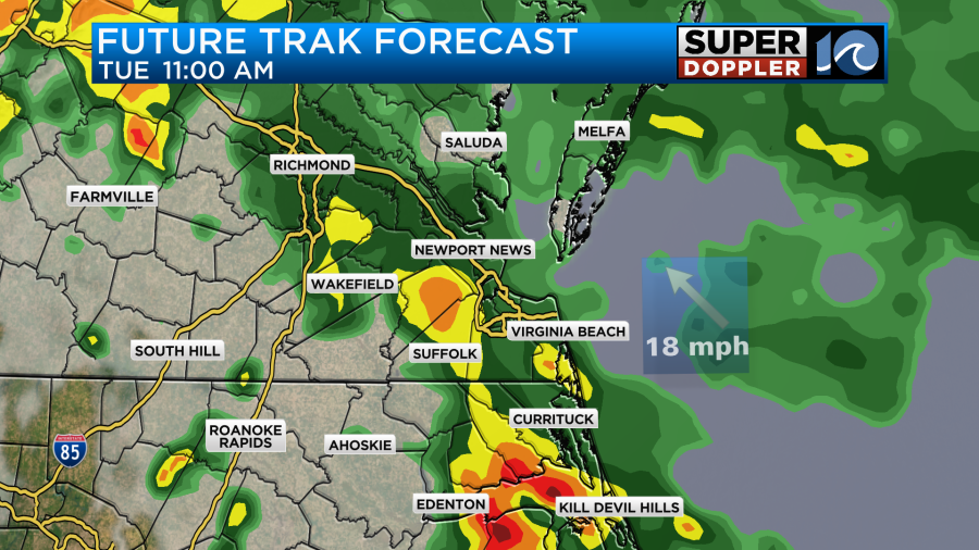
It has a large band of heavy rain coming up from the south through that time. I think there will be a band, but it may be in a different location and more broken. Here is the HRRR model’s forecast.
Later today the warm front will lift to our north. The rain showers will become more scattered. A few thunderstorms will also be possible.
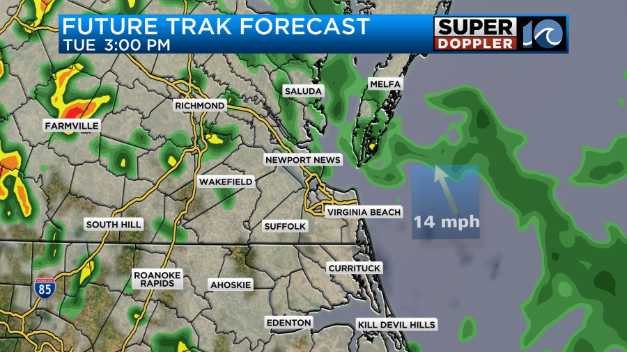
Things should then taper off through the later evening hours.
We do have a Flood Watch through later this evening.
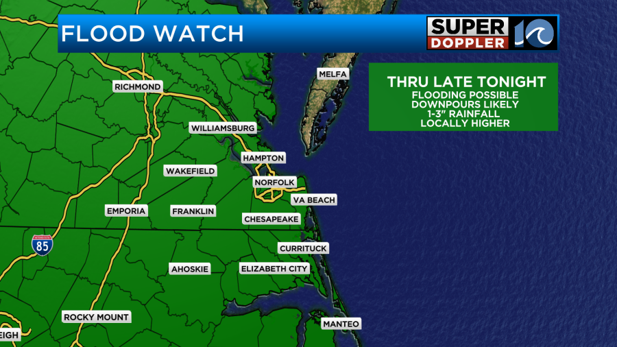
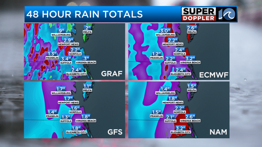
I think we have a potential to get 1-2″ with possibly 3″ in a few areas.
Tomorrow morning should start off fairly quiet. There may just be a few spotty showers. We’ll have a mix of sun and clouds through the day tomorrow. That bit of sun and a southeast breeze should allow temps to heat up to the low 80s.
The surface low and the 2 fronts should slowly push east/northeast of the area. However, the upper level will still be overhead. Plus, the surface low will still be fairly close. That setup will create some more scattered showers and storms. They should pop up mainly in the afternoon.
These will continue into the early evening. Then they should weaken overnight. Before the rain ends we could get 1-2″ of rain with a few locations getting up to 3″.
Things look a bit calmer Thursday through Friday. There may be a few rain showers and storms, but we will definitely have more sunshine. Temps will push up to near 90 Friday and Saturday.
Humidity will stay up through Saturday. It will be pretty muggy for this time of year.
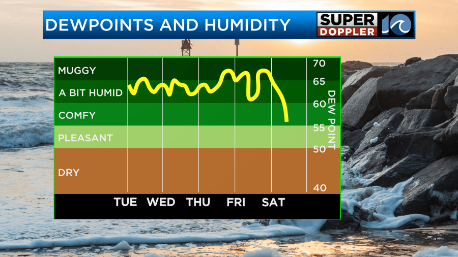
That means that for Friday and Saturday the heat index could rise up to the mid 90s. It might get even higher than that in some inland areas. We’ll see. Stay tuned for updates to all of this. We’ll have updates on on-air and online throughout the day.
Meteorologist: Jeremy Wheeler


