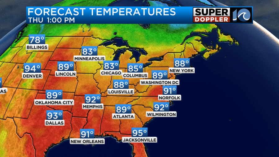
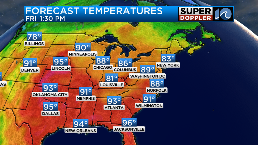
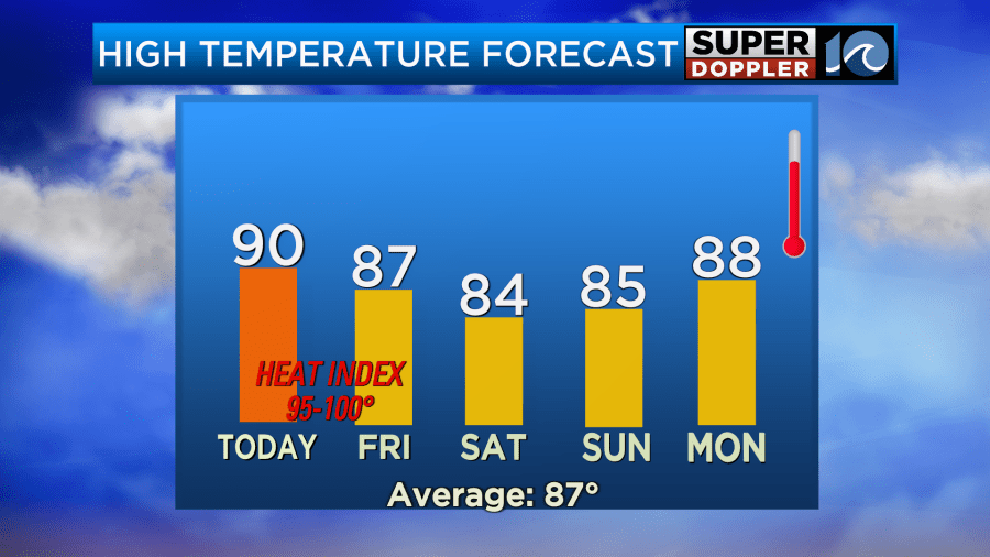
Yesterday was Muggy with a capital M. Today is going to be downright hot and humid! We’ll have a little more sunshine today. That will cook the temps. Yesterday, we hit 88 at Norfolk International. Today we will aim for about 90 degrees.
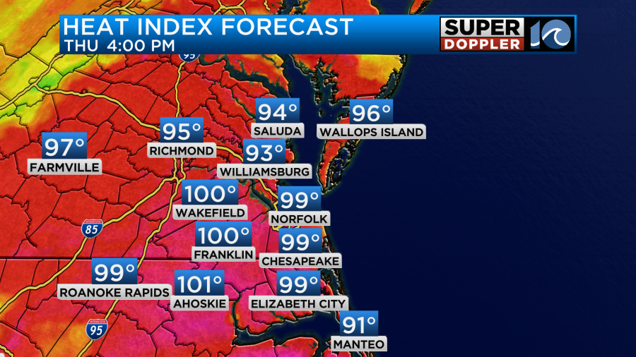
However, the heat index will be in the upper 90s to near 100.
This will create some more instability in the region this afternoon. On top of that there is a cool front approaching from the north.
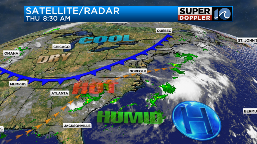
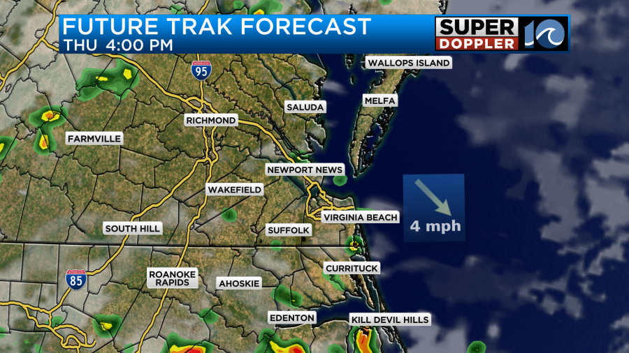
This front won’t get here today, but it will be closer by the evening. So some thunderstorms with heavy downpours will be possible this afternoon into the evening.
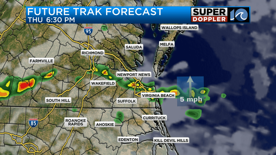
There is a Flood Watch in effect today from 2pm until 2am tonight.

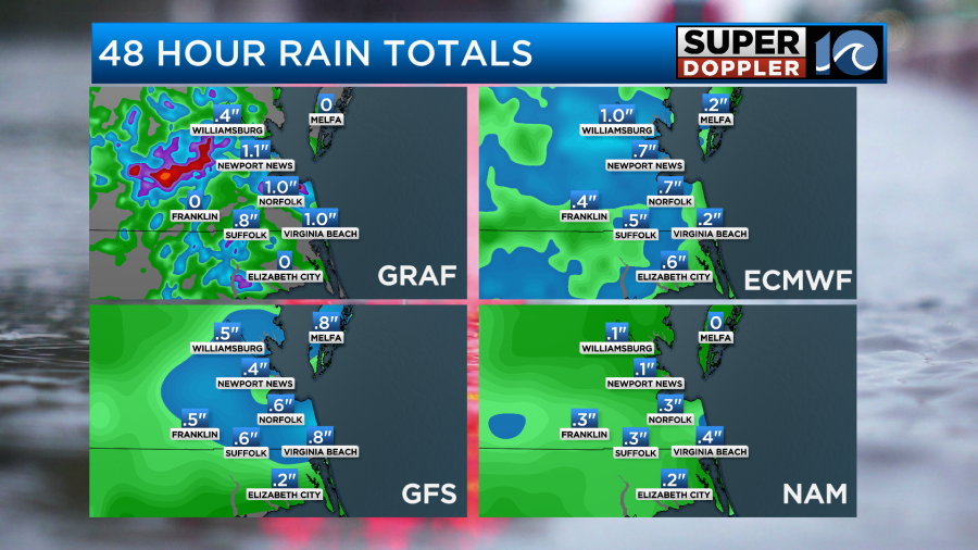
There will be a lot of instability, but there will be hardly any wind shear. So I don’t think we’ll have any severe weather. The exception would be a few strong gusts if we get some downpours. I think the bulk of the showers will put down a quarter to a half an inch of rainfall, but there will be some isolated areas that get 1-2 inches or more.
We’ll have a light west wind today.
Tomorrow the cool front will slowly sink to the south. There will be a few showers and storms out there along the boundary.
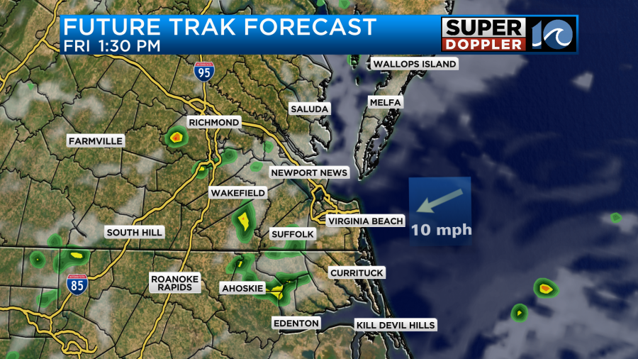
The wind will pick up out of the northeast. This should be able to drop the temps a little. Highs will be in the mid-upper 80s, but it will still be humid.
However, the heat index will still be in the 90s.
We’ll dry out slightly over the weekend, but we’ll also cool down a little.
It should be a decent weekend, and the beaches should be good. We won’t have any big waves yet from tropical storm Erin.
This morning tropical storm Erin was rolling steadily to the west over the central Atlantic.
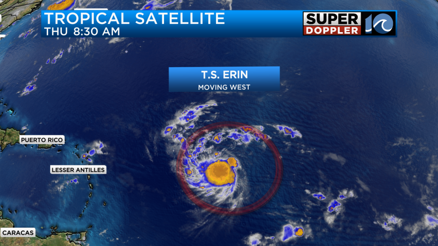
It has slowed down a little since yesterday, and it has strengthened a little as well. It will continue on a west/northwest track for the next couple of days. It is forecast to become a hurricane within the next 23-36 hours.
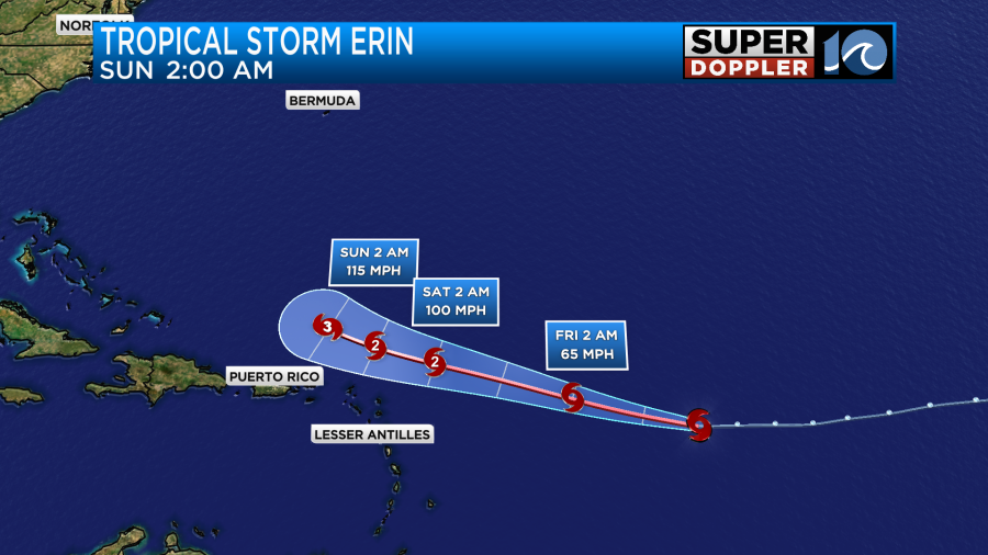
It will be over warmer water, more humid air, and a region of less wind shear during that time. It should stay north of Puerto Rico, but it may be close enough for them to get some rain and wind. After that point it is forecast to strengthen even more as it turns more to the northwest. Then it should turn a bit more north between days 4 and 5.
Erin is forecast to be a major hurricane by Sunday morning.
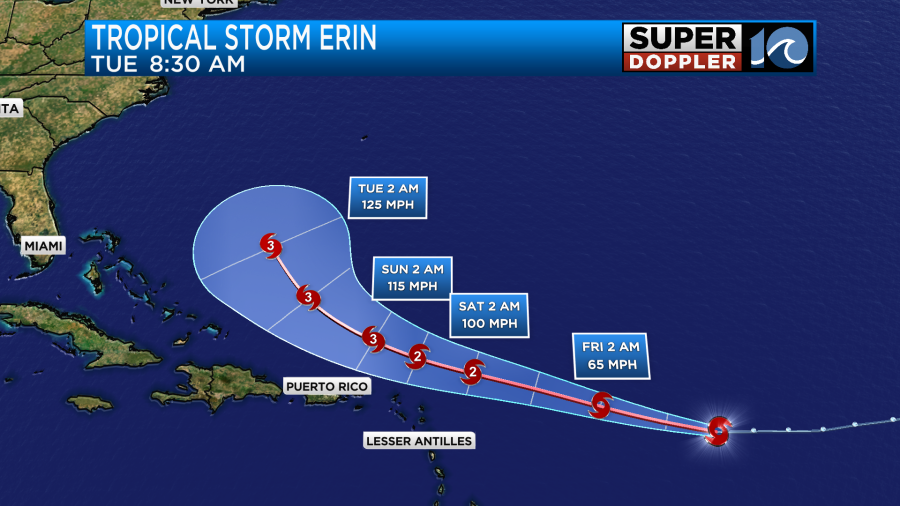
The models are still in good agreement in the short-term, but there is still some split after day 5.
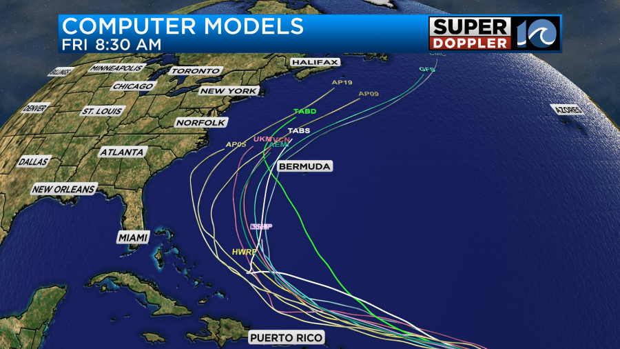
The models I’m showing actually show some clustering on a path near and a little west of Bermuda. However, we are not out of the woods. Here are the GFS Ensembles.
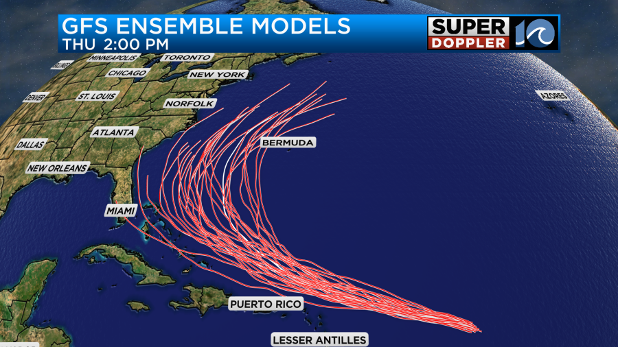
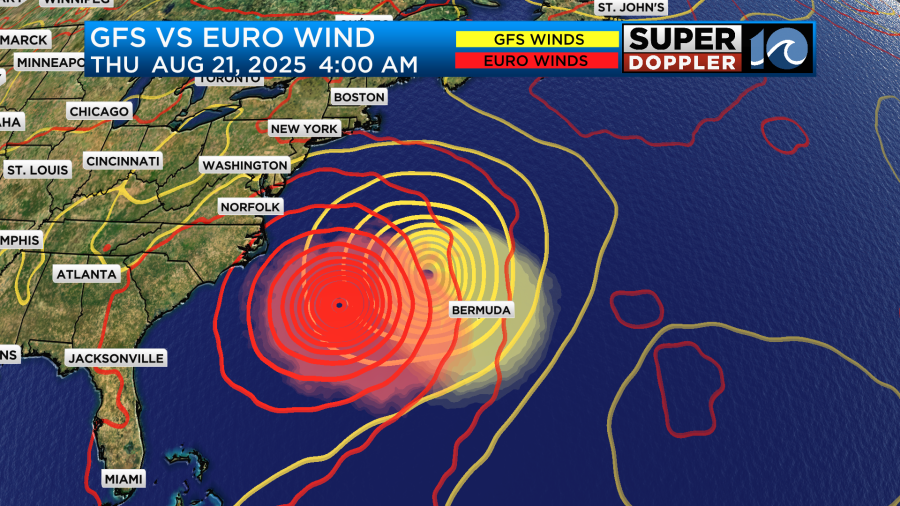
There are still a couple of versions that take Erin closer to the U.S. coast. However, the majority of them keep it out to sea. The GFS and Euro models do have Erin moving to the north and then northeast down the road. However, the Euro is closer to half way between the U.S. and Bermuda. The GFS gets pretty close to Bermuda around the middle of next week.
While these are also reassuring, it is still early. The forecast could still easily change. I’ll breathe a little easier once it starts making that northerly turn in a few days.
Even with the offshore tracks, we will still likely get some big waves. We may get a few small waves on the very outer edges by Sunday evening.
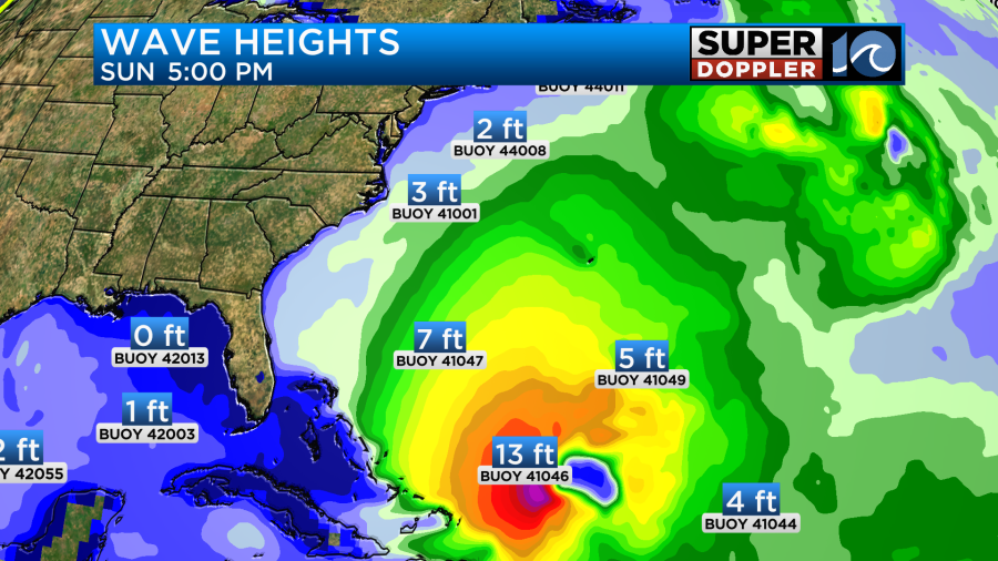
However, by next week the waves may really pick up. They could turn into some big waves for the ECSC.
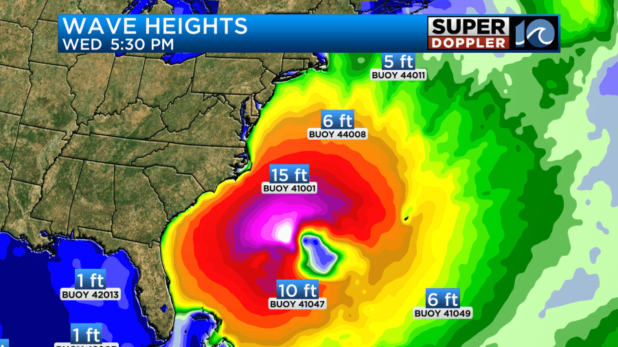
However, it will likely be bad for swimmers as the rip current threats increase. We’ll have a lot more updates on that as it gets closer. Meteorologist Brian Michigan will have updates on beach and boating frequently. Especially on the WAVY+ app.
Meteorologist: Jeremy Wheeler


