
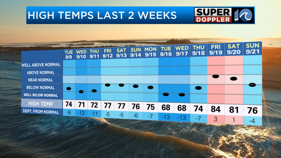
Today is the first day of Fall. However, like some years past…Mother Nature isn’t looking at the calendar. There were a couple of milder days recently after a stretch of cooler weather.
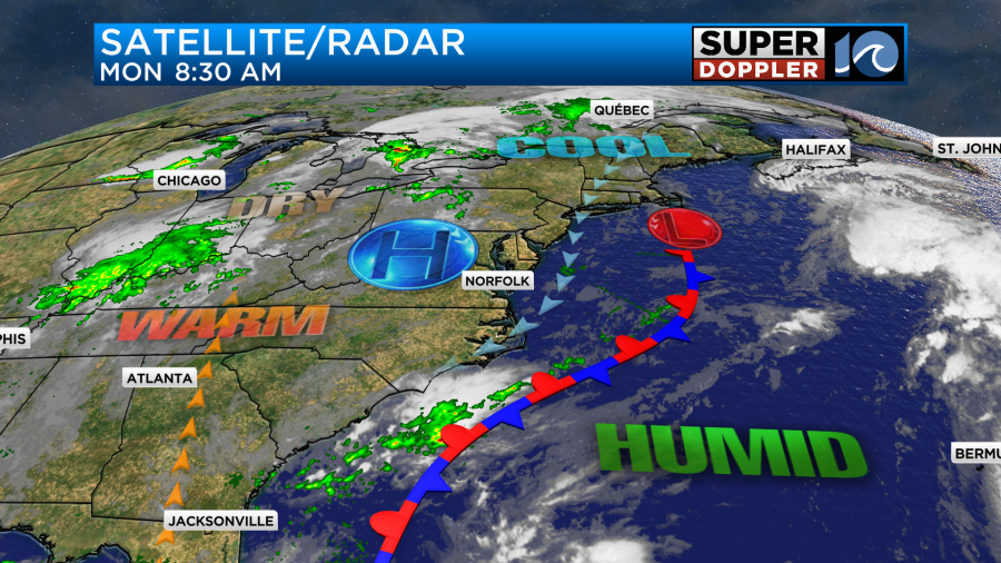
Yesterday was nice with the northeast breeze and highs in the 70s. We’ll hold onto this pattern today as high pressure is to our west with a stationary front offshore.
We’ll be mostly to partly sunny with high temps aiming for the mid-upper 70s this afternoon.
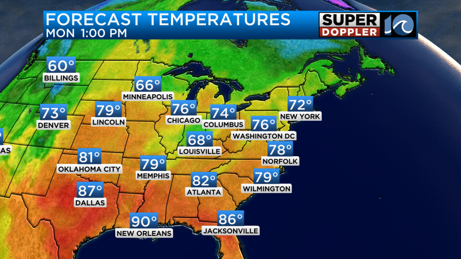
We’ll have a light northeast breeze. Over the next few days, however, we will be warming up. High temps will be in the low-mid 80s tomorrow. Then we’ll be in the mid-upper 80s for a couple of days.
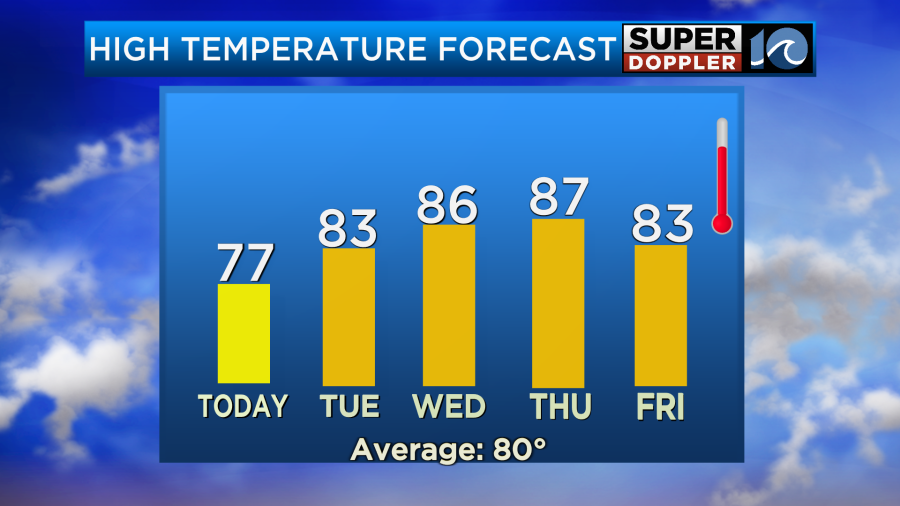
The humidity will also be climbing during that time.
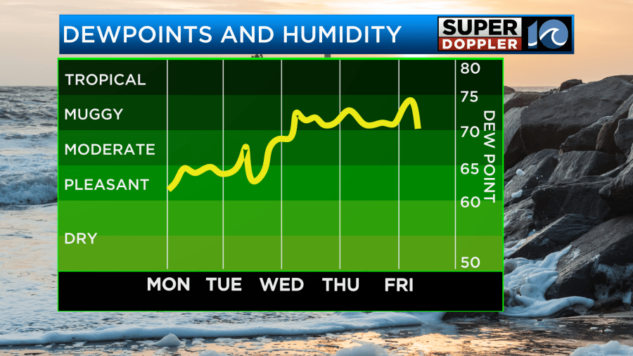
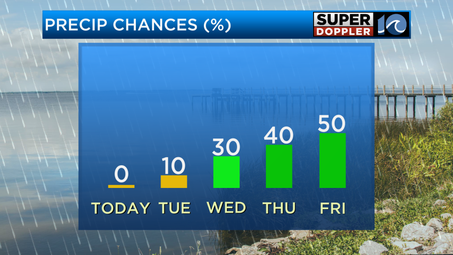
So it will basically feel like Summer out there later this week. We aren’t expecting any rain tomorrow, but some scattered showers and a few storms will be moving in later this week as well.
This will mainly be due to much higher moisture moving in, but there will also be a couple fronts approaching the region. They may stall out.
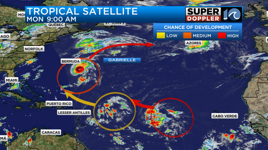
Meanwhile, hurricane Gabrielle is strengthening southeast of Bermuda. The eye on the satellite has become very sharp and defined.
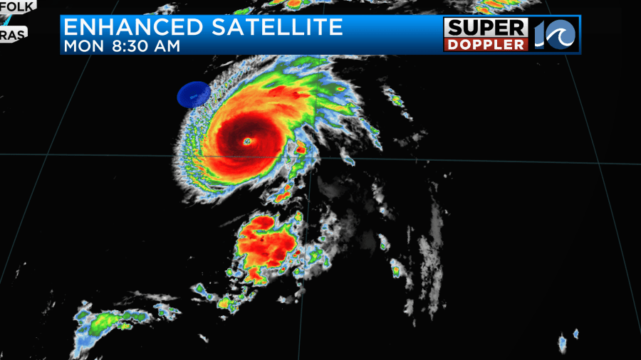
An update came out before 9am, and it was upgraded to a category 3 storm. The hurricane is moving north/northwest right now, but it will turn more due-north soon. Then it will turn to the northeast. It will strengthen a little more during that time.
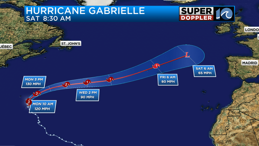
The hurricane will gradually weaken over the cooler waters of the north Atlantic. However, it could hold enough strength that it could affect the Azores islands as a category 1 hurricane. There are a lot of models which take it that way in a few days.
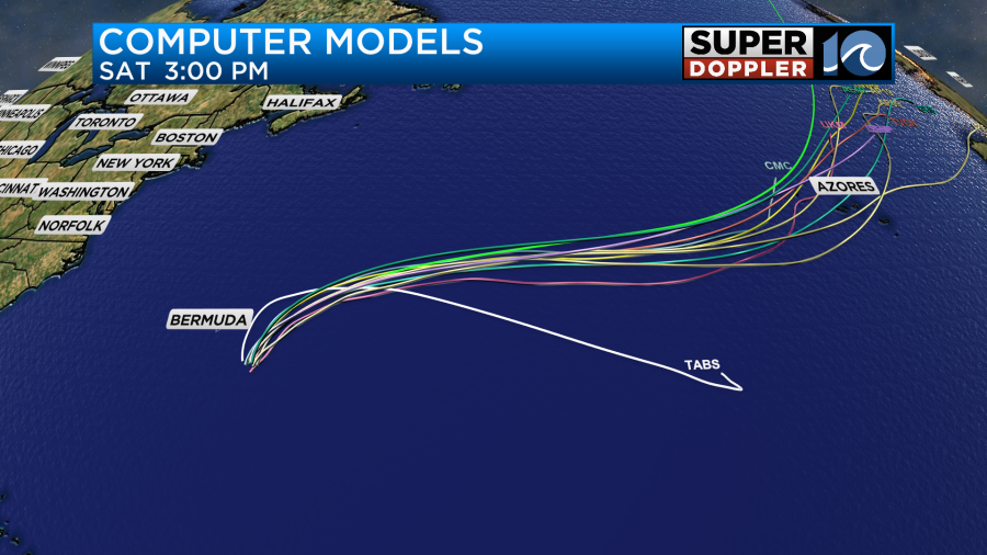
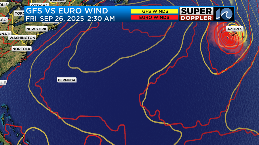
The GFS and Euro have it hitting or getting close to that island chain in a few days.
It will stay well east of the U.S. coast. However, we will have some more waves from the system. Even today there is another high risk for rip currents.
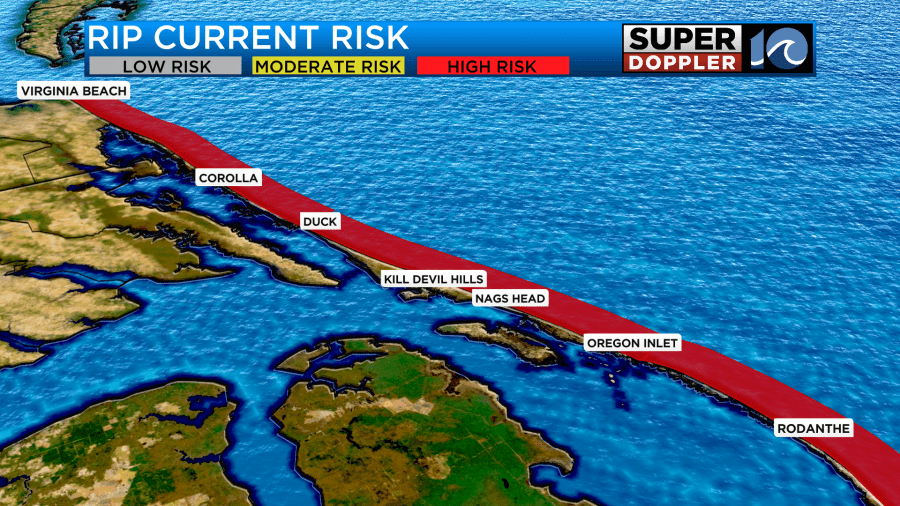
The ocean will likely stay churned up for a while. There are 2 other disturbances in the middle of the Atlantic. They have a moderate to high chance of formation over the next few days.
The GFS and Euro treat one of the disturbances differently. The latest GFS model has the potential system getting close to the U.S. While the Euro has it much farther to the east.
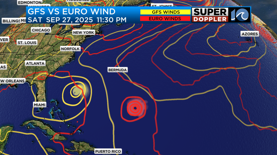
I will say that the GFS has been very volatile lately. I don’t trust it too much right now. Especially after how it handled last week’s coastal system. Either way we are talking about more than a few days out. So stay tuned for updates.
Meteorologist: Jeremy Wheeler


