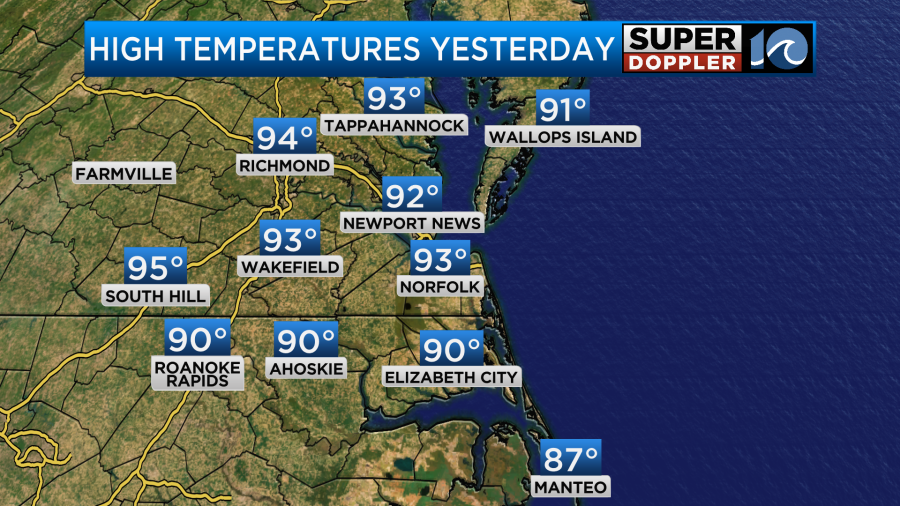
It was fairly hot and humid over the weekend, but at least it was rain-free. High temps yesterday made it into the low-mid 90s.
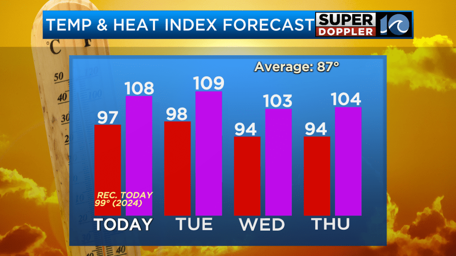
The heat index was over 100. However, there were no heat alerts. However, over the next 2 days (at least) there will be. Last night the National Weather Service posted an Extreme Heat Warning for most of the region.
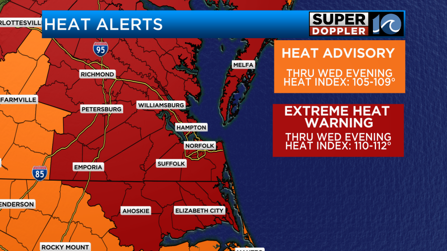
This is basically what the “Excessive” Heat Warnings were. The National Weather Service just tweaked the wording going forward. This means that the heat index this afternoon could reach up to around 110 degrees.
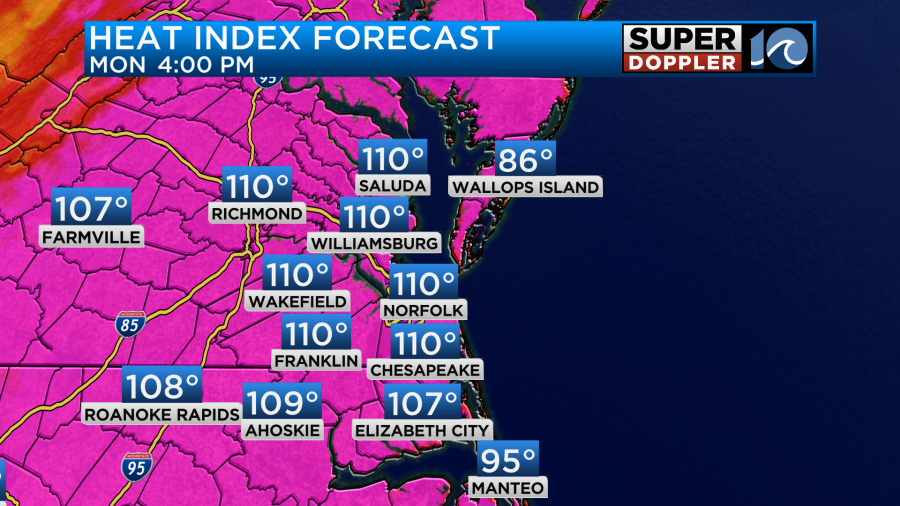
The actual temperatures in the region will be in the mid-upper 90s.
A large/strong area of high pressure is locked-in to our southwest.
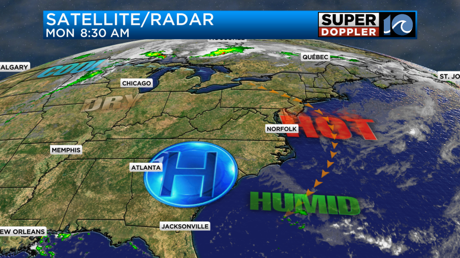
This is going to create a lot of sinking air over the eastern third of the country. That means lots of strong sunshine today. With the way that it is set up there will be a light northeast wind developing here. It will only run at 5-10mph. However, it could (potentially) allow a sea breeze to form this afternoon. That could cool down a few locations near the shore and in the metro. But don’t bet on that.
Heat illness could happen for some folks today. Here are some different symptoms for “heat exhaustion” and “heat stroke.
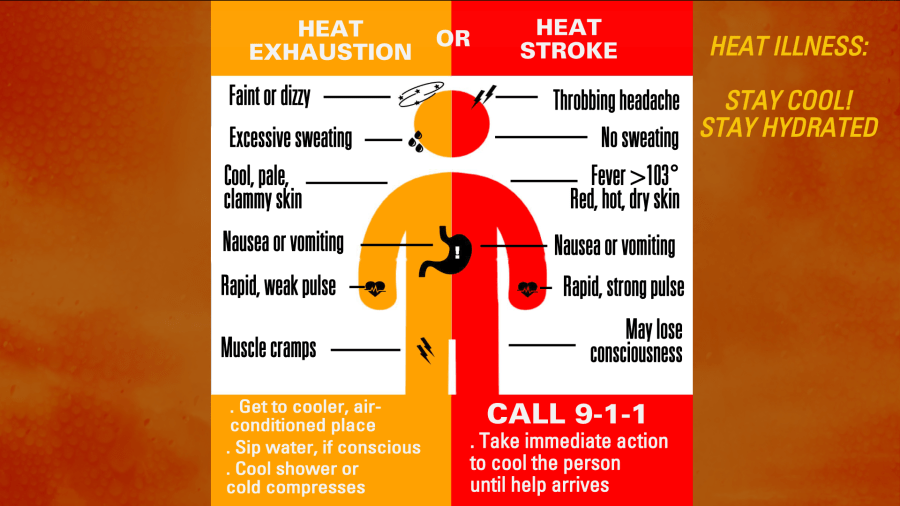
I think the most important distinction between the 2 is that you may stop sweating if you have heat stroke. Also, your body temperature can rise above 103 degrees. In that case call 911. If you have heat exhaustion, then go indoors, cool down, and put cool water over your hands, wrists, face, and neck. So try and avoid these things. Be sure to stay hydrated throughout the day. Take lots of breaks in the shade or indoors if you are working outside. Check on the elderly and the young. Bring the pets indoors if you can. If you can’t, then make sure they have shade all day and access to cool water.
Tomorrow we’ll have similar weather. We’ll have lots of sunshine with a light northeast wind. High temps could be even hotter than today.
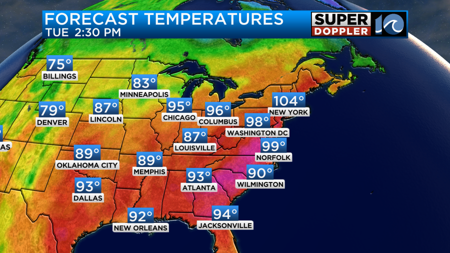
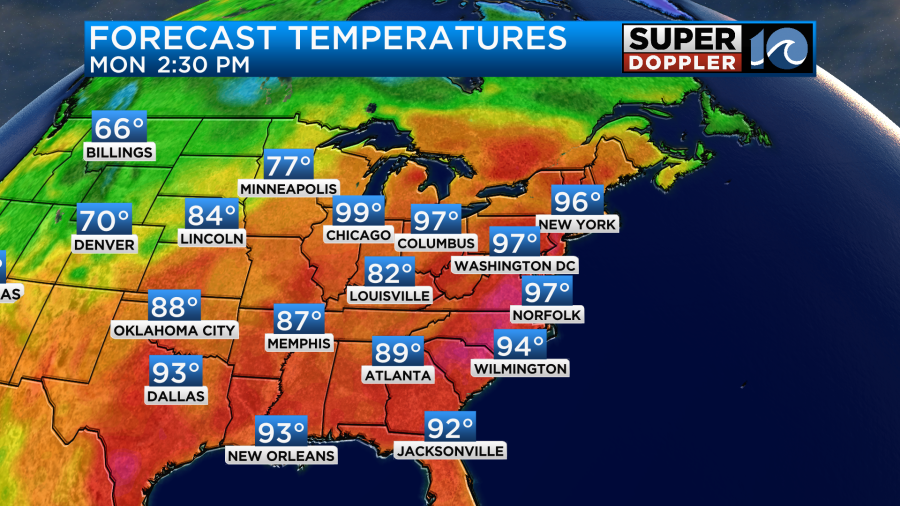
Look at the New York area. They could potentially reach up to 105 degrees. We will likely be in the upper 90s here, but we may hit 100 in a couple of inland locations like Williamsburg, Chesapeake, and/or Ahoskie. The heat index will be over 105 for many. So more heat alerts are likely as well.
It’s possible that we’ll cool down SLIGHTLY towards midweek. This would be due to the high pressure area (and upper level ridge) breaking down a bit. So we’ll probably have a few more clouds in the region. We may also have a few thunderstorms pop up in the region.
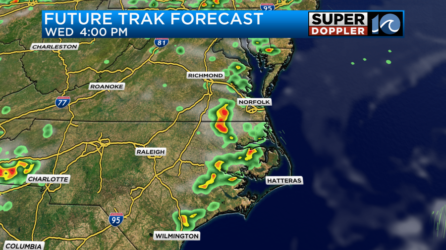
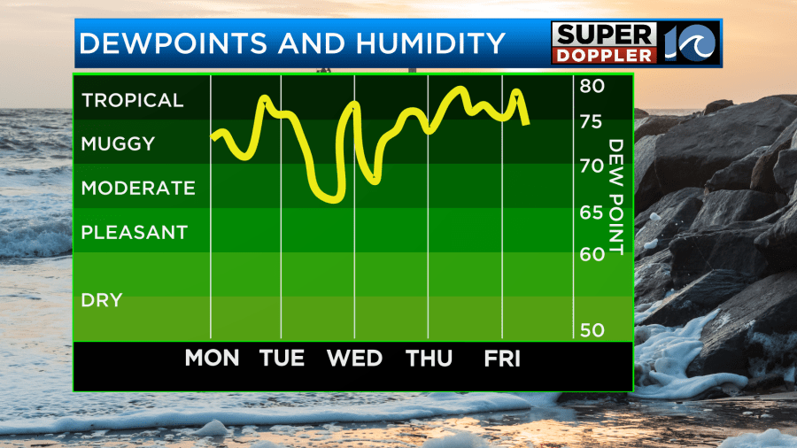
We’ll stay in the 90s all week. The heat index will probably stay over 100 as well. Dew points may dip briefly for a time or two, but overall they will stay above 70 through Friday.
I’ll talk more about the late week forecast in tomorrow’s weather blog.
But that’s not all folks… Things may be heating up in the tropics as well. Sort of…
There is a weak disturbance well east of Bermuda that has a high chance of formation over the next couple of days.
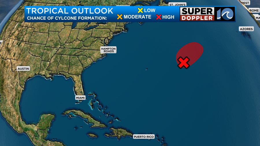
If it does form, then it would likely be brief. It would also definitely stay out to sea. I doubt it would even kick up the local surf. We’ll see. We’ll have updates on all of this. Stay tuned.
Meteorologist: Jeremy Wheeler


