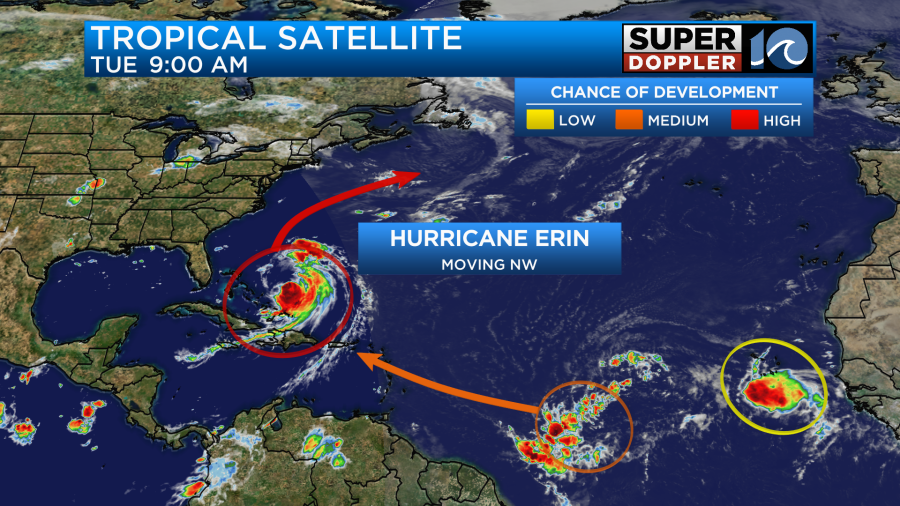
I think the term “When it rains-it pours” applies to the weather forecast lately. On top of tracking hurricane Erin we have had some heavy rain and flooding over the area. I’ll get back to that in a bit. Erin is still a hurricane, but it has weakened from yesterday. This morning when I got in the storm was a category 3, but the winds had decreased a bit. By 8am the winds were down even more. So it was downgraded to a category 2 hurricane.
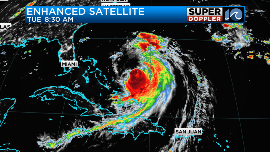
There was some wind shear and drier air that worked on the system. That chipped away at the clouds and storms on the northern and northwest parts of the storm. The shear may weaken a bit over the next 24-36 hours. So there may be some slight (and brief) strengthening of the storm as it moves north.
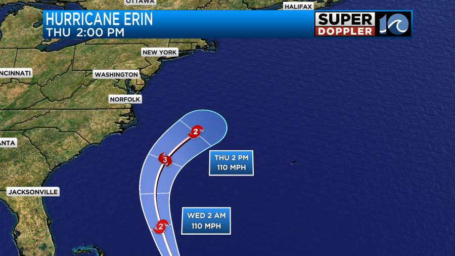
However, the National Hurricane Center also mentioned that Erin may just continue to gradually weaken through that time. Either way the storm will definitely stay offshore. The latest track and the models keep the CENTER well offshore through its lifetime.


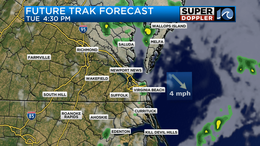
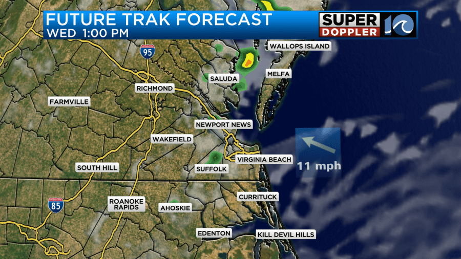
However, the storm has expanded, and it is expected to expand a little more. Luckily the storm is within range of our Future Trak model. So here it is tomorrow afternoon (well to our south).
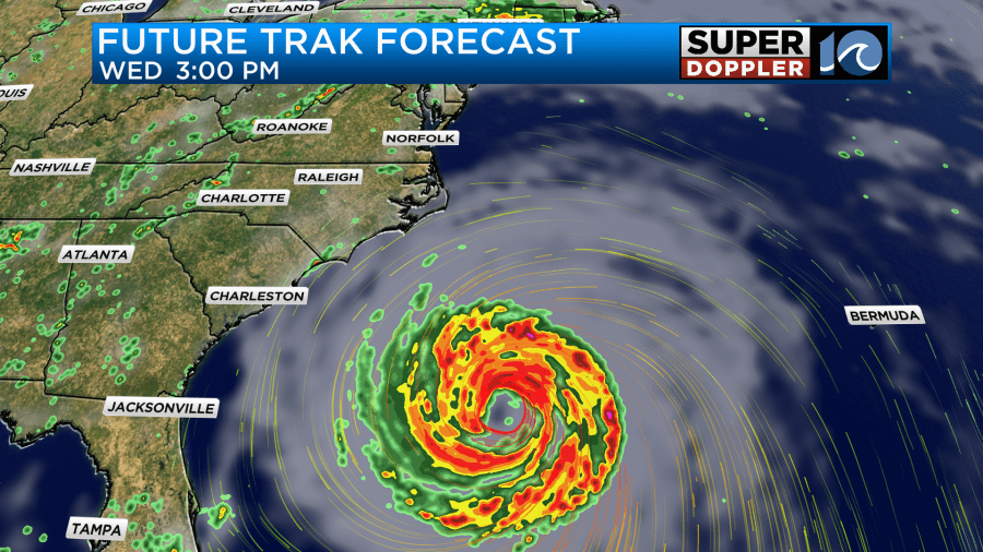
Notice how far out the rain extends from the center of the storm.
Here is Future Trak on Thursday when Erin will be at its closest to the coast.
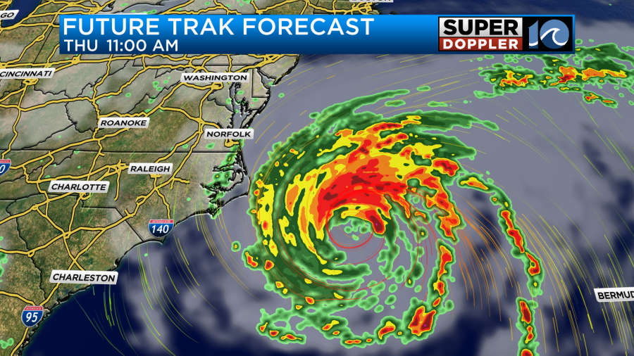
As you can see, the bulk of the rain will stay offshore. However, a few rain bands may come in off of the storm and affect our area. Then we should dry out nicely as we go into Friday and Saturday as the storm pushes farther out to sea.
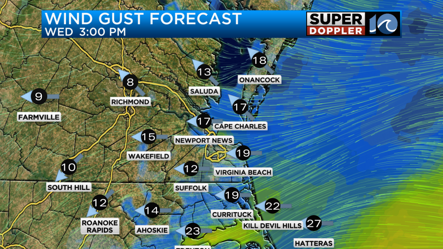
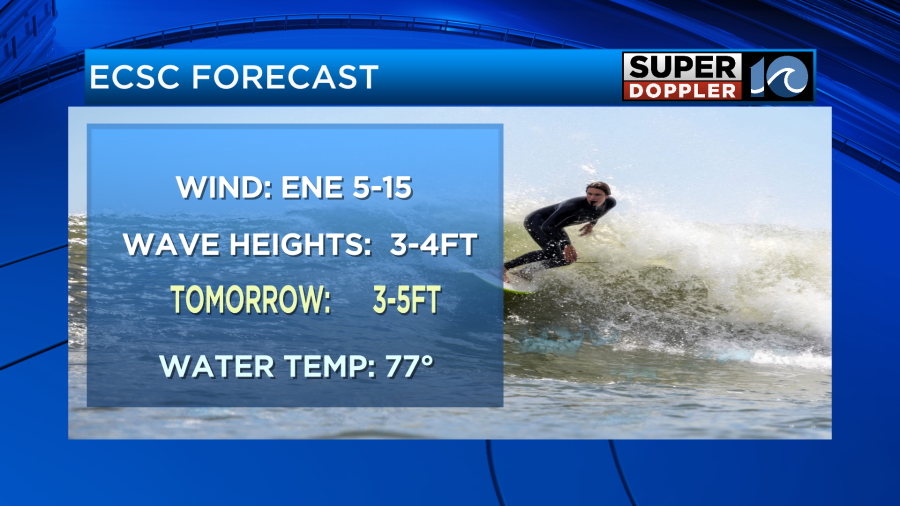
As far as the wind goes…. It won’t be too strong today. We’ll have a light east/northeast wind running at 5-15mph. Tomorrow the wind will pick up a bit. We’ll have some gusts to 20mph out of the same direction.
However, by Thursday the winds will increase as Erin passes offshore. Winds may gust up to 30mph near the Virginia Beach oceanfront. They may gust to over 50mph over parts of the Outer Banks.
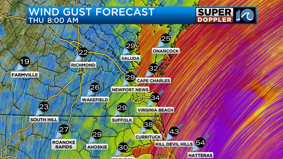
They will be mainly out of the northeast through that time. Winds should then decrease by Friday.
These winds will work to increase the tides. Some minor tidal flooding will be possible Thursday morning. However, some moderate tidal flooding will be possible by Thursday afternoon.

These numbers may change a little before Thursday. We’ll have updates through that time.
The tide will be up, but the waves will really be up. Tomorrow we will have some waves about 3-5 feet with a few higher waves at the Virginia Beach oceanfront. They could be at 5 to near 10 feet along the Outer Banks.
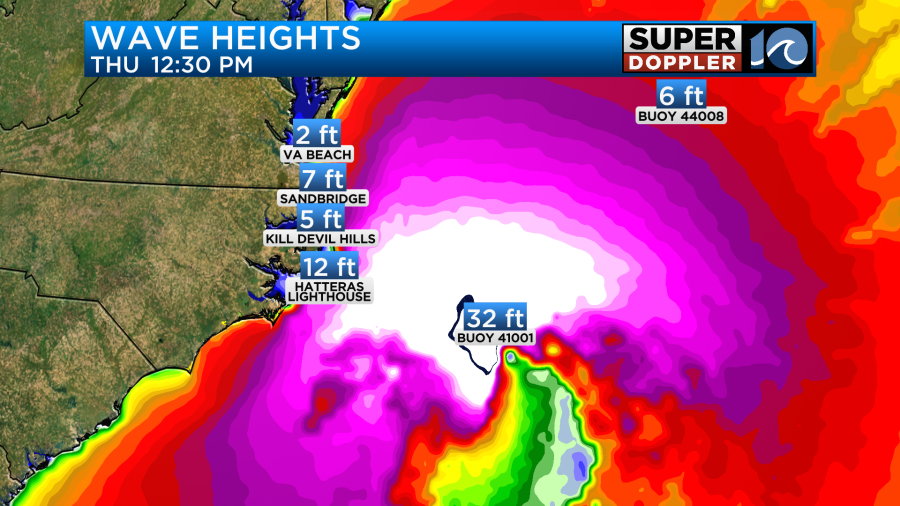
The waves will increase even more on Thursday. Waves could be up to 10 feet around Virginia Beach, but they could be between 15 and 20 feet over the Outer Banks for a time.
This will lead to ocean overwash along the Outer Banks. Especially on Thursday, but it could start sooner. This will likely be bad enough to wash out some roads along highway 12.
That is the latest about Erin and its effects. There are a couple of other tropical disturbances that we are watching. The one following Erin’s path has a medium chance of formation.
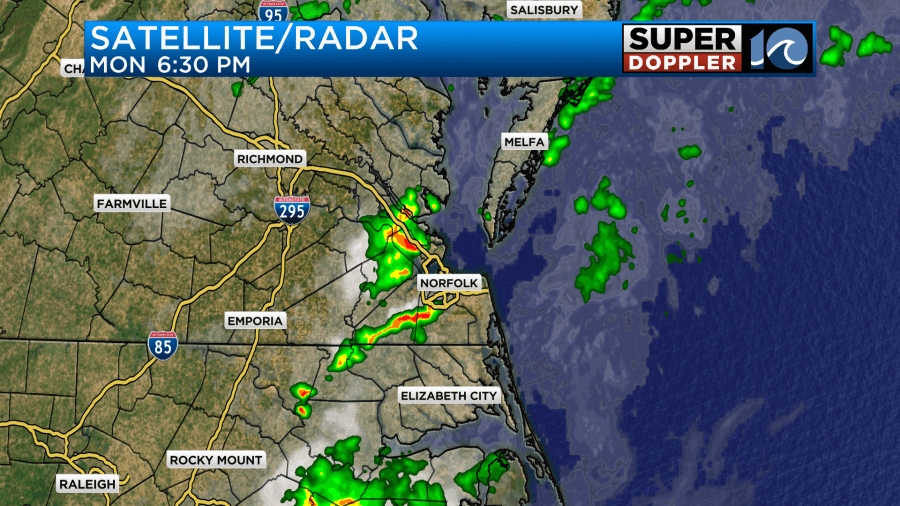
So back to our local weather. We had some very heavy rain and flooding last night over the Peninsula and a few other areas.
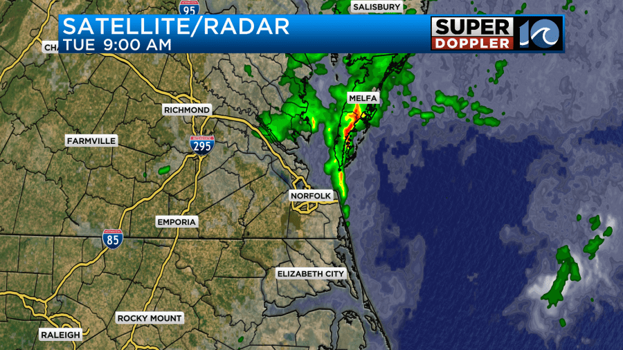
Then this morning we had more heavy rain and some flooding over the Eastern Shore.
These were from a stalled out front and a weak area of low pressure.

So any showers or storms that we get today will be from that feature and NOT from hurricane Erin. There will be a few more showers and storms forming later today.
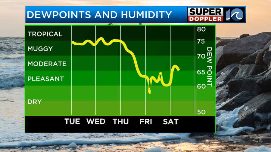
However, it won’t be a washout. High temps will be in the low-mid 80s, and it will be muggy. Tomorrow Erin will be well to our south, but the front will linger. The humidity will also stay very high. So there will be a few more showers and storms with high temps in the 80s.
I mentioned that Thursday we probably won’t have much rain, but there could be a few rain bands coming off of Erin. I’ll have a better idea about that chance by tomorrow.
Either way we should have some nice drying and clearing as we head into Friday and Saturday.
High temps will stay in the 80s.
We’ll have some more updates on all of this over the next couple of days. Stay tuned.
Meteorologist: Jeremy Wheeler


