BREAKING NEWS: Hurricane Erin formed Friday in the Atlantic Ocean, making it the first hurricane of the 2025 Atlantic season.
THIS IS A BREAKING NEWS UPDATE. Previous coverage below.
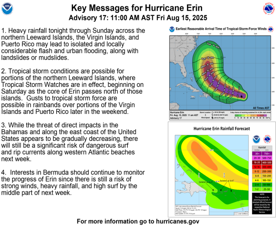
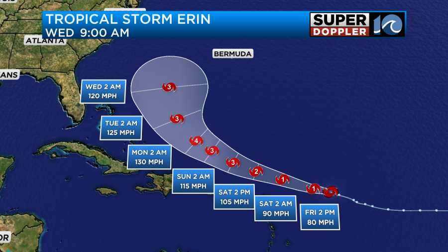
All eyes are on Tropical Storm Erin currently developing in the central Atlantic. During the day today the storm is forecast to strengthen into our first hurricane of the 2025 season. As it remains over warm waters and in an environment will low shear and dry air, it will continue quickly strengthening into our first major hurricane by Sunday.
The current forecast cone as of 8 am this morning has Erin reaching category 4 strength early on Monday before making a sharp northward turn paralleling the east coast.
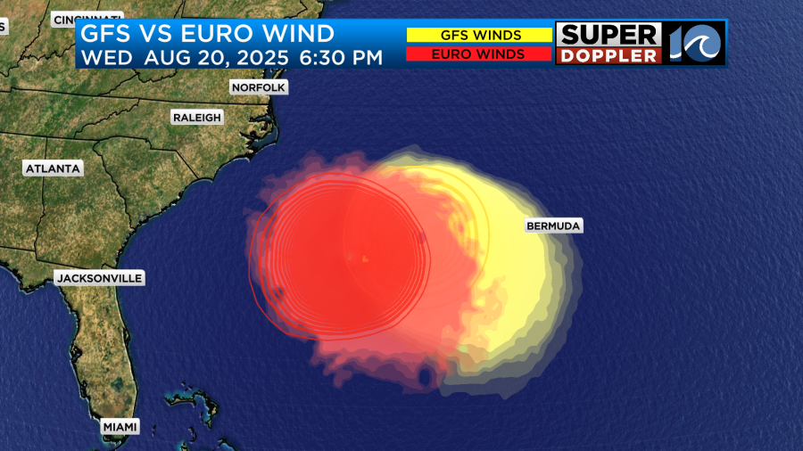
There is still a fair bit of uncertainty within our long range models and in the ensembles as to how close this storm will be to the east coast. The Euro has been consistent on keeping the storm closer to the east coast while the GFS has been slightly east.
Regardless of where this storm goes, high surf and a high rip current risk is a given with a storm of this size and magnitude. We will have to watch during the day Wednesday and Thursday for possible over wash on NC 12 and some tidal flooding during the high tide cycles as the storm will be just offshore.
If the storm tracks more to the west, that could mean some rain and wind impacts for the outer banks but if the storm is closer to Bermuda we will have pleasant weather with rough surf. There is still time to pinpoint these details and I think we will have a better idea tomorrow.
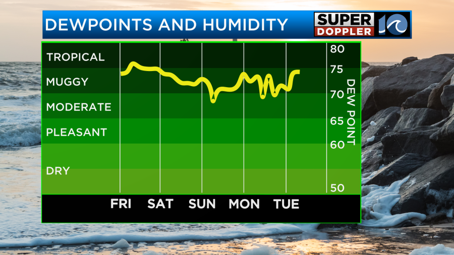
As for the day today, expect warm and very humid weather with a fair amount of sunshine. A slight northeast breeze will keep the coast a bit cooler but humidity will still be up. As a result, the heat index may range between 95 and 100 degrees today.
With a front stalled to our south that will likely provide a bit of lift for an isolated storm to form this afternoon. If a storm does form, expect locally heavy rain in spots.

As we head into the weekend, the stalled front will be offshore to the southeast allowing for drier weather and sunny skies. Humidity may remain in play making it feel warmer but not as much as today. Highs will be in the low to mid 80s both days.

Stay with us through the next few days for the latest on Tropical Storm Erin!

-Meteorologist Brian Michigan