Yesterday, we didn’t have much rain, as expected, as hurricane Erin passed us by. However, there were some strong winds near the shore. Some of the gusts were above 40mph for a time. The waves were impressive. Plus, there was some moderate tidal flooding in the evening.
This morning the skies were already clearing over most of the region.
However, clouds and high waves lingered over the Outer Banks.

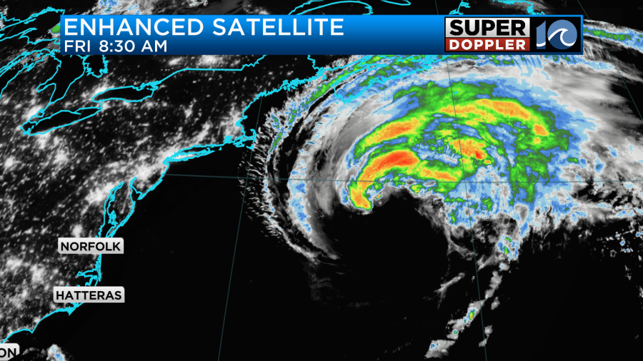
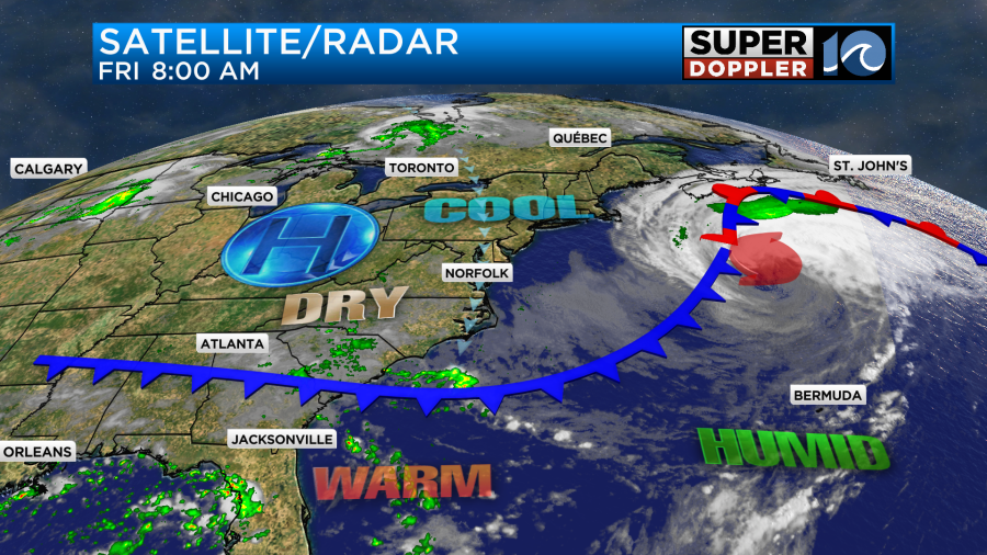
As mentioned, Erin is far out to sea and moving farther away. It is becoming post-tropical, and you can see that transition on the satellite.
Erin will become a big area of low pressure over the North Atlantic. Despite Erin’s far distance from our area we are still going to have some fairly large waves today. They will run about 6-8ft.
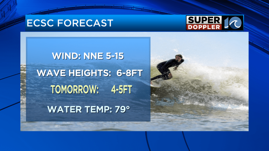
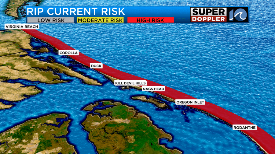
Unfortunately, the surf is still pretty rough. It will still be too dangerous to swim. The rip current threat is high along all our beaches.
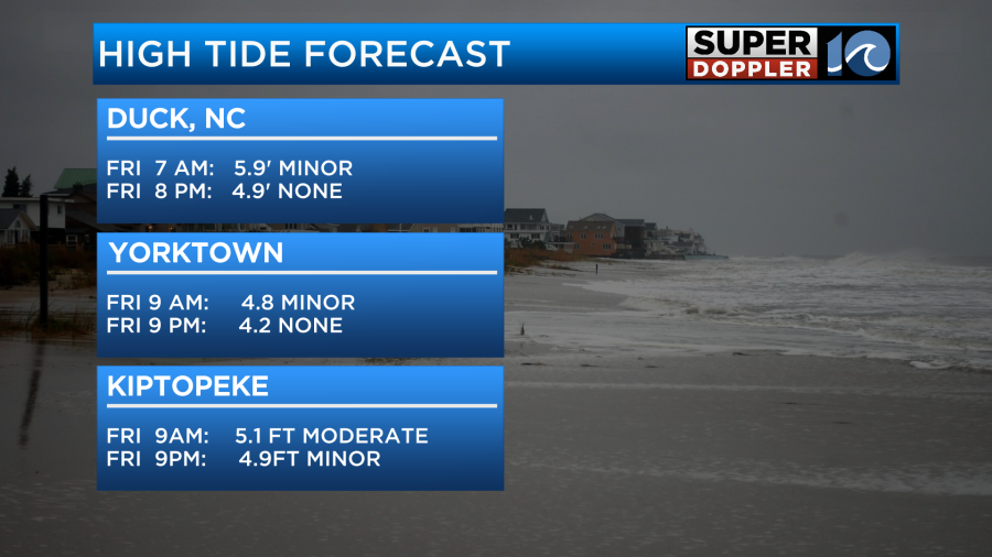
Also, there will be some more tidal flooding today. It will be mostly minor levels this morning and this afternoon. This will be better than last night’s moderate tidal flooding.
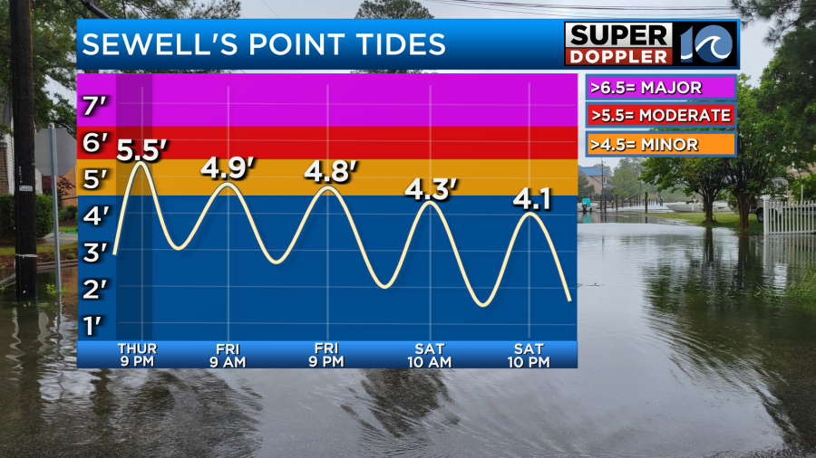
It still could be moderate over on the lower Eastern Shore.
There was more overwash this morning along highway 12. We could see a little more later today as well.

Besides some marine problems the weather should actually be pretty nice today. We have a cool front dropping to our south, and high pressure is building in.
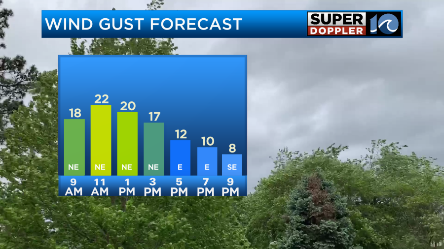
We’ll have a breeze out of the north/northeast running at 5-15mph with a few gusts to 20mph. Mainly near the shore.
High temps will be around 80 degrees with a few upper 70s mixing in.
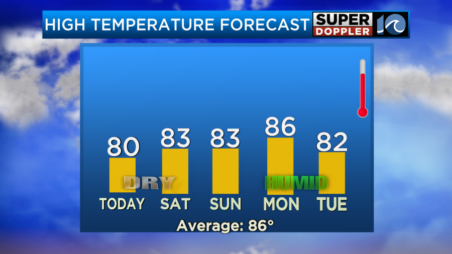
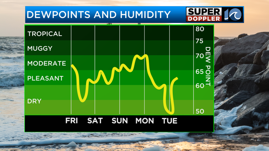
The humidity will drop quickly today. It should feel great with the breeze.
The humidity should stay down over the weekend.
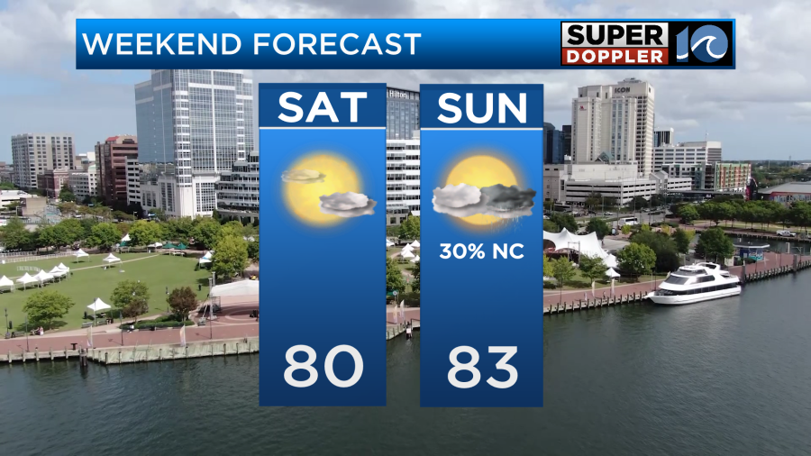
Temps will be near 80 tomorrow, and the weather will be great. Winds will be light. Then we’ll have a few showers on Sunday.
We’ll warm up a bit early next week, but a much bigger cool down may be on the way for later next week.
Meanwhile there are a couple of other things that we are tracking in the Atlantic. The disturbance that is south/southeast of Bermuda has a high chance of formation. Its track keeps it away form the U.S., but it could get fairly close to Bermuda.
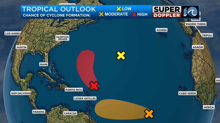
The feature that is over the central Atlantic has a medium chance of formation, but it is pretty far to the south. It will likely get into the Caribbean, and it could form into something in the next few days.
Meteorologist: Jeremy Wheeler


